
After a rather pleasant weekend with a few storms over the region, this week’s weather will be dominated by northwest flow transitioning to a rare northeasterly flow. What that will spell out is the threat of scattered storms into midweek, followed by dry and seasonal temperatures to end the week as the monsoon becomes fully suppressed. Read on for more details.
Unsettled to start the week
Much of this week’s weather can be summed up in two main notes: (1) northwest flow today into Wednesday, and (2) East-northeasterly flow Thursday and Friday. These two pattern shifts will create a sharp change in the forecast both in terms of temperatures and precipitation.
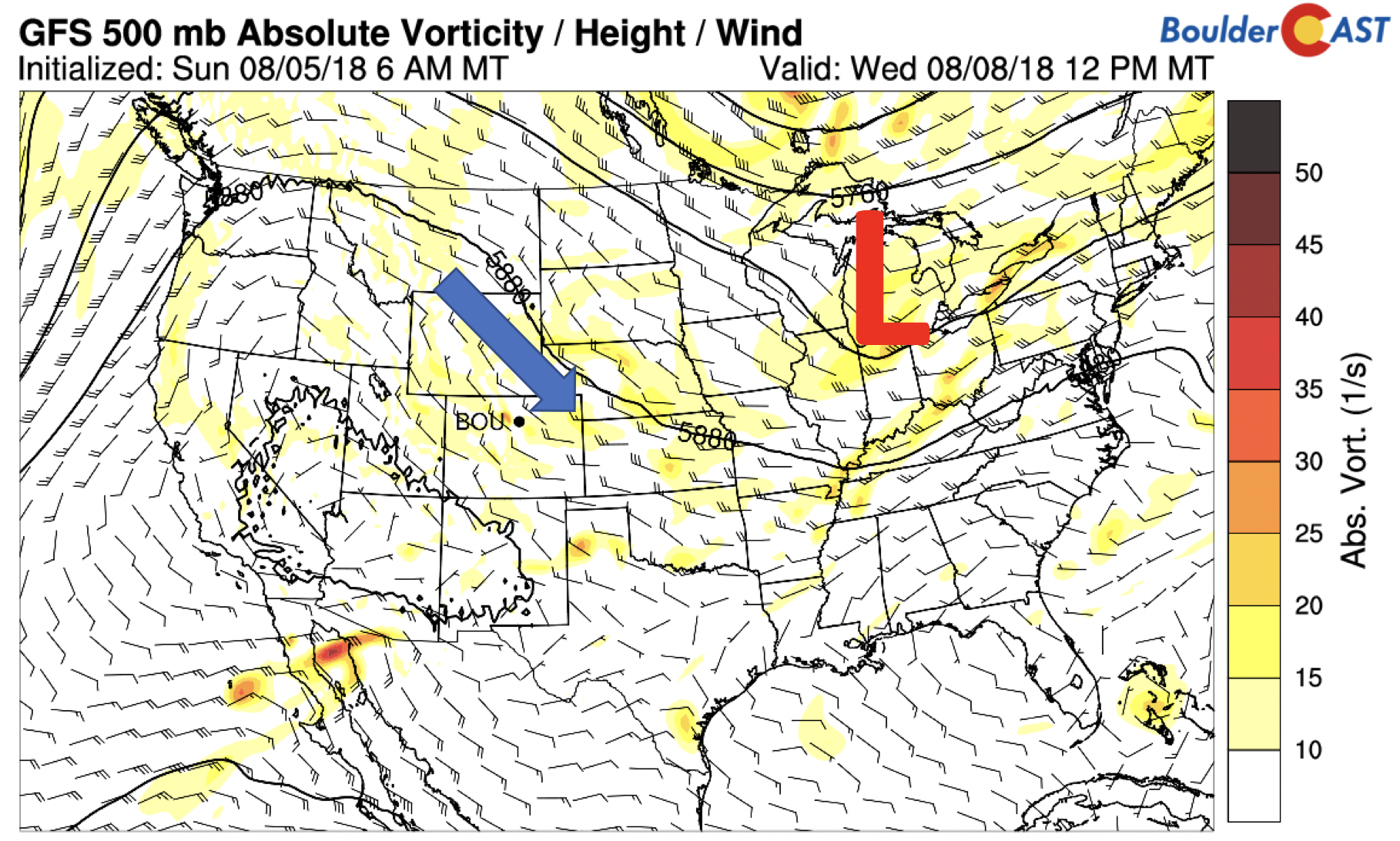
For today (see below), the mid-levels show a weak area of low pressure in Nebraska, with ripples of energy pushing through Colorado in the northwest flow today. These ripples will help create lift for thunderstorm development across the High Country and Plains this evening.
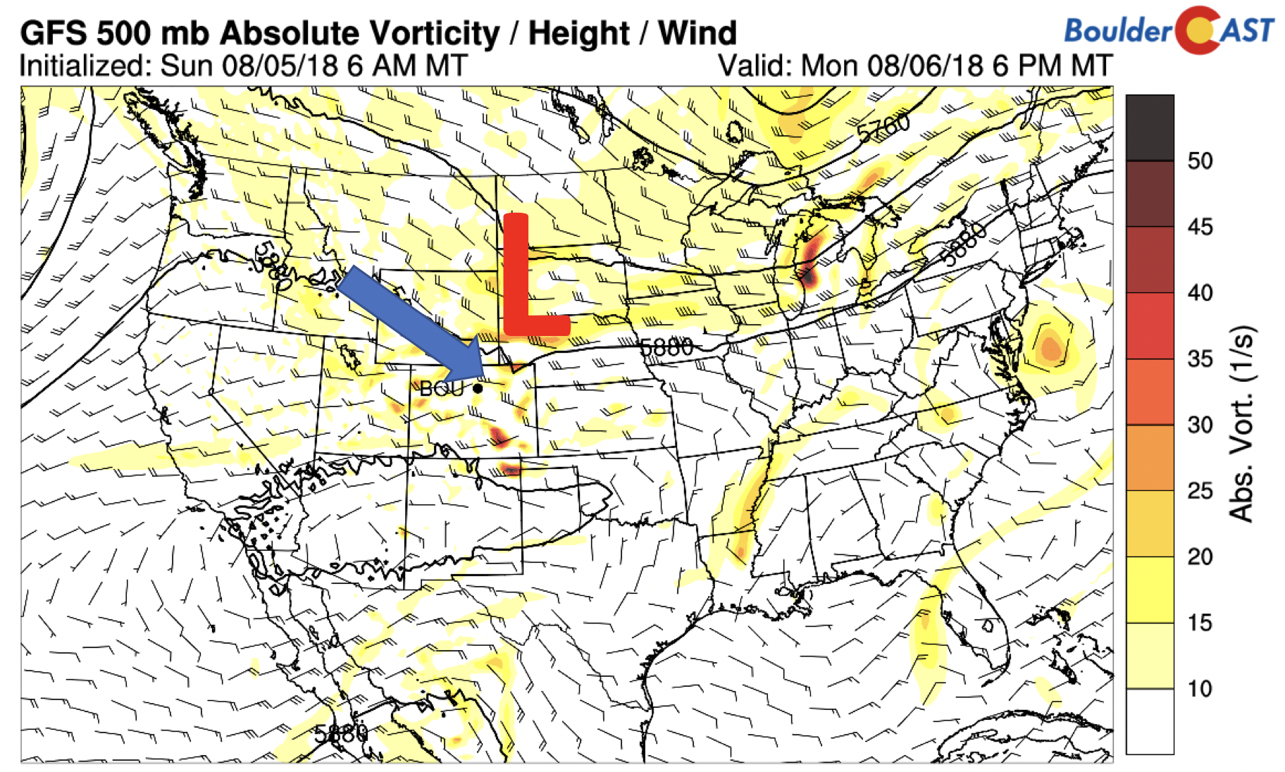
GFS 500 mb absolute vorticity today
At the surface, a cold front moved through late last night, shifting winds to be out of the northeast. That in turn has led to patchy fog development with the upslope conditions coupled to increased moisture in the column of the atmosphere. We can expect a mix of clouds and sun Monday with highs near 80.
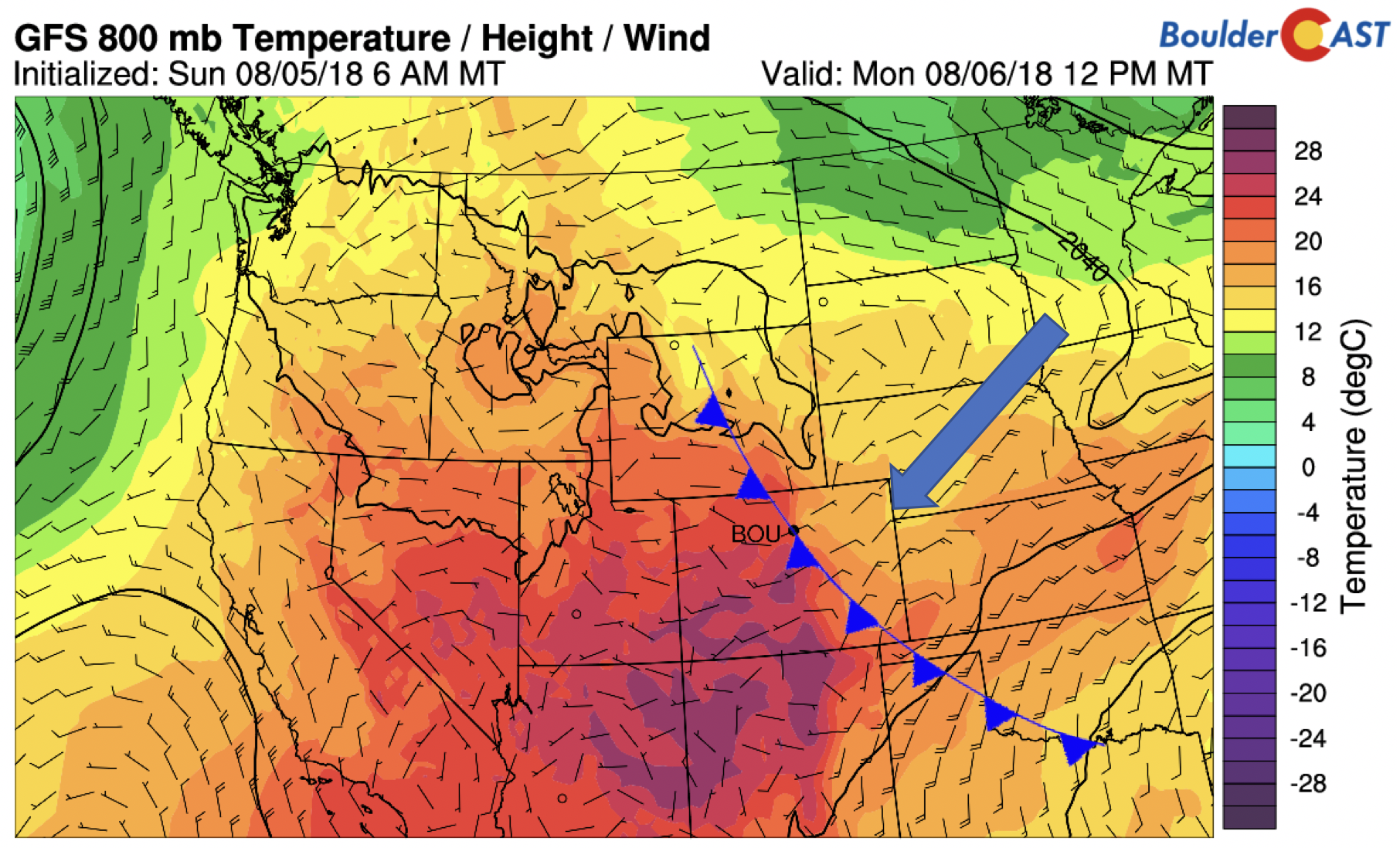
GFS 800 mb temperature today
While sunshine is expected, exactly how much we receive will ultimately determine how many storms develop Monday afternoon and evening – we need the sunshine to create the instability given the cool air at the surface today. Nonetheless, the GFS model (below) is hinting that enough instability will be present for decent widespread showers and thunderstorms, with timing between 3 and 10 PM and a 40% chance area-wide.
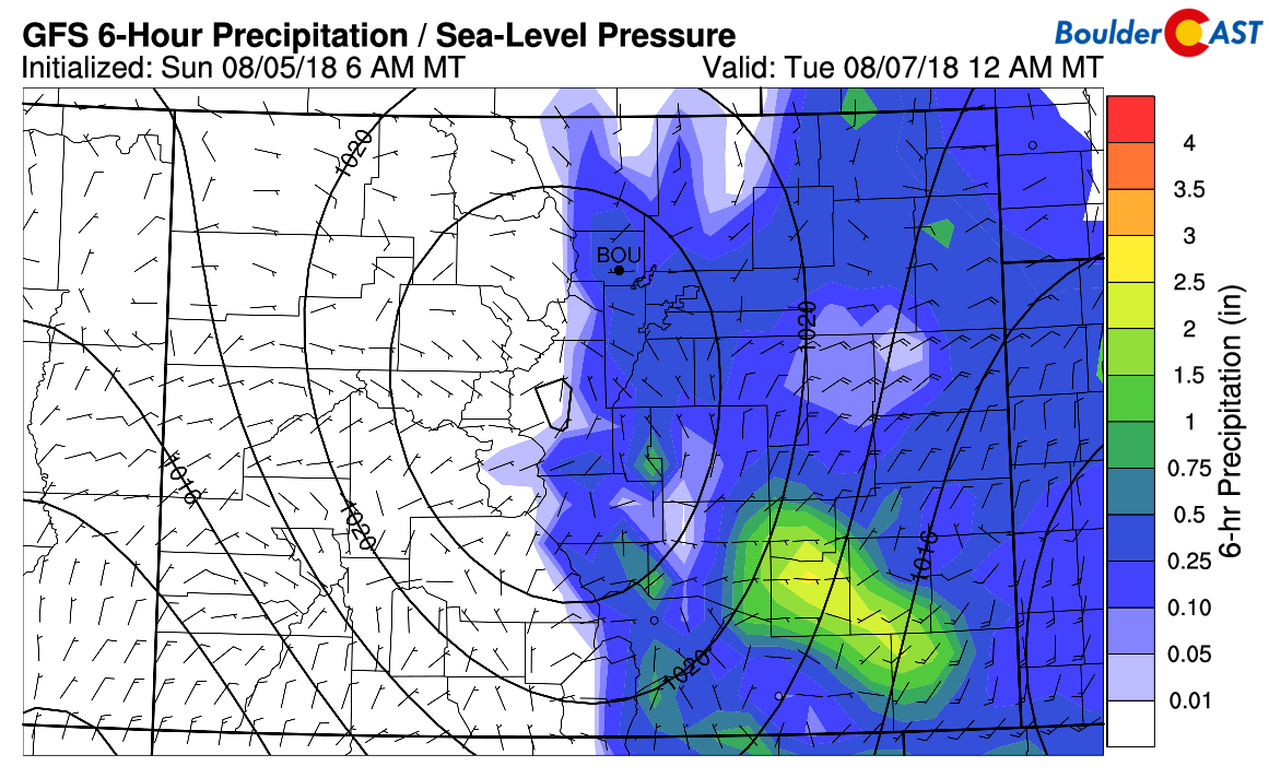
GFS precipitation forecast this evening
As for severity, there is strong directional shear and CAPE values in excess of 1500 J/kg, enough to support some storms of becoming severe with large hail and strong winds. But again, we need the sunshine for this to fully materialize in the Boulder/Denver area. As of Monday morning, it does look like things are coming together to see a decent severe outbreak today from the Metro area eastward into Kansas and Nebraska.
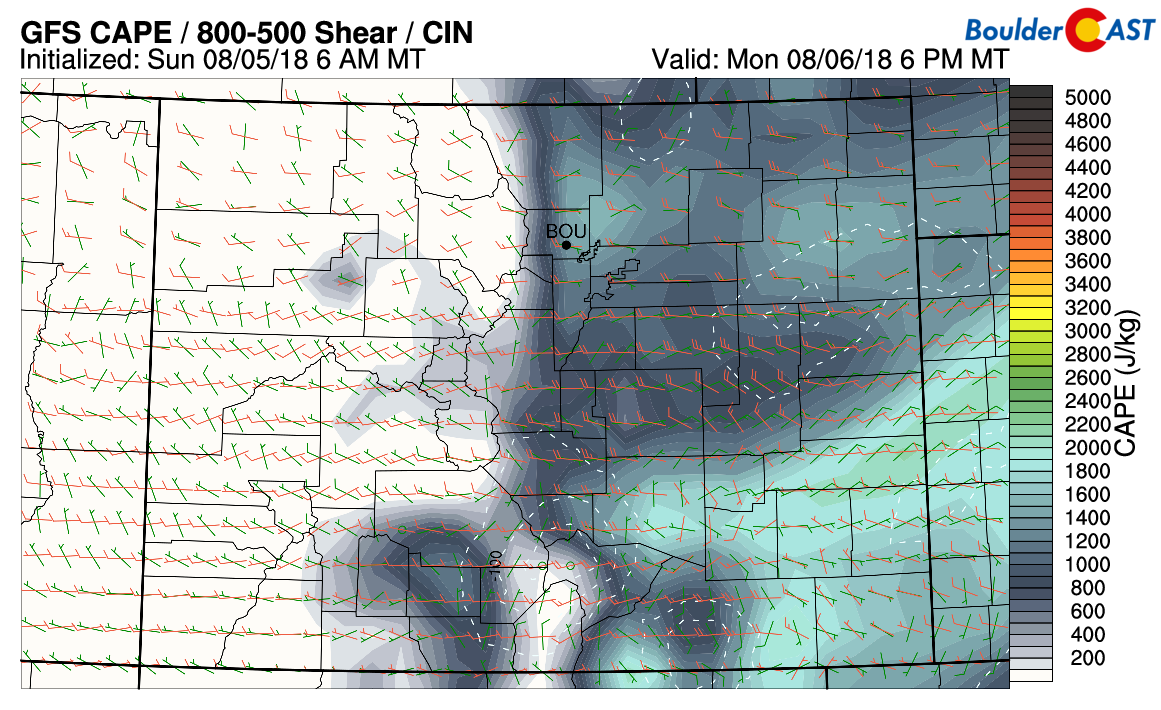
GFS CAPE and Shear today
Storms remain in forecast into Wednesday
Much of the same pattern will exist Tuesday and Wednesday. At 500 mb (below), northwest flow will remain. While there is no clear weather system moving through, the ripples of energy and decent atmospheric moisture, along with upslope flow, will keep showers and storms in the forecast, at about 30% each day, with the prime times being late afternoon and early evening.
GFS 500 mb absolute vorticity for Tuesday
Much of the precipitation this week will be confined to the eastern half of Colorado (see below), with most areas seeing between 1/2″ to 2″ of rain, depending on the exact placement of the storms. We’re thinking the nature of the setup will put the Foothills and western portions of the Metro area in-line to see a good chance of some heavier rainfall, which we hope will come to fruition as we greatly need the moisture.
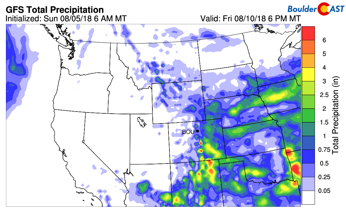
GFS total precipitation through Friday
Dry and seasonal to end
The latter part of the week will see a transition from the northwest flow to a more northeasterly one at mid-levels. Below’s 500 mb map for Friday shows the ridge of high pressure anchored across Nevada and southern Idaho. That position puts Colorado in a rather rare setup, something we have not seen much of this summer. A trough in the Great Lakes coupled with the ridge out west will keep Colorado on the fringe of some near to slightly below average temperatures, in addition to drying out the atmosphere. That should make for a nice end to the week with temperatures in the mid to upper 80’s and dry conditions. By the way, this is probably the worst possible set-up that can happen for monsoon season. Let’s hope it doesn’t stick around too long.
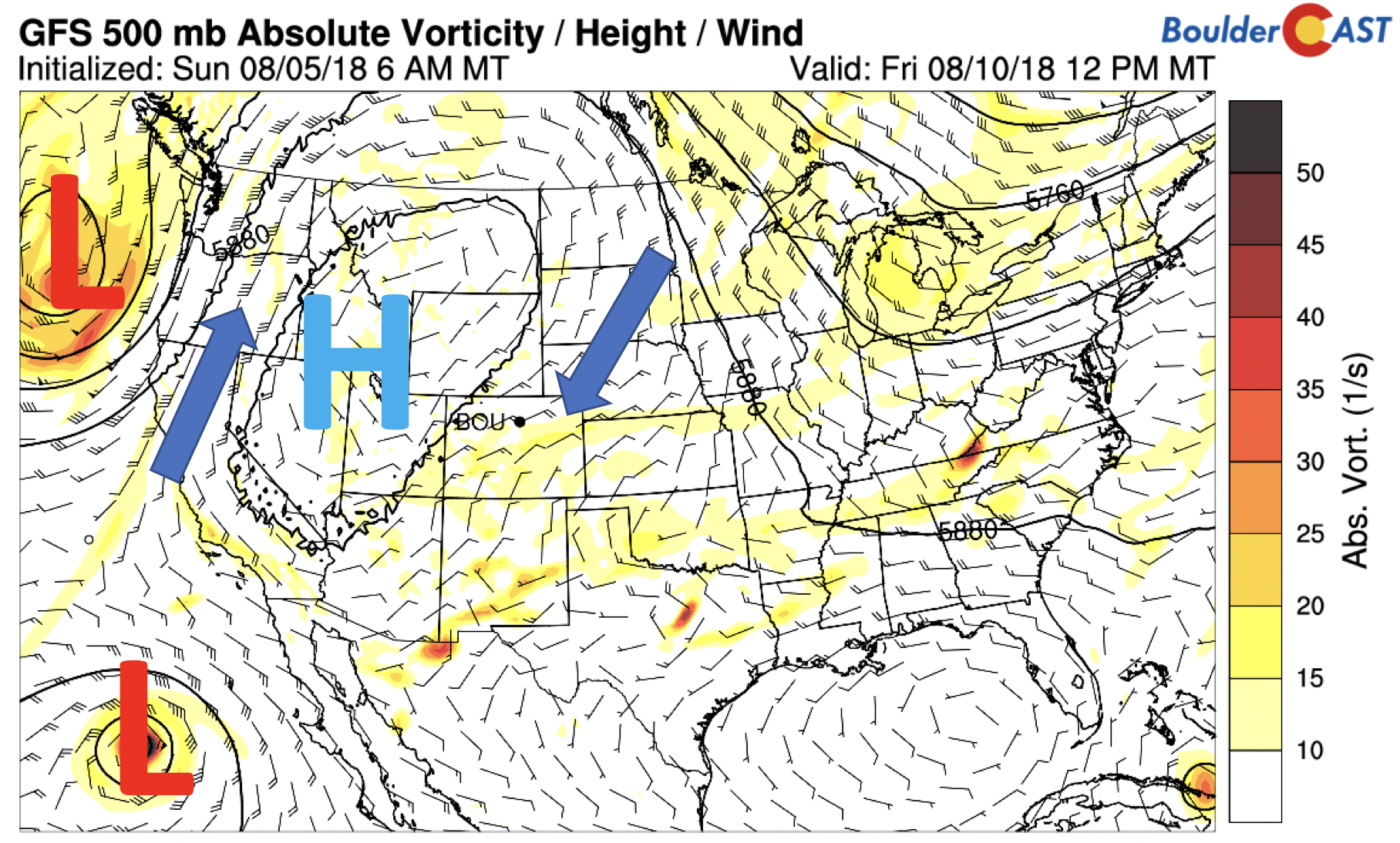
GFS 500 mb absolute vorticity for Friday
The result of this pattern will keep the most extreme heat to our west. Below shows that the anomalously warm 700 mb temperatures will be positioned across the Pacific Northwest and into Nevada and Utah, in the vicinity of the ridge. Seattle will be in store for a few uncommon 90-degree days this week, while parts of eastern Washington and Oregon could hit 110 degrees. Meanwhile, eastern Colorado will see near to slightly below average highs thanks to the slight influence from the northeast winds coming out of Canada.
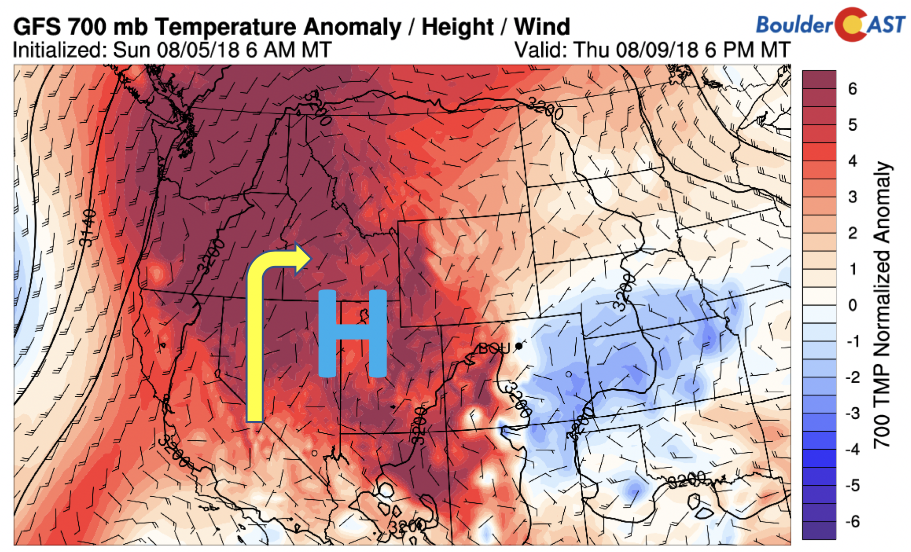
GFS 700 mb temperature anomaly for Friday
Finally, we do have two active tropical cyclones right now in the Eastern Pacific Ocean. Both John and Ileana are expected to become hurricanes in the coming days. However, given the ridge setup across the western United States, these hurricanes are not expected to impact the southwestern United States directly. However, it’s possible they could feed some moisture into our region early next week. We’ll keep an eye on these two for now.
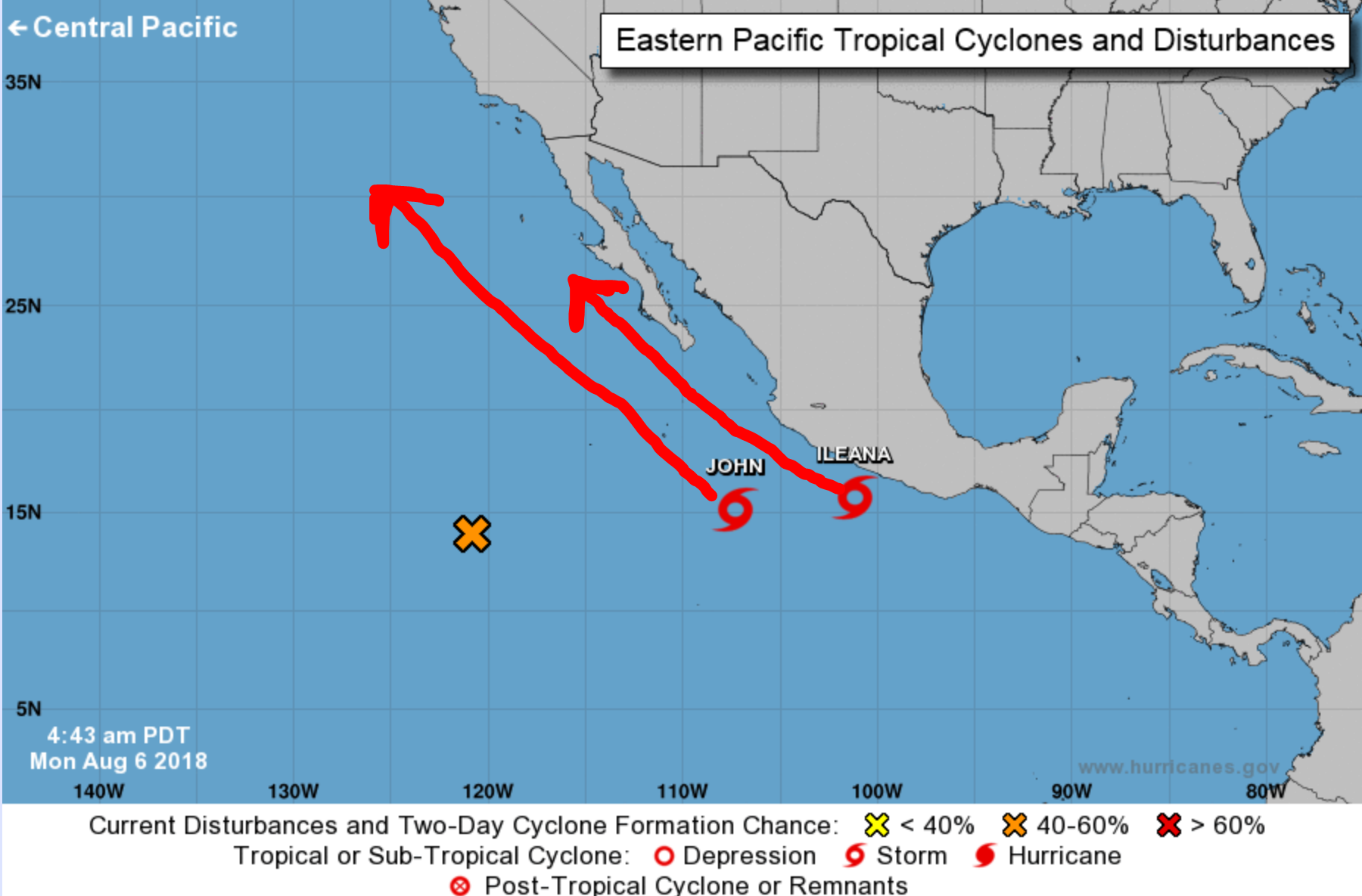
Two tropical cyclones are churning in the eastern Pacific Ocean on Monday.
Enjoy your week! We want to hear how much rain you get so please do continue to tweet or email us your reports!
Forecast Specifics:
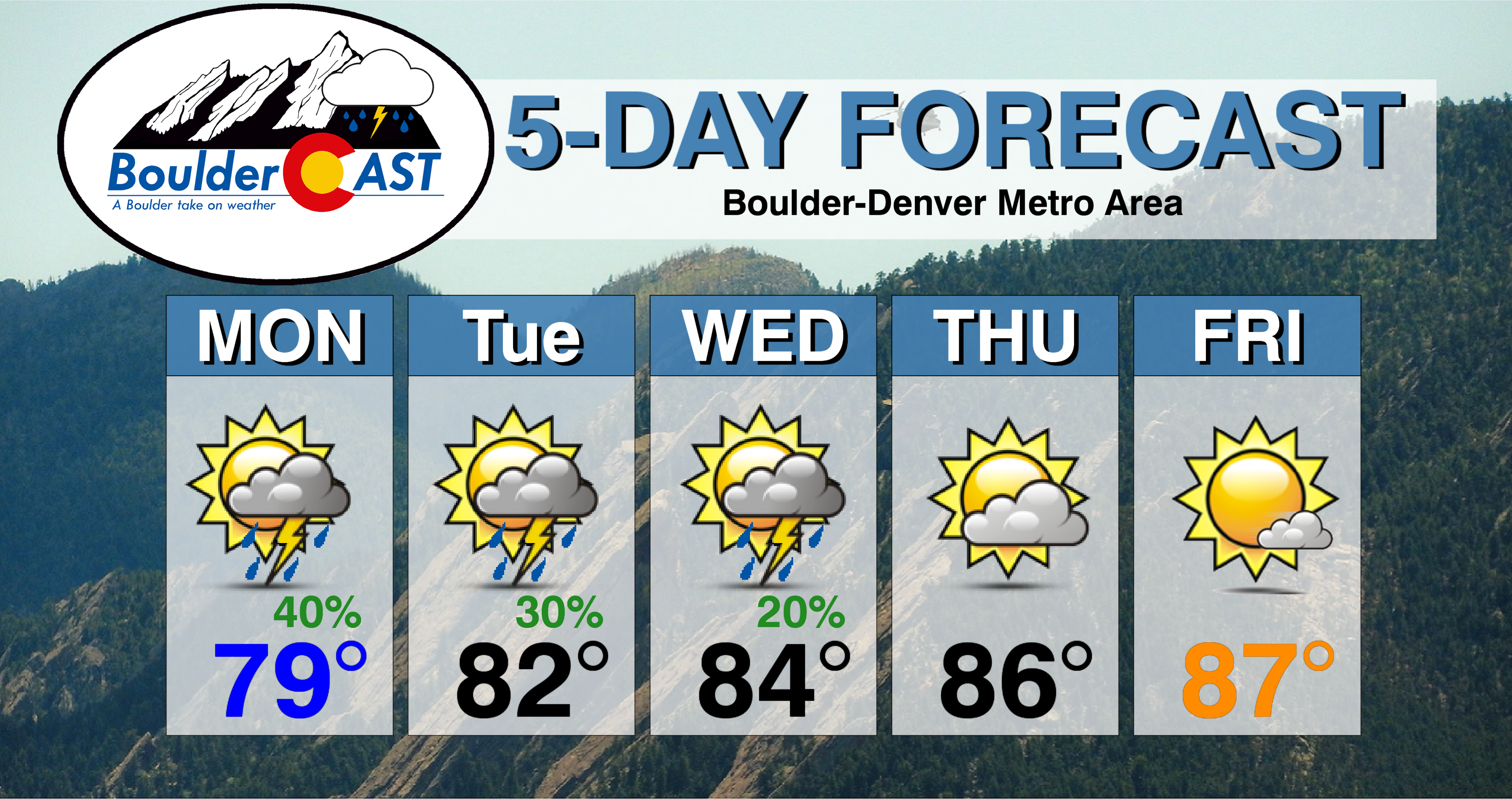
Monday: Cool with partial sunshine through the day. Expect showers and thunderstorms developing for the early evening, several of which could become severe with large hail and damaging winds. Highs in the upper 70’s across the Plains and mid 60’s in the Foothills.
Tuesday: Mostly sunny becoming mostly cloudy with scattered showers and thunderstorms in the late afternoon and evening. Heavy rainfall is possible. High temperatures in the lower 80’s for the Plains with lower 70’s in the Foothills.
Wednesday: Morning sunshine, then increasing clouds with widely scattered afternoon and evening thunderstorms, mainly south of Denver. High temperatures in the middle 80’s across the Plains with mid 70’s in the Foothills.
Thursday and Friday: Mostly sunny skies with highs in the mid to upper 80’s for the Plains and in the mid to upper 70’s in the Foothills.
Weekend Outlook: Ridge of high pressure will remain parked across Nevada into the upcoming weekend. That will keep the extreme heat to our west. Expect gradually rising temperatures into the weekend with overall dry conditions.
High Country: Scattered showers and storms will be across the High Country today into Wednesday thanks to the northwest flow. Storms will remain on Thursday as well but will be primarily located across the southwestern part of the state. Drier weather returns for Friday and the upcoming weekend. Check out SummitCAST for twice daily updated forecasts for more than 120 Colorado mountain destinations!
DISCLAIMER: This weekly outlook forecast was created Monday morning and covers the entire upcoming week. Accuracy will decrease as the week progresses as this post is NOT updated. To receive daily updated forecasts, subscribe to BoulderCAST Premium.

.
Share our forecast!


