
This week begins on the mild side, but transitions toward a wet and chilly pattern quickly come midweek. While snowfall will be confined to the higher Foothills and High Country, the lower elevations are poised to pick up a significant amount of much-needed rainfall. Read on for more details.
Snowpack update – severe conditions down south
The figure below shows the current snowpack water equivalent for Colorado. While the northern part of the state has seen vast improvement in the drought picture, southern and southwest Colorado are seeing a severe shortage of moisture. Can you believe that the San Juans are at just 18% of normal right now? While this is bad news for the spring and early summer regarding potential wildfires, there will be some help this week with a series of systems traversing through the state. We detail these in the next section.
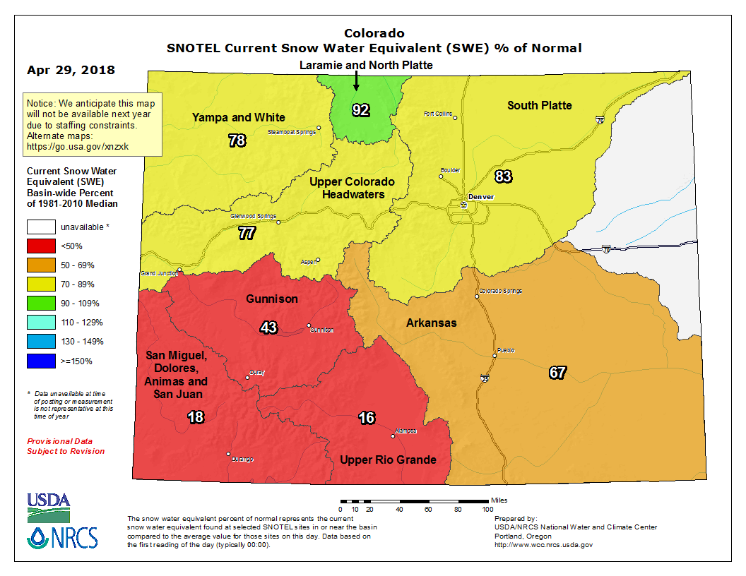
Colorado snow water equivalent percent of normal
The week ahead: Mild to start
We’re right back to where we were Saturday and Sunday, with the exception of just a tad cooler for highs this afternoon. The GFS 500 mb map below shows a trough centered over Idaho, with southwesterly flow over our state. Over the next few days, this system will become cut-off from the main flow and dig into southern California, but eventually move into Colorado. That will enhance our precipitation chances through the week…but not yet for today. Outside of high clouds streaming in from the west and southwest, downslope flow will keep our weather mild and dry for the most part. A chance of isolated thundershowers are possible Monday evening and night, but most areas should not see rain until sometime Tuesday.
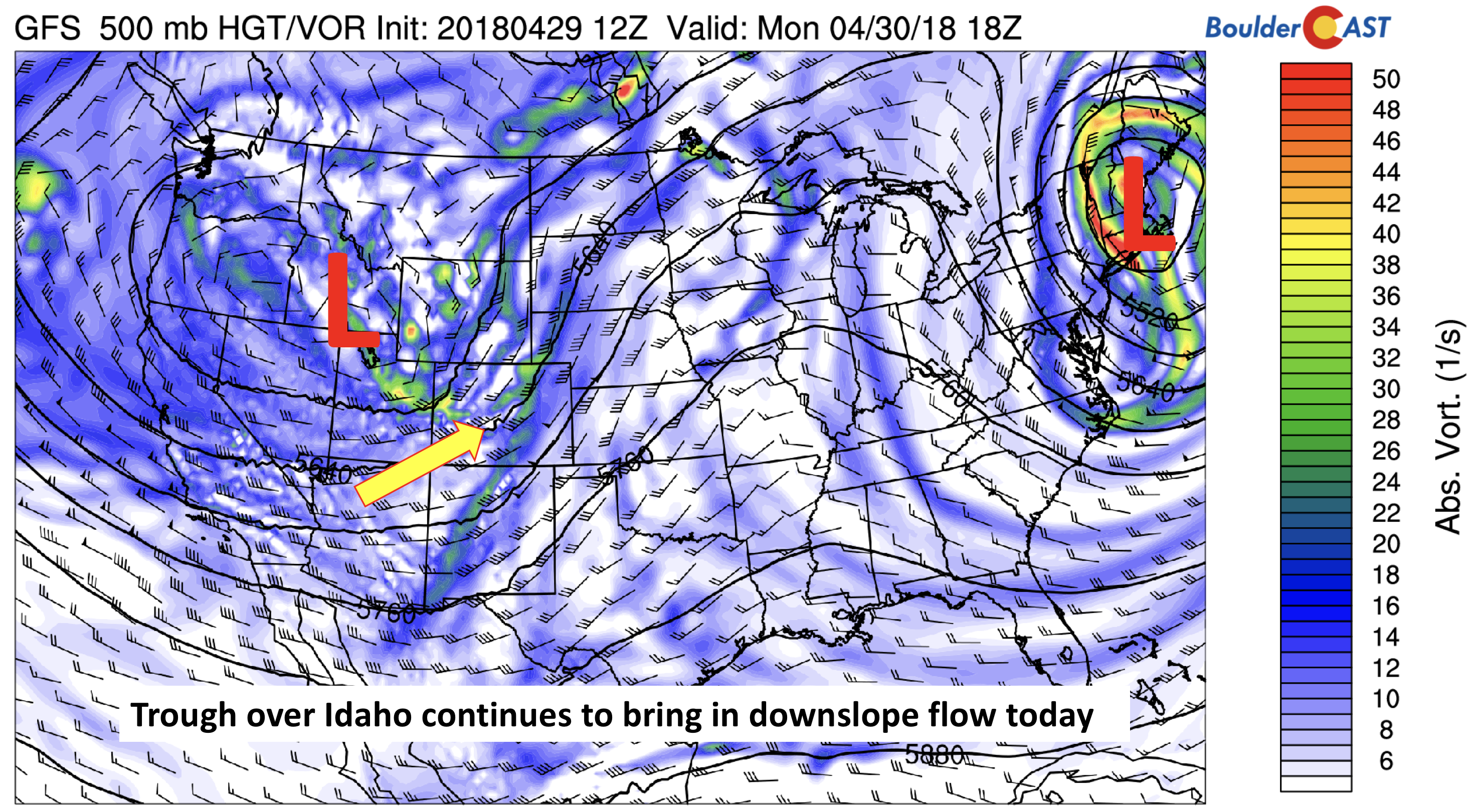
GFS 500 mb absolute vorticity today
Unsettled Tuesday through Thursday
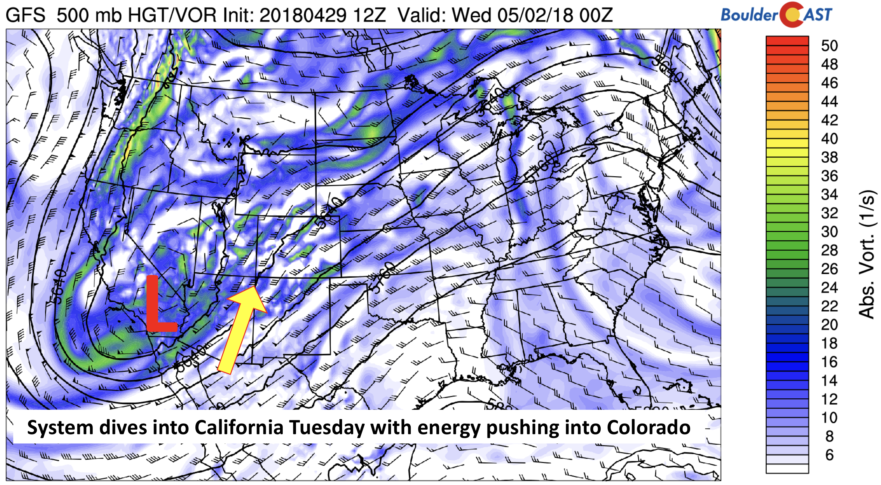
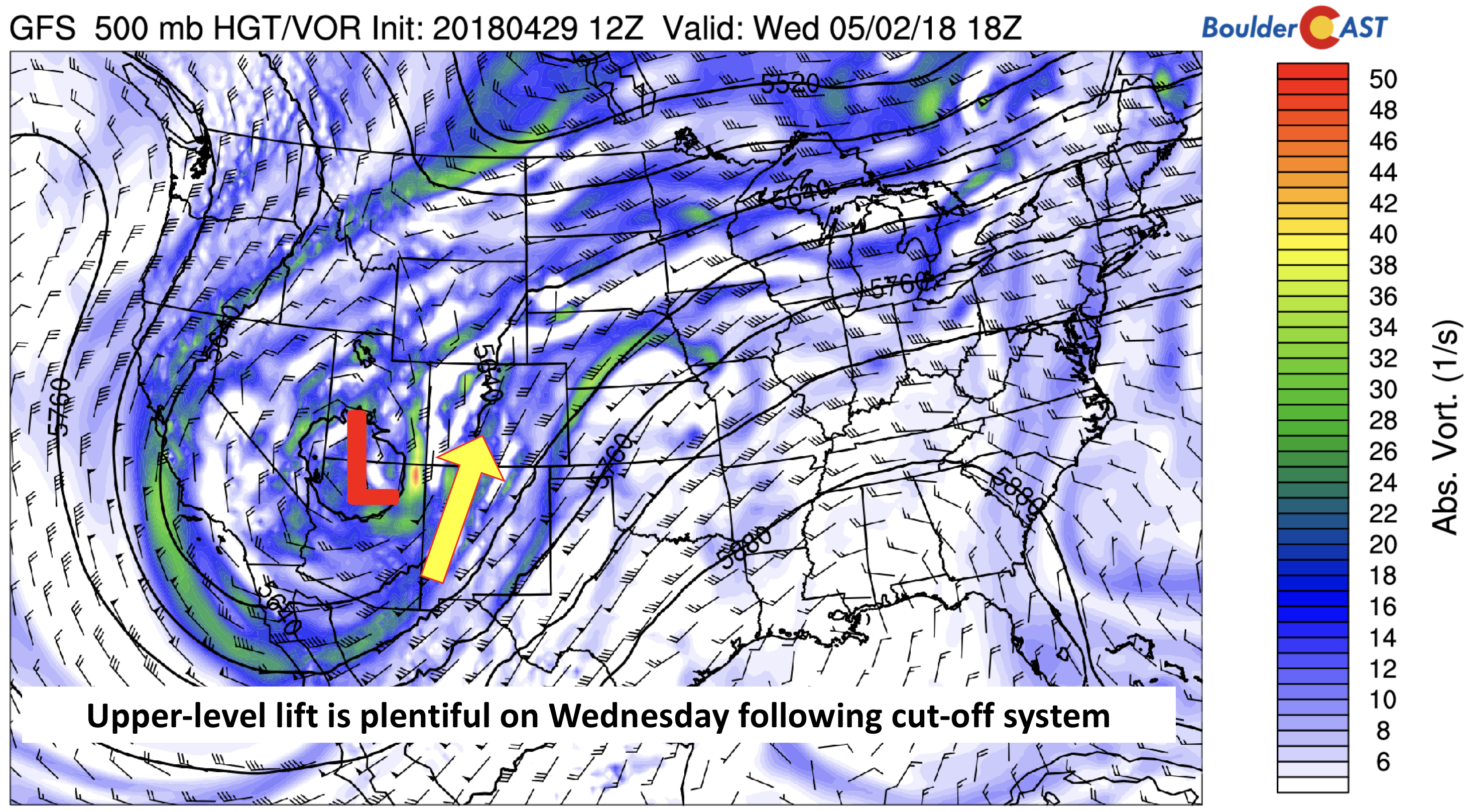
The middle of the week will be VERY active. The 500 mb maps below show the pattern for Tuesday and Wednesday. Notice an area of low pressure over southern California (Tuesday), tracking northeast through southern Colorado and into Kansas by Thursday morning. The cut-off nature of the system will lead to a prolonged period of wet weather for the Metro area and snowfall for the higher elevations.
GFS 500 mb absolute vorticity on Tuesday
GFS 500 mb vorticity on Wednesday
Lift for the area will be accompanied not only from the trough, but some upper-level jet streaks. The image below shows that northeast Colorado will be in a favored region for upper-level forcing both Tuesday and Wednesday. In the case of Tuesday, the region will be in the right entrance region of a jet oriented southwest to northeast over Nebraska. On Wednesday, the region will be in the left exit region of a south-north oriented jet stretching through Colorado. Subtle changes in the track of the system may change these jet positions, possibly effecting the precipitation outlook. Our inclination is that the heaviest precipitation will be between Denver and the Wyoming border in and near the Foothills.
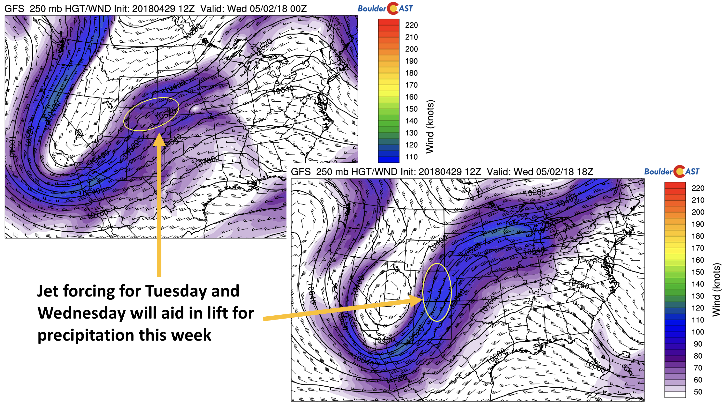
GFS 250 mb jet stream for Tuesday (left) and Wednesday (right)
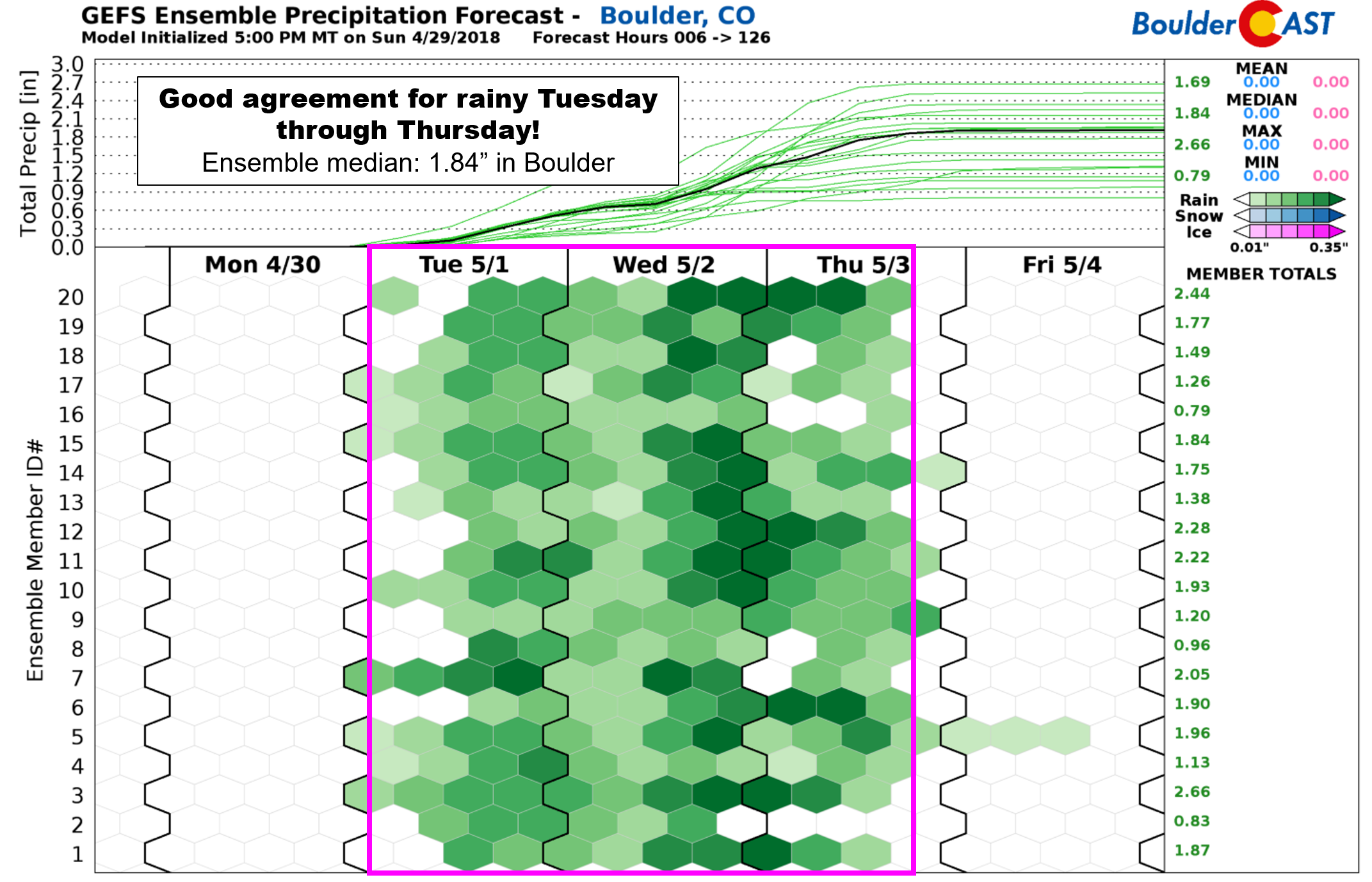
As of now, however, Tuesday and Wednesday appear to be the primary “soggy” days. This is evident below looking at the GEFS ensemble forecast. The latter part of Tuesday is wet; all ensemble members have rain on Wednesday, and rain may even linger into Thursday. Thursday’s forecast is somewhat uncertain as it remains to be seen how fast the system will eventually pull-out of Colorado. We would expect a good chance for rain at least in the morning.
As for the orientation and timing of the precipitation, the models depict a southwest to northeast oriented precipitation shield both Tuesday and Wednesday evenings. This is shown below. Note that the locations of these bands are coincident with the jet stream pattern shown earlier. Hence, the accurate location of the rain will depend on how the system evolves over the next day or so in the forecast models.
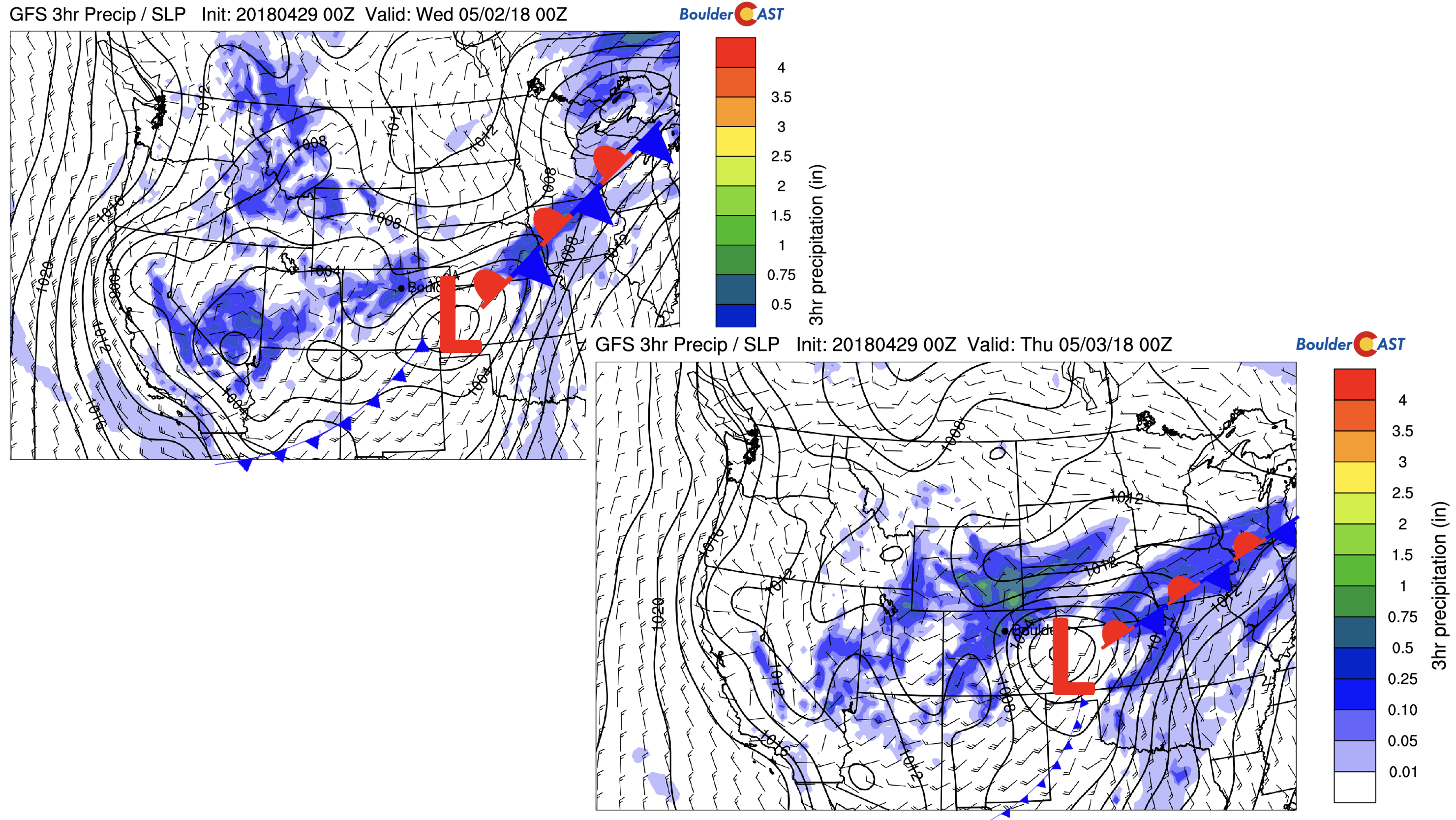
GFS precipitation forecast for Tuesday evening (left) and Wednesday evening (right)
Will it get cold enough for snow?? By all indications thus far, the precipitation should fall as rain for the Plains. The below snow level predictions indicate snow levels will dip at best to ~ 7000 feet Wednesday night and early Thursday. This will be the colder day as the system wraps in colder air from the north with upslope flow. However, it won’t get cold enough to change over to snow for Denver…not even close really. The Foothills, however, above 8000 feet, could see several inches of snow.
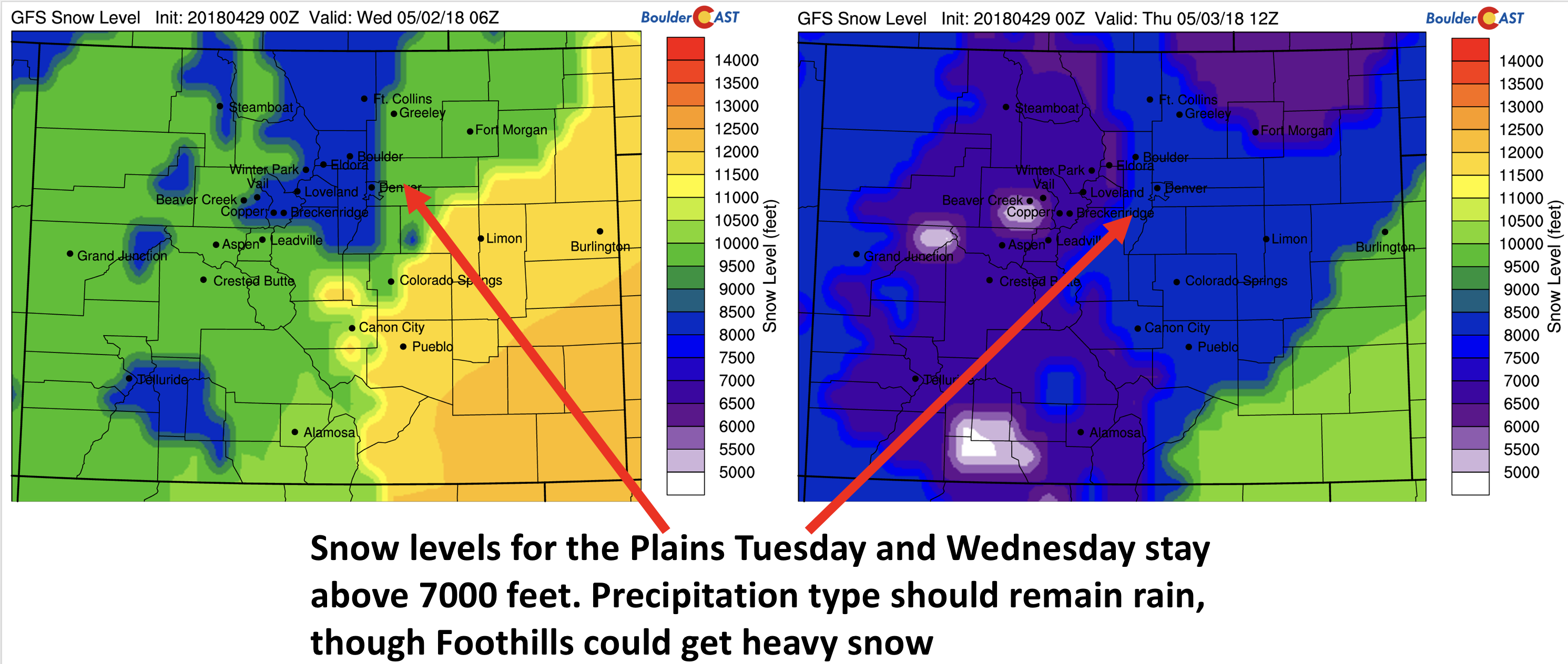
GFS snow levels for Tuesday night (left) and Wednesday night (right)
The current GFS model shows that portions of southwest Colorado (a very drought stricken region) could benefit from this week’s storm, with over 4″ in most spots and up to a foot in localized areas. The snow also spreads north in the location of the jet forcing, with accumulation possible in the Foothills above 8000 feet.
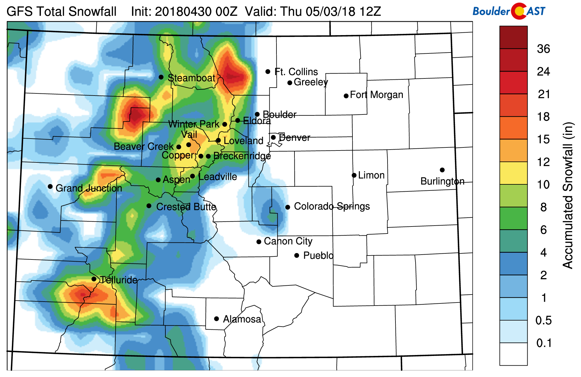
GFS snowfall forecast through Thursday
Chilly Thursday, milder to end the week Friday
Come Thursday, the low pressure trough will have moved off to our east just enough to allow some drier air and a cooler airmass to filter in from the north. The system will be centered over central Nebraska, with a cold front trailing it trough the Desert Southwest. Our region will likely be under upslope flow for half of the day. As a result, rain may linger during the early part of the day, as well as lingering snow showers over the Mountains and Foothills, but drier air should take over by the evening. Clouds will again limit highs to only the middle or upper 50’s. Once again, how fast the system moves out will play a big role in how wet we will be on Thursday – so stay tuned.
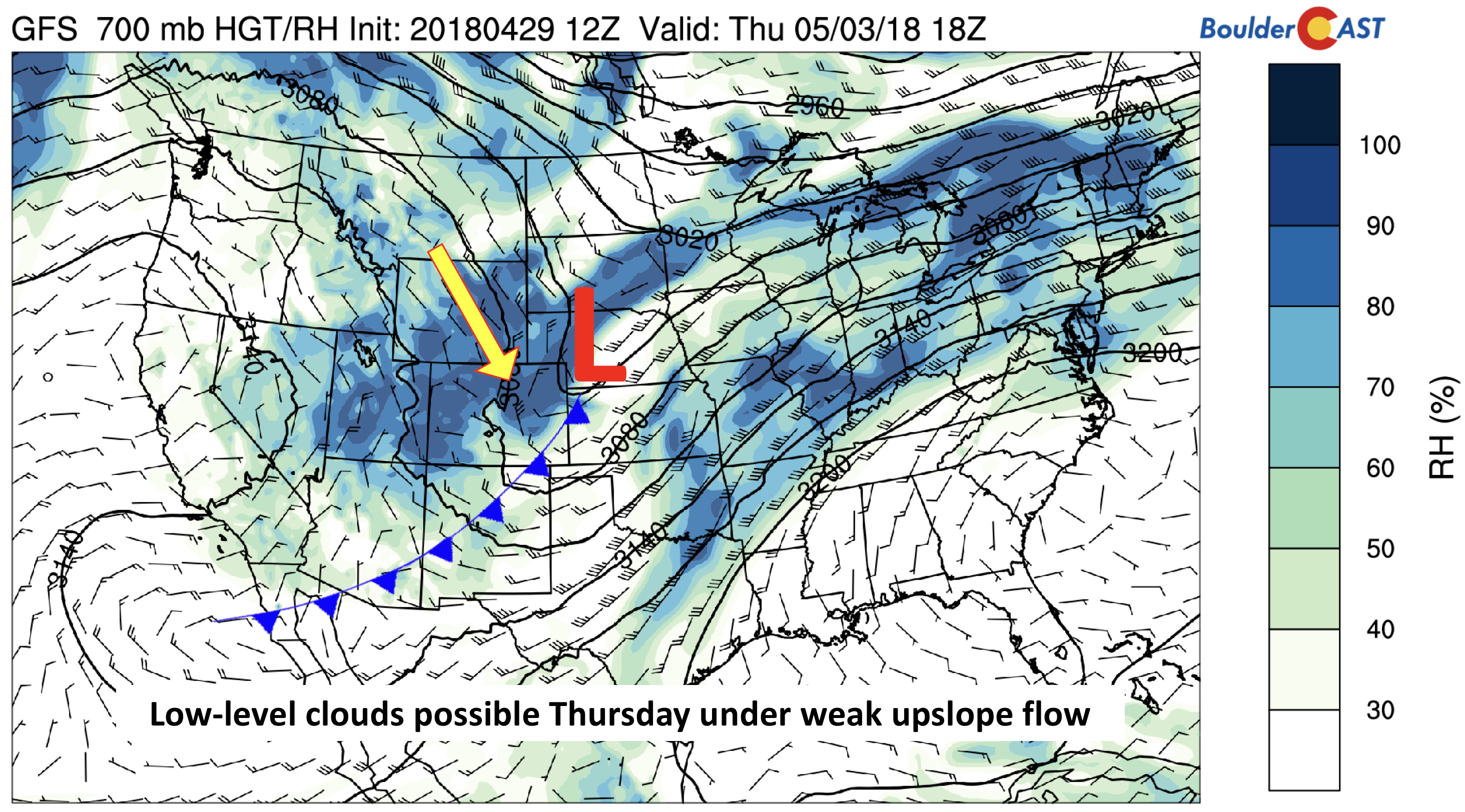
GFS 700 mb relative humidity and wind Thursday
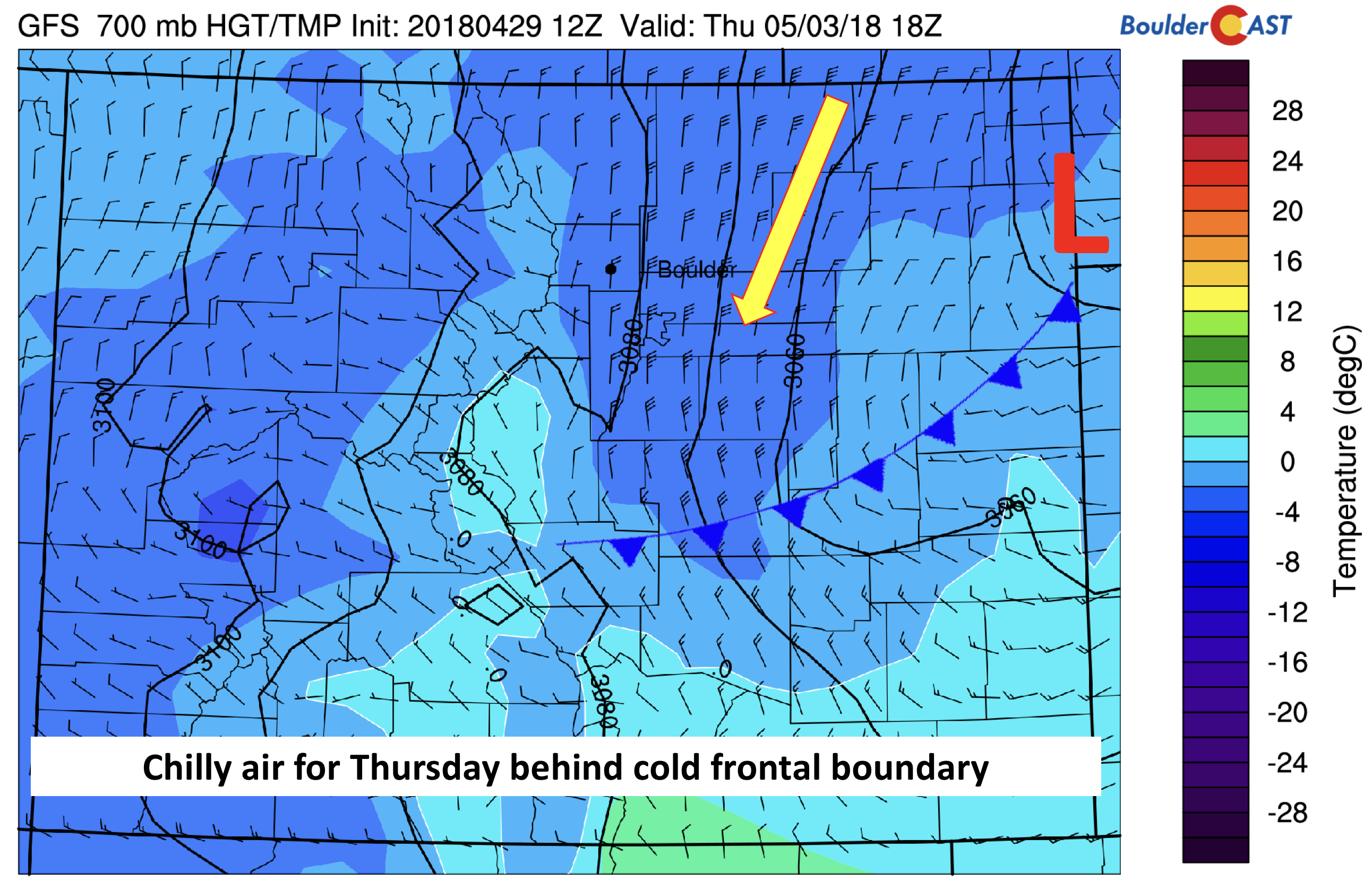
GFS 700 mb temperature and wind map for Thursday afternoon.
By Friday, the start of the weekend turns beautiful by all accounts. Models are showing a ridge to build in, with temperatures rebounding back to near 70 degrees under mostly sunny skies. We can’t rule out a few isolated afternoon thunderstorms across the higher elevations, however.
We rarely see our weather turn this soggy in northeast Colorado…Enjoy it while you can!
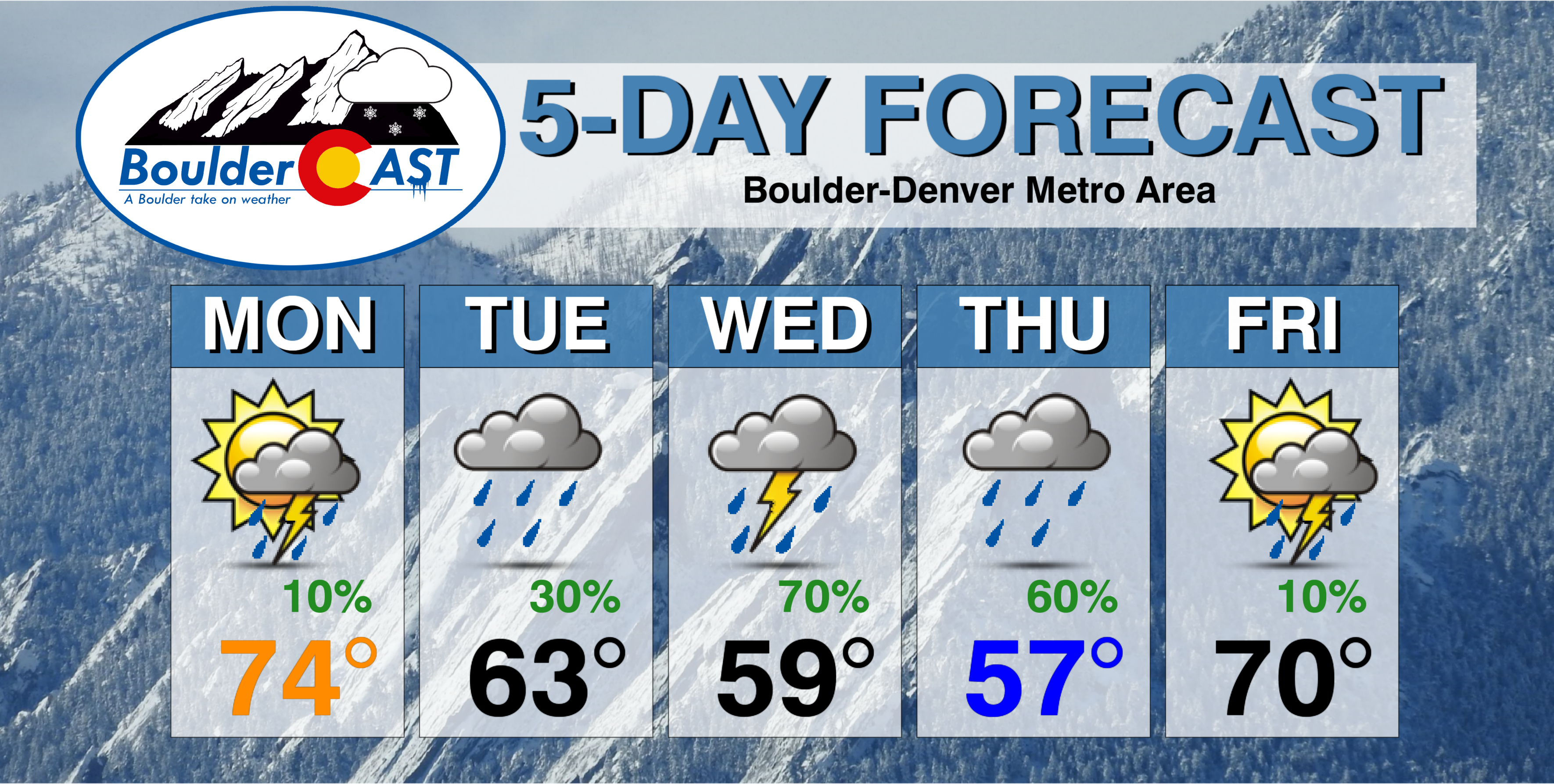
Forecast Specifics:
Monday: Partly cloudy with breezy southwest winds at times exceeding 20 mph. Isolated thundershowers are possible in the evening and overnight, but most areas to stay dry. Highs over the Plains in the middle 70’s with lower 60’s in the Foothills.
Tuesday: Mostly cloudy with scattered rain showers developing through the afternoon and early evening. Light snow is possible over the Foothills above 9000 feet as well. Highs in the lower 60’s on the Plains and upper 40’s in the Foothills.
Wednesday: Overcast with rain likely, particularly in the late afternoon to early evening and continuing overnight. Over 0.5″ of rainfall is possible with several inches of snow in the Foothills above 8000 feet. Highs in the upper 50’s for the Plains and middle 40’s in the Foothills.
Thursday: Overcast skies with lingering rain showers through the morning and maybe the afternoon. Snow will linger in the higher elevations as well. Highs in the middle 50’s on the Plains and lower 40’s in the Foothills.
Friday: Sunshine and milder weather with temperatures in the upper 60’s to near 70 degrees on the Plains and upper 50’s in the Foothills. A few isolated storms may form across the Foothills in the afternoon.
High Country: Rain/snow showers will increase across the Mountains Tuesday afternoon, continuing into Tuesday evening. 1 to 4″ of snow is expected for portions of the state. Heavier snowfall, 6+” worth, is likely to fall Wednesday into Thursday. Tranquil weather returns on Friday. Find the latest forecast for all your favorite Colorado ski resorts on our PowderCAST page.
DISCLAIMER: This weekly outlook forecast was created Monday morning and covers the entire upcoming week. Accuracy will decrease as the week progresses as this post is NOT updated. To receive daily updated forecasts, subscribe to BoulderCAST Premium.

.
Share our forecast!


You must be logged in to post a comment.