This week will feature generally warm weather, but there will be periods of cooler weather and some precipitation mixed in.
Warm early in the week
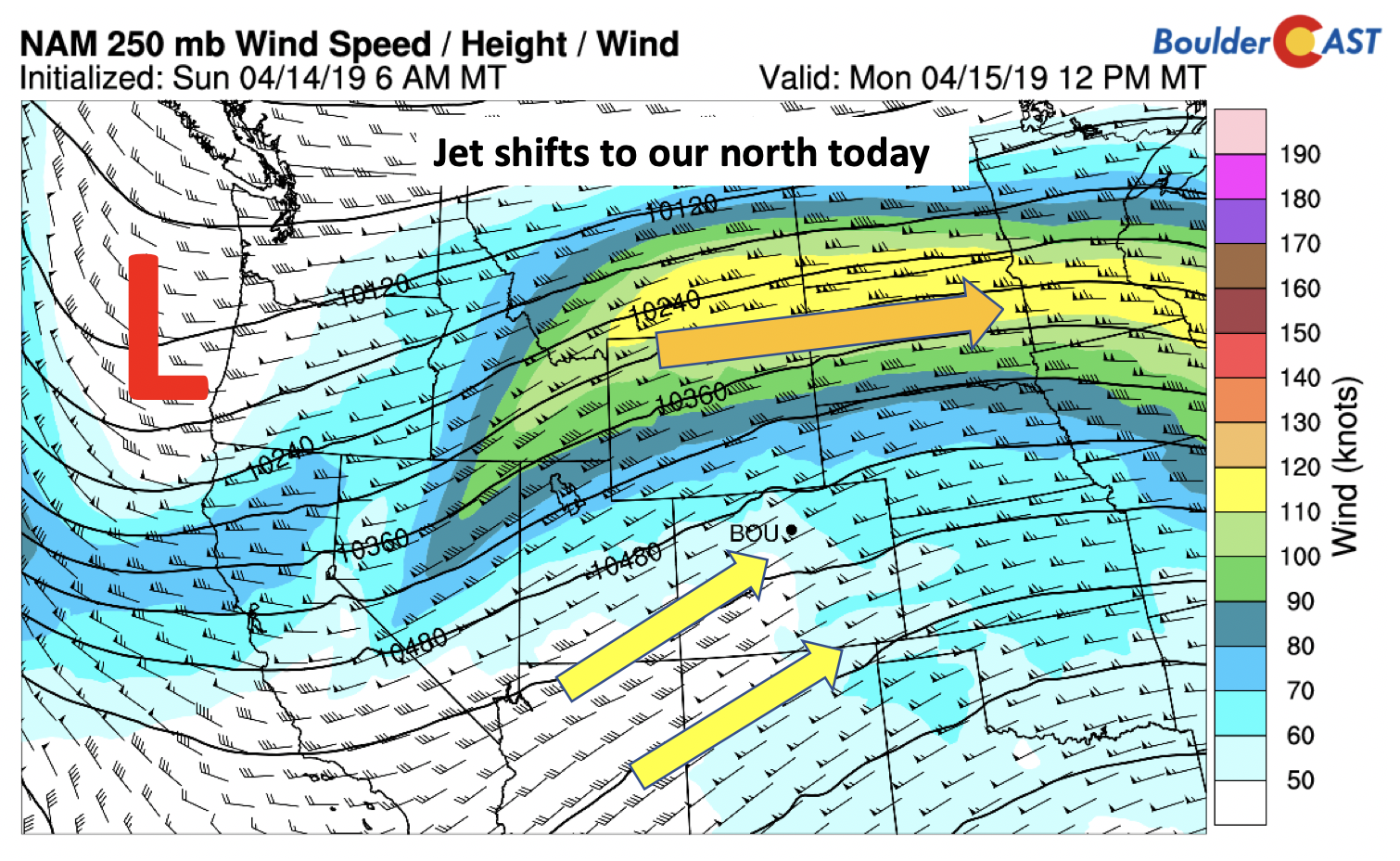
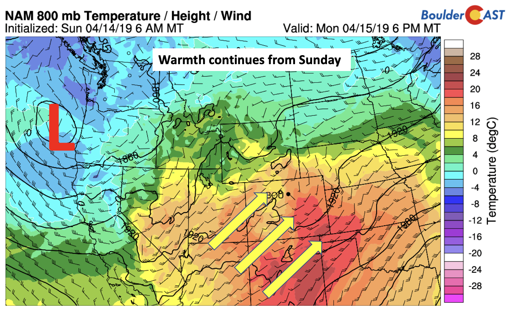
Monday basically picks up where we left off on Sunday. The upper-level jet stream (below) shifts northward compared to its position yesterday. As a result, southwesterly winds pump-in warmer air.
There will be patches of wave clouds early Monday. However, sunshine should be prevalent thereafter with the jet moving out of the state. With that, warm air advection should push us into the lower 70’s. We’re watching a midweek system that is currently out over the Pacific which will turn us cooler and increase the chances of precipitation.
Look for increasing clouds Tuesday, but within the same airmass temperatures will remain nice and mild. Expect highs Tuesday in the upper 60’s to near 70 degrees.
Unsettled mid-week
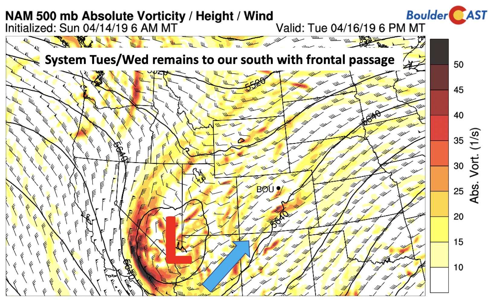
The weather starts to really change as we go into Tuesday evening and Wednesday morning. The system out in the Pacific will move onshore into southern Nevada by Tuesday night. This is very similar to last week where we had a snowstorm pushing through around the same time. However, this storm has much less cold air and a more southern track. Nevertheless, temperatures will fall into the 50’s for highs Wednesday.
While most of the daytime Tuesday will be dry, some weak unstable air (below) will be present with some embedded shortwaves from the low pressure (above) pushing into the state. This is quite isolated in nature, so at best just very widely scattered thundershowers are expected late in the day Tuesday.
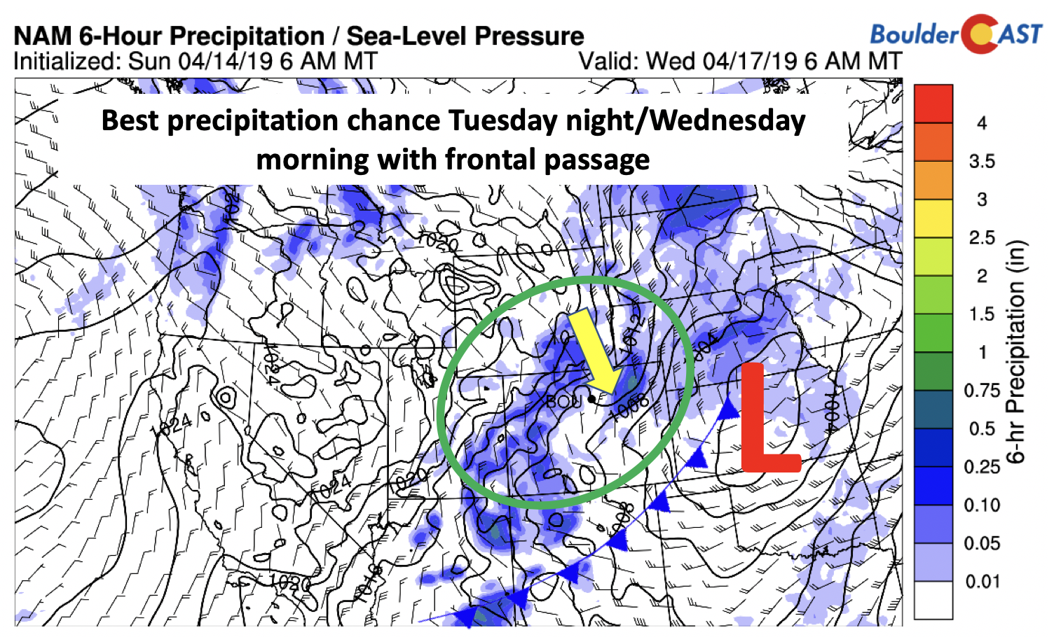
The primary airmass change will take place early Wednesday with a cold frontal passage and northerly winds ensuing. We could see a few rain showers continue Tuesday night and early Wednesday with the front approaching, but chances are not looking great. With the system mainly to our south, there isn’t a whole lot of lift outside of the front. Nevertheless, moisture is higher and enough to warrant a mention here.
The question then comes up…”Will it be cold enough to snow?” The trough will certainly bring down cooler air but nothing like what we had last Wednesday. The derived snow levels (below) show snow remaining at or above 6000 feet for most of the period. We certainly think the Foothills will see snow, primarily in the Wednesday and Thursday timeframe. For the Plains, precipitation will fall as rain.
It certainly won’t be a wash out Wednesday and Thursday. On Wednesday our best chance will be during the morning to early afternoon hours. A secondary chance comes early Thursday as the system pulls into the Midwest (below) and a shortwave impacts the region. We’re not super confident in this second shortwave, as it is rather subtle. The GFS is quite bullish but we’ll stick with just a 10 to 20% chance or rain showers for early Thursday. We’ll certainly be colder Wednesday and Thursday in the 50’s.
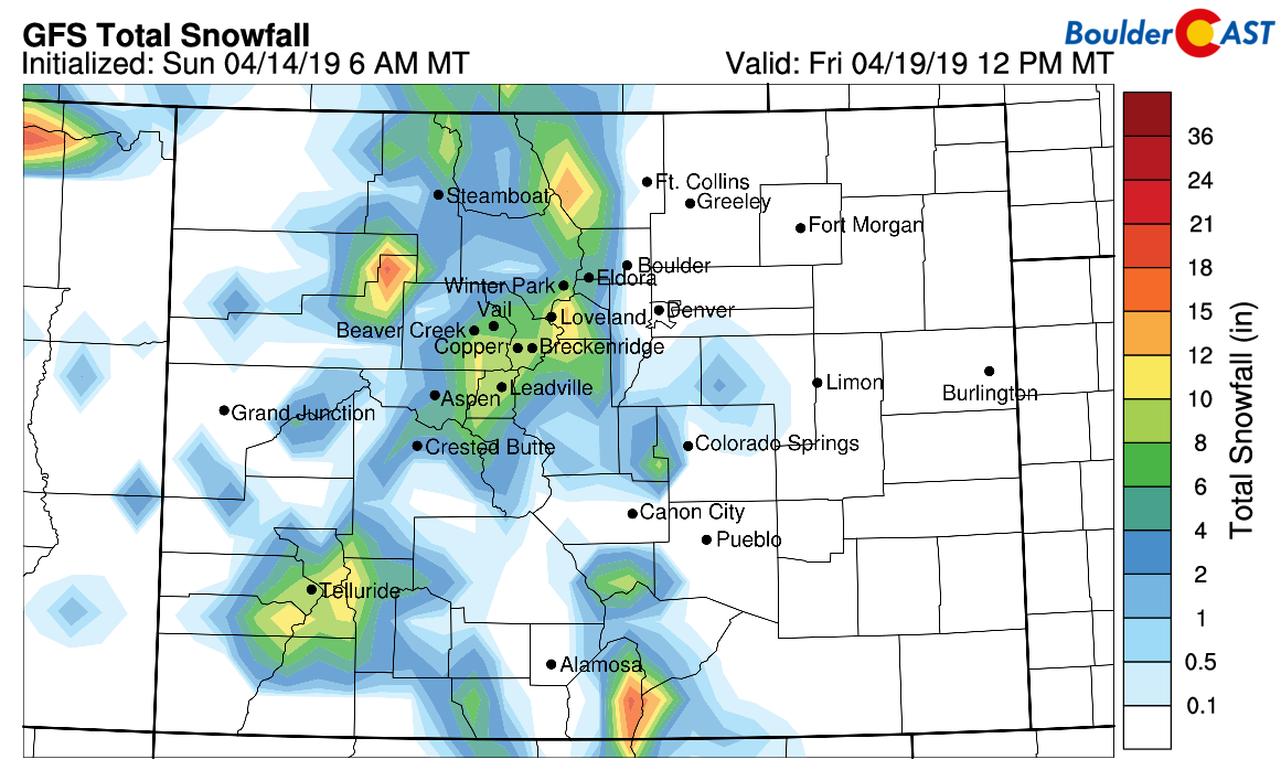
The snow delineation will basically be from the higher Foothills westward (below). Portions of the Mountains should pick up another 3 to 8 inches, with isolated higher amounts as usual. The Foothills can expect 1 to 2″ at mos through the week.
A warm Friday!
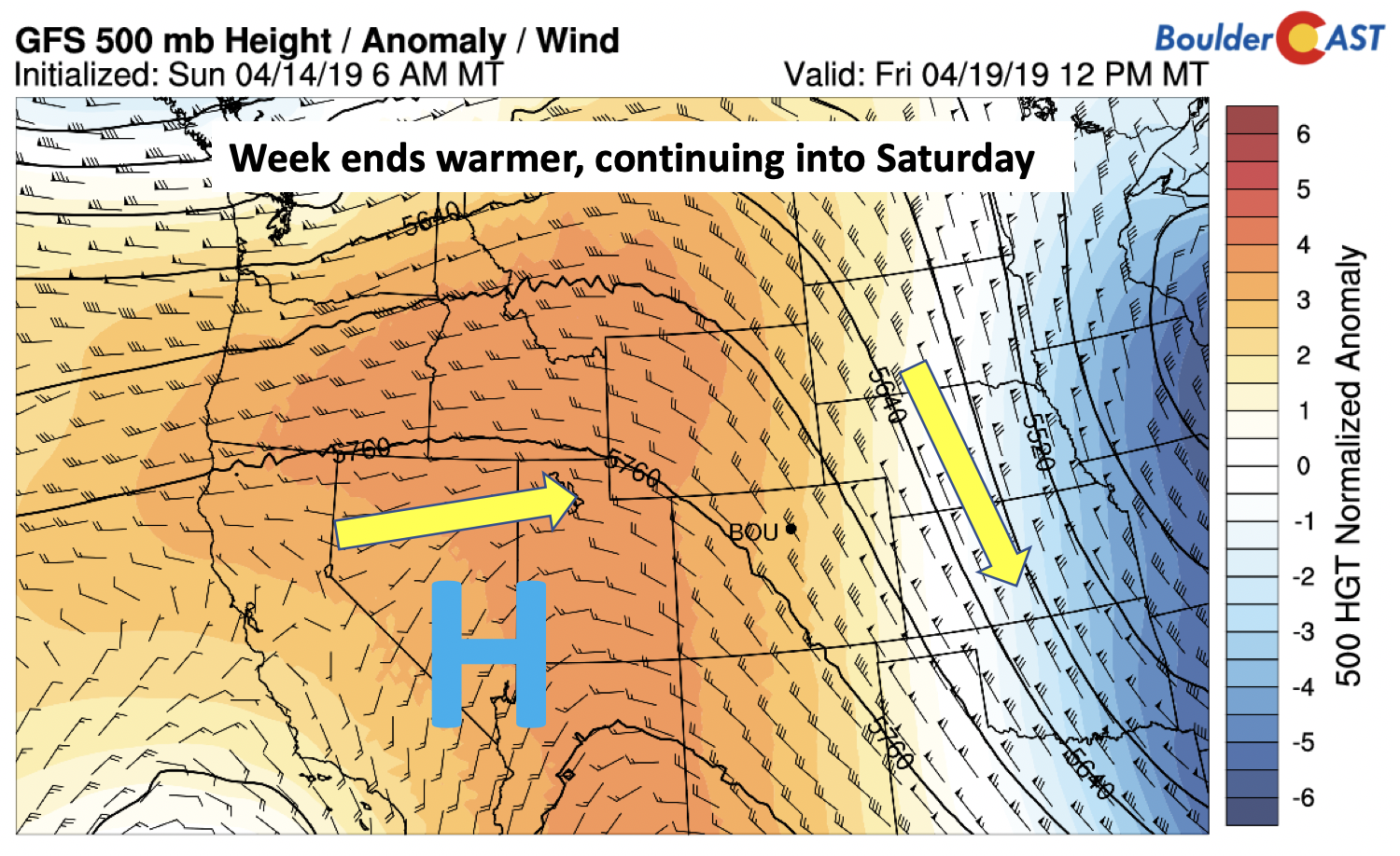
By Friday, the spring-like feel returns. At the mid-levels the trough pushes out. Behind it, a nice large ridge of high pressure takes over across the West. That should return us to the upper 60’s to maybe 70 on Friday, and even warmer still for Saturday!
Light snow last Friday night
We’re you surprised to wake up to a dusting of snow Saturday morning? You shouldn’t have been…it was in our forecast.
Shown below is our snowfall forecast map with storm totals overlaid in boxes. Green boxes indicate that our forecast verified to within one inch of the observed snowfall. Red did not. Boulder reported 0.8″ of snow and DIA 0.3″.
Forecast Specifics:
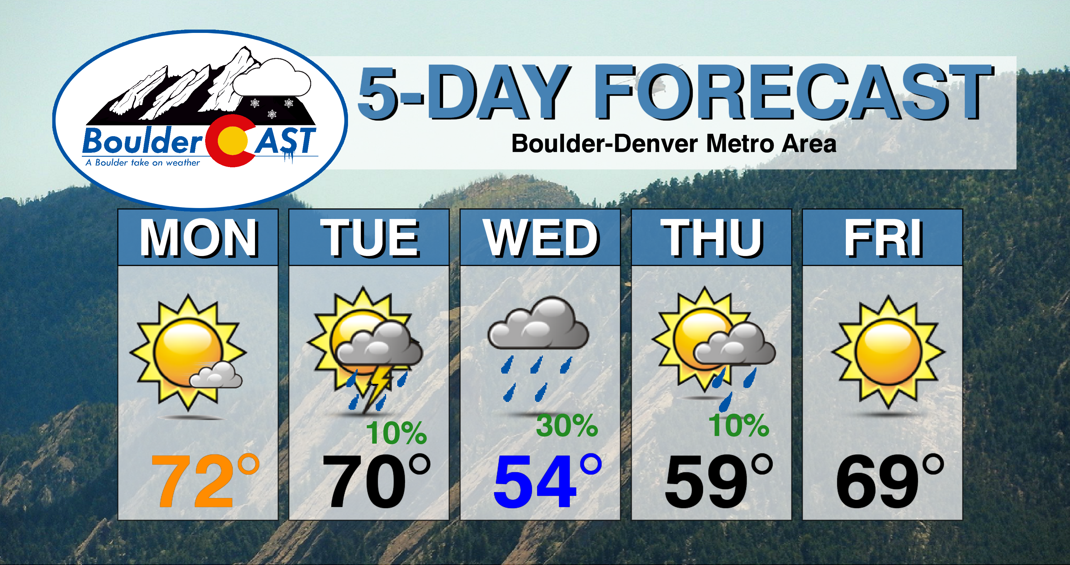
Monday: Some wave clouds early, then mostly sunny. Highs on the Plains in the lower 70’s and in the lower 60’s in the Foothills.
Tuesday: Mostly sunny to start, then increasing clouds with a slight chance of isolated thundershowers. Highs near 70 on the Plains and upper 50’s in the Foothills. Isolated rain showers remain a threat overnight into Wednesday morning.
Wednesday: Morning clouds and fog with scattered rain showers. Rain/snow showers in the Foothills with up to 1″ of accumulation. Drier in the afternoon under mostly cloudy skies. Highs will be much cooler in the middle 50’s on the Plains and upper 30’s in the Foothills.
Thursday: Partly to mostly cloudy with a chance of light showers during the morning and a chance of snow in the Foothills. Highs in the mid to upper 50’s on the Plains and in the low 40’s in the Foothills.
Friday: Sunshine and warmer with temperatures near 70 degrees on the Plains and middle 50’s in the Foothills.
High Country: Dry weather will start the week, although it will be gusty with the jet nearby. Unsettled weather returns Tuesday through Thursday, with several locations seeing 4 to 8 inches of snow. Drier weather and warmer conditions return Friday. Check PowderCAST for updated forecasts for all the Colorado ski resorts.
DISCLAIMER: This weekly outlook forecast was created Monday morning and covers the entire upcoming week. Accuracy will decrease as the week progresses as this post is NOT updated. To receive daily updated forecasts from our team, subscribe to BoulderCAST Premium.
.
Share our forecast!








You must be logged in to post a comment.