An active weather pattern is in store this week as two wintry storm systems take aim on the region. The first one arrives Tuesday with a second following up on Thursday. Both systems will provide impacts for the Mountains and Plains in terms of precipitation, gusty winds, and colder temperatures, but it appears the second one will offer the better chance for the first accumulating snow event in the Boulder-Denver area. Let’s take a look!
This week’s highlights include:
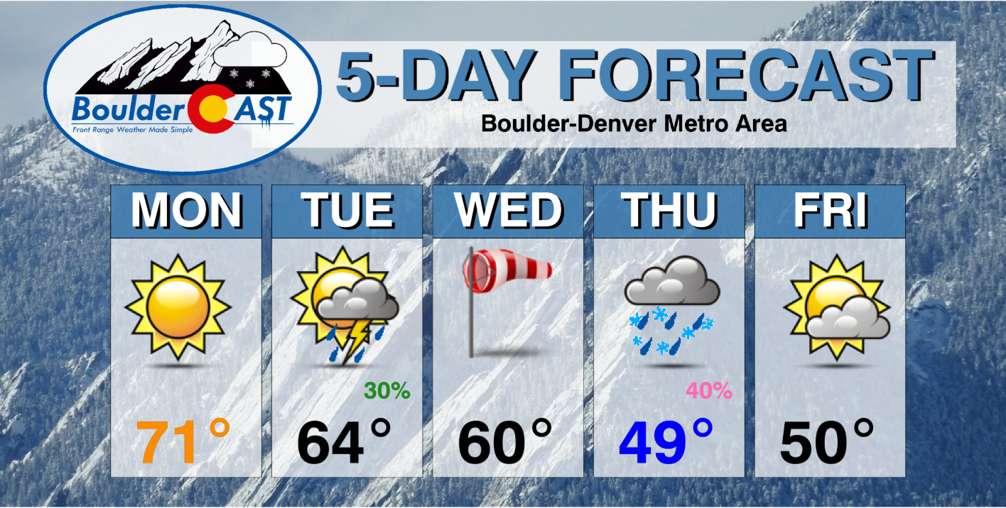
- Near normal temperatures on Monday and Tuesday, but significantly cooler the rest of the week
- Two storm systems will impact our area, the first Tuesday into Wednesday and a second one on Thursday
- Gusty downslope winds and a chance of thunderstorms will accompany the first storm
- The second event is more favorable for lower elevation snow
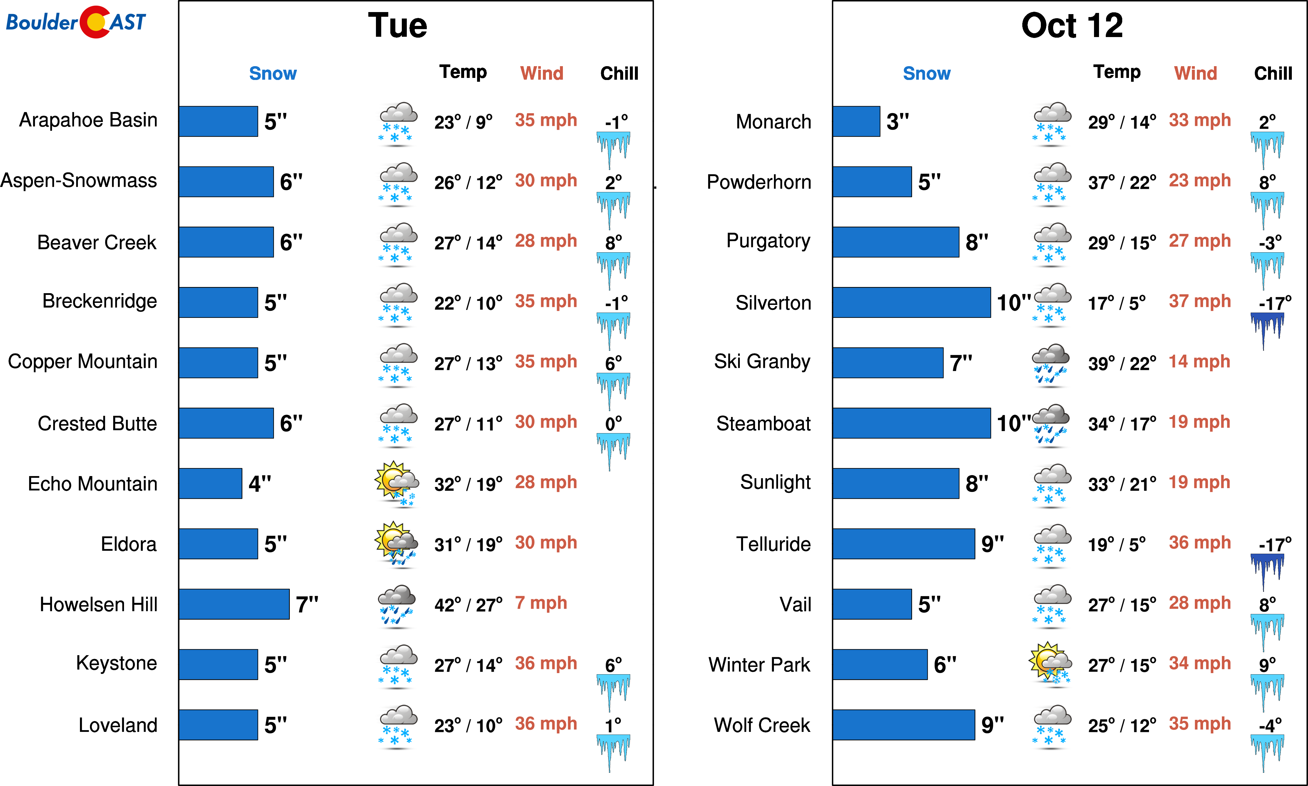
- Heavy snowfall for the High Country and ski resorts this week
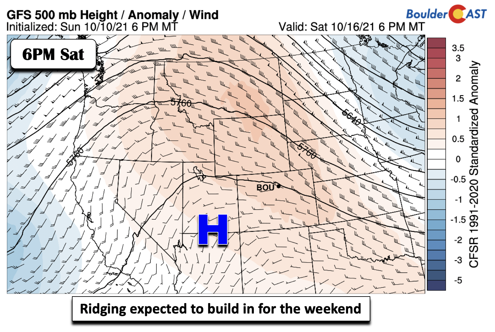
- Ridging is favored for the upcoming weekend with fair weather and milder temperatures
DISCLAIMER: This weekly outlook forecast is created Monday morning and covers the entire upcoming week. Accuracy will decrease as the week progresses as this post is NOT updated. To receive daily updated forecasts from our team, subscribe to BoulderCAST Premium.

An busy weather week with the warmest day being Monday
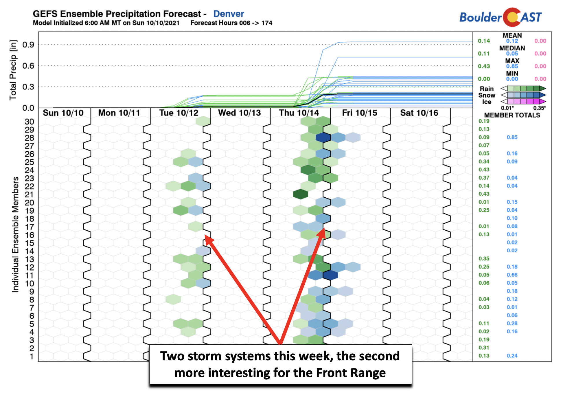
An active week of weather is in store for the state of Colorado and especially the Front Range. An overall summary of the week is highlighted below from the GFS ensemble precipitation forecast. As you can see, we have two main chances of precipitation, the first on Tuesday and the second on Thursday. As we will discuss later, the trend over the past weekend has been for the first system to be more of an impact for the mountains. The second system on Thursday appears more favorable for our first accumulating snow, but still that is not guaranteed.
Crystal clear sunshine will be the norm on Monday as the airmass warms relative to our Sunday. That along with the sunny skies should push our afternoon highs into the lower 70s for most locales. The storm system approaching tomorrow is still out in northwest Nevada at the moment.
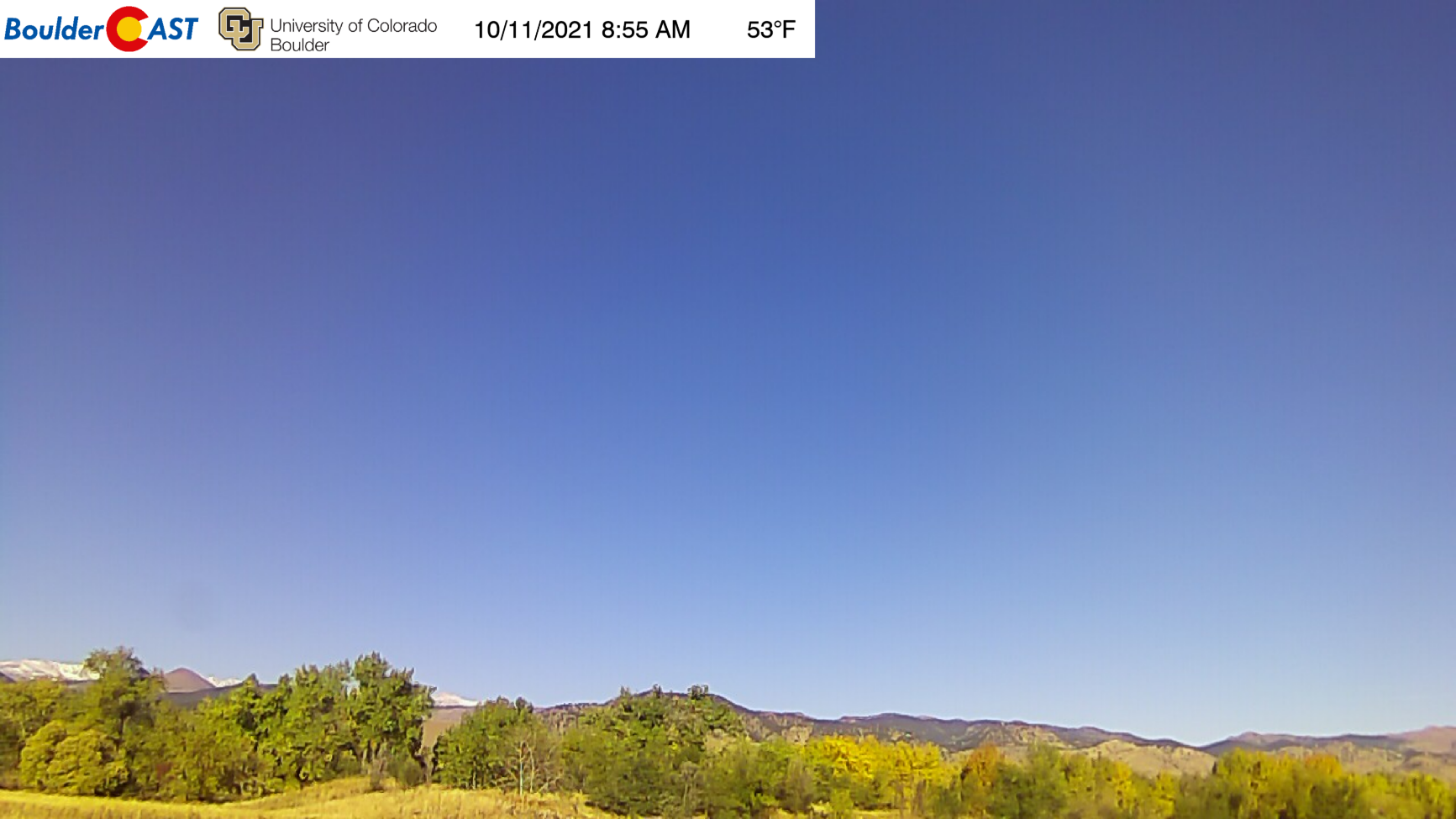
View of Boulder from early Monday morning
First of two systems arrives Tuesday
As we briefly touched on above, the models over the past weekend have come into very good agreement for the Tuesday system, our first of two low pressure systems this week. The mid-level pattern is shown below for the GFS and NAM solutions for midday Tuesday over the CONUS. Note how both models show the system centered over the Four Corners. Strong lift ahead of the trough will lead to precipitation across the majority of the state, including the Plains.
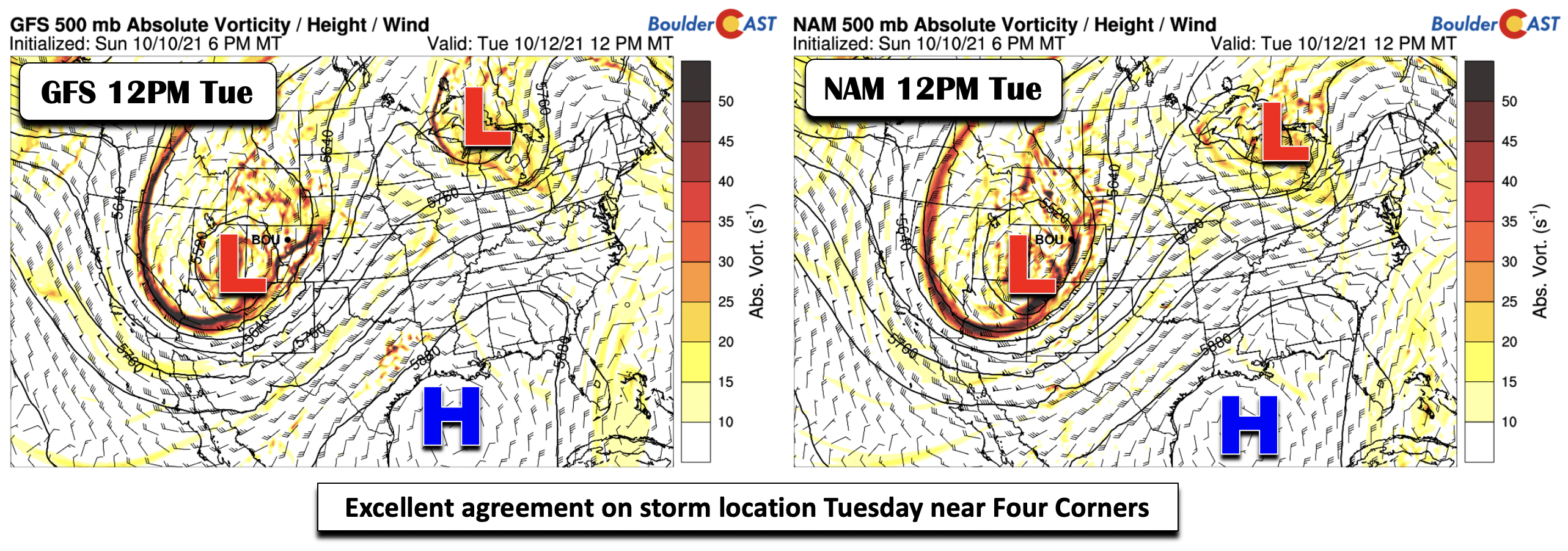
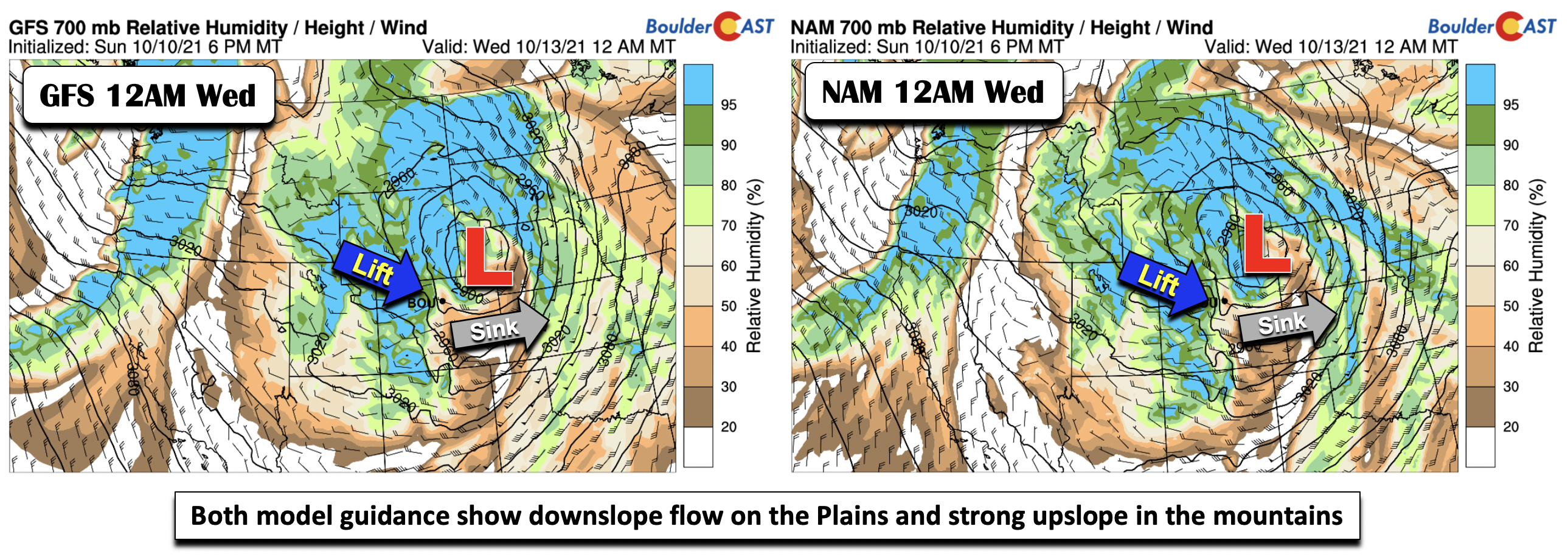
The system is progged to track east-northeast into western Nebraska by early Wednesday (below) per both model solutions. Once again, the two models are in very good agreement, leading to high confidence in the overall pattern and forecast specifics. Probably most important in these solutions, from a pattern recognition standpoint, is that strong lift will be present over the High Country, especially in the north-central and northwest mountains of Colorado, as west-northwest winds force strong upslope over the terrain. As the system pulls east, downslope flow on the east side of the Rockies will favor sinking air and lower precipitation chances for the immediate Boulder-Denver area late Tuesday into Tuesday night. Highs Tuesday will be cooler, likely in the lower 60s to possibly upper 50’s as clouds and scattered rain/storms develop.
The HRRR simulated reflectivity is shown below for midday Tuesday. Notice how precipitation is largely favored over most of the state, but generally spotty over the Plains at this time.
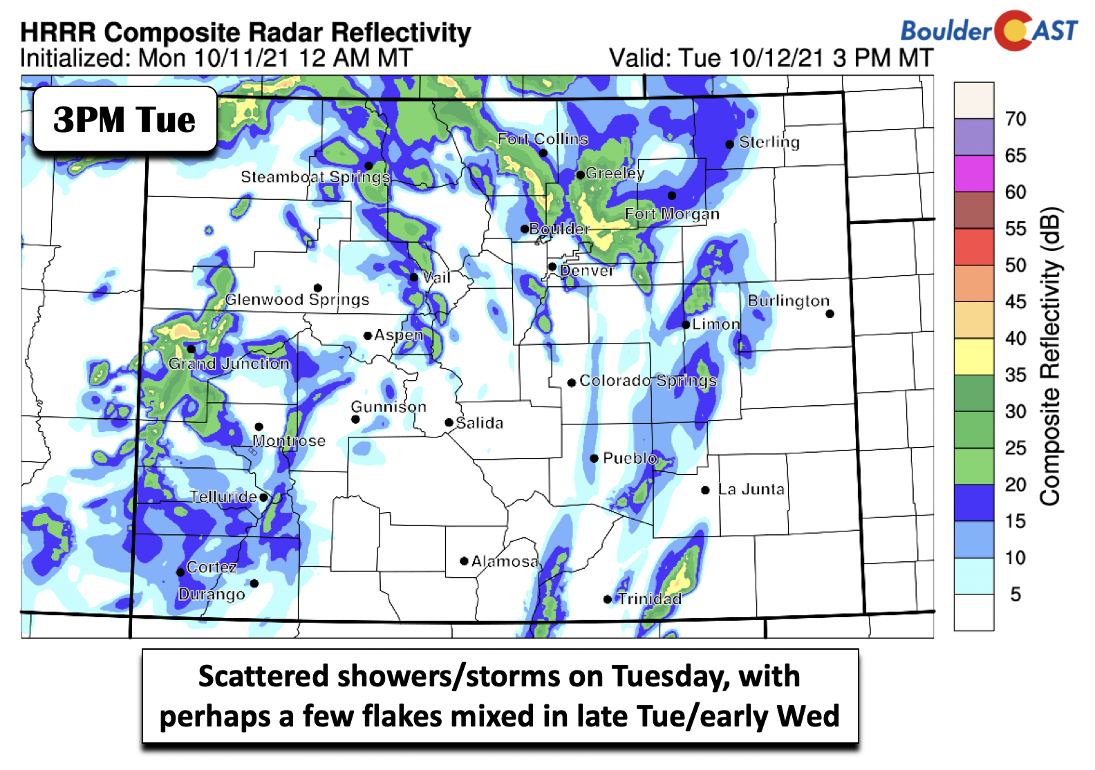
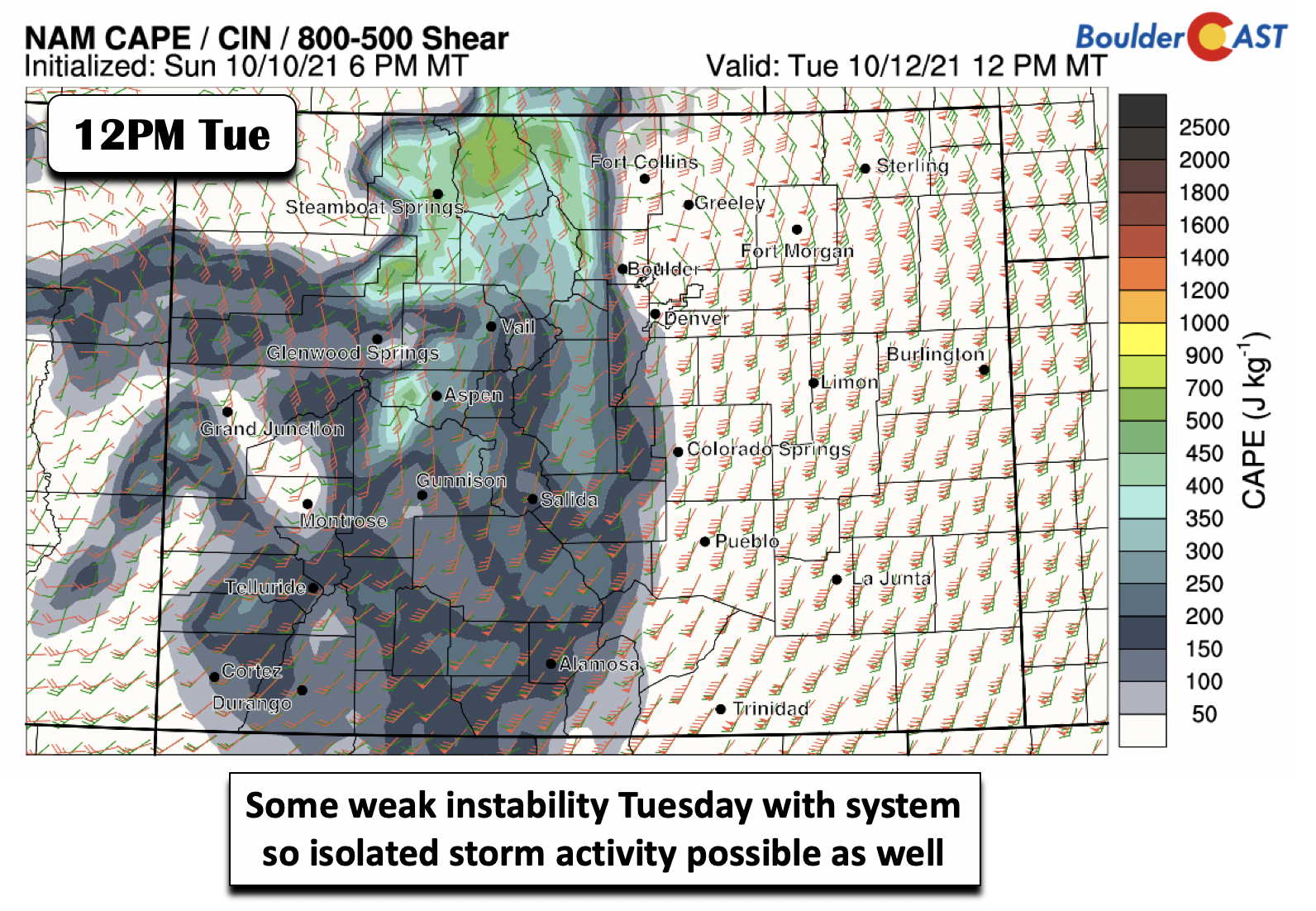
The spotty chances on the Plains are a result of the general downslope nature of the storm track, as well as some likely afternoon unstable air (below) that will develop east of the system Tuesday with strong shear also in place. We would not be surprised if a few storms become marginally severe given the strong dynamics in place, but that should be few and far between. The best chance of severe weather will be near the Kansas and Nebraska borders Tuesday evening into the overnight.
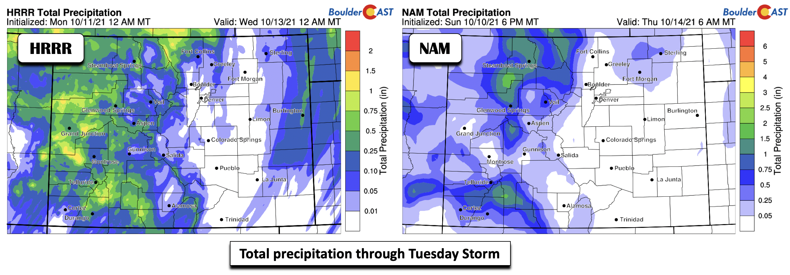
In addition to the downslope flow on the Plains for this first event, as evident in the total precipitation forecast from the HRRR and NAM (below) models, thermal profiles are generally above freezing for most of the event, until early Wednesday when colder air sets in from the north on the back side of the system. As you can see below, little if any accumulated rain is forecast for the Denver Metro outside of some scattered showers and storms Tuesday. The main winners from this first system will be the Mountains, especially Steamboat! Up to 1″ of snow is possible for portions of the Foothills in places like Nederland and even Estes Park.
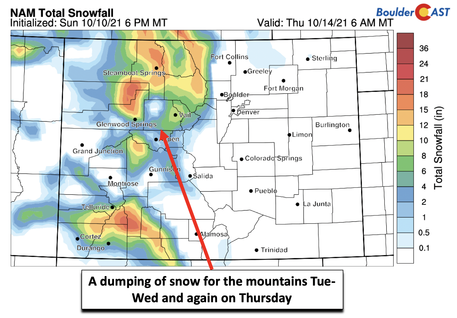
In these west-northwest flow regimes under these types of storm tracks, Steamboat is highly favored for heavy snow. The models indeed paint a rosy picture for Steamboat, but also much of the north-central mountains (below) and even southwest Colorado.
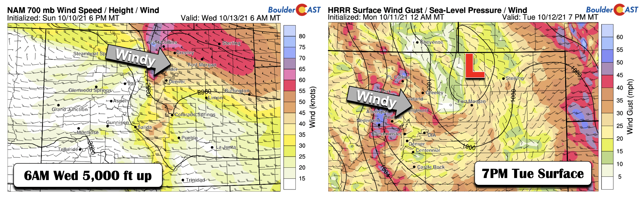
The main impact for the Plains of this first system will be gusty winds on the backside of the low pressure as it lifts into western Nebraska (below). At 5000 feet up, strong winds and downslope cross-mountain flow will force wind speeds in excess of 60 mph. At the surface, this should translate to winds up to 45 mph in spots. A wind advisory may be issued for late Tuesday into early Wednesday as a result so make sure you secure your belongings outside prior to this.
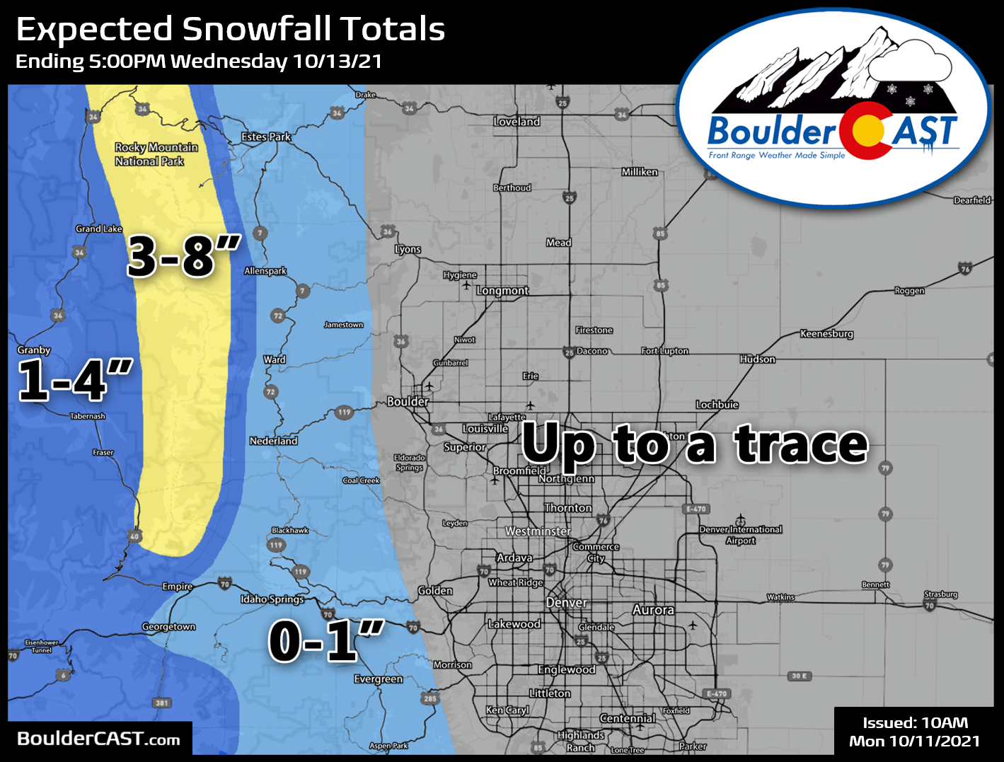
As the cold air oozes in early Wednesday, we would not be surprised to see a few flakes of snow on the Plains, but that should be rather limited. Our snowfall forecast map covering the first storm system through Wednesday evening is shown below. This will mainly be a snow-maker for areas along and west of the Continental Divide, but there could be a light dusting of snow in the Foothills with up to a trace of snow across the lower elevations by early Wednesday morning.
Colder air will drop highs into the the upper 50s to near 60 degrees for Wednesday. Some near freezing temperatures are also possible Wednesday morning, but the wind speeds should limit any widespread frost.
System number two brings cold & a chance of snow
System number two is currently slated to arrive Thursday and Thursday night. The model solutions are also in good agreement for this second low pressure, with the GFS only somewhat faster than the NAM (below). The system is progged to track similarly over the Four Corners, but instead take a more eastward track than northeast.
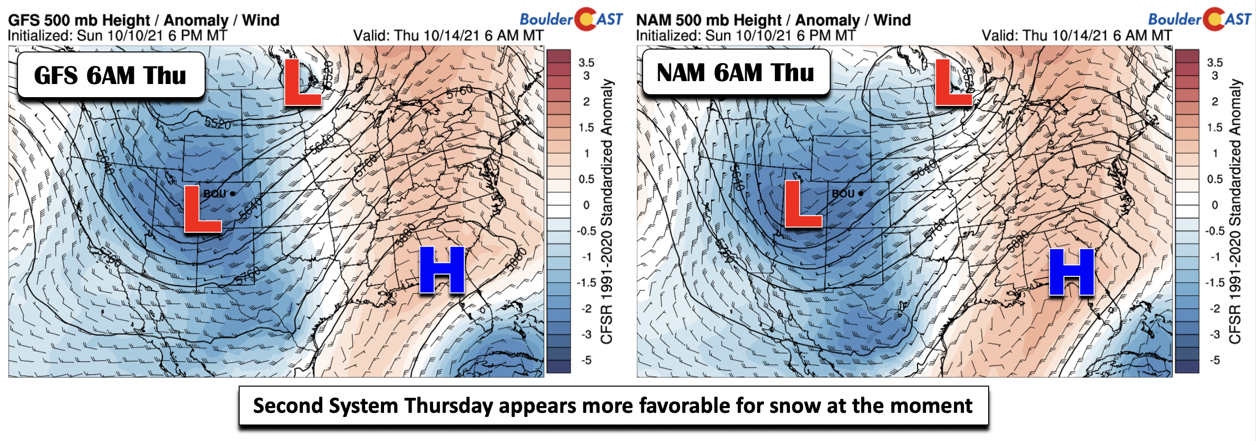
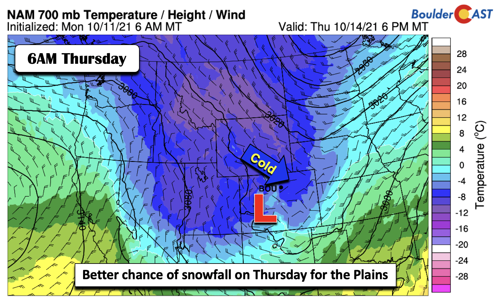
This second system, as it currently is depicted in the guidance, from a pattern standpoint, is more favorable for our first accumulating snow in Denver and Boulder. Colder air will be in place behind the first system, which tracks up into northern Minnesota. Also, some upslope is present east of the Mountains (below). Both of these factors are positive if your hoping for snow! However, snowfall amounts should be light with this second system (less than 3″ everywhere), but we will continue to monitor this winter storm through the week so check back for updates.
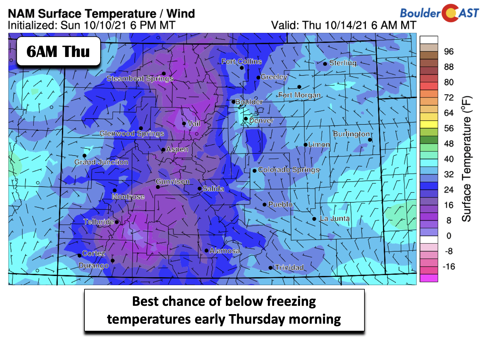
Our first below freezing temperatures also appear more favorable early Thursday morning and Friday morning as colder air continues to filter in. Much of the state is forecast to be at or below 32 degrees by early Thursday (below). Frost and freeze advisories will likely be needed later this week for most of the state so prep accordingly. With precipitation favored again Thursday, along with the colder airmass, highs may not get out of the 40’s.
The system slowly pushes out Friday, with another below normal day on tap, likely in the upper 40’s to around 50 under slowly decreasing clouds. The upcoming weekend is looking much nicer with mild temperatures and sunny skies. A ridge is favored in the long-range, especially come Saturday (below).
Stay up to date with Colorado weather and get notified of our latest forecasts and storm updates:
We respect your privacy. You can unsubscribe at any time.
Forecast Specifics:
Monday: Lots of sunshine and mild again with highs in the lower 70s on the Plains and around 60 in the Foothills.
Tuesday: Partly to mostly cloudy with isolated to scattered storms in the morning and afternoon, perhaps ending as some wet snowflakes Tuesday night. Highs in the lower 60s on the Plains and upper 40’s in the Foothills. Gusty winds are likely in the Foothills and Plains late Tuesday and early Wednesday.
Wednesday: Breezy and chilly with a chance of snow showers in the Foothills. Highs in the upper 50s on the Plains and middle 40’s in the Foothills.
Thursday: A possible hard freeze in the morning, then mostly cloudy with a chance of rain changing to snow and highs in the upper 40’s on the Plains and upper 30’s in the Foothills. The first accumulating snow of the season is possible during the evening and overnight.
Friday: A possible hard freeze in the morning with decreasing clouds and highs in the upper 40’s to around 50 in the Denver Metro area and around 40 in the Foothills.
Mountains: An active week is forecast for the higher terrain with heavy snow Tuesday and Thursday. The north-central mountains and southwest part of the state appear the most favored areas for accumulating snow. Some places could see a foot or more of snowfall by the end of the week. Gusty winds are likely both Tuesday through Friday as well. Calmer weather is anticipated for the upcoming weekend.
Help support our team of Front Range weather bloggers by joining BoulderCAST Premium. We talk Boulder and Denver weather every single day. Sign up now to get access to our daily forecast discussions each morning, complete six-day skiing and hiking forecasts powered by machine learning, first-class access to all our Colorado-centric high-resolution weather graphics, bonus storm updates and much more! Or not, we just appreciate your readership!
.
Spread the word, share the BoulderCAST forecast!
.


You must be logged in to post a comment.