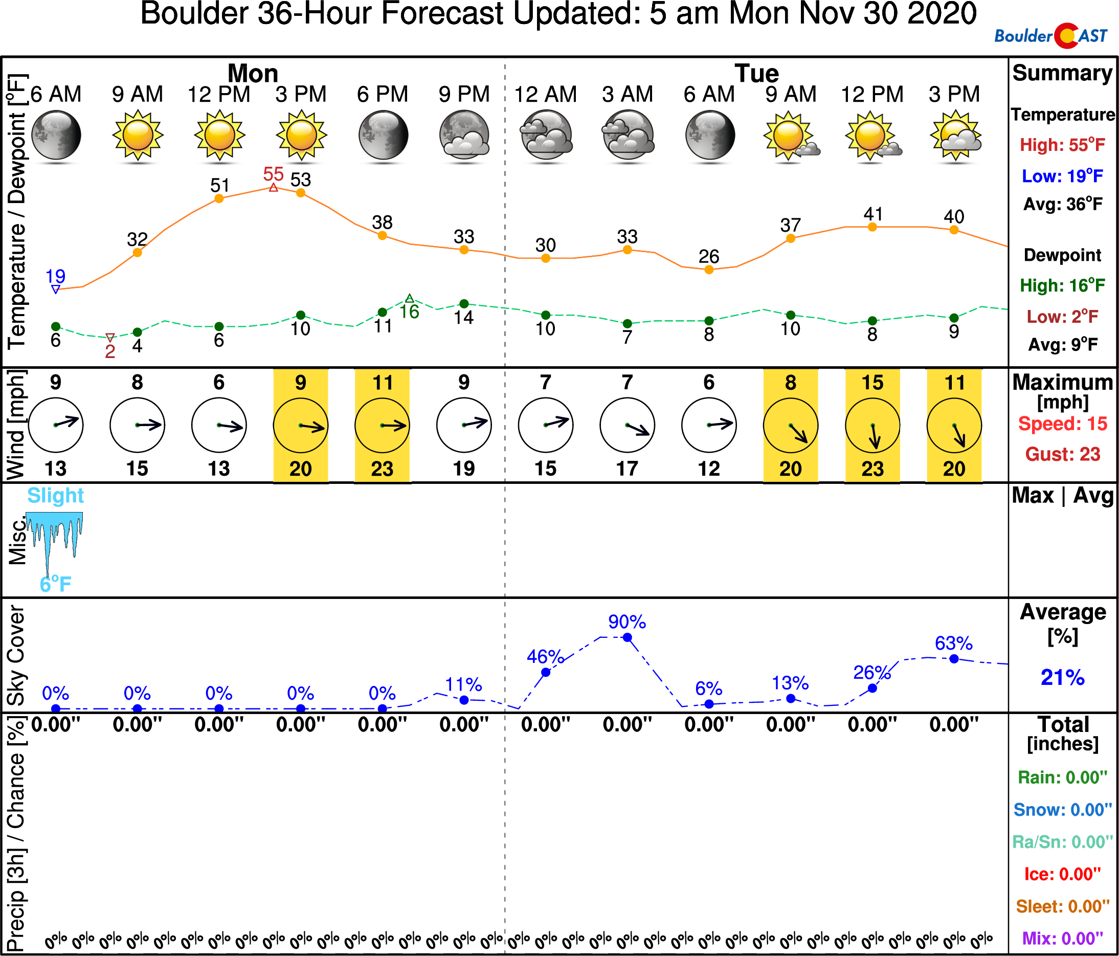
The week ahead will commence and conclude on a rather pleasant note. However, sandwiched in between will be a few cold and unsettled days with snow possible across the Boulder and Denver area. All in all, we expect only light accumulations, but there is some uncertainty as two nearby storm systems interact with one another. Let’s take a look!
This week’s highlights include:
- A beautiful Monday under shortwave ridging and record-setting dry air……sunny with highs in the 50’s
- Chilly and unsettled weather develops Tuesday and Wednesday with intermittent light snow
- A warming and drying trend will take hold late week
DISCLAIMER: This weekly outlook forecast is created Monday morning and covers the entire upcoming week. Accuracy will decrease as the week progresses as this post is NOT updated. To receive daily updated forecasts from our team, subscribe to BoulderCAST Premium.
A bone dry Monday
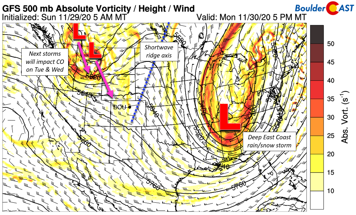
The week begins with a shortwave ridge axis progressing across Colorado as seen below in Monday’s forecast 500mb map. This will lead to light winds, mild temperatures, and sunny skies in our area on Monday. Just what you wanted to hear! Another key aspect from the map below: there are two areas of low pressure dropping southward towards Colorado out of western Canada. These will become a nuisance for us Tuesday into Wednesday. More on this in a moment.
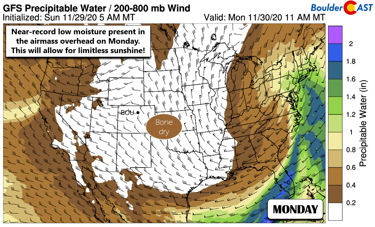
Interestingly, the airmass associated with this particular ridge axis over Colorado is one of the absolute driest possible for this time of year. Precipitable water values will be under 0.1″ across a large swath of the northern Plains and Rockies. In fact, Denver could set multiple dry air records this morning and tonight as the airmass moves through. Ultimately, this extreme dryness really doesn’t matter as the winds are light and fire danger, while elevated, will be far from dangerous.
Enjoy highs in the 50’s and sunny skies on Monday. The weather takes a sharp turn thereafter!
Turning unsettled Tuesday and Wednesday
As the week progresses, the two disturbances mentioned a bit earlier will begin to impact our area. The GFS 500 mb animation through Thursday evening is shown below. Notice how the two storms pass directly through Colorado and do a bit of a “dance” in the process. The “one-two punch” brings a broad and significant trough over our state and much of the central United States. The exact forecast for this timeframe will be difficult to predict as these two storms will actually be steering one another. However, we do know it will be cold and unsettled for eastern Colorado during this time. Weak lift and weak but very deep upslope will allow for light snow sprinkled throughout Tuesday and Wednesday alongside chilly temperatures.
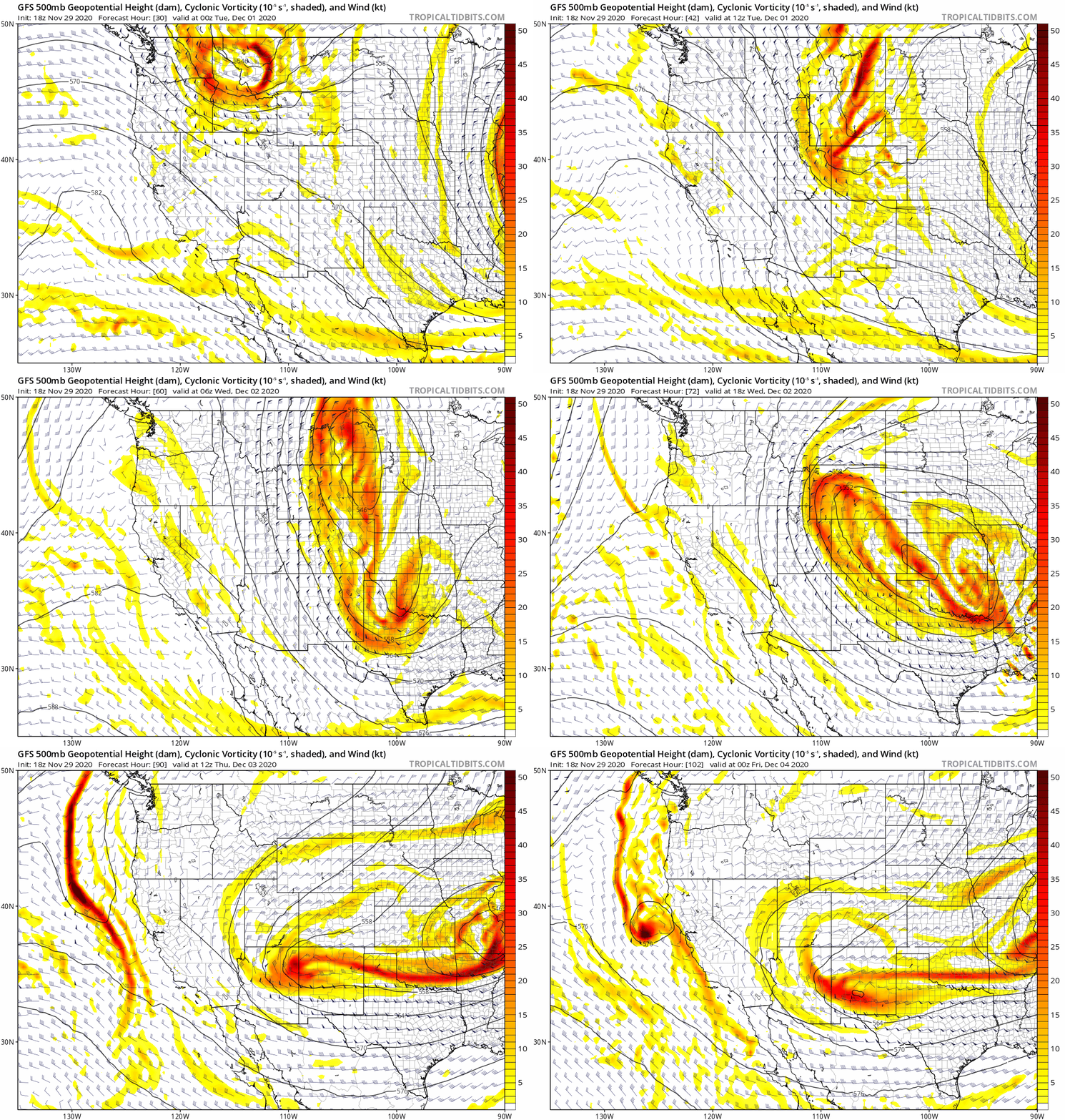
GFS 500mb height and vorticity forecast animation from Tuesday through Thursday showing a deep trough develop across the central US
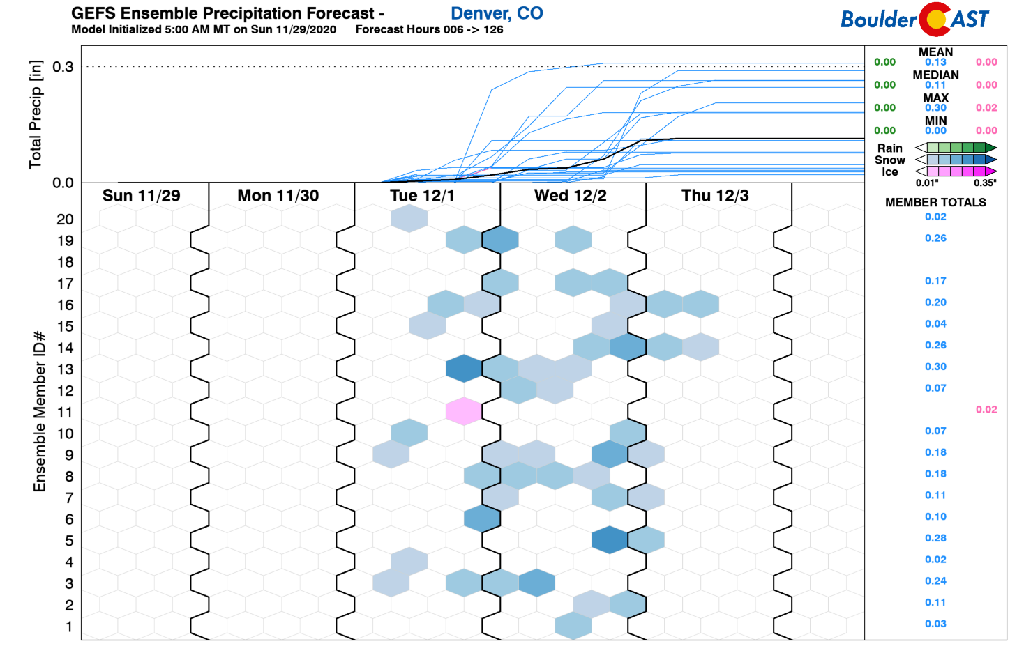
The GFS ensemble precipitation forecast for Denver shows the sporadic nature of the snowfall chances Tuesday into Wednesday night. While there will be a fairly lengthy period of snowfall potential, it will be spotty and light.
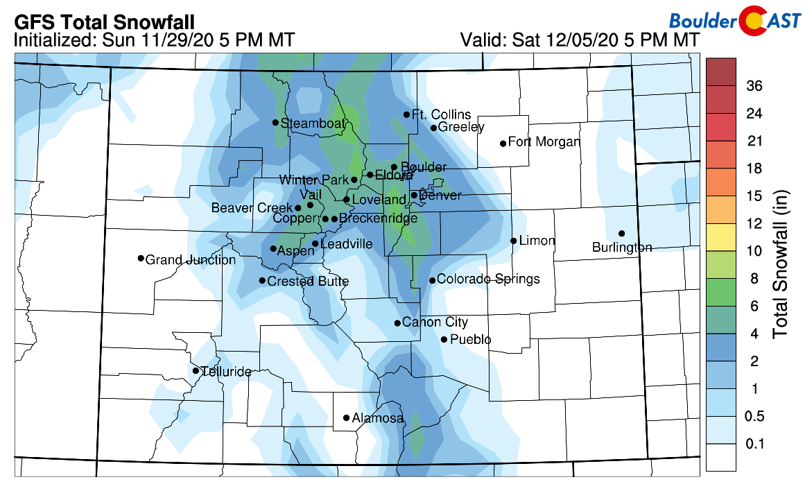
We can’t stress enough the lack of moisture with both of these systems. Most likely together they will produce just 1 to 4″ or so of total accumulation through Wednesday with a preference towards upslope-favored areas along and west of Interstate 25. Wednesday in particular will be quite cold (highs in the 20’s) which will provide fluffy snow ratios. An early look at forecast snow totals from the GFS model is shown below. We like the look of this forecast a lot right now.
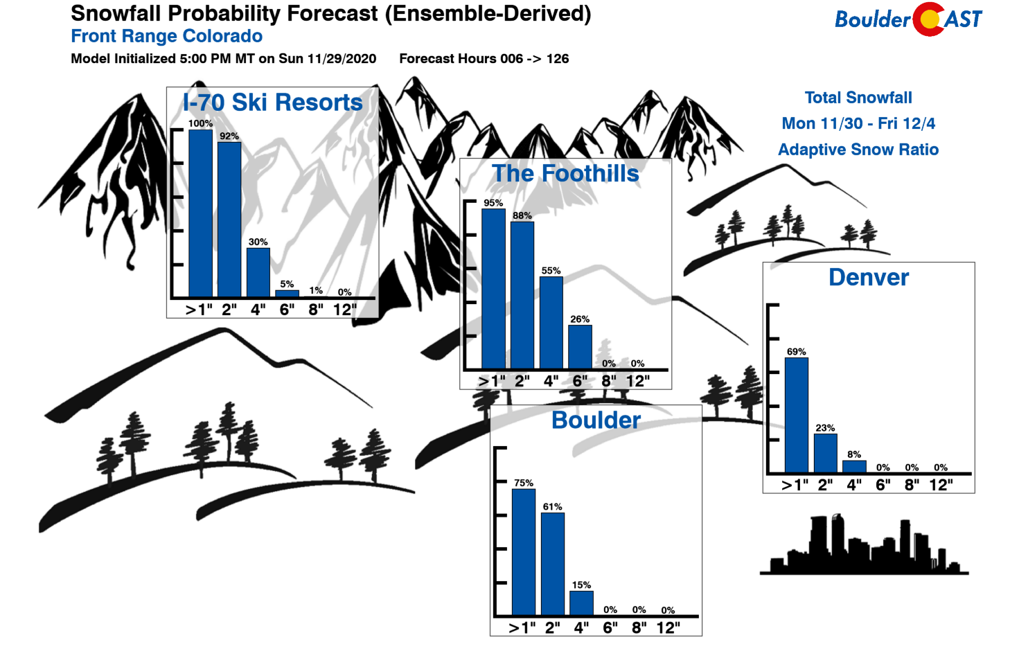
Our latest Snowfall Probability Charts show that not even 1″ is guaranteed around Boulder and Denver, though up to 4″ or so is possible in the coming days.
Moderating and drying out to end the week
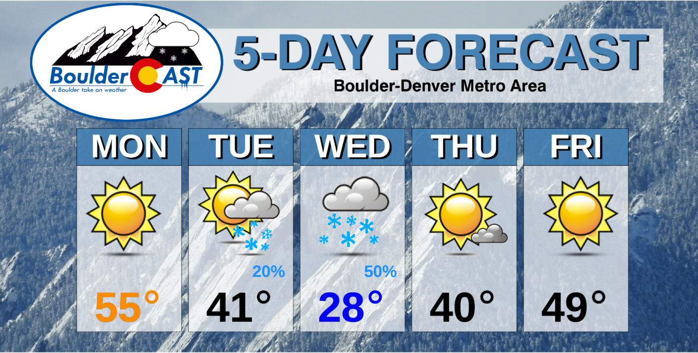
After the two cold storm systems have their way with Colorado, things quiet down to wrap-up the week with temperatures slowly warming and things drying out. Highs should get back to near 40°F by Thursday and near 50°F by Friday. Both days will have plentiful sunshine.
That’s all we have for now. Should things begin to look snowier for the midweek period, we’ll be the first to let you know. Be sure to check back or subscribe for the latest.
Forecast Specifics:
Monday: Sunny, mild and beautiful with highs in the middle 50’s on the Plains and lower 40’s in the Foothills.
Tuesday: Much colder and blustery with a slight chance of snow showers. Highs mid day near 40 degrees, then falling through the 30’s. Winds gusting 20 to 30 MPH at times out of the north and northwest. Less than 1″ of snow accumulation expected. Highs near 40 degrees on the Plains and near 30 degrees in the Foothills.
Wednesday: Overcast and cold with light snow, most widespread in and near the Foothills. Up to 2″ of snow accumulation possible. Highs in the upper 20’s on the Plains and upper teen in the Foothills.
Thursday: A few morning clouds, but sunshine returns during the day. Temperatures cool near 40 degrees across the Plains with upper 20’s in the Foothills.
Friday: Sunny and mild with highs rebounding to near 50 degrees on the Plains and in the upper 30’s in the Foothills.
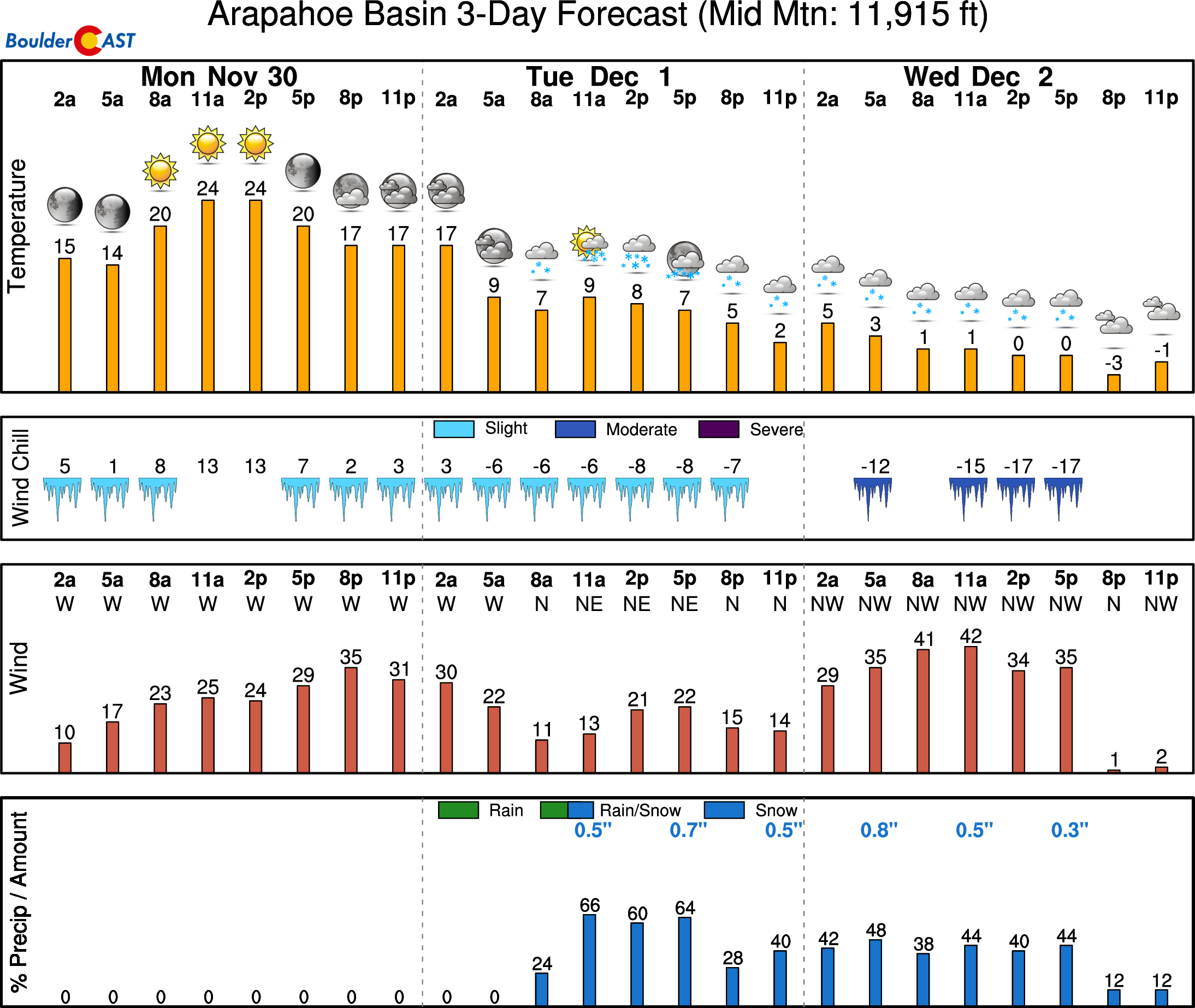
Mountains: The weather in the Mountains will be very similar to the Plains this week. That is, mild and dry Monday, Thursday and Friday. Light and intermittent snow will drop in the Mountains Tuesday and Wednesday with total accumulations of 2-4″ or so. Find daily updated forecasts for all the Colorado ski resorts over at our PowderCAST page.
Help support our team of Front Range weather bloggers by joining BoulderCAST Premium. We talk Boulder and Denver weather every single day. Sign up now to get access to our daily forecast discussions each morning, complete six-day skiing and hiking forecasts powered by machine learning, first-class access to all our Colorado-centric high-resolution weather graphics, bonus storm updates and much more! Or not, we just appreciate your readership!
.
Spread the word, share the BoulderCAST forecast!
.





You must be logged in to post a comment.