It will be a rather quiet Thanksgiving week overall with dry conditions and temperatures remaining near or slightly below normal through Thursday. Beyond the holiday, a strong ridge will build into the area with warmer weather on the way for Black Friday. No precipitation is expected this week outside of light snow in the Mountains. Read on as we discuss the weather week ahead in the Front Range.
This week’s highlights include:
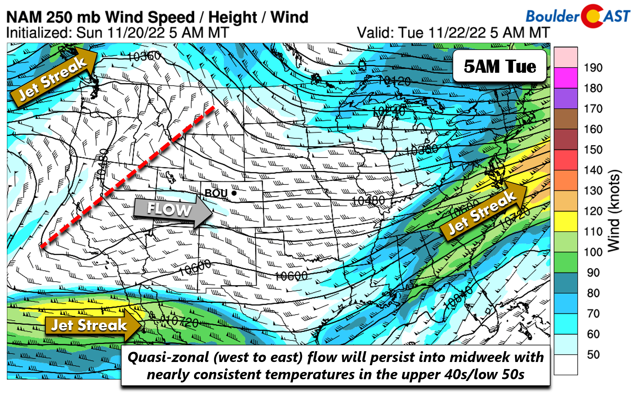
- Near to slightly below normal temperatures persist into midweek under quasi-zonal flow
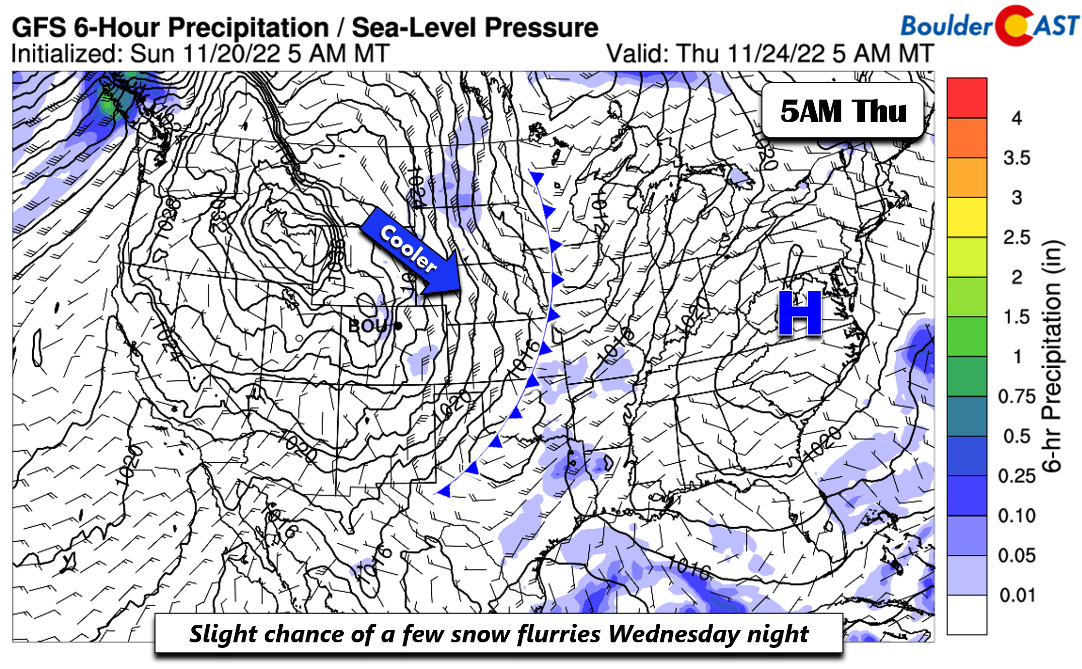
- A cold front moves through Wednesday night, keeping things on the cooler side for us
- Snow showers expected in the High Country Wednesday night, but only a flurry at best on the Plains — though gusty winds are possible
- A cool and sunny Thanksgiving Day in the upper 40s
- Perhaps lower 60s by Black Friday under a large dome of high pressure
DISCLAIMER: This weekly outlook forecast is created Monday morning and covers the entire upcoming week. Accuracy will decrease as the week progresses as this post is NOT updated. To receive daily updated forecasts from our team, among many other perks, subscribe to BoulderCAST Premium.
Upper 40s to low 50s into Thanksgiving Day
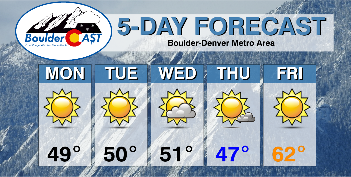
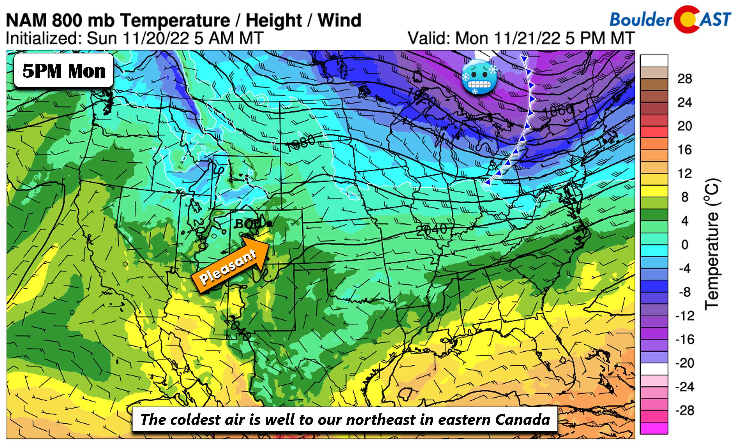
We start the week under zonal flow at mid-levels with weak downslope conditions present at the surface. The truly cold air will actually be to our north and east this entire week. On Monday that cold air is over southeast Canada and the far northeast US. We can expect upper 40s with partly cloudy skies, about 3-5°F below normal — our average highs are in the lower 50s in late November.
The quasi-zonal flow will be with us through Tuesday as well and even into midday Wednesday. There will be a weak shortwave trough in the zonal flow that will move through Tuesday afternoon/evening, bringing some mid and high clouds to the region. But all in all, another day of temperatures slightly below average at around 50 degrees.
The zonal flow will transition to a west-northwest flow late Wednesday as a stronger trough dives southeastward into the Central Plains. A cold front associated with the trough will move through Colorado likely Wednesday evening, reaching the Great Plains by early Thanksgiving Day. The front will largely be a dry passage, albeit somewhat gusty at times from the north-northwest Wednesday night and early Thursday. However, the lack of any upslope will limit any possibility for accumulating snow on the Plains, though we can’t rule out a few snow flurries. The better chance of snowfall will be in the High Country with a few inches possible in north-central and northwest Colorado on Wednesday.
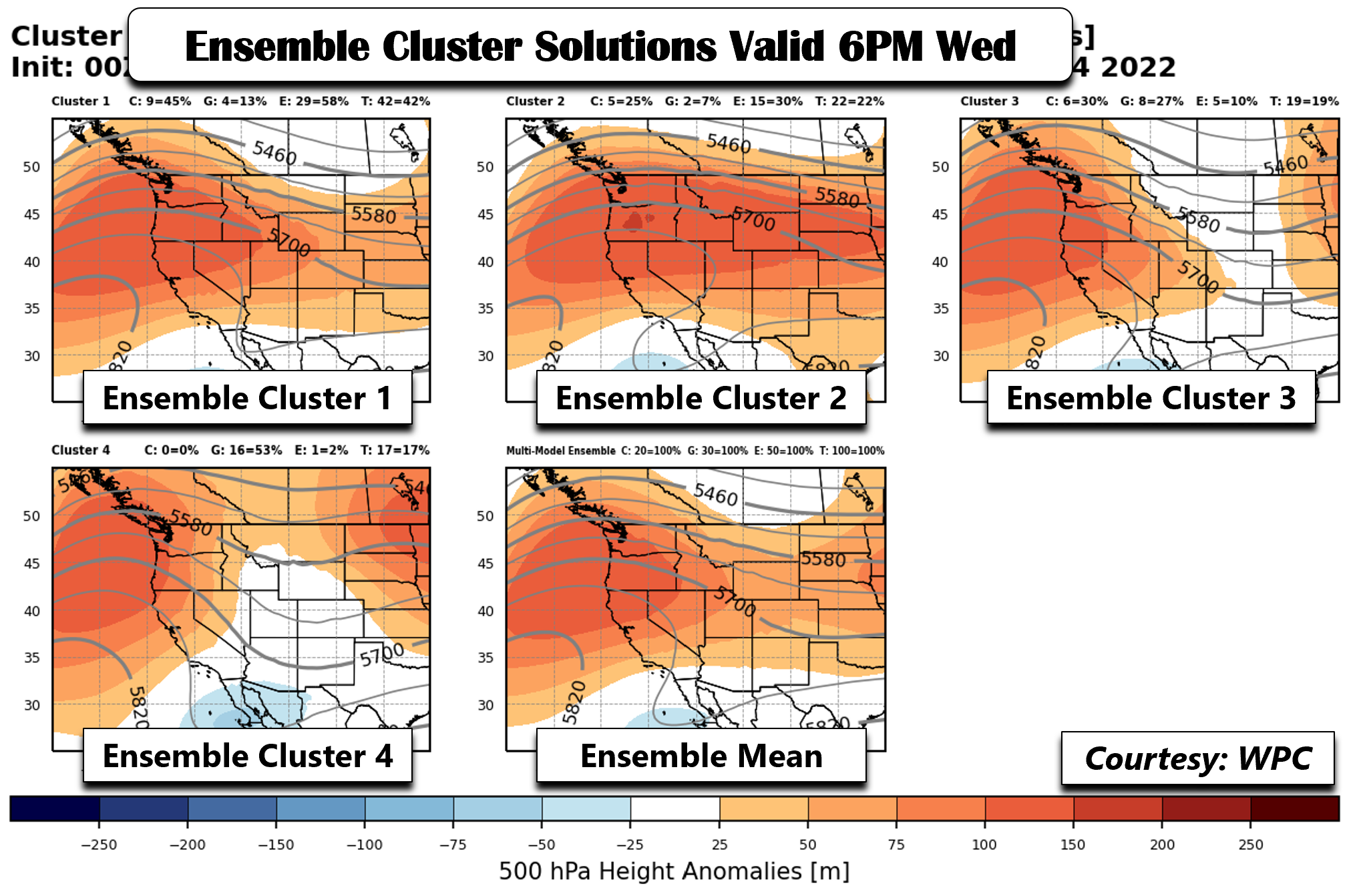
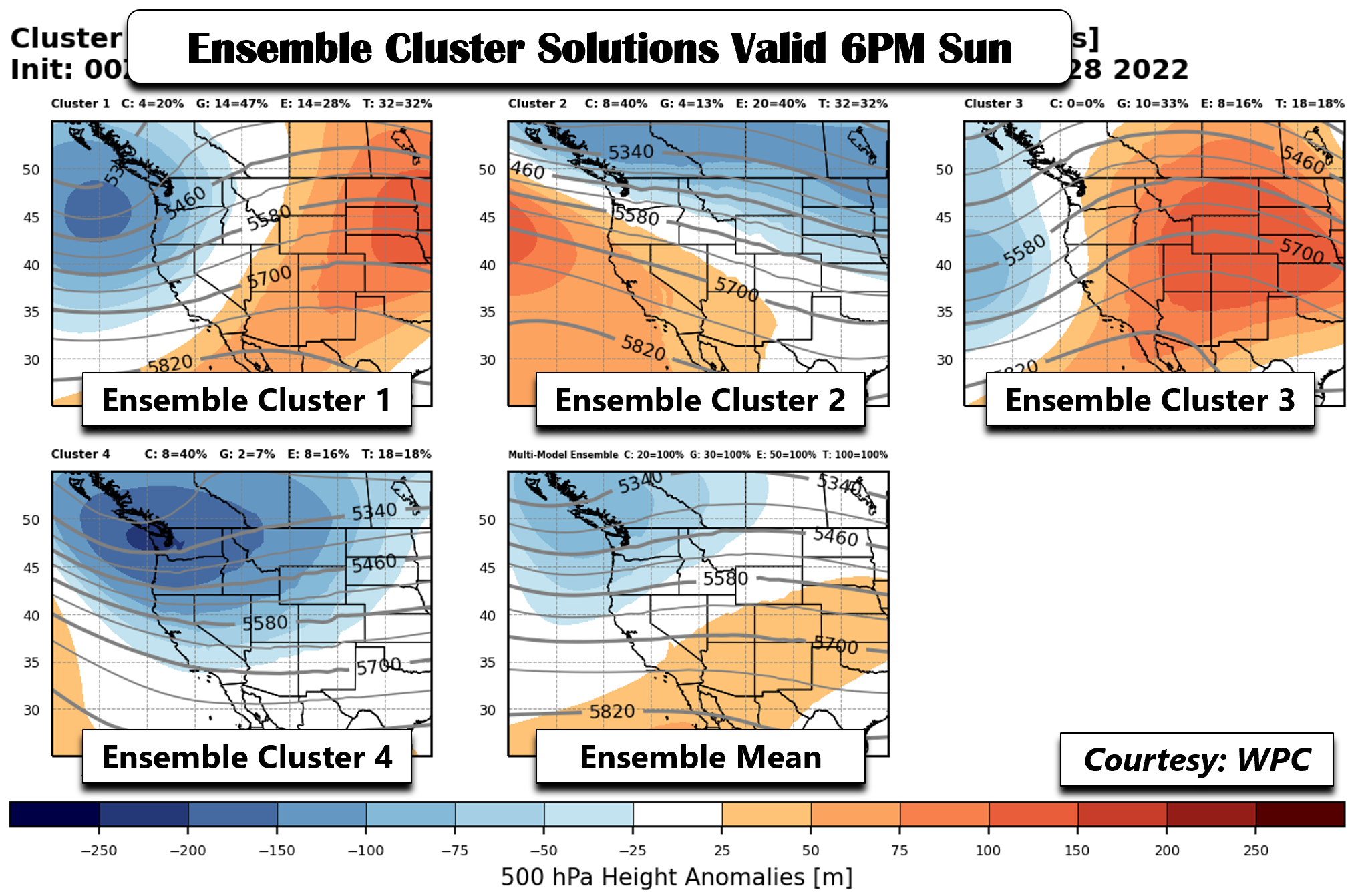
Highs on Wednesday should reach seasonal averages in the lower 50s as some slightly warmer air builds in ahead of the front. Come Wednesday night, the trough will move through, though the operational GFS, which is a tad further south with its trough position, is an outlier compared to the top three ensemble cluster solutions (below). The GFS and GEFS are largely represented by cluster 4, which has the trough just north of the Four Corners. The ECMWF/CMC are represented by the first two cluster solutions, largely accounting for 64% of the variance. Hence, the pattern would favor a higher probability of the trough remaining to our north and east over the central/northern Plains. Thus, while a tad cooler than Wednesday, Thanksgiving Day will not depart too much from our average highs (upper 40s to around the low 50s). Expect partly to mostly sunny skies for the holiday with overall great weather.
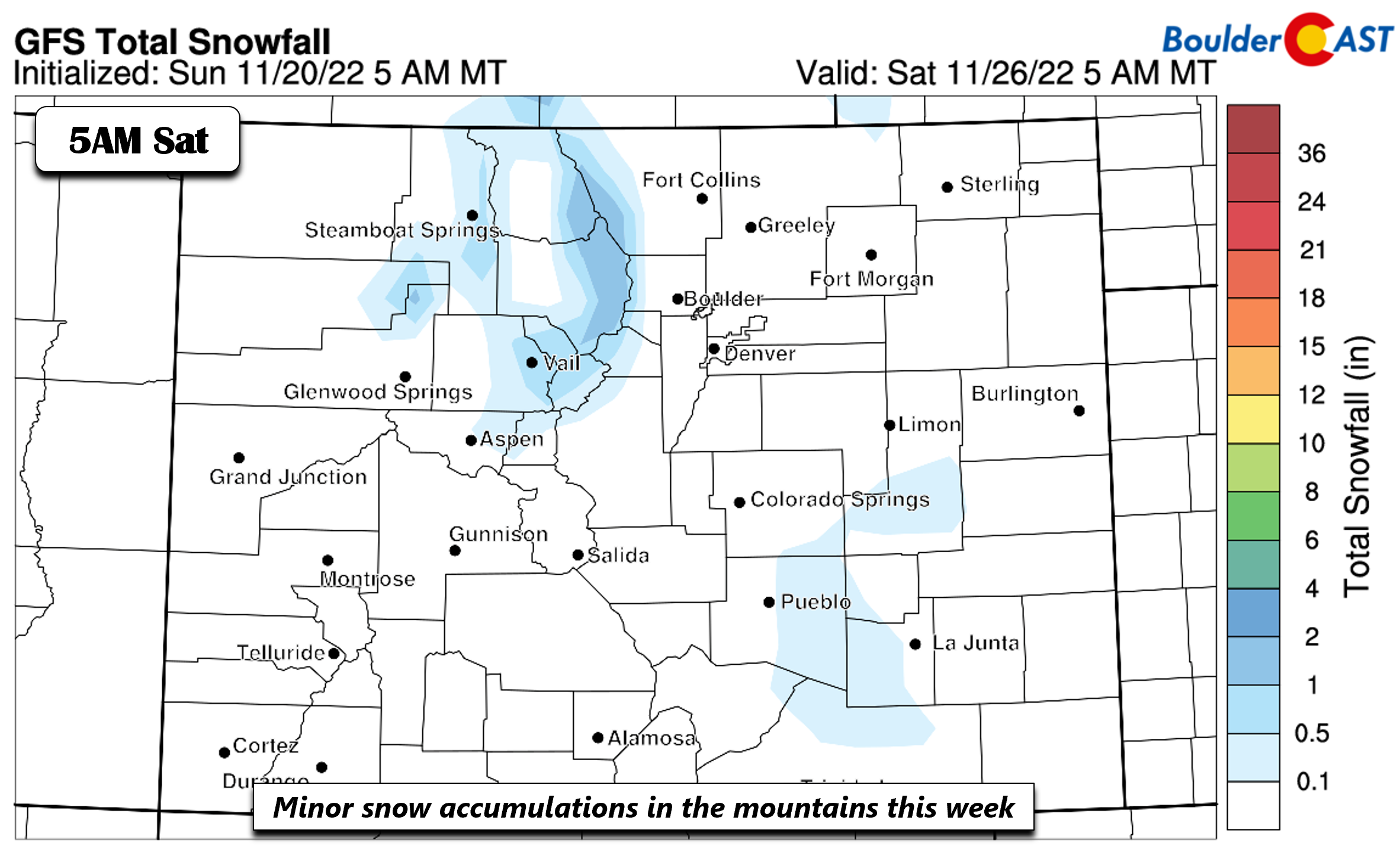
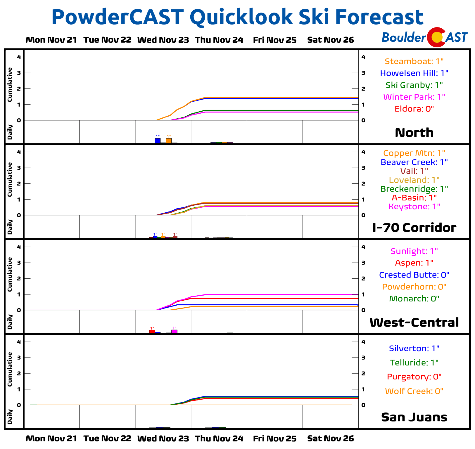
With a more northeastward position of the trough late Wed into Thu, the best chance of any snow will be along and northwest of the Divide from Vail to Steamboat Springs. Total accumulated snowfall does not look impressive at this stage of the game, perhaps 1 to 3 inches in these areas. We are not expecting any snowfall for the Plains given the downslope nature to the cold front.
A warmup by week’s end
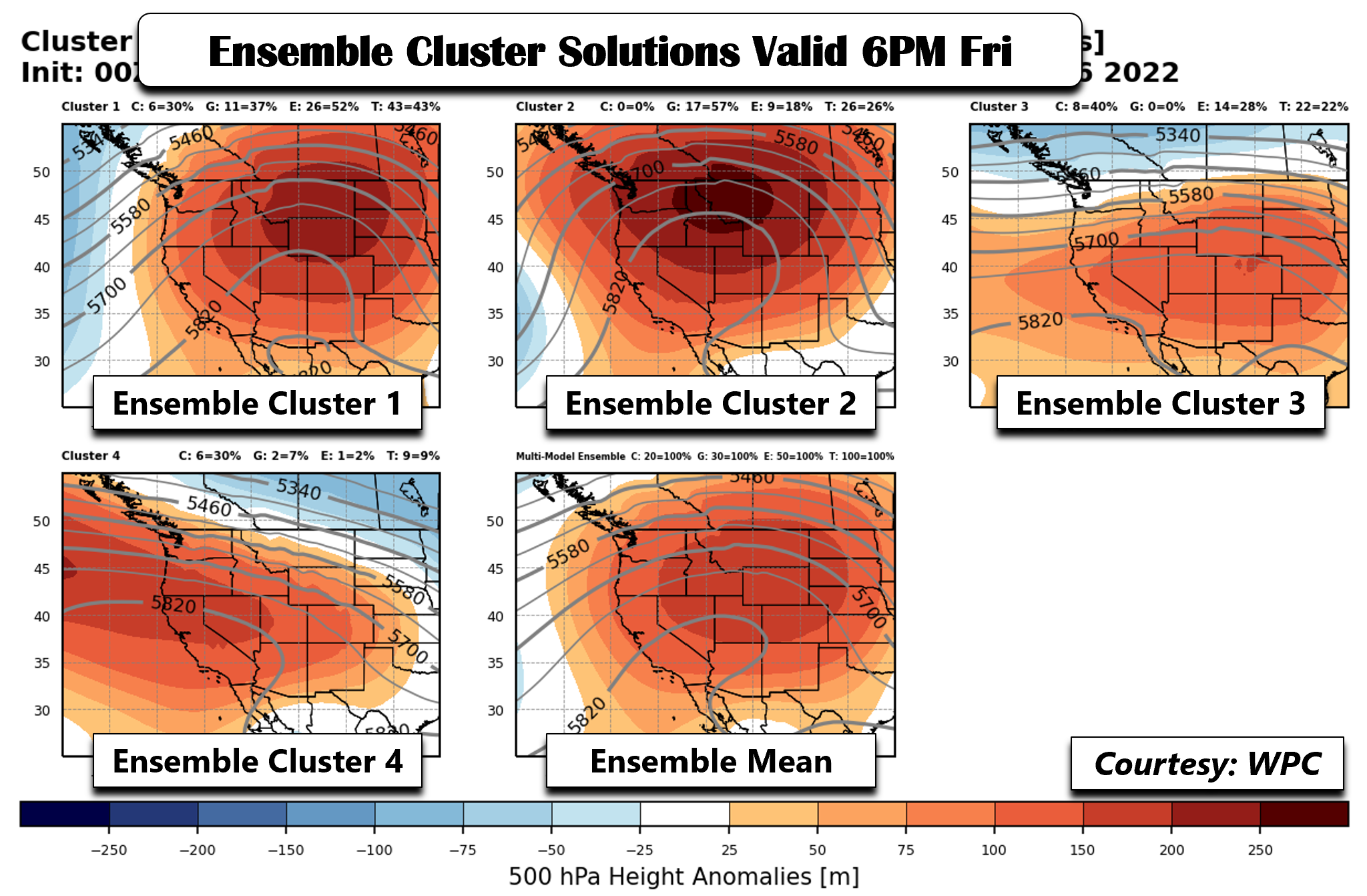
After Thanksgiving, we are looking at a pattern change with above normal temperatures favored come Black Friday. The top three ensemble cluster solutions show an anomalous and expansive mid-level ridge over the western US. While the position of the ridge does vary between ensemble solutions, there is high confidence that it will be much warmer across the Front Range and sunny. Only one solution, accounting for only 9% of the variance, shows weak northwest flow. The ensemble mean shows a ridge centered over the Desert Southwest, with 5820 m heights extending into southwest Colorado.
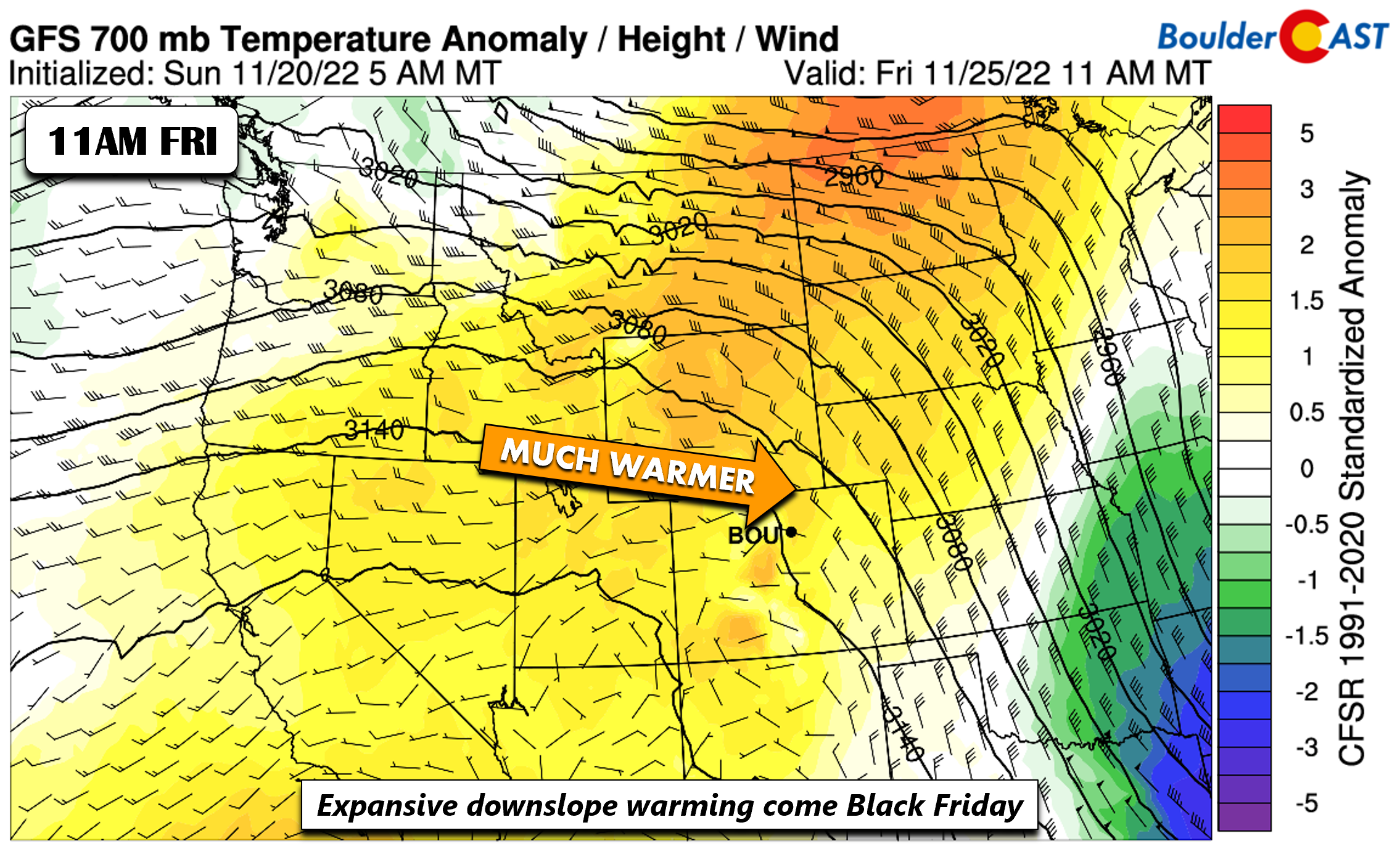
Looking at the operational GFS, it agrees fairly well with the pattern discussed above. The result at 700 mb is anomalously warm temperatures spreading into the state and into the northern Great Plains.
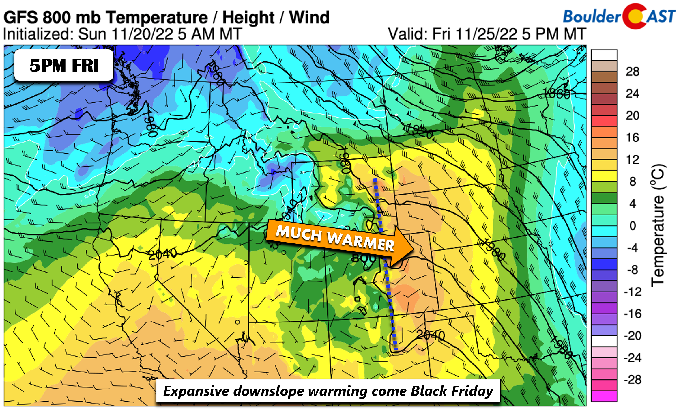
At the surface, there is a strong signature for adiabatic downslope warming all along the Plains of Colorado and reaching western Kansas. While some ensemble members show upper 50s for highs, we think the pattern would favor lower 60s at this point. Enjoy your Black Friday with some hiking or shopping or both at once!
The next best chance of any snow/precipitation would likely not come until early next week. By then, the pattern in the ensembles indicates that the jet stream will dive back south, allowing for some embedded shortwaves to traverse the area from west to east. Though, as you can see from the various images below, there is still large uncertainty in the pattern, as the first two cluster solutions disagree on a trough/ridge pattern by Sunday. Expect the above average temperatures to continue into Saturday, with a gradual downward trend in highs late in the weekend and early next week.
From the entire BoulderCAST team, we wish you a safe and joyous Thanksgiving with your friends and family alike!
Forecast Specifics:
Monday and Tuesday: Partly sunny and slightly below normal with upper 40s to near 50 on the Plains. Highs in the Foothills in the lower 40s.
Wednesday: Increasing clouds with a slight chance of evening flurries. Highs in the lower 50s with dropping temperatures and gusty winds in the evening. Highs in the Foothills will be in the lower 40s.
Thursday: Partly cloudy and cool with highs upper 40s to around 50 degrees with a light north wind for the Plains and around 40 in the Foothills.
Friday: Mostly sunny and much warmer with highs near the lower 60s for the Plains and lower 50s in the Foothills.
High Country: A mid-level system will move through the region late Wednesday into early Thursday, bringing a light accumulation (1-3 inches) to the northern mountains, from Vail to Steamboat. Gusty winds are likely Wednesday night into Thursday night. Dry and above normal weather is favored by week’s end under a dome of high pressure.
Help support our team of Front Range weather bloggers by joining BoulderCAST Premium. We talk Boulder and Denver weather every single day. Sign up now to get access to our daily forecast discussions each morning, complete six-day skiing and hiking forecasts powered by machine learning, first-class access to all our Colorado-centric high-resolution weather graphics, bonus storm updates and much more! Or not, we just appreciate your readership!
Spread the word, share the BoulderCAST forecast!




You must be logged in to post a comment.