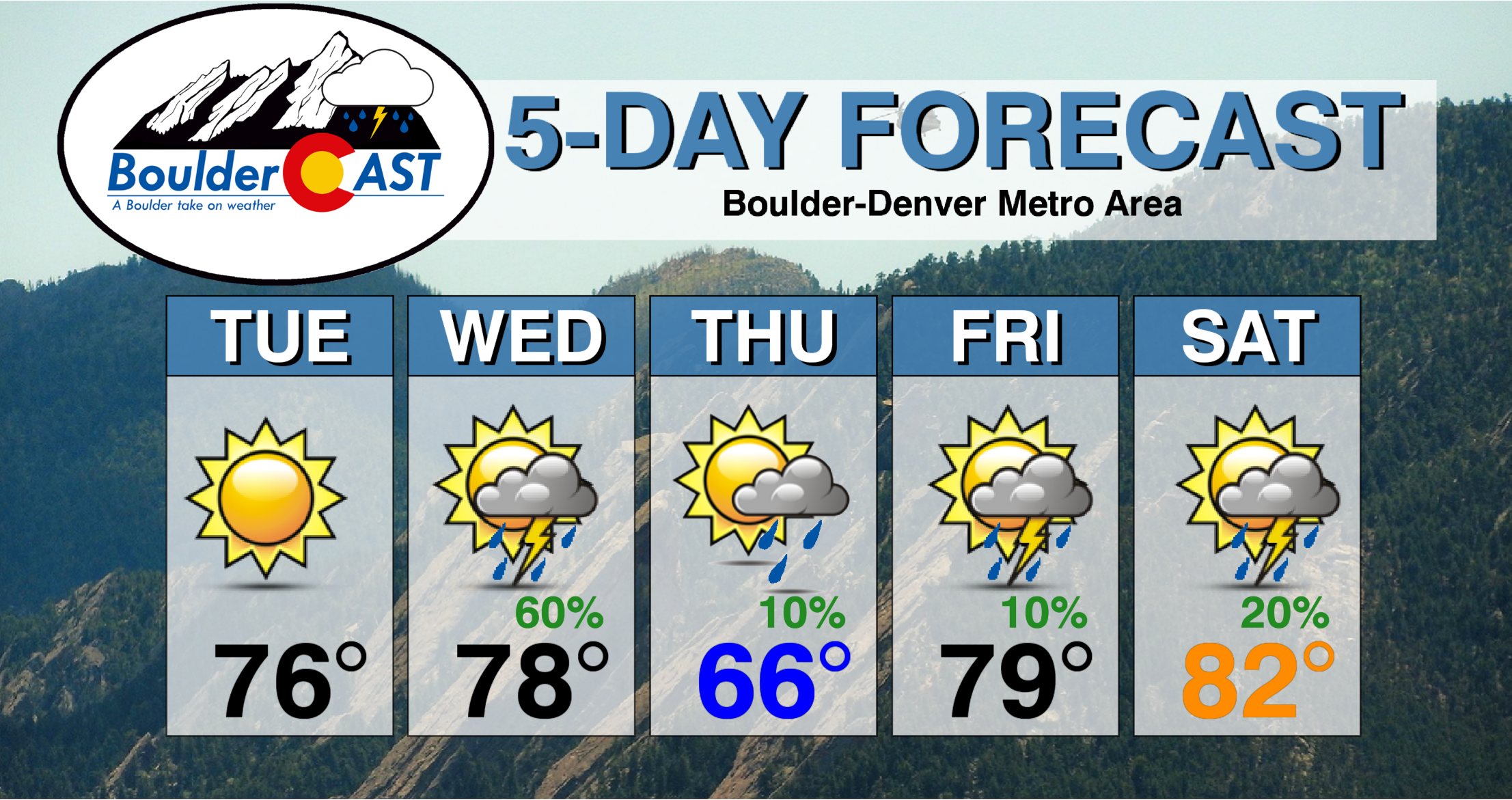
The week ahead is one typical for the last week of May. We have some warmer days, some cooler ones and chances for rain throughout the forecast. Let’s take a look!
This week’s highlights include:
- Nearly 1″ of rain fell this past Sunday across the entire Front Range
- A weak trough will impact the area late Wednesday into early Thursday bringing our best chance of rain for the week
- Above normal temperatures are expected every day but Thursday
- A pattern shift is coming late week which will bring warmer temperatures but also an increased chance of storms over the weekend ahead
DISCLAIMER: This weekly outlook forecast is created Monday morning and covers the entire upcoming week. Accuracy will decrease as the week progresses as this post is NOT updated. To receive daily updated forecasts from our team, subscribe to BoulderCAST Premium.
Sunday’s rain was just what the hydrologist ordered
Hopefully you planned your elongated weekend accordingly and were prepared for a the cold and wet weather this past Sunday. Luckily the holiday weekend was book-ended by two pleasant, mostly dry, and sunny days to make up for it! Observations show that 0.75″ to 1.25″ of precipitation was reported across the entire Front Range from Colorado Springs to Fort Collins.
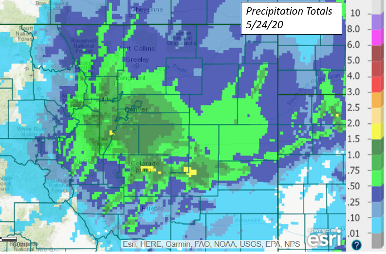
It wasn’t a smattering of springtime thunderstorms that produced these totals. Instead, it resulted from widespread cold and steady rain that lasted for several hours across the region. This is just the type of rain we needed after a rather dry month so far. While radar returns were very high Sunday afternoon and evening between Boulder and Denver (see our post from Twitter below), this signal was bolstered by melting snowflakes within the cloud aloft which have significantly higher reflectivity than plain raindrops. This “drawback” of weather radar is called bright banding.
Moderate to heavy rain is falling across the Boulder and Denver area. Already approaching 1" of rain so far in Boulder. Showers will continue through the evening, ending from west to east before 9pm#COWx pic.twitter.com/l77YXIK9A6
— BoulderCAST Weather (@BoulderCAST) May 24, 2020
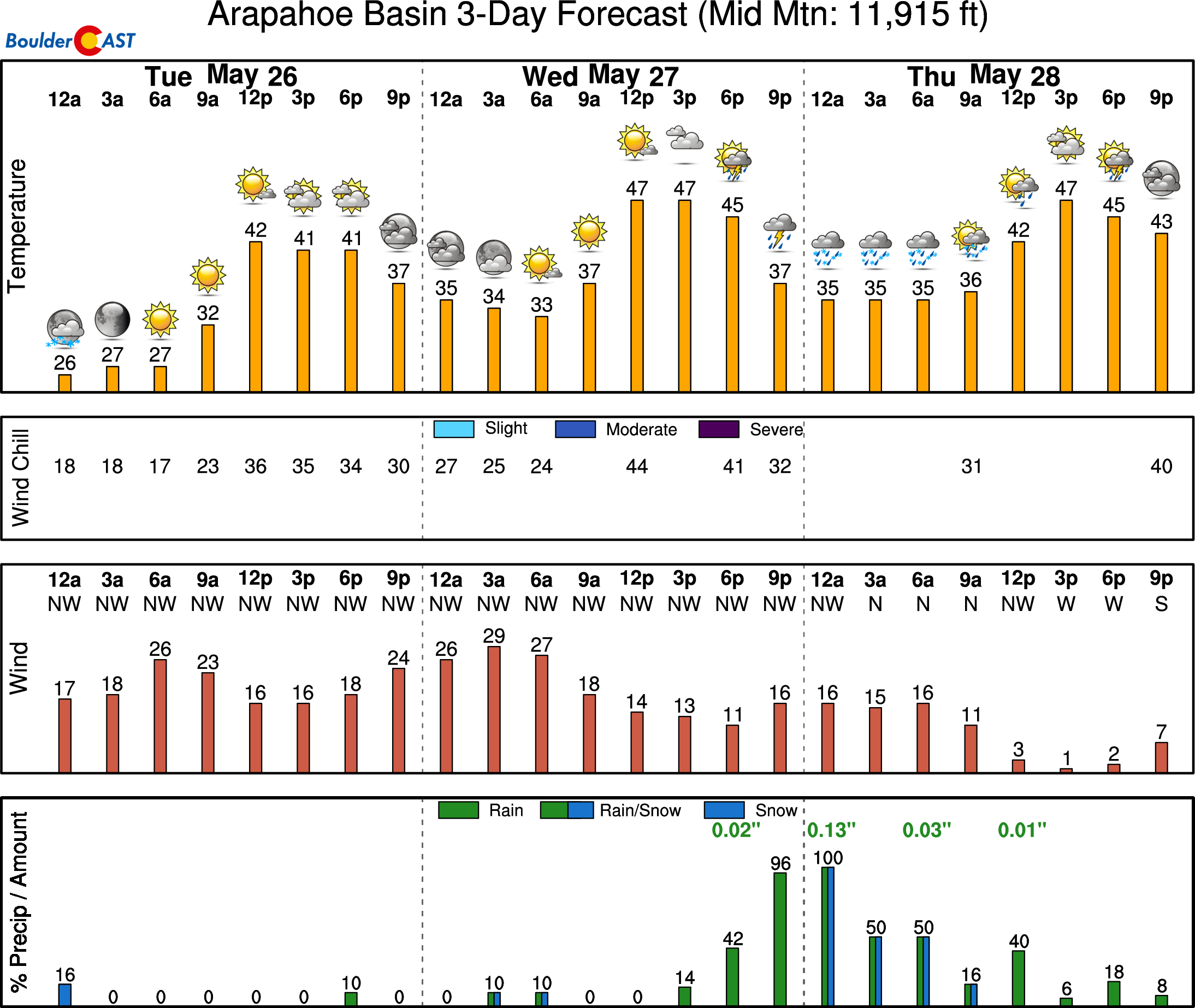
Higher up in the Foothills, there was a light dusting to 2″ of fresh snow reported in cities like Nederland, Evergreen, and Conifer above 8000 feet. Ultimately the snow melted rather quickly with no real impacts. The same can’t be said for the higher passes through Vail, Berthoud and Loveland. Roadways became slick and slush-covered Sunday and Sunday night as temperatures dropped below freezing. This is nothing out of the ordinary for late May, though. It’s also great news considering A-Basin will be opening back up beginning tomorrow for limited skiing.
This (short) week in weather
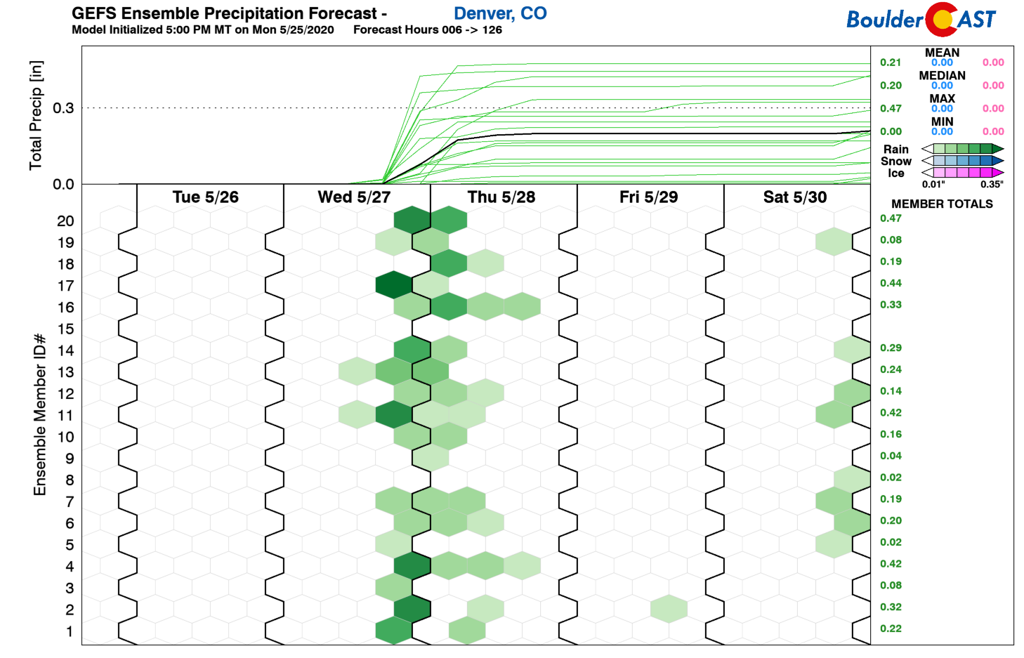
One look at the precipitation forecast from the GFS ensembles for the next five days and we see that Wednesday evening into Thursday morning will offer our best chance of rain for the week.
What’s happening on Wednesday? A weak piece of energy embedded in the northwest flow is progged to move across Colorado and help fire off a few late-day showers and storms. Both before and after this, however, a ridge of high pressure will be in control across the area leading to fairly nice weather, particularly later in the week.
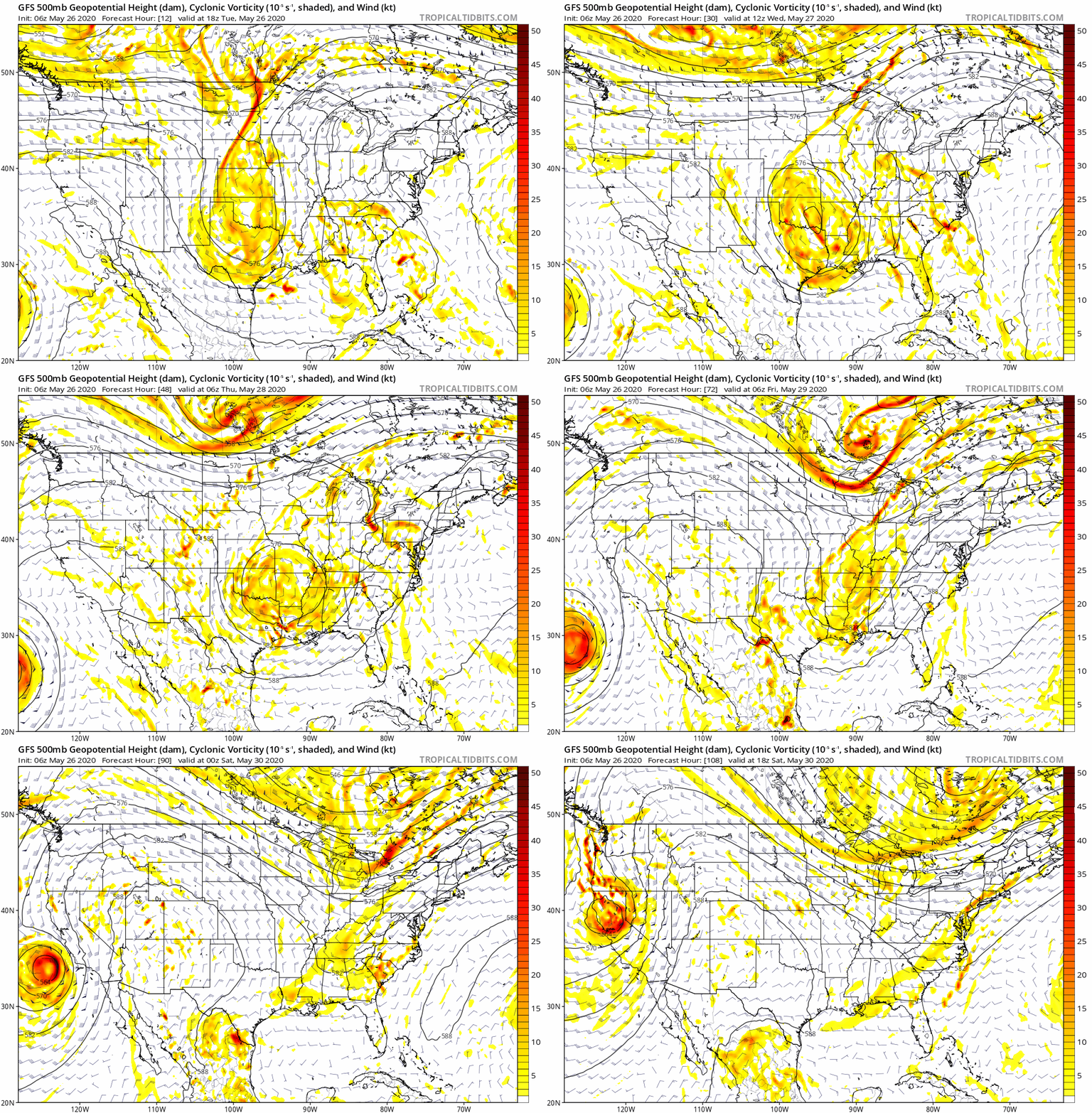
We saw a taste of these conditions yesterday and this will carry over into our Tuesday with sunny skies and seasonal temperatures in the 70’s.
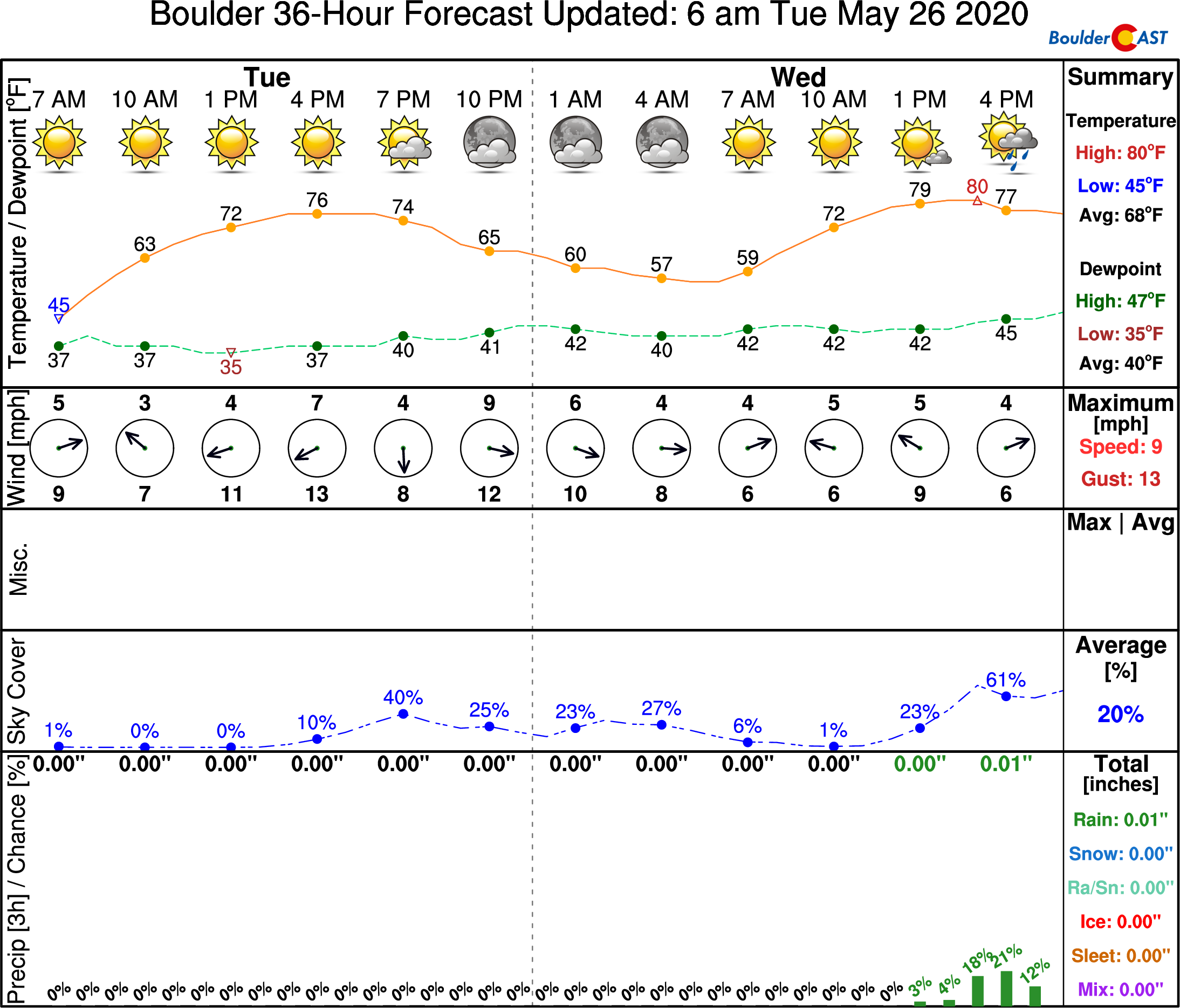
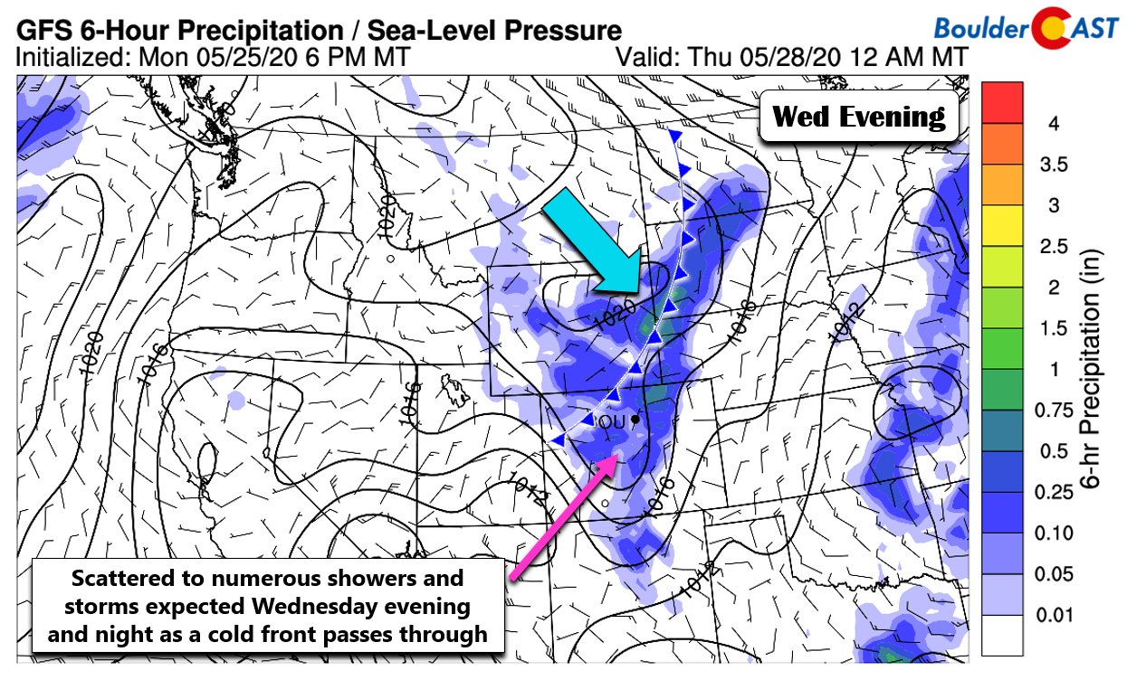
As mentioned, we’ll need to watch out for developing late-day rain on Wednesday with the trough moving through. It’s not a major storm system by any means. It will pass by quickly and without too much of a fuss. The GFS and NAM models agree on scattered to numerous shower and storm coverage Wednesday evening persisting through Wednesday night into early Thursday (see below). The Euro model is notably drier at the moment, but seems like a bit of an outlier. We’ll add in a 60% chance of rain during this period. There will also be a cold front with this system. Depending on how much rain falls and how much upslope lingers into Thursday, we may see some morning low clouds, fog and drizzle. Temperatures will be perceptibly cooler on Thursday with highs in the mid to upper 60’s.
A warm-up is likely to take hold late in the week as strong southerly flow ramps up into Colorado aided by a tight low pressure system coming ashore into California.
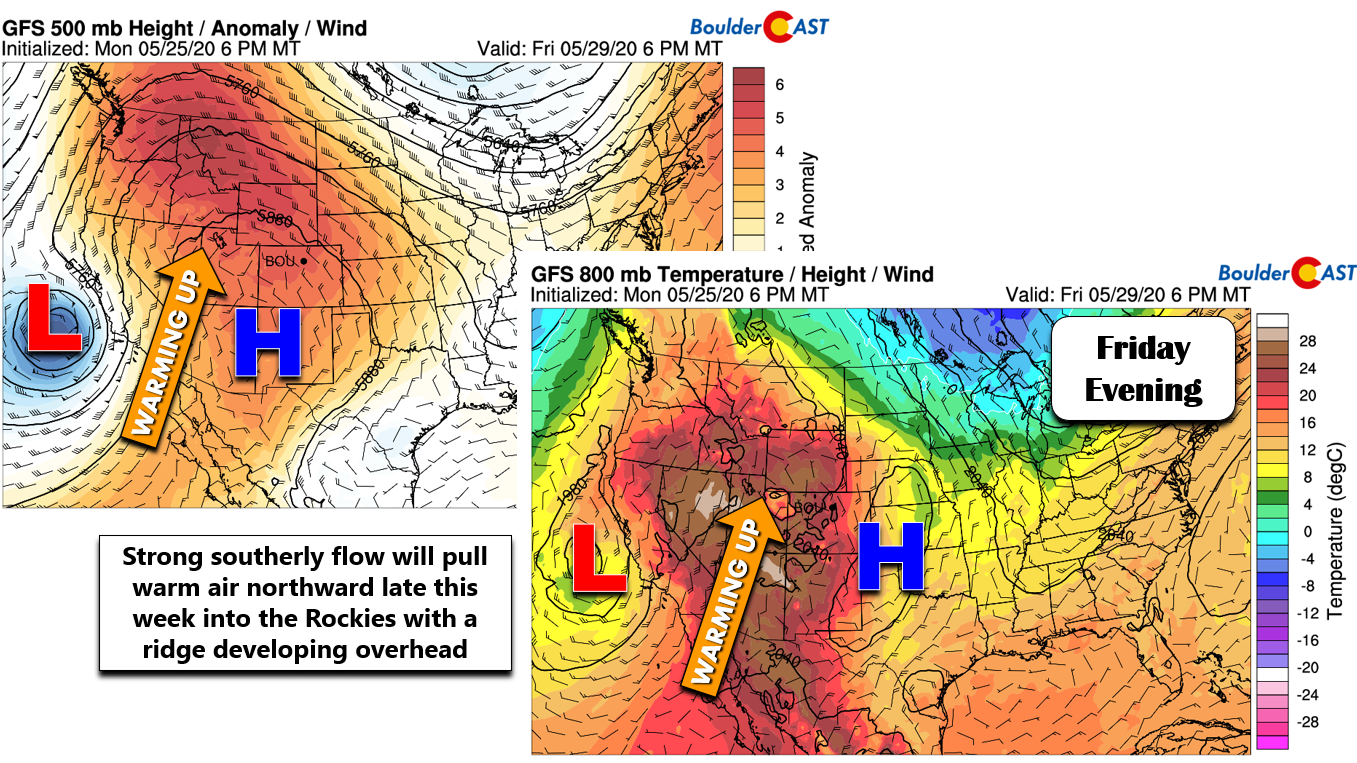
Typically this pattern would be accompanied by a plume of moisture surging northward and that will indeed be the case. However, it doesn’t appear that this moisture will move eastward into Colorado until the weekend. Until then, we’ll be sitting in a hot and fairly dry airmass capped by high pressure aloft. Look for highs returning to the 80’s Friday with the best chances for rain holding off until later in the day Saturday.
Forecast Specifics:
Tuesday: Mostly sunny with highs in the middle 70’s on the Plains and lower 60’s in the Foothills.
Wednesday: Morning sun with increasing clouds and scattered to numerous showers and storms developing from late-afternoon into the overnight hours. Highs in the upper 70’s across the Plains with middle 60’s in the Foothills.
Thursday: Much cooler with possible low clouds and patchy drizzle or showers in the morning. We dry out with skies turning partly cloudy through the day. Highs in the mid to upper 60’s on the Plains and middle 50’s in the Foothills.
Friday: Mostly sunny with one or two afternoon storms developing across and nearby to the higher terrain. Highs near 80 degrees on the Plains with upper 60’s in the Foothills.
Saturday: A mix of high clouds and sun with a chance of afternoon and evening thunderstorms. Highs in the low to middle 80’s on the Plains and lower 70’s in the Foothills.

High Country: Breezy conditions will exist early this week before a ridge moves overhead to warm things up. There will be a chance of storms every day in the Mountains, with isolated coverage Tuesday, Thursday and Friday….but scattered coverage Wednesday and Saturday. Temperatures will generally be near to slightly above normal. Check SummitCAST for daily updated forecasts for more than 120 mountain hiking destinations across Colorado.
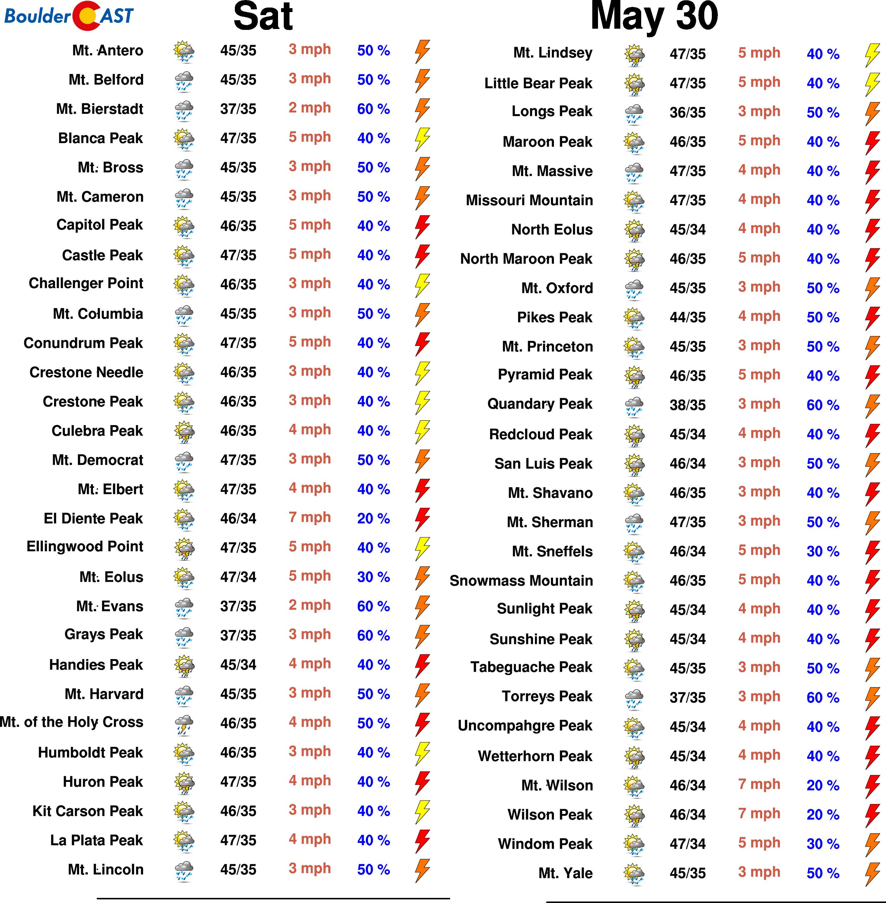
We discuss Boulder and Denver weather every single day on BoulderCAST Premium. Sign up today to get access to our daily forecast discussions every morning, complete six-day skiing and hiking forecasts powered by machine learning, access to all our Front Range specific weather models, additional storm updates and much more!
.
Spread the word, share the BoulderCAST forecast!


You must be logged in to post a comment.