The week ahead will largely feature colder than normal temperatures with just minor chances for precipitation on several of the days. A frontal boundary will waver along and south of the Front Range through the week ahead leaving our area stuck in a pesky chilly airmass. A series of shortwave troughs will track through but for the most part remain north of our region leading to just limited rain/snow potential east of the Mountains. We detail all of this and more in our regularly-scheduled weekly outlook.
This week’s highlights include:
- An active pattern remains with a series of upper-level shortwave troughs tracking along/north of our region in the southwest flow
- Below normal temperatures in the 30s and 40s throughout the week
- Some potential for freezing drizzle and fog both Tuesday and Wednesday
- A mid to late-week system may bring snow to the Front Range and Foothills, but models are trending drier
- Larger uncertainty by week’s end on another potential wintry system moving in over the upcoming weekend
DISCLAIMER: This weekly outlook forecast is created Monday morning and covers the entire upcoming week. Accuracy will decrease as the week progresses as this post is NOT updated. To receive daily updated forecasts from our team, among many other perks, subscribe to BoulderCAST Premium.

A chilly week lies ahead
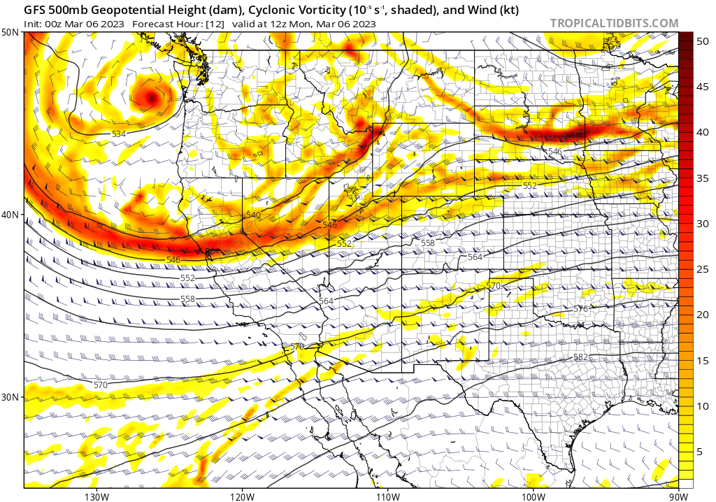
It will be a chilly to cold week with temperatures largely below normal in the 40s to 30s across the Denver Metro area. The animation below shows a rough idea as to how the pattern will evolve through the week. A series of shortwave upper-troughs will track through in the southwest flow as a mean trough pattern persists over the Pacific Northwest. While some embedded weaker shortwaves will move in prior to mid-week, the primary feature of the week approaches late Wednesday night into Thursday. The current track takes it just north of our area, but uncertainty still remains in terms of our chances of snow with it. We’ll discuss that a bit later…
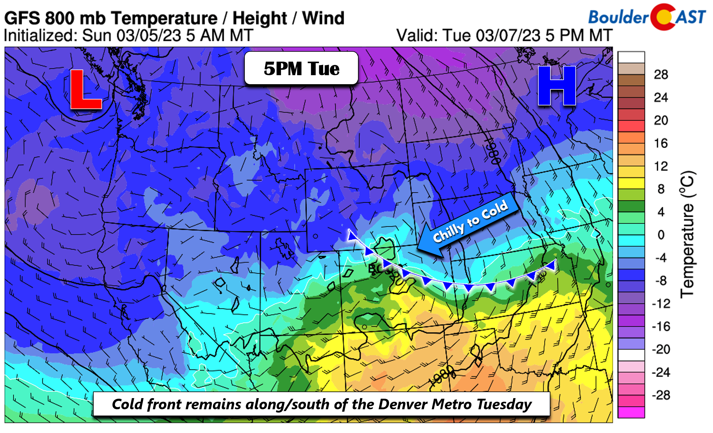
Due to a series of upper-troughs tracking through, a stationary and/or cold front will remain draped along and south of our region through most of the week — that means our area will mostly end up on the colder side of this boundary. Today, the front will be along the Colorado/Oklahoma/Kansas border region, with east-southeast flow over the Denver Metro. Chilly high pressure will be over the northern Great Plains resulting in temperatures on Monday cooler relative to Sunday —- look for highs in the upper 40s.
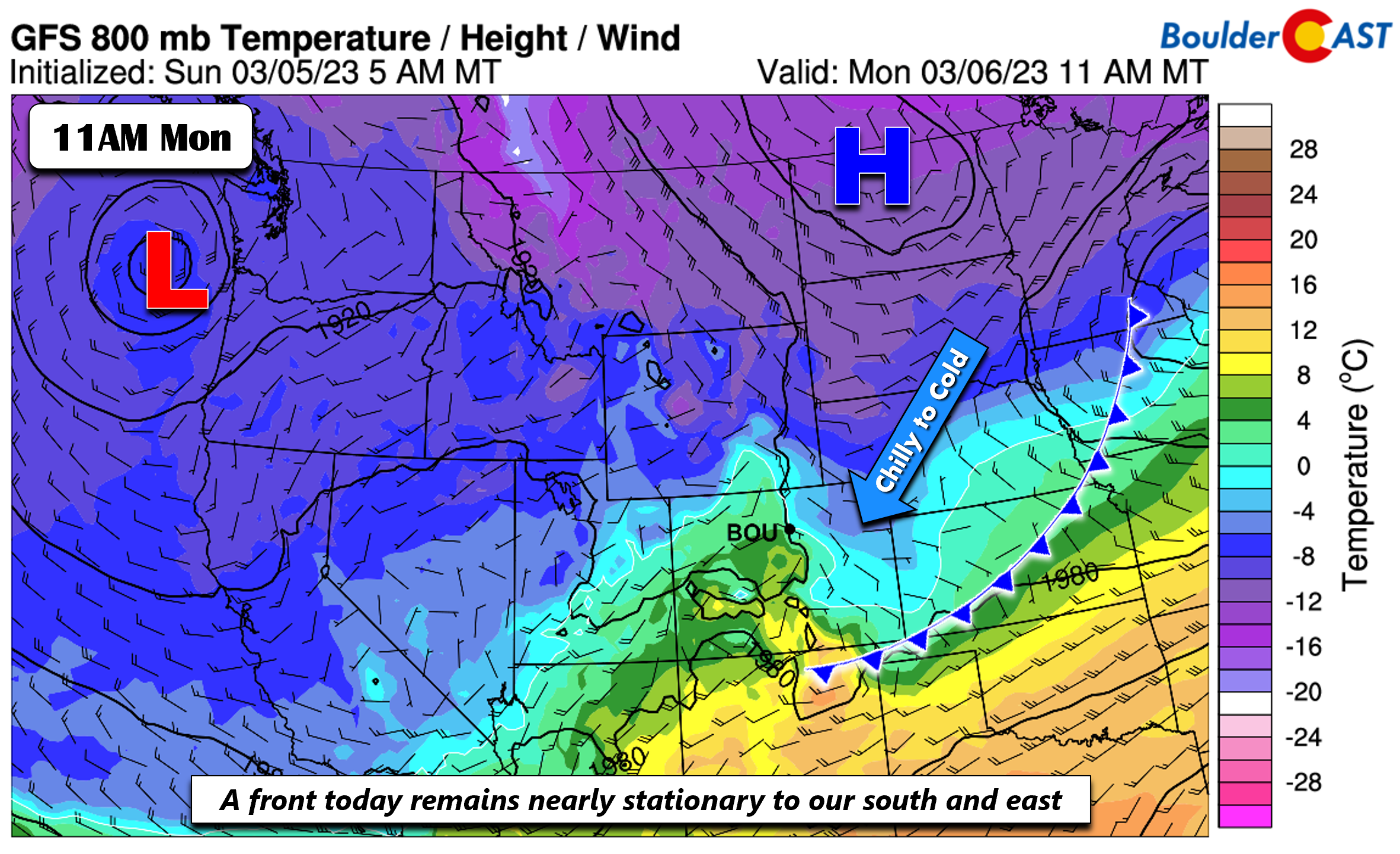
The front moves northward somewhat Tuesday, but still sets up along/south of the region, draped from Wyoming into central Kansas, while the surface high retreats towards Minnesota. Highs will fall back to near 40 degrees for most of us as moist upslope flow spreads low clouds and possibly some freezing drizzle and fog into the area.
Mid to late-week snow?
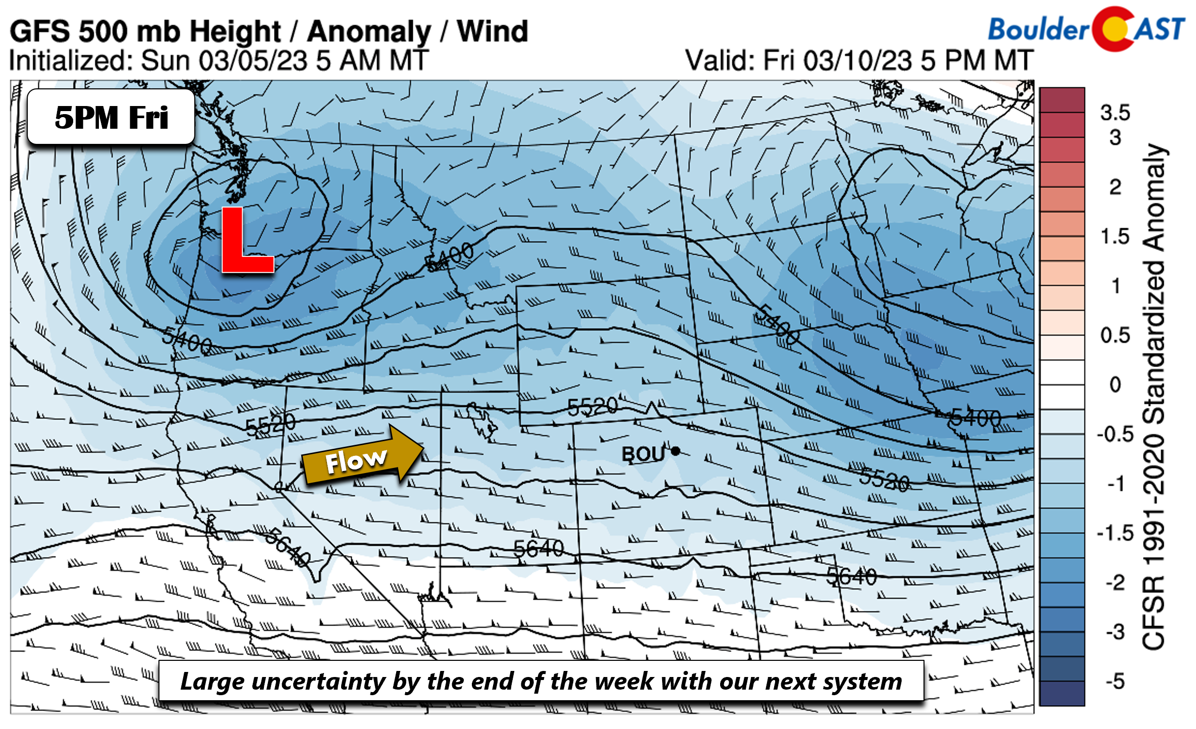
We can’t rule out some stray snow flurries prior to our mid to late-week system, but we are most concerned with late Wednesday into Thursday timeframe. The surface front by Thursday will be steered along by a surface low that is forecast to develop over Nebraska/Kansas early Thursday as an upper-trough tracks from the Rockies into the central/northern Great Plains late Wednesday into Thursday. The GFS is roughly the furthest south with the system, while the NAM/ECMWF are further north. The Canadian/GEFS appear to be in between at the moment. The GFS therefore indicates a stronger period of upslope late Wednesday night into midday Thursday as the low tracks along/north of northeast Colorado.
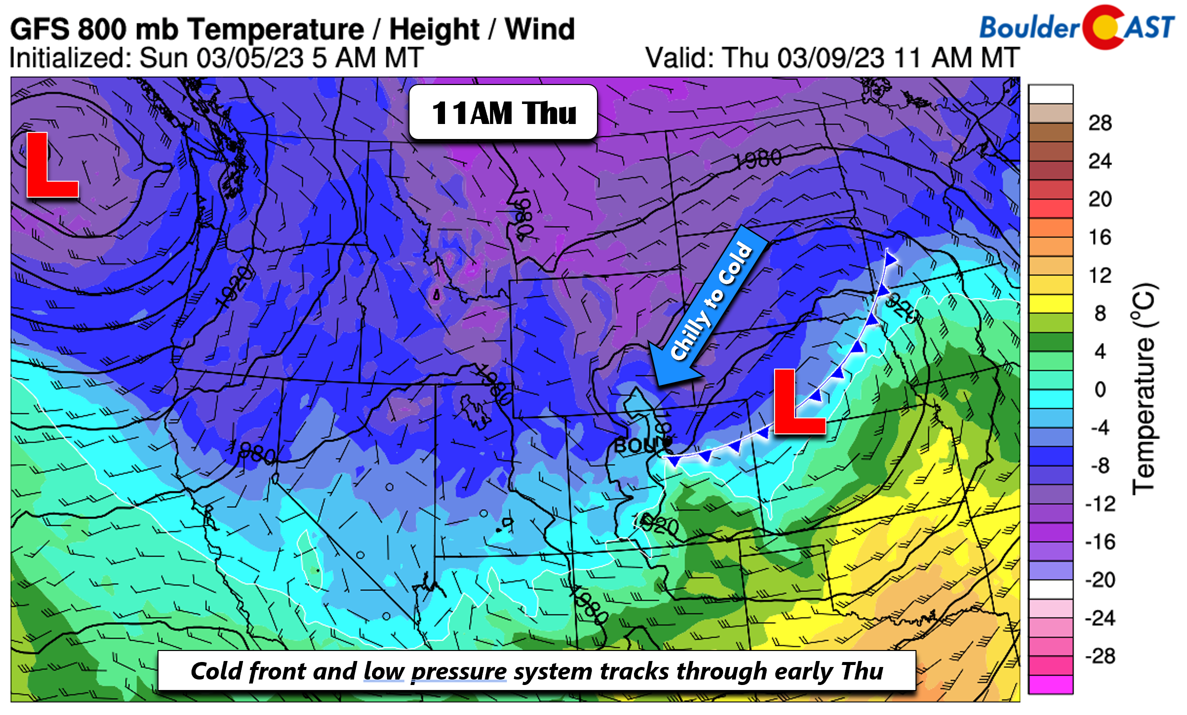
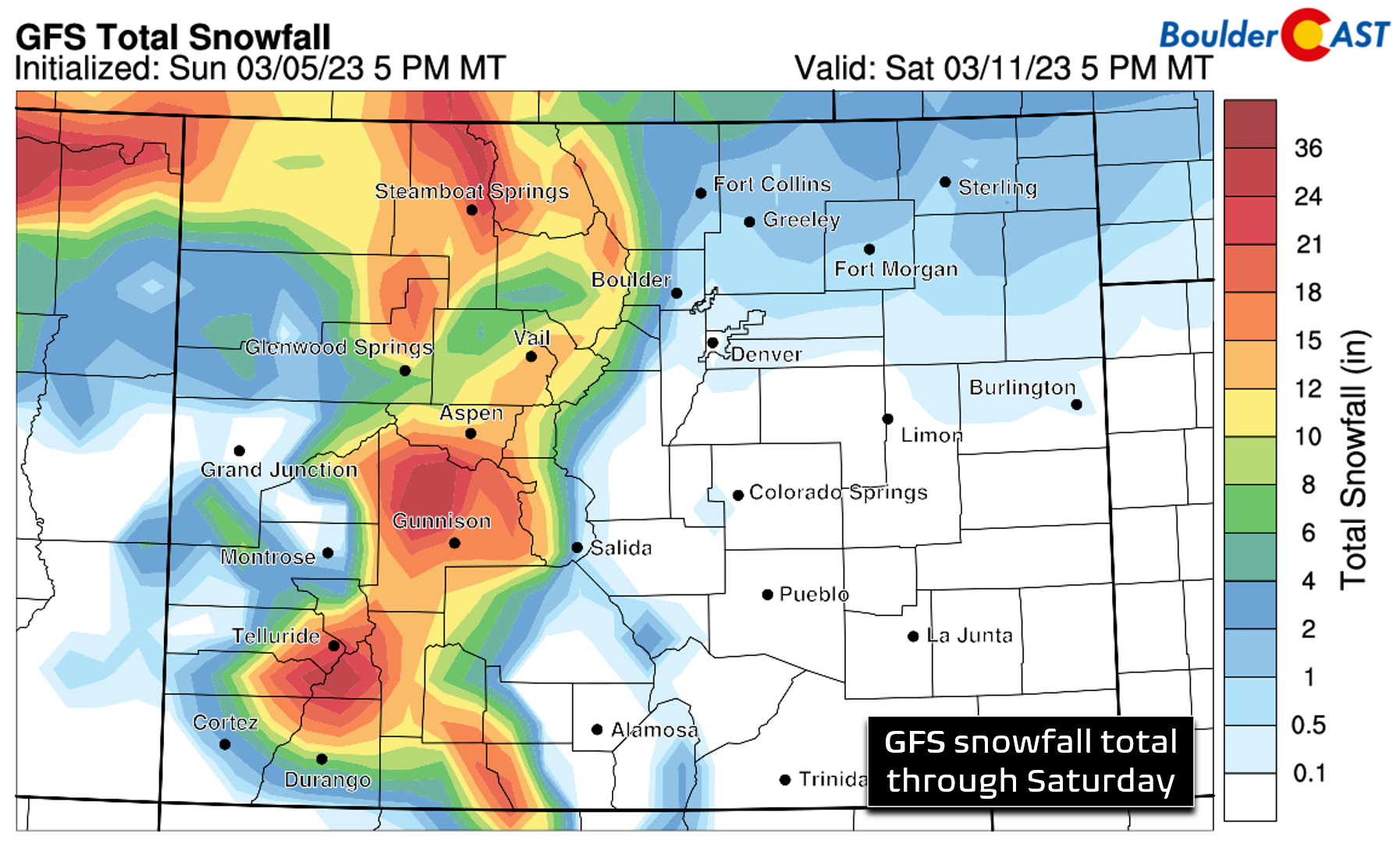
The result is that most models show snowfall accumulations for Boulder/Denver of less than 1″, with slightly more possible closer to the Wyoming border.
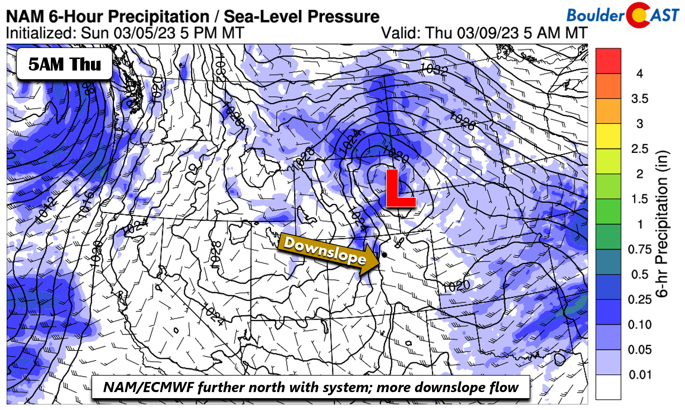
Taking a look at the even drier solutions of the NAM/ECMWF, the system takes a more northern track, moving from Utah into northeast Wyoming and western South Dakota. The result is a drier pattern on the Plains Thursday with downslope flow. Overall, it appears models are trending drier and more north with the trough, which would favor lesser snow chances on the Plains with the better chance for flakes in the High Country.
A look at the GEFS ensemble plumes, you can see the spread of snow chances are throughout Wednesday and Thursday, though uncertainty does exist.
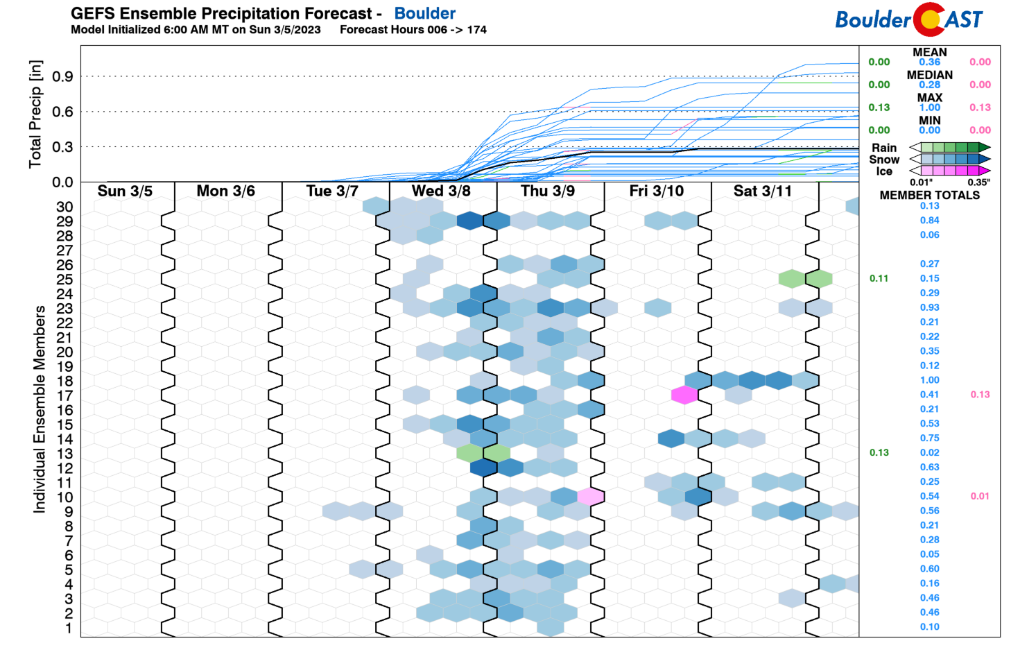
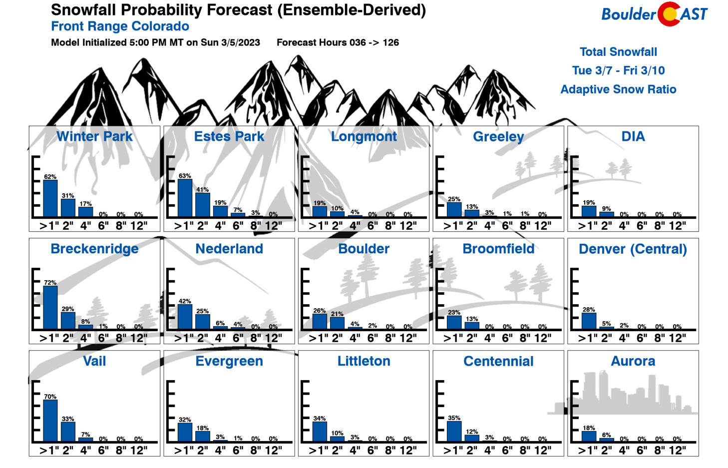
Our Snowfall Probabilities really indicate a minimal chance of accumulating snowfall for areas east of the Mountains this week — just a 10-20% chance of seeing even an inch or two. Our bet is that this system will indeed stay drier for the Plains given the northern track of the upper-trough.
Trending drier but still below normal at week’s end
By the end of the week, uncertainty persists, though it appears by Friday a drier trend unfolds with westerly flow at mid-levels. Another system is potentially forecasted to impact the region sometime late Friday or over the weekend. The GFS/CMC bring the system in by Saturday, while the ECMWF is more muted and still has dry westerly flow until later in the weekend. Given that, we opted to keep Friday dry at the moment with a trend toward more seasonal temperatures into the 50s by the weekend.
Enjoy the first full week of March — spring is right around the corner!
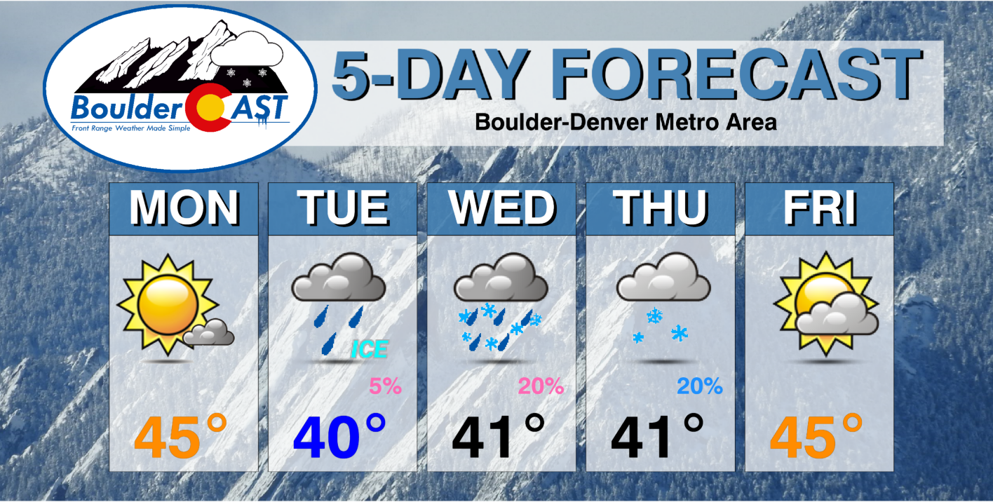
Forecast Specifics:
Monday: Mostly sunny and cooler with middle 40s to lower 50s on the Plains and middle 30s in the Foothills.
Tuesday: Low clouds develop with possibly a few areas of patchy freezing drizzle in the morning. Highs near 40 degrees on the Plains and lower 30s in the Foothills.
Wednesday: Areas of low clouds and freezing drizzle in the morning. Then mostly cloudy and staying cold. Highs in the upper 30s to around 40 for the Plains and upper 20s in the Foothills. A 20% chance of rain and snow showers late in the day or evening
Thursday: Mostly cloudy with a 20% chance of snow in the morning and afternoon. Windy at times. Highs near 40 degrees on the Plains and near 30 in the Foothills.
Friday: Partly sunny and not as chilly with highs near the middle 40s for the Plains and middle 30s in the Foothills.
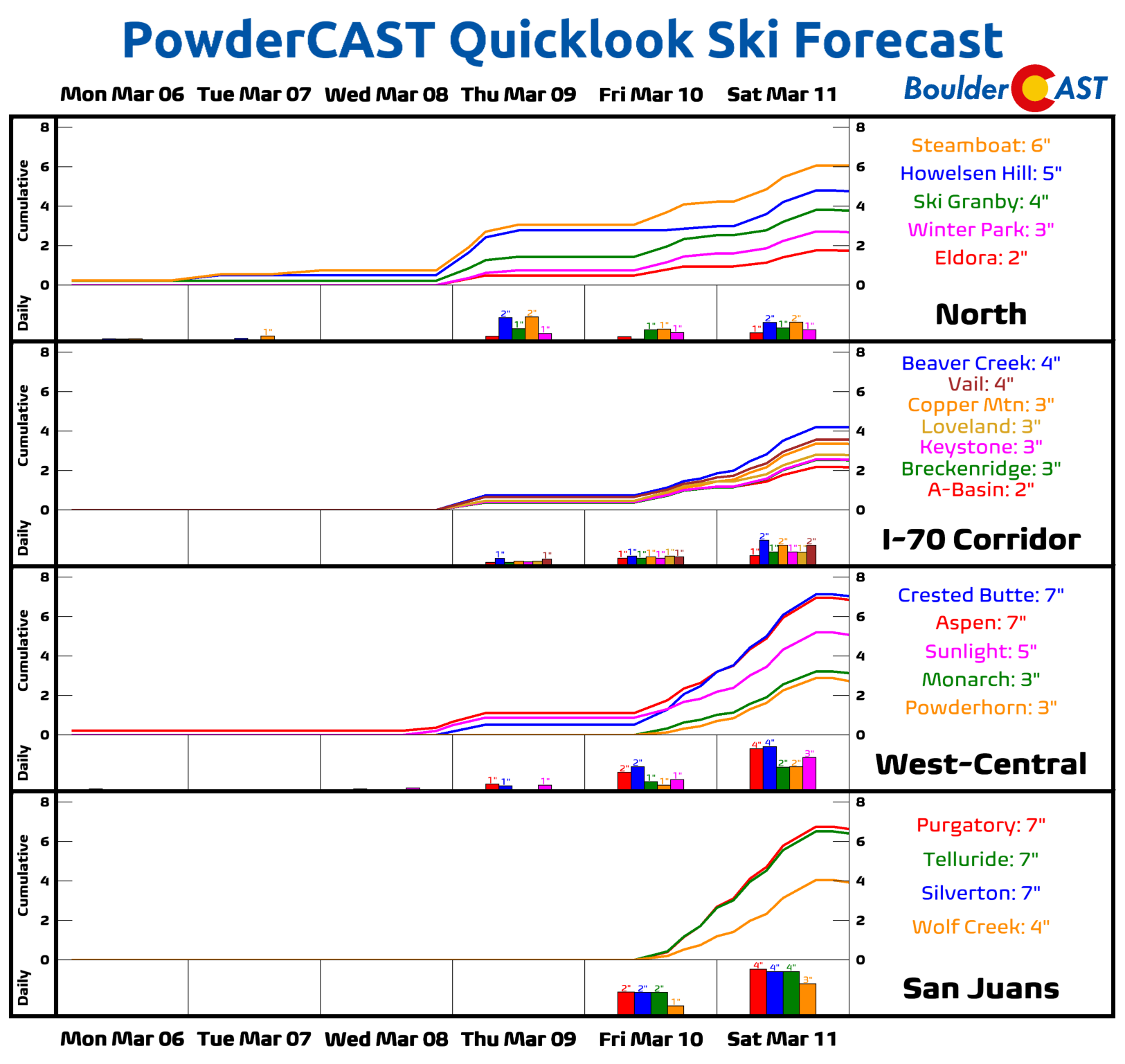
PowderCAST: A series of upper-level systems with a trough in the Pacific Northwest will bring periods of light to moderate snow through the week. The most prominent chances of snow will be Wednesday and Thursday, and then again Friday into Saturday. Snowfall amounts may exceed a foot or more in places.
Help support our team of Front Range weather forecasters by joining BoulderCAST Premium. We talk Boulder and Denver weather every single day. Sign up now to get access to our daily forecast discussion email each morning, complete six-day skiing and hiking forecasts powered by machine learning, first-class access to all our Colorado-centric high-resolution weather graphics, bonus storm updates and much more! Or not, we just appreciate your readership!
Spread the word, share the BoulderCAST forecast!


You must be logged in to post a comment.