A quiet week is expected across the beautiful state of Colorado! The low pressure system which brought feet of snow to the Front Range just a few days ago will slowly begin to vacate the Desert Southwest in the coming days. The weakened storm will be shunted to our south by a ridge advancing into the area from the northwest. This ridge will slide east through the week, keeping our temperatures mild and our weather dry. We are watching a few backdoor cold fronts mid to late-week but we should still remain dry and fairly mild in spite of their passages. Read on for more details.
This week’s highlights include:
- Quite pleasant and mild for entire week: The week starts with highs in the mid to upper 50s, but trends into the low to middle 60s the remainder of the week
- Watching a few weak backdoor cold fronts: The first one arrives Wednesday with a second on Friday — both are likely to be totally dry
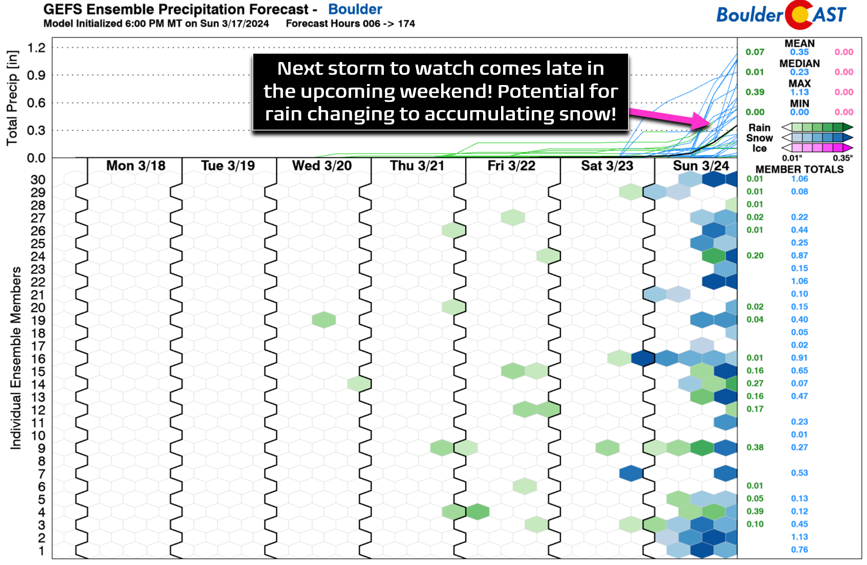
- Snow in the extended? There is little chance of precipitation in the Front Range this week, but a potential rain/snow event may be taking shape late in the upcoming weekend
DISCLAIMER: This weekly outlook forecast is created Monday morning and covers the entire upcoming week. Accuracy will decrease as the week progresses as this post is NOT updated. To receive daily updated forecasts from our team, among many other perks, subscribe to BoulderCAST Premium.

Go Premium, get all the perks.
Daily Forecast Updates
Get our daily forecast discussion every morning delivered to your inbox.
All Our Model Data
Access to all our Colorado-centric high-resolution weather model graphics. Seriously — every one!
Ski & Hiking Forecasts
6-day forecasts for all the Colorado ski resorts, plus more than 120 hiking trails, including every 14er.
Smoke Forecasts
Wildfire smoke concentration predictions up to 72 hours into the future.
Exclusive Content
Weekend outlooks every Thursday, bonus storm updates, historical data and much more!
No Advertisements
Enjoy ad-free viewing on the entire site.
A mild and quiet week overall
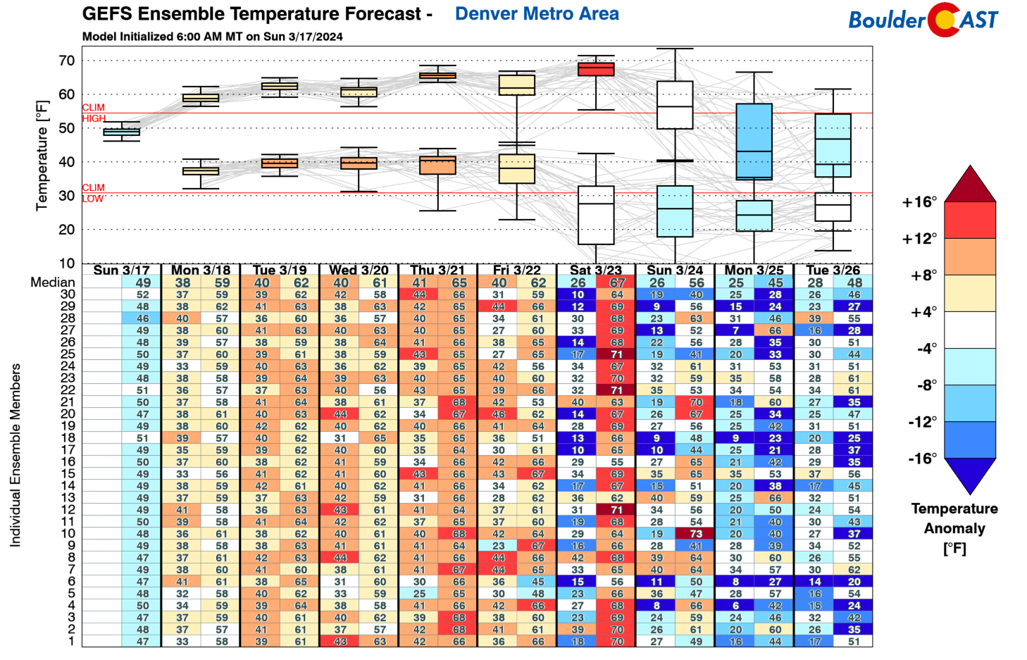
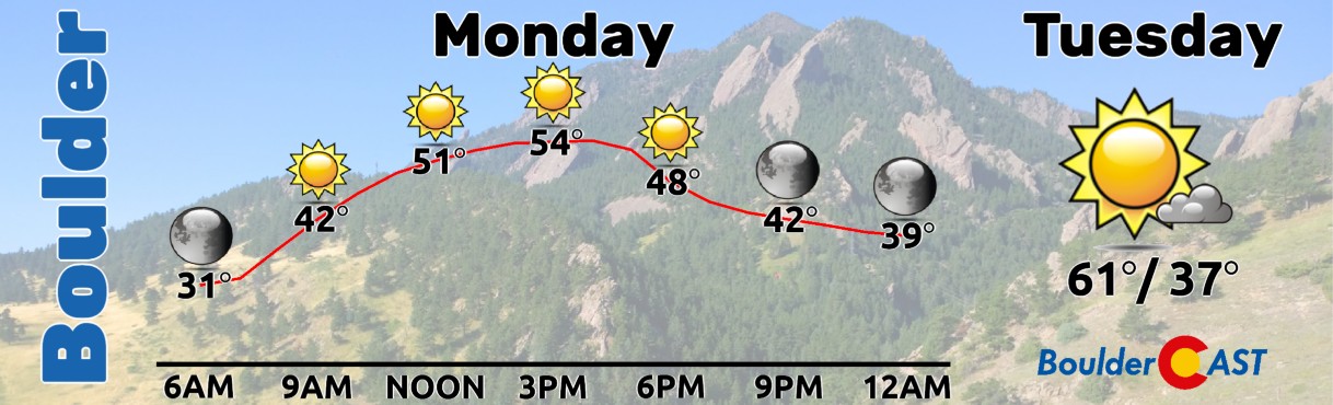
Aquiet stretch of weather is headed to Colorado, a far cry from where we were during the midst of the monster snowstorm last week! Temperatures this week will hover above average across the Front Range with the deep blanket of wet snow continuing to melt away. We start off the week in the 50s on Monday but we’ll make a return to the 60s for Tuesday and really the rest of the week. We are watching a few backdoor cold fronts, one on Wednesday and one on Friday, noted in the brief drop in high temperatures from the GEFS below.
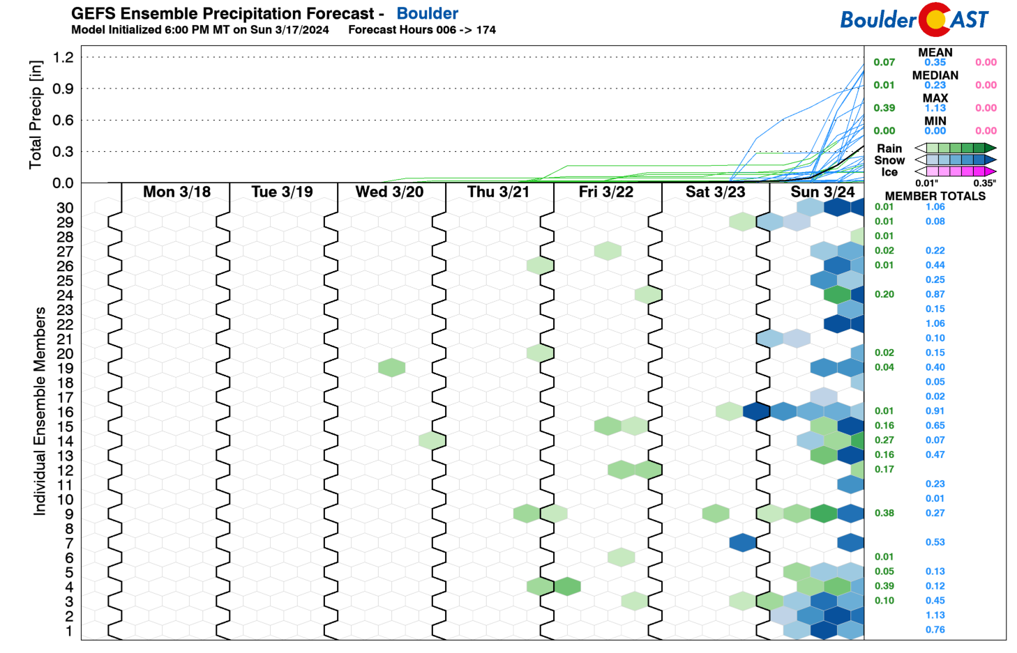
While the GEFS shows a few blips of precipitation chances this week, little moisture and lift will be present in the atmosphere across Colorado — we should be dry every day. However, Friday’s cold front could bring some showers that we will discuss here in a moment.
For Monday, high pressure ridging will be over Nevada and a low pressure system over southern California — the latter is indeed the low pressure that brought us the big-time snow last week! Dry northwest flow is over Colorado and it will aid in keeping us dry and sunny.
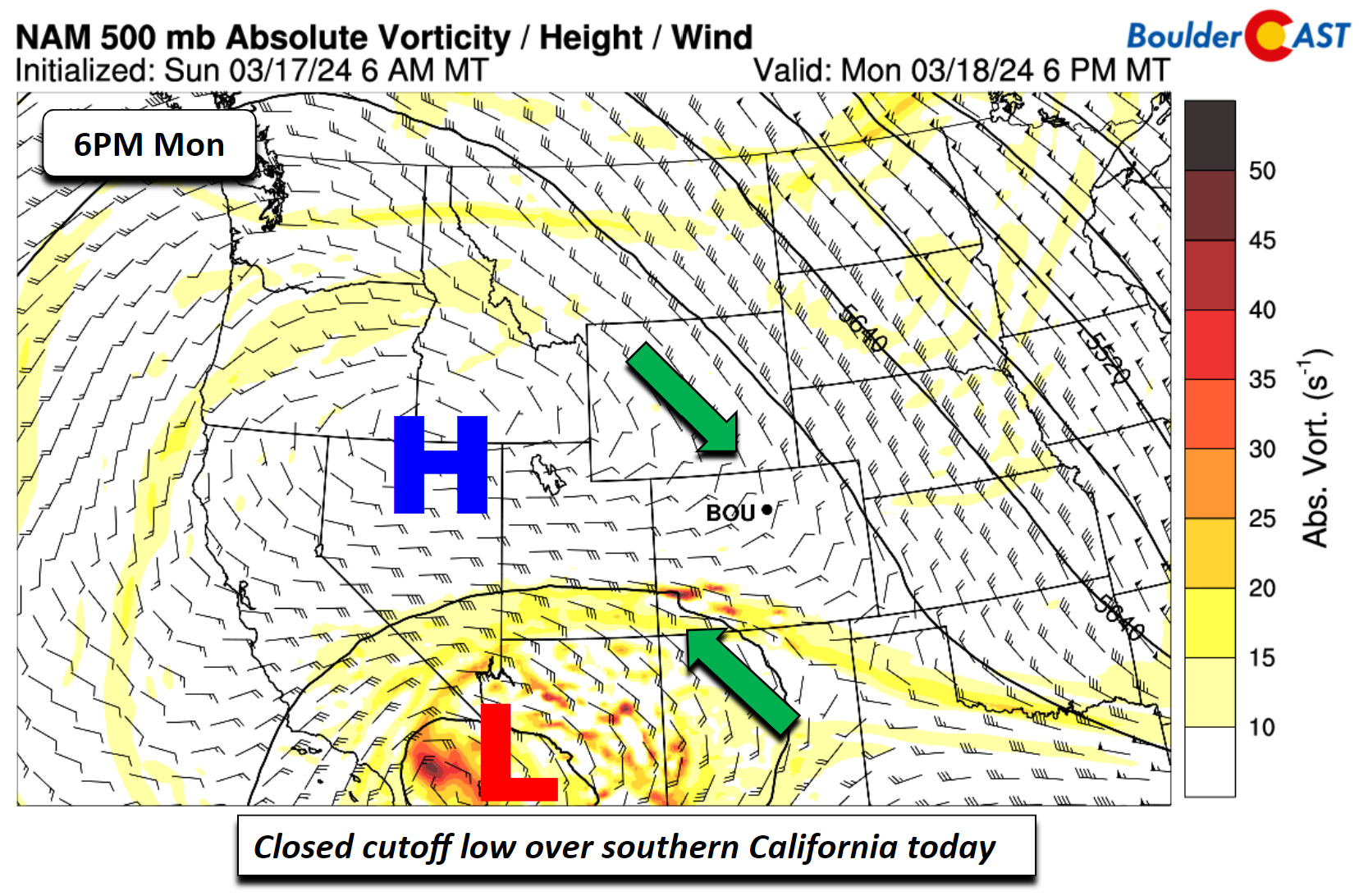
Warmer air spreads east on Monday, but with snow cover still around, highs should stay somewhat cool the mid to some upper 50s.
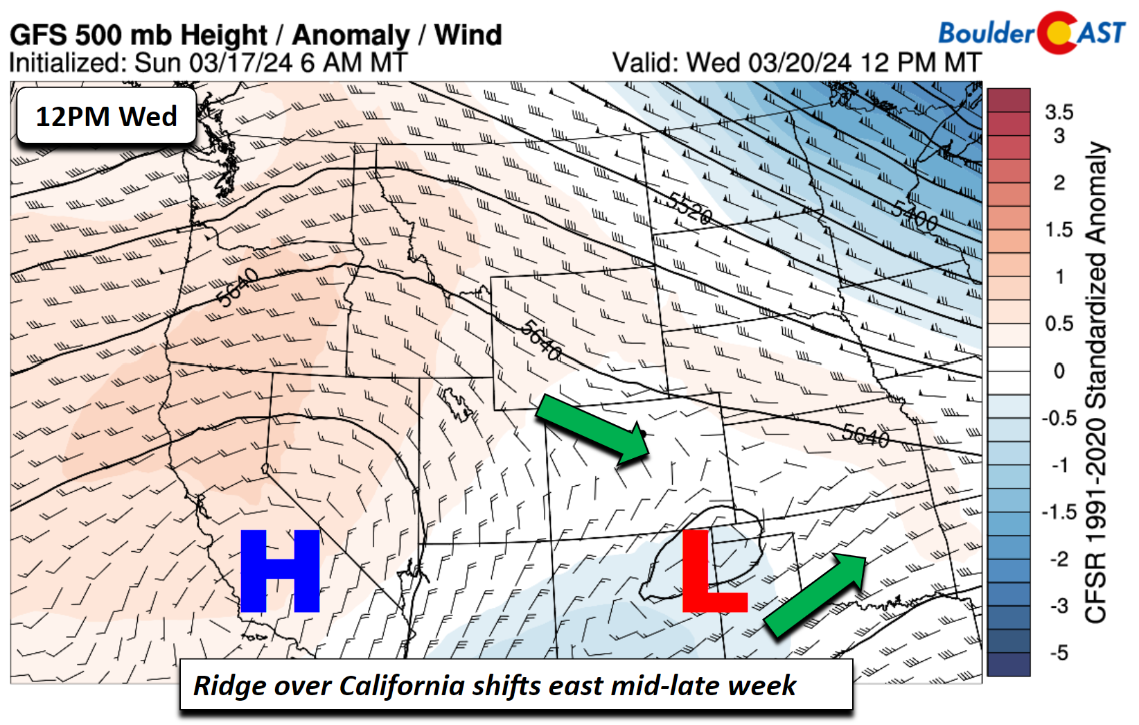
As we progress into midweek, the ridge over Nevada/California will slowly slide east. The cutoff system from Monday will remain to our south but it’ll reach New Mexico and Texas by Wednesday afternoon. The system largely skirts to the south of Colorado, but some snow/rain could impact southern portion of the state into midweek. We will be dry over the Front Range nonetheless.
You can’t really go wrong with the lovely, sunny weather in store for our Monday and Tuesday!
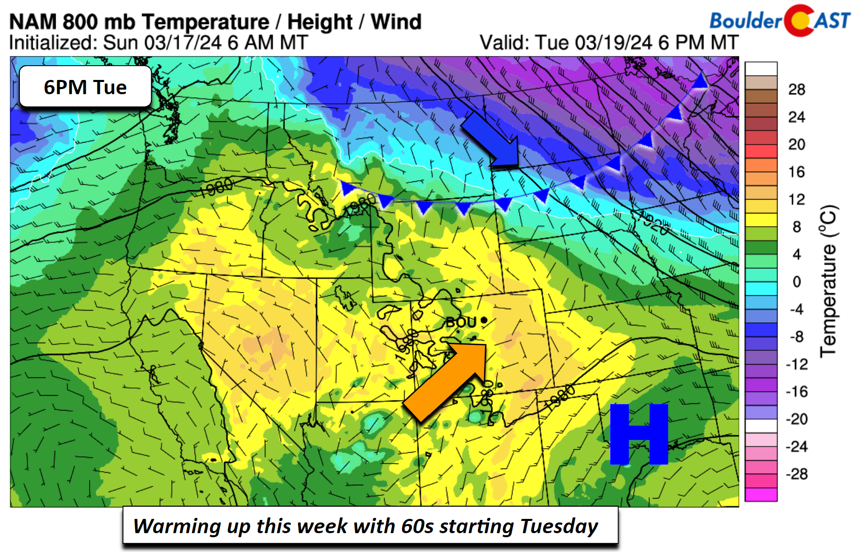
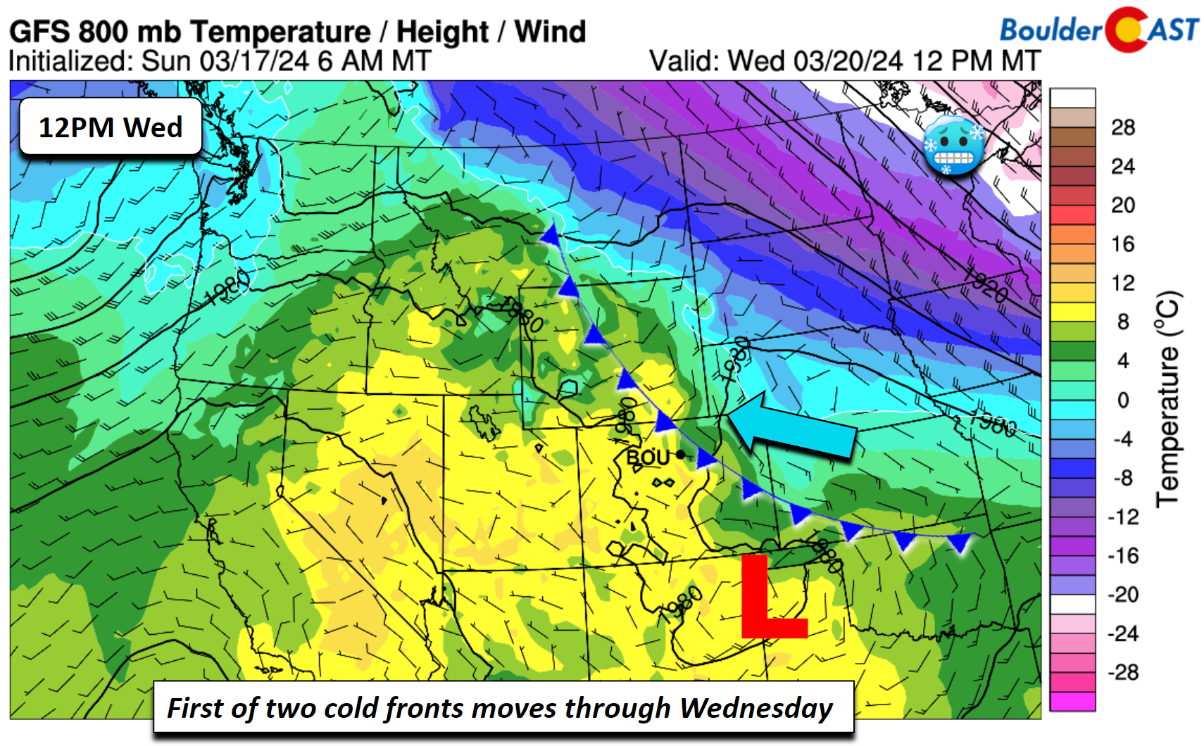
The first of two cold fronts will drop through northeast Colorado Wednesday morning. The brunt of the chilly air will reside to our north and east. Nevertheless, highs in the low to mid 60s Tuesday will trend a few degrees cooler Wednesday to the low 60s with the east-southeast flow. The front should pass through completely dry.
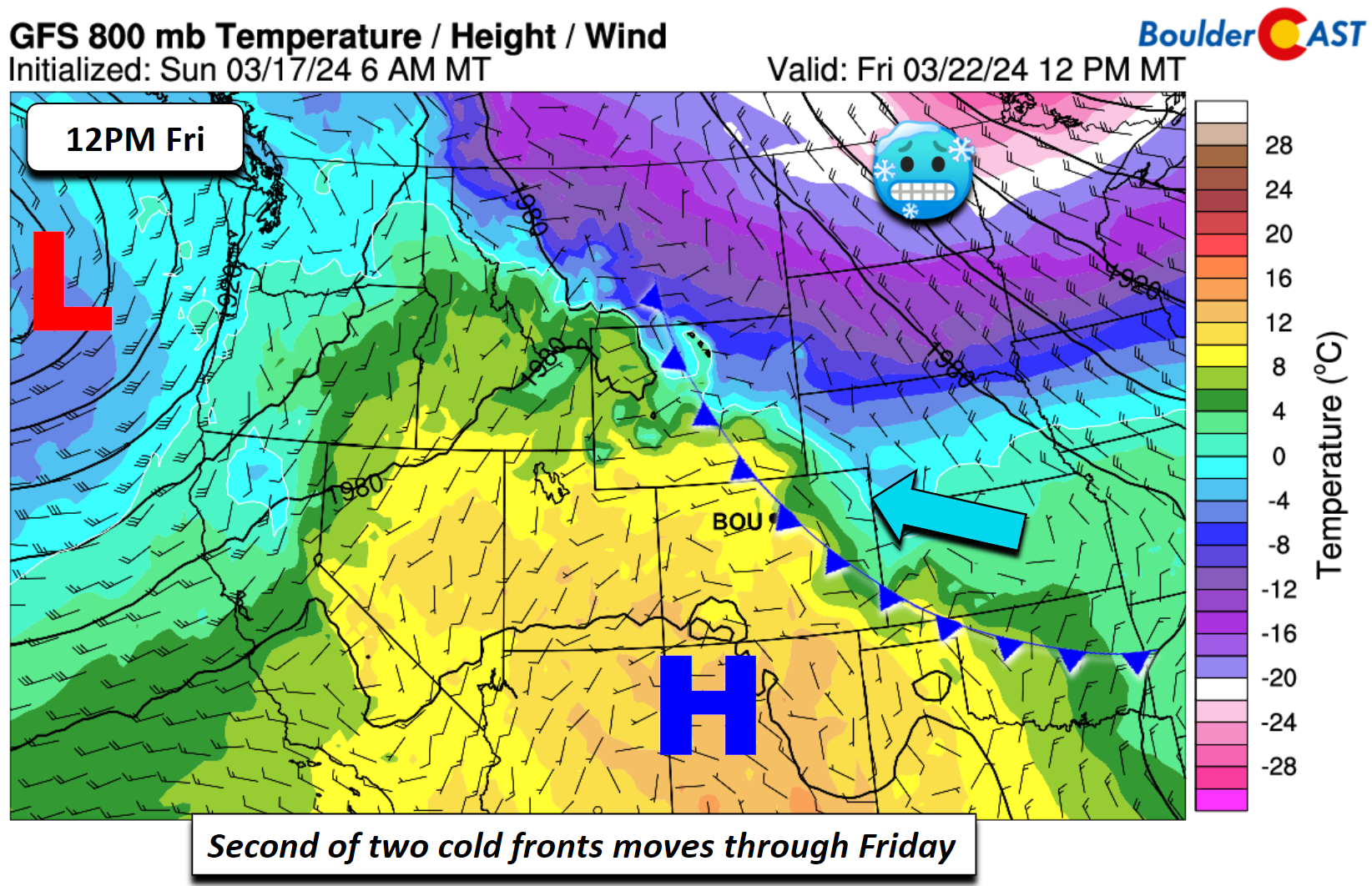
By week’s end, ridging will spread eastward and the southern closed low will be out of the region. Lots of sunshine will overspread Colorado for a great end to our week.
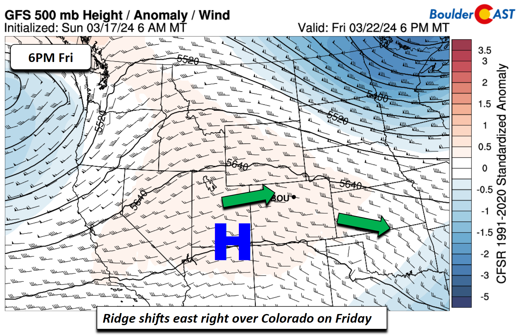
The second of two cold fronts will then arrive Friday morning, with again the coldest air well to our north and east. However, lower 60s look to be the norm, although if the cold air is further south than anticipated, we could dip back into the 50s.
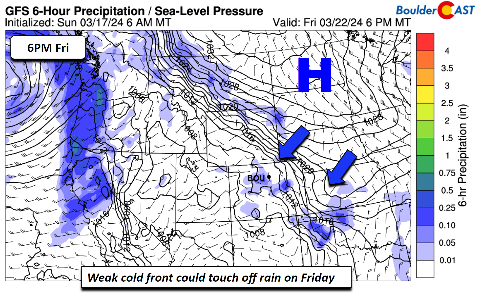
The GFS/GEFS are hinting at a few showers with the cold front Friday, but we don’t fully buy it yet given the lack of upper-level forcing. We’ll keep an eye on it, but expect dry weather to end the week for now.
Below is a look at the week as a whole. This is the perfect stretch of weather to follow up the monster snowstorm last week — but we may be a tad biased!
The next storm system to keep an eye on doesn’t arrive until late in the upcoming weekend or early next week when a trough digs into the Rockies. Though it is still a solid week or so out, model ensembles are latching onto a potential rain/snow event for the Front Range during this timeframe. Stay tuned and enjoy the wonderful weather this week!
There's so much snow above #Boulder! #cowx pic.twitter.com/mS2RPwnNPG
— BoulderCAST Weather 🏔️❄️ (@BoulderCAST) March 17, 2024
Get BoulderCAST updates delivered to your inbox:
Forecast Specifics:
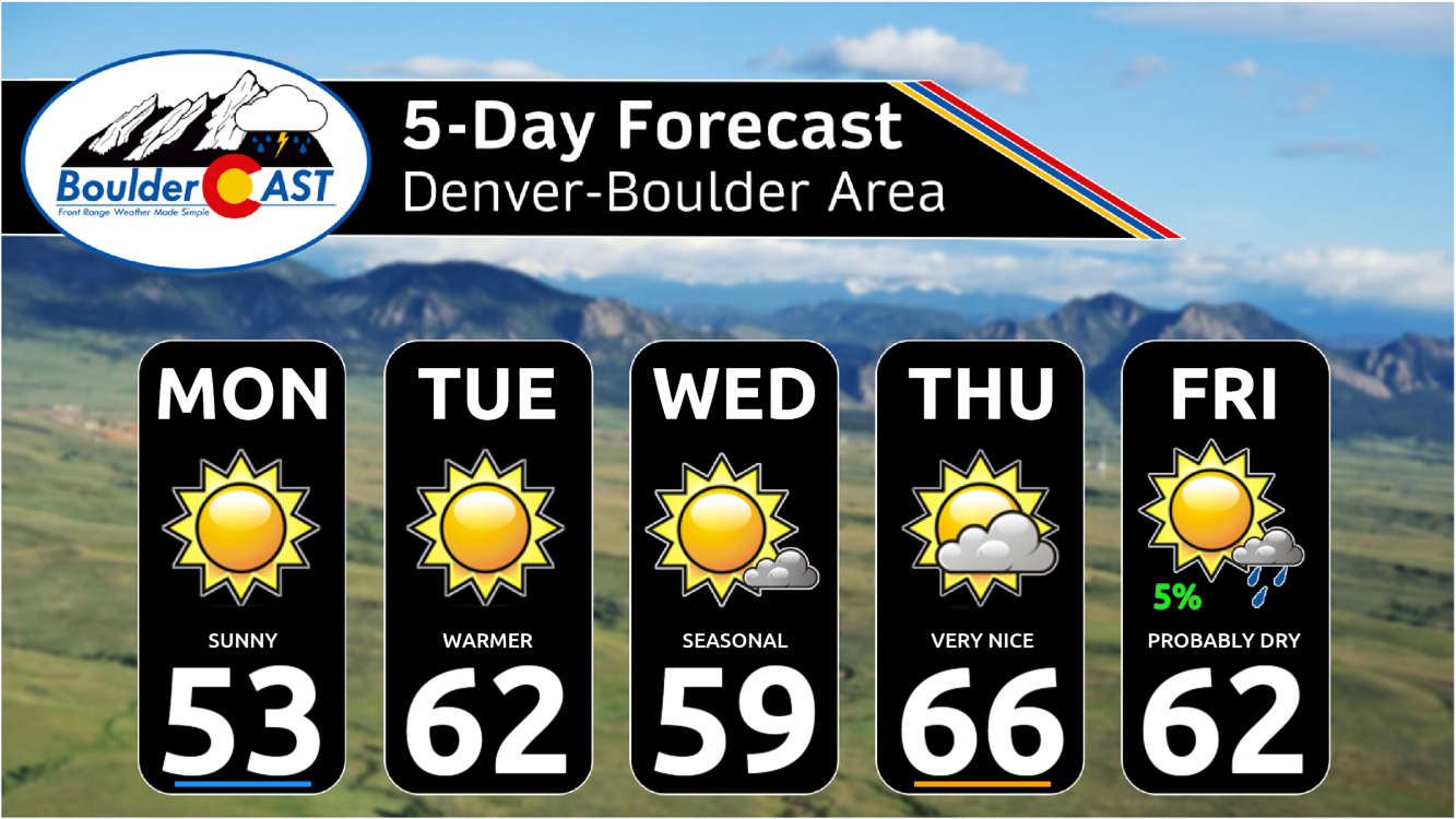
Monday: Sunny with highs in the middle 50s on the Plains and lower 40s in the Foothills.
Tuesday: Sunny and warmer yet with low to middle 60s for the Plains and lower 50s in the Foothills.
Wednesday: Mostly sunny and mild with low 60s on the Plains and low 50s in the Foothills.
Thursday: Partly sunny and warmer with mid to upper 60s on the Plains and middle 50s in the Foothills. This is likely to be our warmest day of the week.
Friday: Partly to mostly sunny and pleasant with near 60 degrees on the Plains and near 50 degrees in the Foothills. There is a very slight chance of a shower, but that is less than 5% for now.
DISCLAIMER: This weekly outlook forecast is created Monday morning and covers the entire upcoming week. Accuracy will decrease as the week progresses as this post is NOT updated. To receive daily updated forecasts from our team, among many other perks, subscribe to BoulderCAST Premium.
Go Premium, get all the perks.
Daily Forecast Updates
Get our daily forecast discussion every morning delivered to your inbox.
All Our Model Data
Access to all our Colorado-centric high-resolution weather model graphics. Seriously — every one!
Ski & Hiking Forecasts
6-day forecasts for all the Colorado ski resorts, plus more than 120 hiking trails, including every 14er.
Smoke Forecasts
Wildfire smoke concentration predictions up to 72 hours into the future.
Exclusive Content
Weekend outlooks every Thursday, bonus storm updates, historical data and much more!
No Advertisements
Enjoy ad-free viewing on the entire site.
Enjoy our content? Give it a share!


You must be logged in to post a comment.