We’ve got a stormy start to the week with continued cool temperatures and a risk of hail and flash flooding from slow-moving thunderstorms. Our rain chances will lessen toward the tail end of the week as a mid-level system exits and leaves behind a ridge pattern. On the wildfire front, smoke from fires in western Canada should stay to our north keeping air quality good here in the Front Range. Read on for more details.
This week’s highlights include:
- A pesky mid-level system and surface upslope will favor a continued unsettled pattern into midweek with below seasonal temperatures
- Westerly to zonal flow takes hold Wednesday into Friday, with warmer weather in the 70s to lower 80s and lesser rain chances
- The wettest days appear to be Monday and Tuesday when flash flooding and hail will be possible; the driest days look to be Wednesday and Friday
- The smoke from Canadian fires should stay to our north this week resulting in continued good air quality
DISCLAIMER: This weekly outlook forecast is created Monday morning and covers the entire upcoming week. Accuracy will decrease as the week progresses as this post is NOT updated. To receive daily updated forecasts from our team, among many other perks, subscribe to BoulderCAST Premium.
Daily Forecast Updates
Get our daily forecast discussion every morning delivered to your inbox.
All Our Model Data
Access to all our Colorado-centric high-resolution weather model graphics. Seriously — every one!
Ski & Hiking Forecasts
6-day forecasts for all the Colorado ski resorts, plus more than 120 hiking trails, including every 14er.
Smoke Forecasts
Wildfire smoke concentration predictions up to 72 hours into the future.
Exclusive Content
Weekend outlooks every Thursday, bonus storm updates, historical data and much more!
No Advertisements
Enjoy ad-free viewing on the entire site.
Staying wet & chilly to start
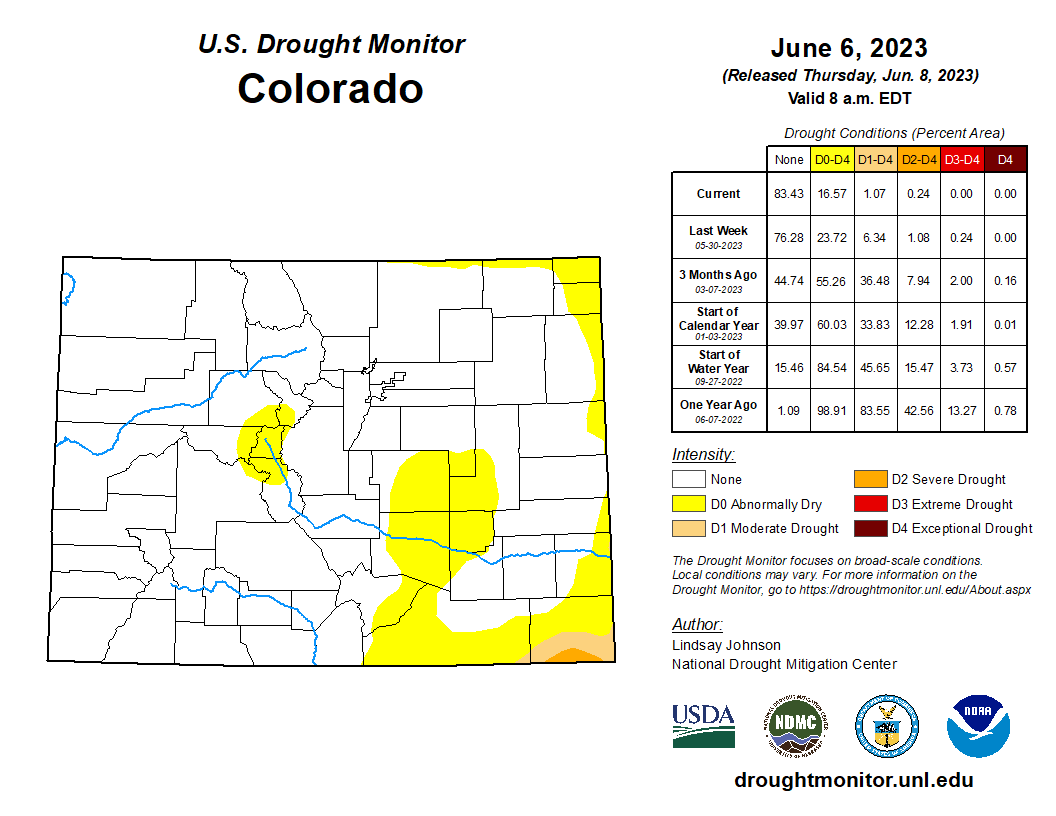
It’s the middle of June and our main weather concern for the Front Range right now is for flash flooding, not raging wildfires or crippling drought as it normally would be this time of year. The latest drought update has brought incredible news for Colorado: only 1% of the state is currently in drought — that being the far southeast corner — down from 84% one year ago!
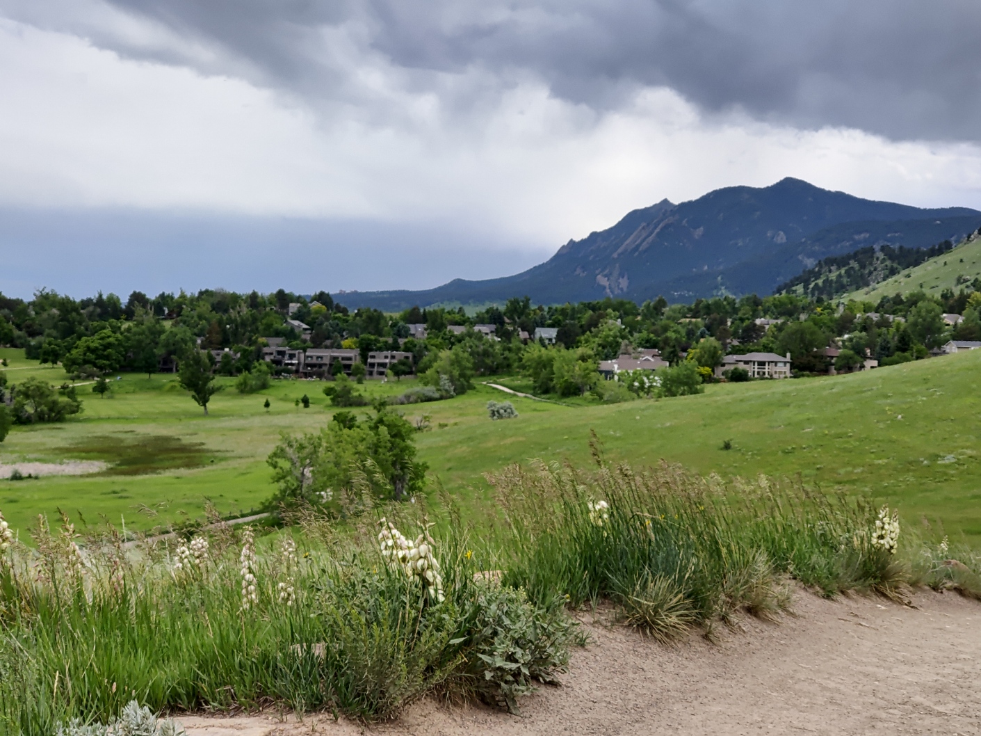
Thanks to a “Top 12” wettest month of May and continued wet weather heading into June, the hills are currently donning a beautiful shade of green. The wildflower display right now is on point — even the yuccas are ready to bloom:
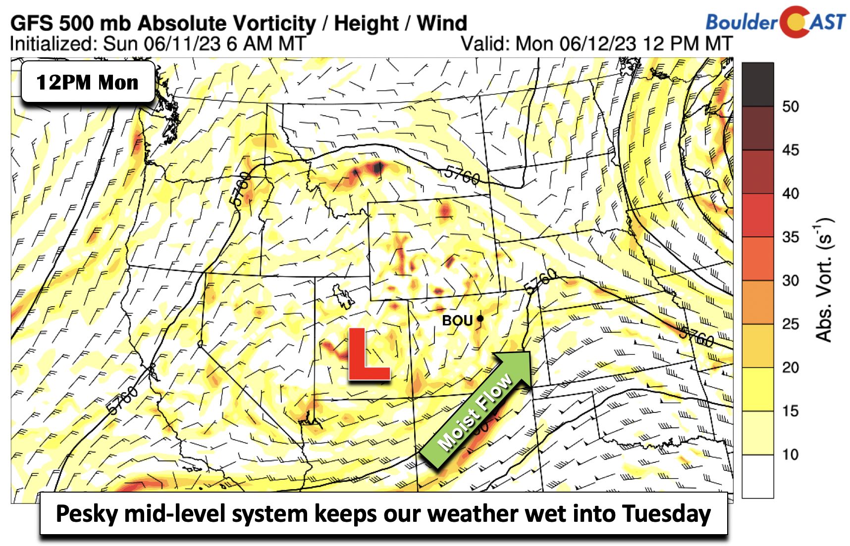
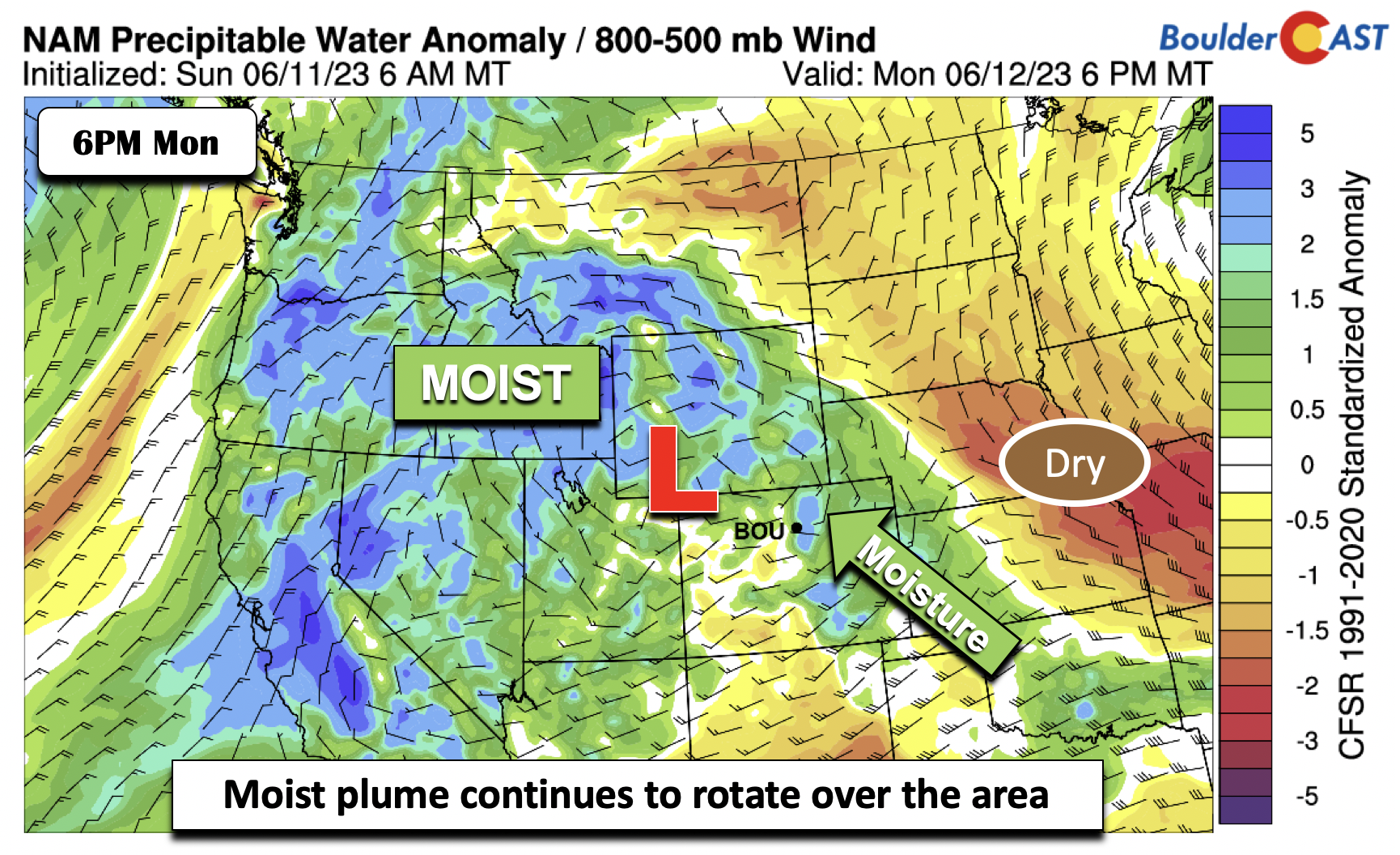
We expect no changes to the situation this week either with continued cool and unsettled weather across Colorado. The pesky mid-level system that was to our southwest this past weekend will continue to impact us to start our week unfortunately. On Monday that system slides into central/eastern Utah. A deep plume of moisture continues to punch its way into Colorado for afternoon and evening showers and storms.
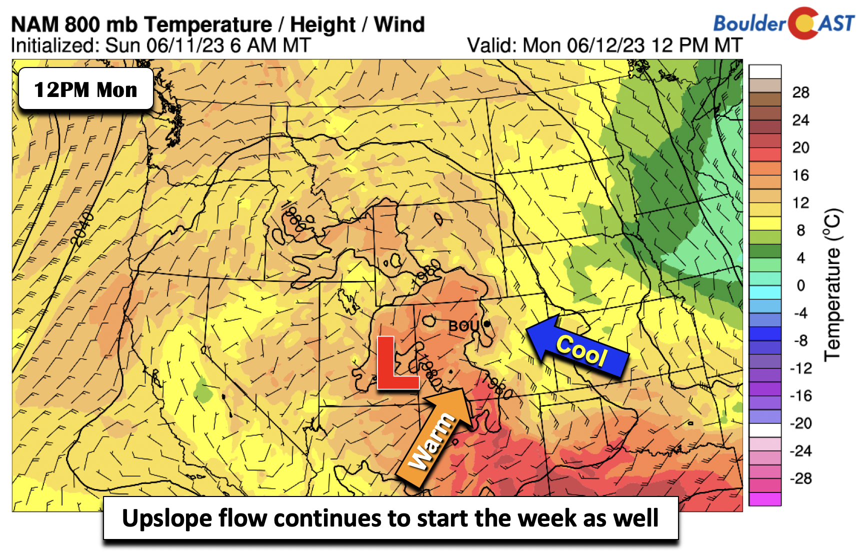
Monday will also continue our trend of easterly upslope flow with high pressure over the northern Great Plains. This will keep us in that chilly pattern with middle 60s for the Plains and upper 50s in the Foothills.
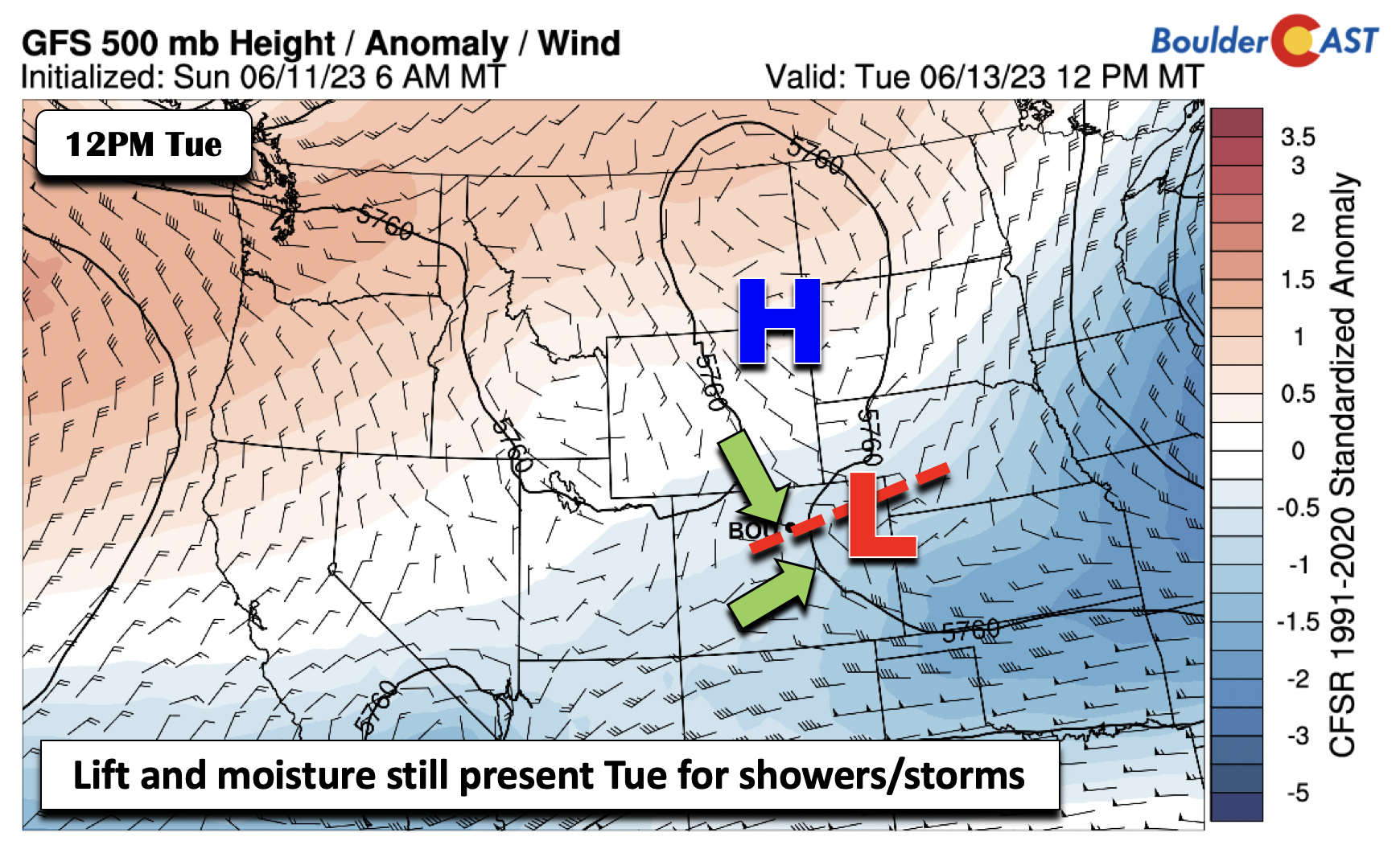
While dry air exists to our east over the Midwest, notice how the moisture plume stretches from eastern Colorado into Idaho around the upper-low. This will keep us in that very wet weather pattern Monday and Tuesday.
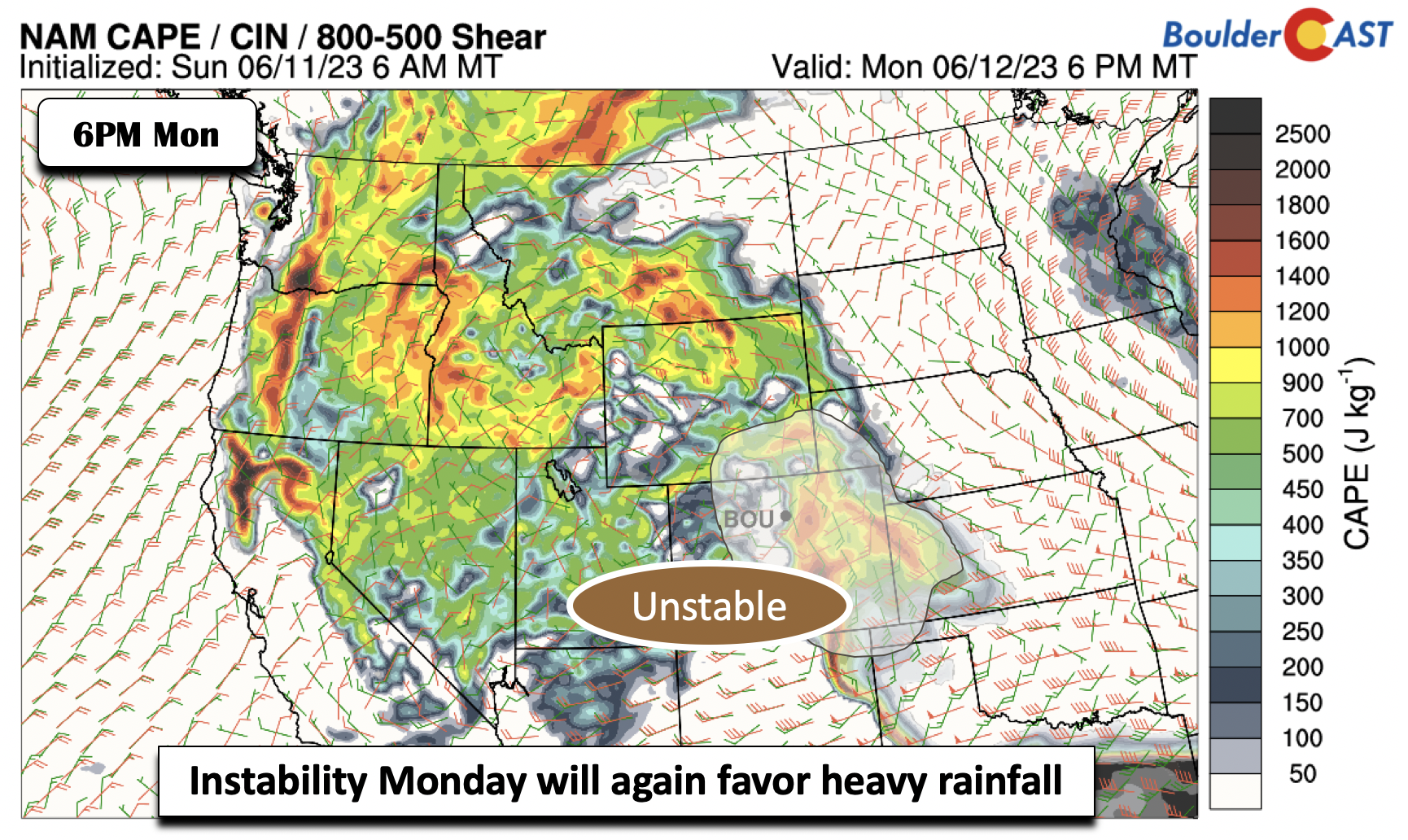
Like we saw on Sunday, much of the same setup is in place today and tonight, with slow storm motions, deep moisture, instability, juicy dewpoints, and surface upslope. All of these ingredients will favor heavy rainfall and isolated flash flooding.
Storms will again be diurnally driven on Monday, maximizing in the afternoon/evening, and tapering off in the late evening/overnight hours. Monday’s high will only reach the middle 60s, some 15 degrees below normal.
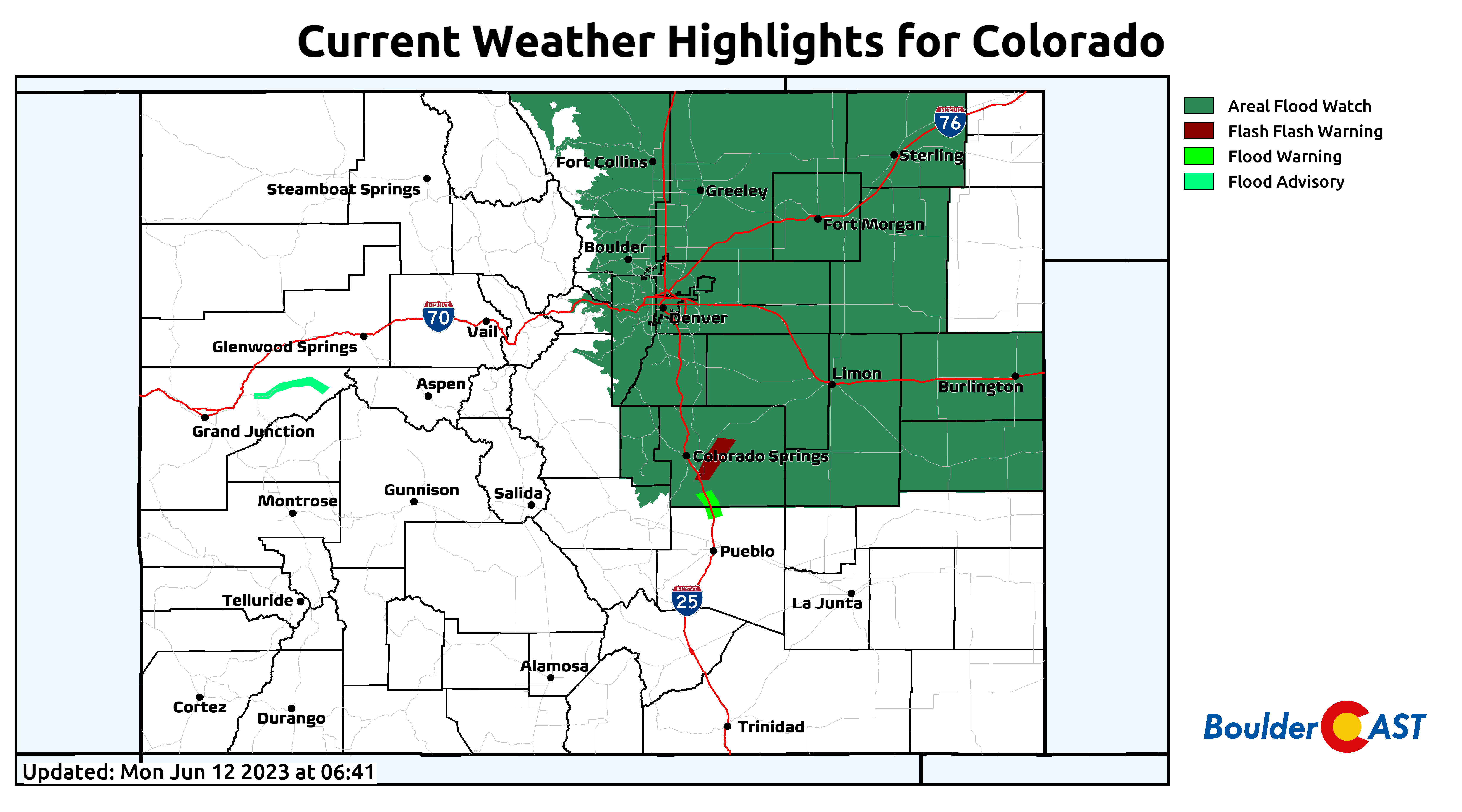
A Flash Flood Watch is in effect Monday for all of northeast Colorado for the risk of slow-moving intense downpours which could locally produce 1-3″+ rainfall in less than 90 minutes. The risk of flooding will decrease towards midnight Monday night. Any of Monday’s storms could also contain hail up to 1″ in diameter with the risk being greatest from Boulder southward.
On Tuesday the system will track ever so slightly to the east over towards the Kansas/Colorado border. Weak but still ever-present mid-level convergence/moisture will favor another round of afternoon and evening thunderstorms. However, weak ridging will be present to our north over Wyoming. This high may aid in favoring more isolated/scattered storms along the Wyoming border. The most widespread storms Tuesday appear to be favored south and east of Denver, though a 40-50% chances for storms is warranted for Tuesday, once again being diurnally driven. Temperatures will hover in the 60s again with more widespread low clouds expected under light easterly flow.
Lesser rain chances & warmer temps for mid to late week
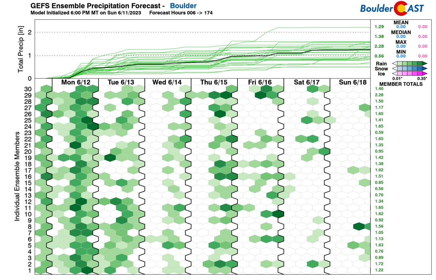
As we progress into the middle and latter part of the week, we “should” start to see an overall slight drying trend across the state. GEFS and CMC/ECMWF guidance shows that drier zonal/westerly flow will likely take hold, resulting in downslope flow and lower moisture content. Take note how the GEFS precipitation plumes start to dry out once we get to Wednesday.
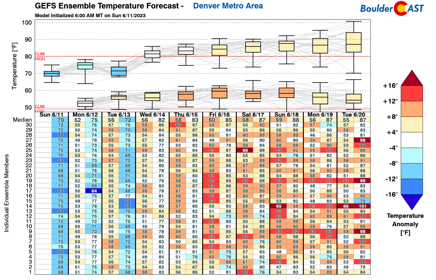
Along the same lines, temperatures will feature an upward trend into the upper 70s to lower 80s during this drying period as well, as suggested by the GEFS temperature forecast.
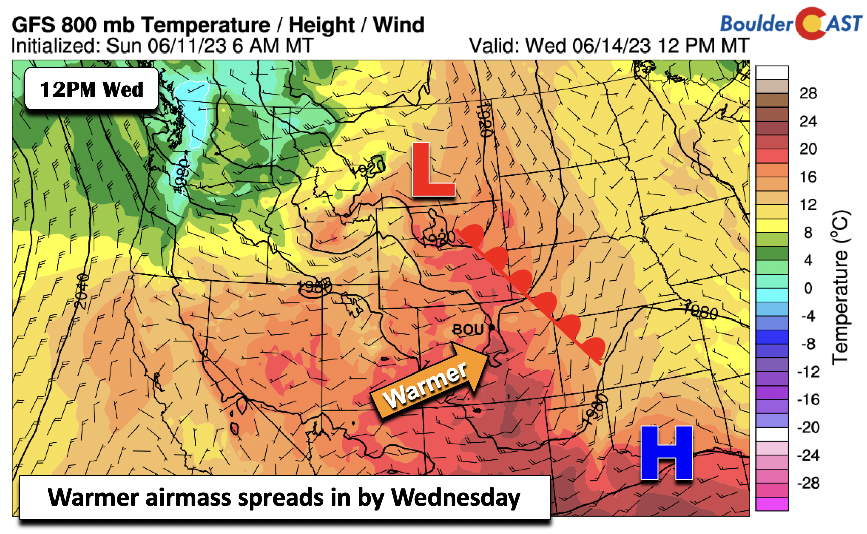
The warmth starts Wednesday as a warm front lifts through the area. With west-southwest flow taking hold, warmer weather from the Four Corners will spread into the state. This should also favor lesser storm chances as downslope flow prohibits most storms from surviving their trek east from the High Country.
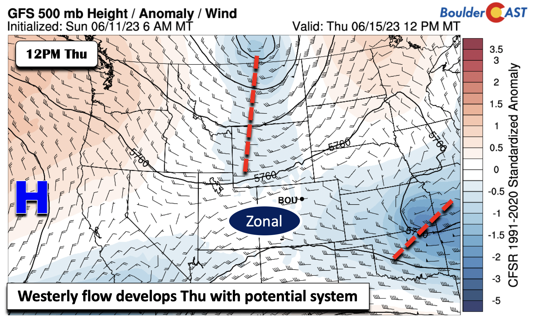
On Thursday, a west-southwest to zonal flow starts to develop. Some of the guidance shows a potent mid-level system to our north near Montana/Canada that will swing to the east Thursday evening. This should favor a good threat of storms in the High Country. As for the Plains, there is more uncertainty as the surface downslope should limit overall coverage for the Front Range. Still, we may see an uptick of storms on Thursday resulting from this clipper-type system.e
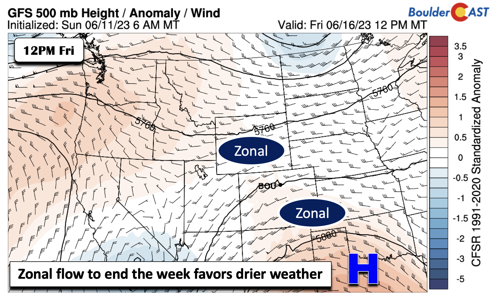
The driest and warmest day looks to be Friday as most guidance shows a broad zonal flow over the state. Outside of the GFS, which shows a more northern position of a southwest system, most other guidance is drier. If the GFS were to verify, we could be wetter, but our hedge at this point favors the drier zonal-flow model solutions with lower 80s ensuing.
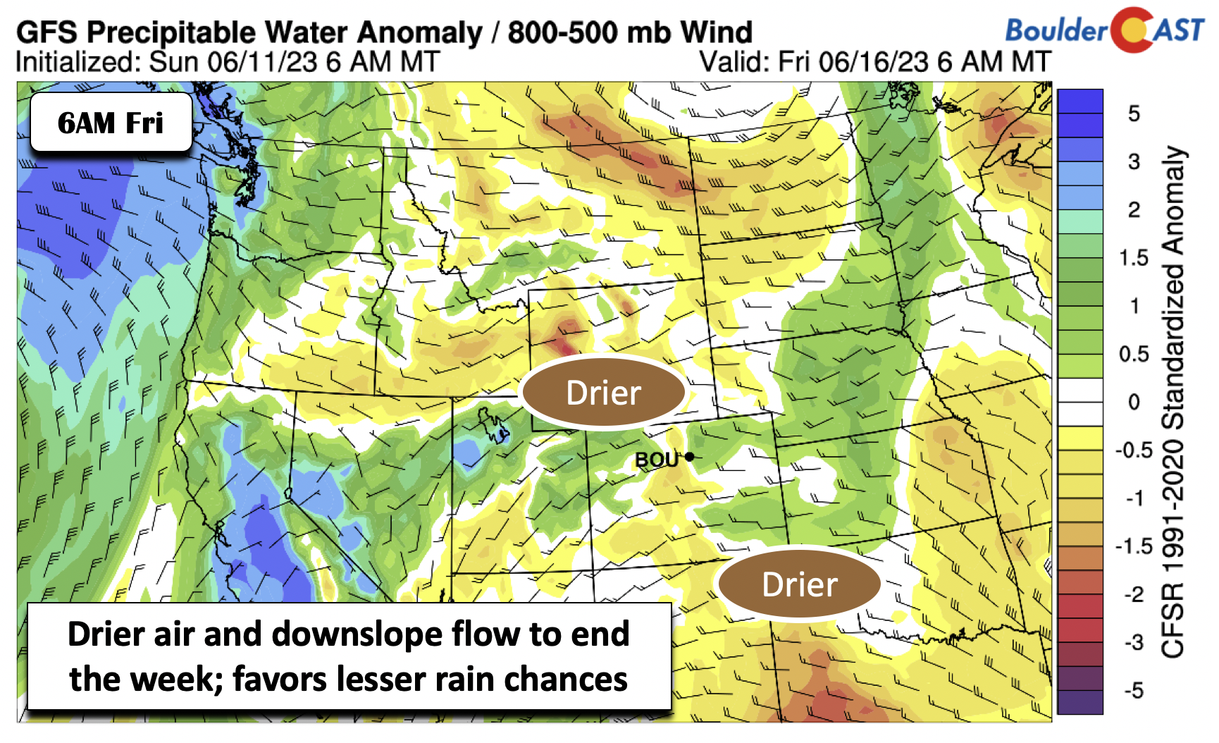
An aiding factor to the driest day on Friday would be the reduced precipitable water values, about one standard deviation below normal for mid-June.
Outside of the local weather, wildfires continue to burn over the western and eastern parts of Canada which are deeply embedded in drought. A look at the most recent FireWork smoke model shows that this wildfire smoke over northwest Canada should stay well north of Colorado to keep skies clear and air quality in the good range through at least Wednesday evening. The HRRR model shows a more southward penetration of smoke on Tuesday, but in any case, that should still stay north of us especially as southwest flow takes over from midweek onwards.
Overall temperatures will remain below normal through the week, but there is a chance we could reach 80 degrees by Thursday or Friday. Enjoy the weather!
Forecast Specifics:
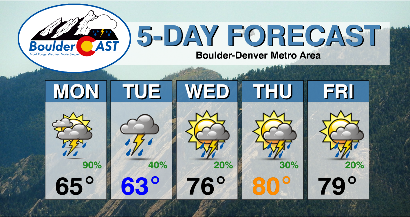
Monday: Partly sunny, then afternoon widespread showers/storms continuing into the mid-late evening hours. Highs in the middle 60s for the Plains and near 60 in the Foothills. Some of the stronger storms will be capable of heavy rain, flash flooding and accumulating hail.
Tuesday: Mostly cloudy with afternoon/evening scattered showers and storms, most numerous from Denver southward. Highs in the lower 60s on the Plains and middle 50s in the Foothills. Heavy rainfall is again possible with isolated flash flooding.
Wednesday: Mostly cloudy becoming partly cloudy with widely scattered afternoon/evening storms. Highs in the upper 70s on the Plains and upper 60s in the Foothills.
Thursday: Warmer with perhaps an uptick in late-day storms to scattered level. Highs near the upper 70s to low 80s on the Plains and near 70 in the Foothills.
Friday: Drier and mostly sunny with just a slight chance of afternoon/evening storms. Highs in the middle 70s to lower 80s on the Plains and around 70 in the Foothills. There is some uncertainty whether a cold front may reach the area, so this day could be cooler.
DISCLAIMER: This weekly outlook forecast is created Monday morning and covers the entire upcoming week. Accuracy will decrease as the week progresses as this post is NOT updated. To receive daily updated forecasts from our team, among many other perks, subscribe to BoulderCAST Premium.
Daily Forecast Updates
Get our daily forecast discussion every morning delivered to your inbox.
All Our Model Data
Access to all our Colorado-centric high-resolution weather model graphics. Seriously — every one!
Ski & Hiking Forecasts
6-day forecasts for all the Colorado ski resorts, plus more than 120 hiking trails, including every 14er.
Smoke Forecasts
Wildfire smoke concentration predictions up to 72 hours into the future.
Exclusive Content
Weekend outlooks every Thursday, bonus storm updates, historical data and much more!
No Advertisements
Enjoy ad-free viewing on the entire site.
Get BoulderCAST updates delivered to your inbox:
Enjoy our content? Give it a share!





You must be logged in to post a comment.