This week will favor continued northwest flow across the central and northern Rockies. We’ve got strong winds, potential 60 degree temperatures, and even snow to discuss this time around. Read on for more details.
Windy Monday and Monday night
We kick off the week with a quick-moving system already progressing through the region. You can see the shortwave disturbance and its associated vorticity maximum passing from east to west through Colorado in the animation below.
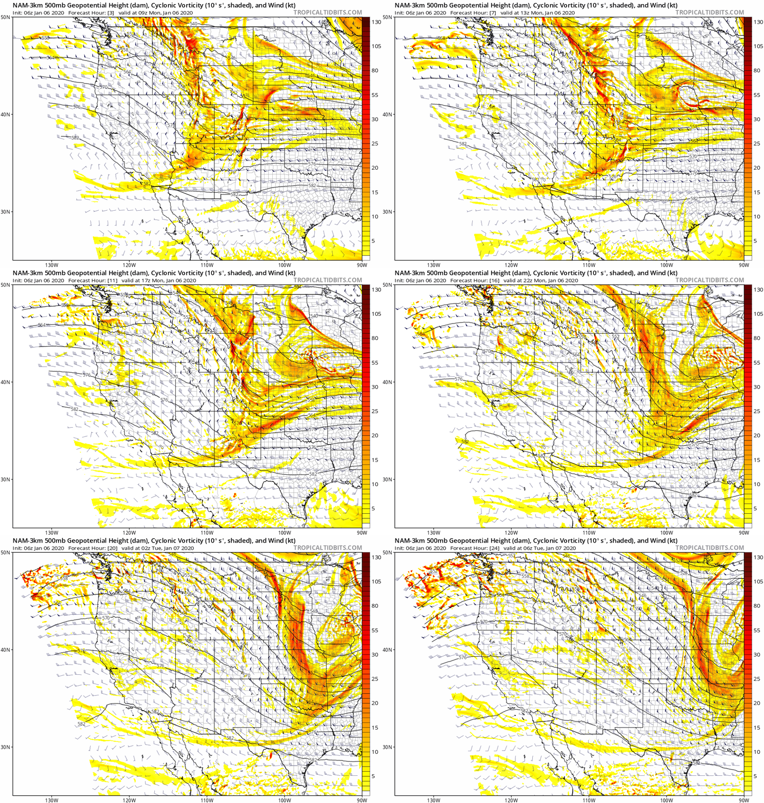
NAM high-resolution 500 mb height and vorticity animation spanning Monday morning into Monday night.
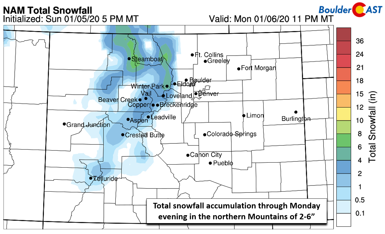
There’s not a lot of moisture with this speedy system, and certainly we won’t see any precipitation east of the Mountains. However, in the High Country, 2 to 6″ of fresh snow is possible by Monday evening. The higher totals will be north of Interstate 70. Winter Weather Advisories are hoisted for most locations above 10,000 feet for travel impacts due to a combination of the light snow and strong winds.
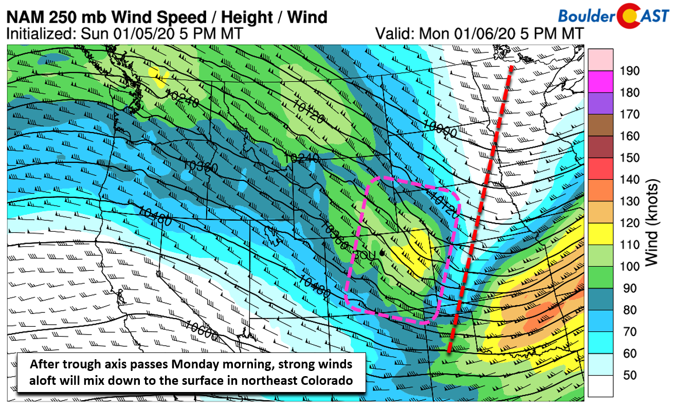
It will also be very blustery with two jet stream maximums passing overhead today. These stronger winds are expected to mix down into the Denver Metro area through the late morning and afternoon on Monday. There isn’t really a true mountain wave present and cross-barrier flow is reduced due to the direction, so we expect the stronger winds to be more sporadic then they were during the recent high wind events Saturday night and Sunday night. Despite this, gusts of40+ MPH will be common Monday afternoon and early evening region-wide, with gusts of 55+ mph in and near the Foothills and closer to the Wyoming border. Winds should begin to relax after sunset as mixing goes away for most areas. However, high-resolution models are showing a shot of strong winds in and near the Foothills overnight Monday night, with gusts possibly exceeding 65 MPH. This is related to an amplified mountain wave. High temperatures Monday will be cool in the lower to middle 40’s.
Quieting down and warming up
Tuesday will be a much quieter day overall with lessened winds and continued sunshine as high pressure builds in aloft from the west. We also anticipate warmer temperatures pushing into the lower 50’s.
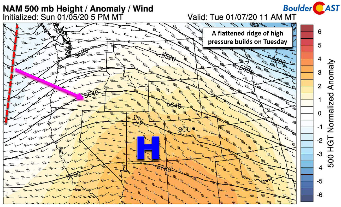
NAM 500mb height anomaly forecast for Tuesday. A ridge of high pressure takes control across Colorado.
There is yet another weak storm system expected to arrive Wednesday night into Thursday to Colorado. You can observe this system above just beginning to come ashore as of Tuesday morning. Its delayed arrival should allow for a beautiful day on Wednesday with temperatures possibility cracking 60 degrees. More clouds will be around though.
Late week snow chance
Just like that, our weather pattern later this week will turn more unsettled with a broad trough expected to developed across the Intermountain West.
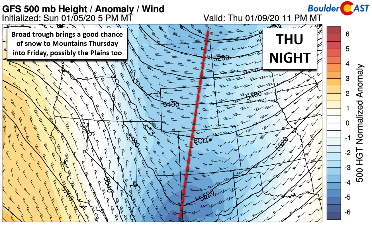
GFS 500mb height anomaly forecast for Thursday night. A trough develops across the region leading to the potential for snow.
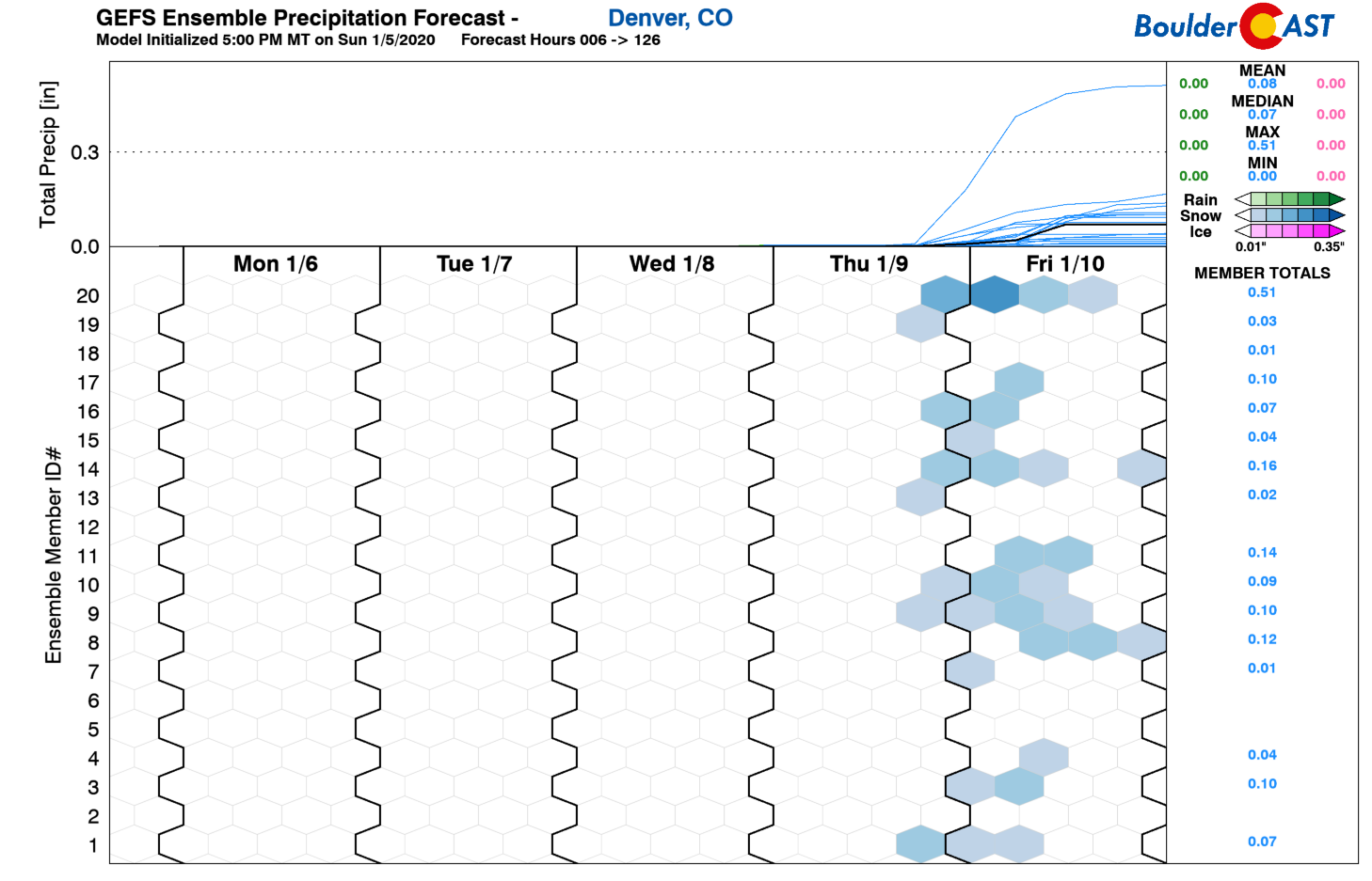
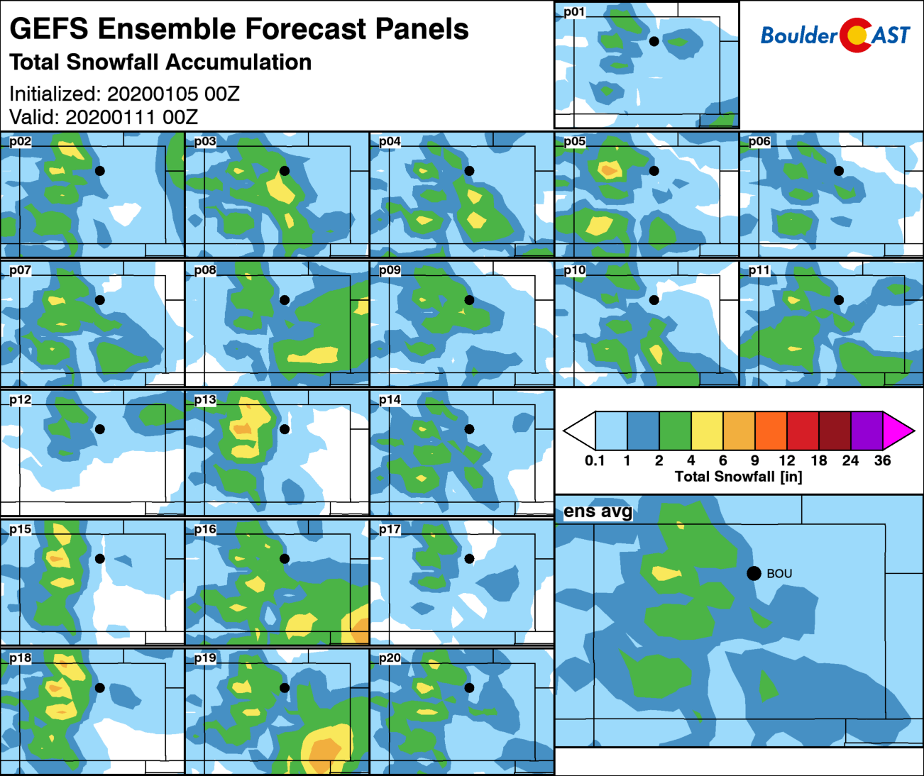
The details at this time are not finalized. This pattern would typically offer a fair to good chance of more snow in the Mountains. The potential for white stuff across the lower elevations is much lower, however, but definitely not zero. The GFS ensembles are showing hints of some snow reaching Boulder and Denver Thursday night into Friday with generally less than 1″ total resulting from shallow upslope and weak lift from the trough. It’s not much, but it could break up the monotony of sunshine and wind we’ve experienced of late!
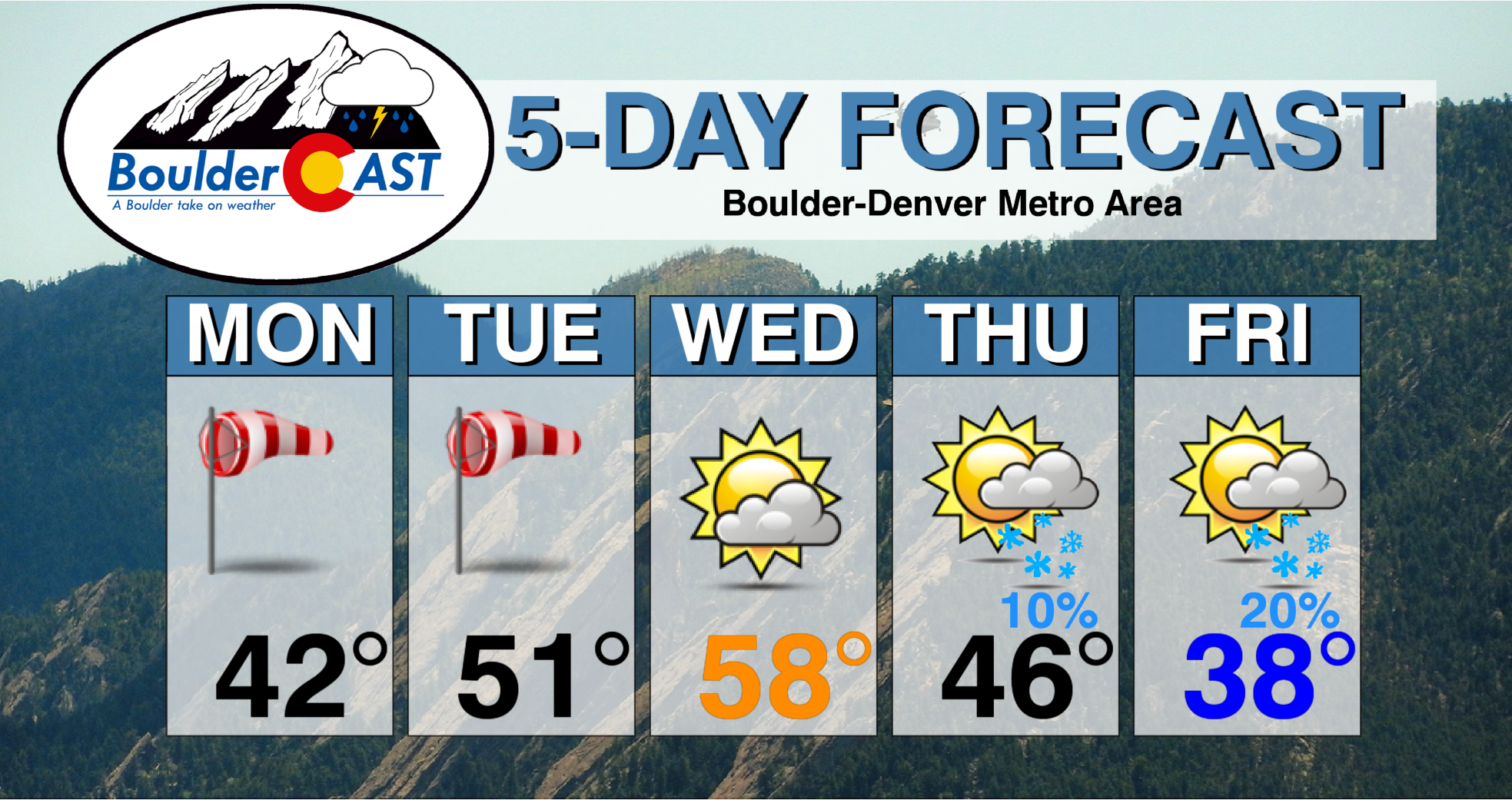
The week will wrap-up with tumbling temperatures in the 40’s on Thursday and 30’s on Friday. For now we’ll mention that light snow is possible in Boulder and Denver Thursday night and Friday, but any accumulations should be minor given the way things are looking as of now.
Forecast Specifics:
Monday: Sunny and windy. Gusts will reach 40+ MPH in most areas and 55+ MPH in and near the Foothills. Strong winds will continue into the overnight hours. Highs in the middle 40’s across the Plains and in the middle 30’s in the Foothills.
Tuesday: Sunny, warmer and breezy at times. Highs in the lower 50’s on the Plains and upper 30’s in the Foothills.
Wednesday: A mix of sunshine and wave clouds. Highs in the upper 50’s to near 60 degrees on the Plains and upper 40’s in the Foothills.
Thursday: Increasing clouds with a slight chance of light snow showers in the evening and overnight hours. Highs in the middle 40’s for the Plains and lower 30’s for the Foothills.
Friday: A slight chance of snow in the morning, then partly cloudy and chilly with temperatures in the upper 30’s for the Plains and upper 20’s in the Foothills.
High Country: Light snow and strong winds will make for slightly difficult travel in the Mountains on Monday. Storm total accumulations by Monday evening will range from 1 to 4″. Warmer and quieter weather takes hold Tuesday and most of Wednesday. Late in the week, an incoming broad trough will lead to unsettled weather and more snow spread across several days from Thursday into the weekend. Light to moderate accumulations are possible, maybe 3 to 8″. Check our PowderCAST page for always-updated weather forecasts for all of Colorado ski resorts.

Snow outlook for the week. Snow winds down on Monday, but picks back up again Thursday into the weekend
DISCLAIMER: This weekly outlook forecast is created Monday morning and covers the entire upcoming week. Accuracy will decrease as the week progresses as this post is NOT updated. To receive daily updated forecasts from our team, subscribe to BoulderCAST Premium.
.
Spread the word, share our forecast!




You must be logged in to post a comment.