If last week was considered the winter deep freeze, this week shall be the spring thaw! The main story for the majority of the week ahead will be above normal high temperatures and dry conditions under a strong mid-level ridge of high pressure. A storm system moving onshore along the West Coast on Thursday will return our area to a more unsettled pattern late Friday into the weekend, along with a likelihood of snow and colder air filtering in. Read on for more details.
This week’s highlights include:
- Last week’s bitter cold stretch was historic in intensity, but not so much in duration
- Well above normal temperatures through the week under strong ridging
- No record highs expected, but 70 degrees likely by midweek
- A late-week system may bring rain changing to snow for the start of the weekend
- Low confidence in snow accumulation potential Friday into Saturday at the moment
- A more active and cold pattern is favored for the weekend into the beginning part of next week
DISCLAIMER: This weekly outlook forecast is created Monday morning and covers the entire upcoming week. Accuracy will decrease as the week progresses as this post is NOT updated. To receive daily updated forecasts from our team, among many other perks, subscribe to BoulderCAST Premium.
Last week: 120 hours of sub-freezing temperatures
The winter blast last week was definitely something to behold. Following the passage of a strong Arctic front, temperatures plummeted below freezing around midday Monday and never recovered above the 32-degree mark until Saturday afternoon. The streak of sub-freezing temperatures lasted just a few minutes shy of 120 hours in Boulder. During this time, the city set one new daily record low and one daily record low maximum temperature. Accompanying the cold was three waves of light snow totalling up to just 5.2″ of accumulation. Not bad considering the very dry Arctic airmass which lingered across the region through the week.
Surely a long stretch of bitter cold weather like this had to rank up historically? Well, not really! A streak of below freezing temperatures lasting 4 calendar days happens about once per year. Boulder’s top 5 sub-freezing streaks from the historical record are much more impressive (albeit quite antiquated at this point)…
Top 5 Sub-freezing Streaks in Boulder, CO
#1 – 12 days: January 12-23, 1930
#2 & 3 – 10 days: March 1-10, 1912 & March 10-19, 1906
#4 & 5 – 9 days: February 23-March 2, 1960 & December 7-15, 1932
While the duration of the streak was far from impressive, the magnitude of the cold air for this late in the season was noteworthy!
Enough about the cold — let’s move onto warmer discussions…
Very warm temperatures through the week
Well above normal temperatures are expected this week as a strong mid-level ridge parks itself across the intermountain West. Below shows the GEFS temperature forecast for the Denver Metro Area. Note the string of above average temperatures through the week. We can’t overstress the fact that this will be a great week to be out and about. March will start off relatively benign. It appears our warmest days will be Wednesday and perhaps Thursday. A trend to colder weather returns late Friday and for the weekend, along with a more unsettled pattern. More on that later…
The pattern below for Monday across the country might indicate an active one with all the subtle shortwaves traversing in the west-northwest flow. However, the nation is largely quiet. A shortwave shear axis over central Colorado today will sag southeast this afternoon. That will lead to clouds decreasing and sunny skies taking over. Highs will add to what we were at on Sunday, ranging from the upper 50s to around 60 degrees.
By Tuesday, the ridge that was over California on Monday shifts into the Utah/Colorado region. Well above normal heights will dominate the area. This is exactly what you want to see if you’re hoping for spring-like temperatures for the first day of Meteorological Spring (March 1st)!
Underneath the ridge, well above average temperature anomalies will overspread much of the West. Highs Tuesday in the middle to upper 60s are likely — get outside and go for a bike ride, run or long walk to break up the work day!
The ridge does not move much on Wednesday, located at this time over south-central Colorado. With a slight warming of the airmass, highs should be a tad warmer in the low 70s across the Denver Metro. Some wispy high clouds may overspread the region, but that will be about it!
Come Thursday, a storm system will move onshore over the West Coast, reaching portions of Nevada by Thursday evening. While the system will remain to our west at this time, the pattern at the surface will change slightly. A more east-southeasterly flow will take shape as a trough axis sets up. While the airmass is unchanged from Wednesday, temperatures may be a degree or three lower in the middle to upper 60s with the upslope flow and increasing high clouds. Who are we kidding, though — that’s still gorgeous for early March!
Turning more active/colder late in the week and upcoming weekend
The aforementioned storm system is forecast to track east and then eject northward into northeast Colorado and the upper Great Plains Friday night into Saturday. The current model solutions would bring unsettled weather to the area late Friday into the weekend.
The latest GEFS ensemble also shows the trend toward more unsettled weather in this time-frame. There is the best chance late in the day Friday, with chances increasing as the weekend takes over. You’ll also notice some green on Friday. With the warm airmass, any precipitation is likely to start out as rain if this pattern holds true. As colder air filters in, it could change over to snow for the weekend ahead. But as we discuss next, our confidence is low at the moment on snow.
The GFS (below left) and ECMWF (below right) vary quite a bit in snow potential by early Saturday as the system pulls northeast. Part of this discrepancy could be from the fact that the track is not the most favorable for the Front Range. A low tracking directly through northeast Colorado and Nebraska would usually favor more robust northwest downslope, leading to a shorter duration of upslope and cold air. The ECMWF has a more southern track, which is colder with more upslope. The potential southern-track nature to this system bears watching for the time being.
Models should come into better agreement as we get closer to Friday — there is plenty of time to hone in on the snow potential with the warm stretch this week. Whether or not we get snow in the Friday night period, the pattern will remain active through the weekend into early next week along with colder temperatures. Chances of snow will continue to remain elevated as a result. Our latest Snowfall Probabilities (below) show decent chances for some accumulation by the end of the weekend in all Front Range cities. Given the current uncertainty, there’s no point in discussing this too much yet. In the meantime enjoy the warm temperatures this week!
Stay up to date with Colorado weather and get notified of our latest forecasts and storm updates:
Forecast Specifics:
Monday: Morning clouds giving way to sunny skies. Highs in the upper 50s to near 60 degrees on the Plains and upper 40s in the Foothills.
Tuesday: Sunny and very mild with middle to upper 60s on the Plains and middle to upper 50s in the Foothills.
Wednesday: Partly cloudy and very warm with highs near the lower 70s on the Plains and low 60s in the Foothills.
Thursday: Cloudier with highs in the upper 60s to near 70 degrees for the Plains and upper 50s in the Foothills.
Friday: Partly to mostly cloudy skies with a chance of rain or snow late in the day evening. Light accumulations possible by Saturday morning. Highs in the upper 50s to lower 60s for the Plains and middle 40s in the Foothills.
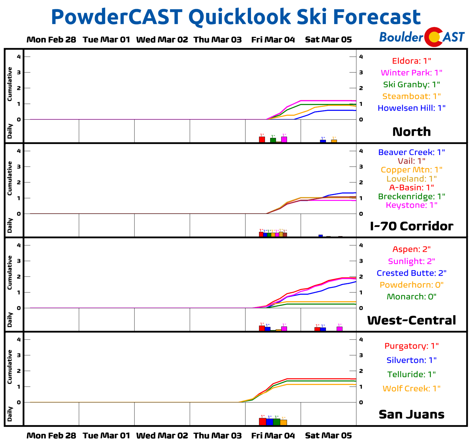
Mountains: Dry and warmer temperatures are expected across the High Country through Thursday. Gusty winds are possible Thursday night and Friday with an approaching system. Unsettled weather, including rain trending towards snow is favored Thursday into the weekend.
Help support our team of Front Range weather bloggers by joining BoulderCAST Premium. We talk Boulder and Denver weather every single day. Sign up now to get access to our daily forecast discussions each morning, complete six-day skiing and hiking forecasts powered by machine learning, first-class access to all our Colorado-centric high-resolution weather graphics, bonus storm updates and much more! Or not, we just appreciate your readership!
Spread the word, share the BoulderCAST forecast!


You must be logged in to post a comment.