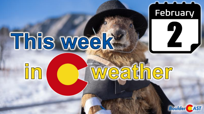
February isn’t wasting any time showing us who’s in charge along the Front Range—and spoiler alert, it’s not winter. As we roll into Groundhog Day and beyond, the pattern overhead keeps leaning warm, quiet, and stubbornly snow‑stingy. A weak system will try to shake things up Tuesday night, but the bigger story is how quickly we bounce back into springlike warmth and how the broader West continues to miss out on meaningful moisture. If you’re wondering where the real winter weather is hiding, or if Colorado has any chance of breaking its dry streak, read on for all the details.
This week’s highlights include:
- 🌤️ Mild start to February: Groundhog Day kicks off another not‑so‑wintry week, with temperatures running well above normal across the Front Range.
- 🌬️ Weak front midweek: A passing trough and cold front Tuesday night bring a brief dip into the upper 40s on Wednesday, but nothing truly cold.
- ❄️ Low‑end rain/snow chance: Light sprinkles or flurries are possible late Tuesday into early Wednesday, mainly south of Denver and the Palmer Divide, with Boulder unlikely to see more than a dusting.
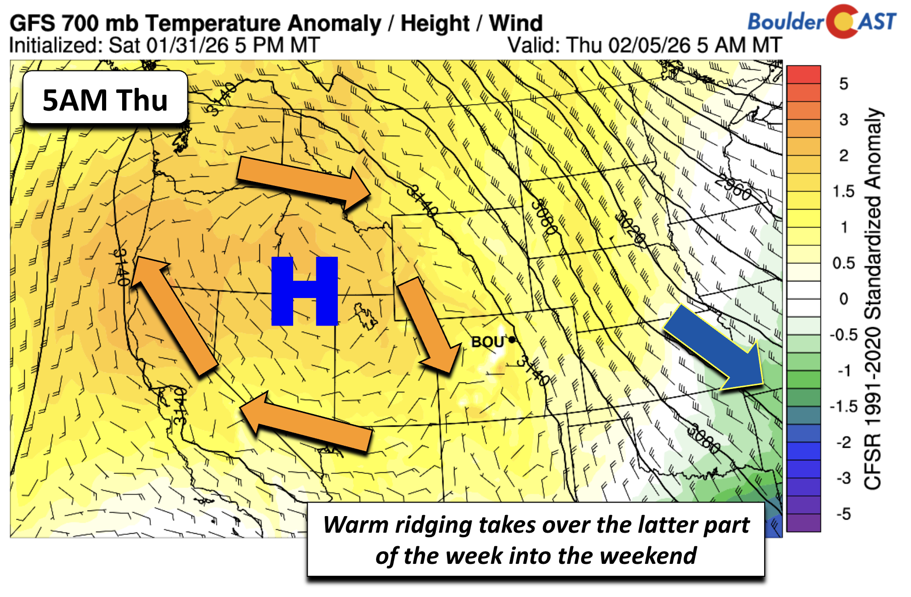
- ☀️ Warmth rebounds fast: Ridging builds back in by Thursday, sending highs soaring into the low–mid 60s to close out the workweek.
- 🔭 Weekend ridge holds: Ensemble guidance keeps a strong Western ridge locked in place, keeping storm systems at bay and the thermometer cranked up.
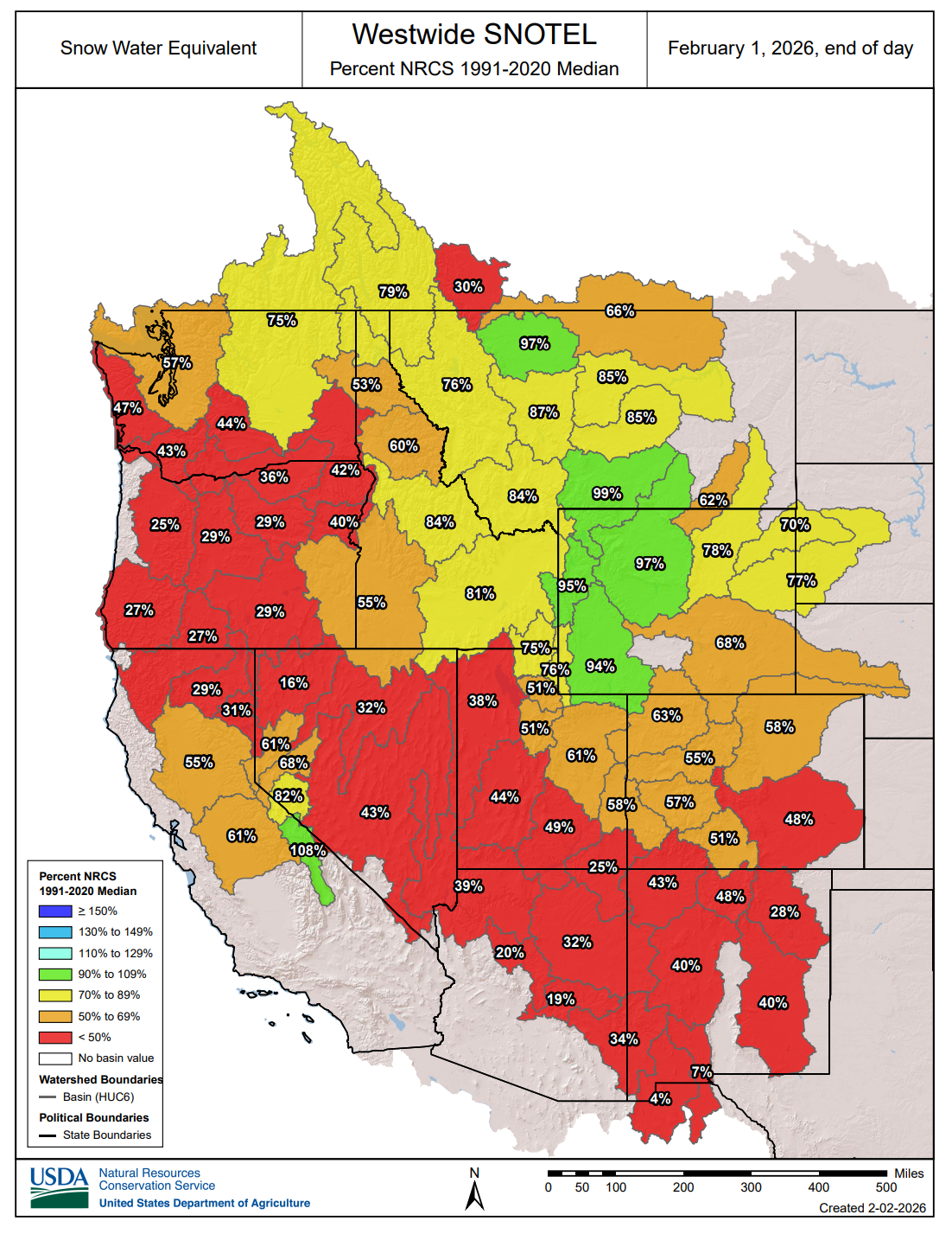
- 🏜️ Snow drought persists: Another dry week adds to the West‑wide snow deficit, with Colorado’s mountains still running below average as winter storms continue favoring the eastern U.S.
DISCLAIMER: This weekly outlook forecast is created Monday morning and covers the entire upcoming week. Accuracy will decrease as the week progresses as this post is NOT updated. To receive daily updated forecasts from our team, among many other perks, subscribe to BoulderCAST Premium.

Go Premium, get all the perks.
Daily Forecast Updates
Get our daily forecast discussion every morning delivered to your inbox.
All Our Model Data
Access to all our Colorado-centric high-resolution weather model graphics. Seriously — every one!
Ski & Hiking Forecasts
6-day forecasts for all the Colorado ski resorts, plus more than 120 hiking trails, including every 14er.
Smoke Forecasts
Wildfire smoke concentration predictions up to 72 hours into the future.
Exclusive Content
Weekend outlooks every Thursday, bonus storm updates, historical data and much more!
No Advertisements
Enjoy ad-free viewing on the entire site.
An overall quiet and mild start to February
The first week of February continues our theme of “winter in name only” along the Front Range. And fittingly, we kick things off on Groundhog Day. Whether Flatiron Freddy calls for an early spring or not, the atmosphere over Colorado already seems to have made up its mind and you know which way that is.
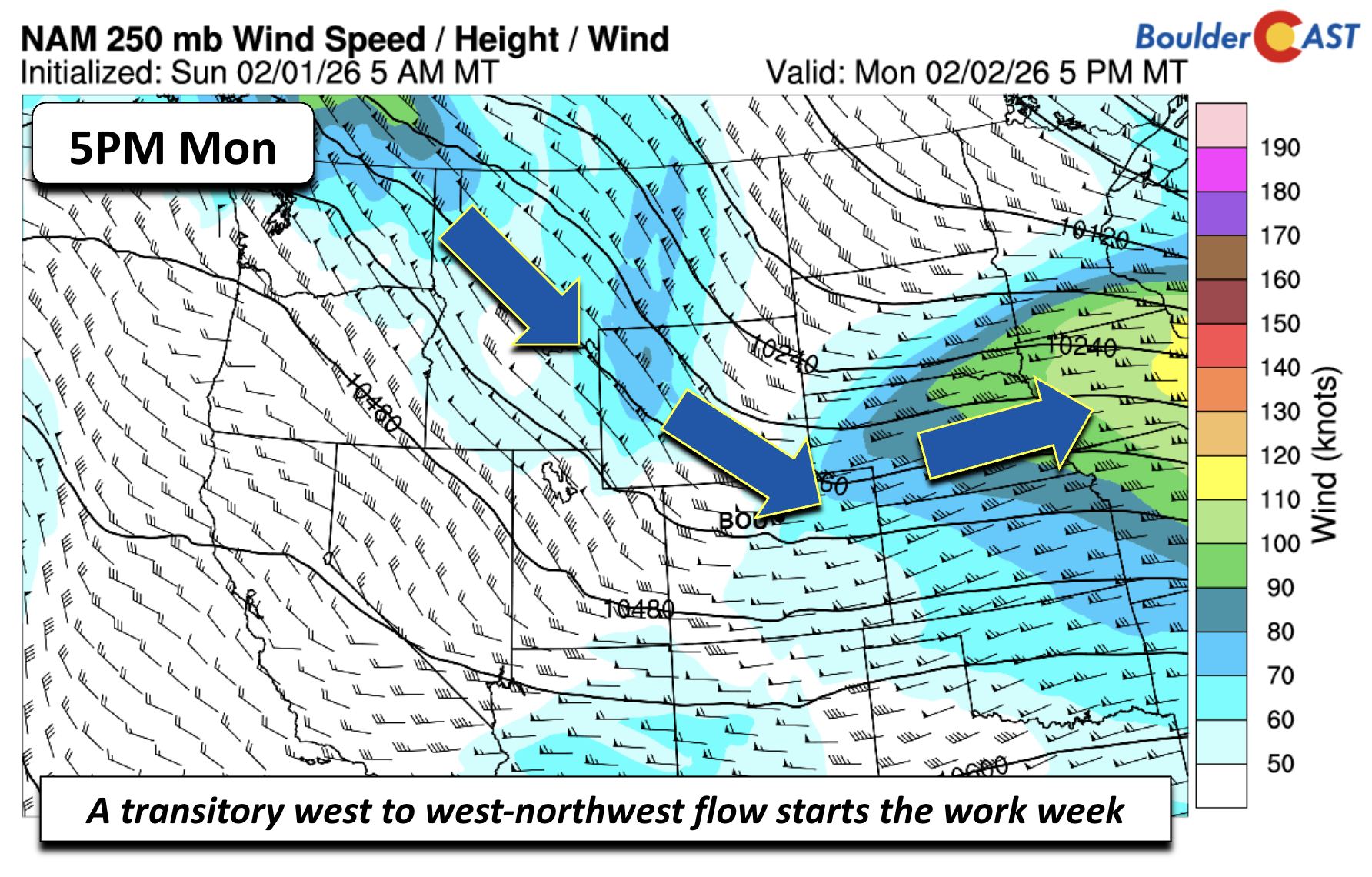
We begin the week under a transient west‑northwest flow, with the jet stream lazily draped from the Pacific Northwest into the Upper Mississippi Valley. It’s not a storm‑bearing pattern for us. It’s only going to nudge our temperatures slightly downward into midweek as a weak cold front slips through. Even then, “cooler” is relative. Average highs this time of year sit in the mid to upper 40s, and our planned coldest day of the week, Wednesday, still will reach into the upper 40s.
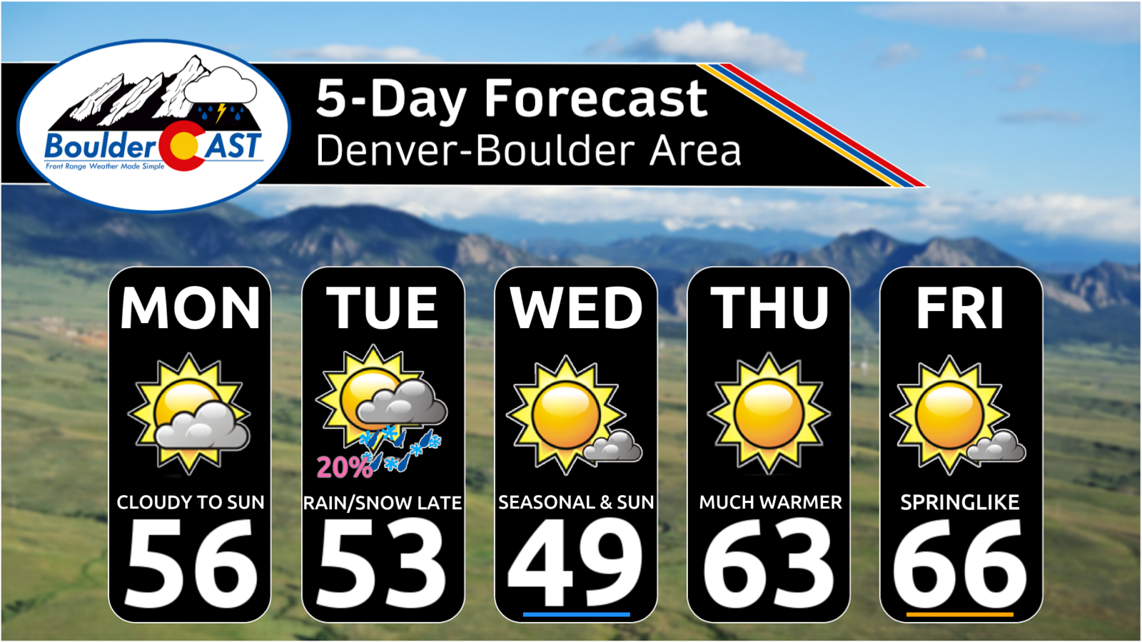
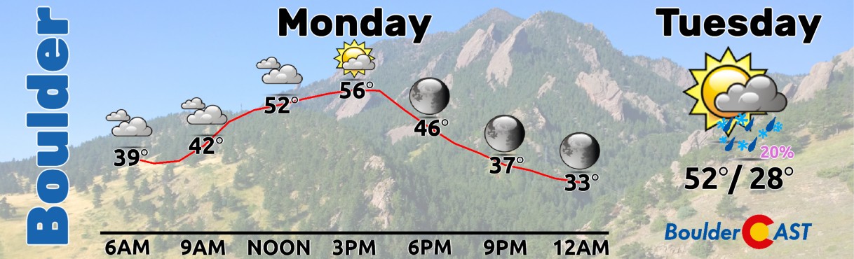
Monday will begin with a lot of mid-level clouds, but these will clear out this afternoon allowing temperatures to reach the mid‑50s, just a hair cooler than Sunday’s warmth.
By Tuesday, that northwest flow helps a small shortwave dig southward, carving out a modest trough by Wednesday morning. It’s enough to generate weak lift along and east of the Rockies, which opens the door to a low‑end chance of flurries or light snow Tuesday night. But the ingredients are meager: limited moisture, unimpressive forcing, and an overall quick‑moving system.
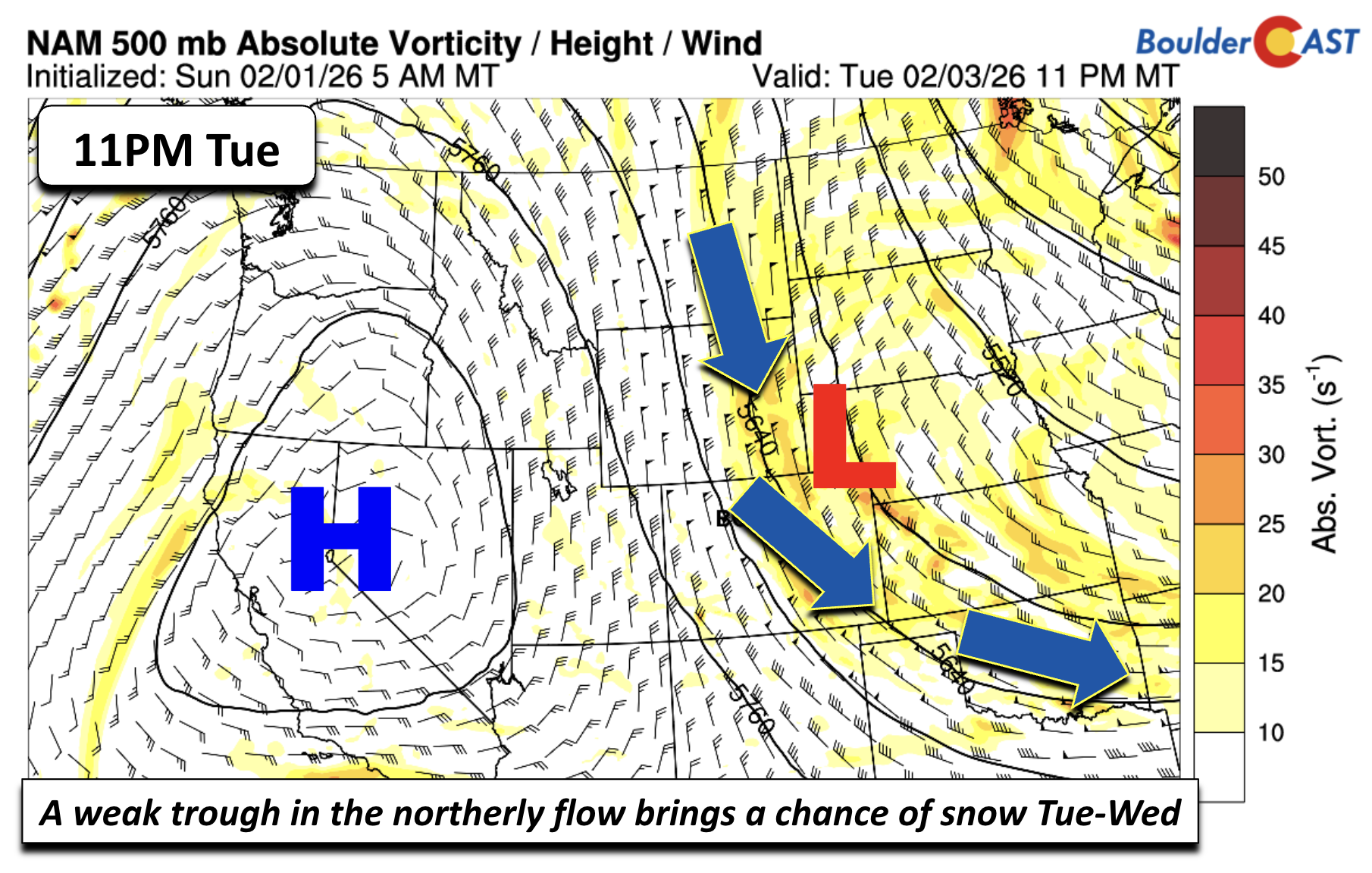
Highs Tuesday remain above average, topping out in the low 50s before the cold front arrives Tuesday evening. That front ushers in a more seasonable airmass for midweek, with highs Wednesday in the upper 40s.
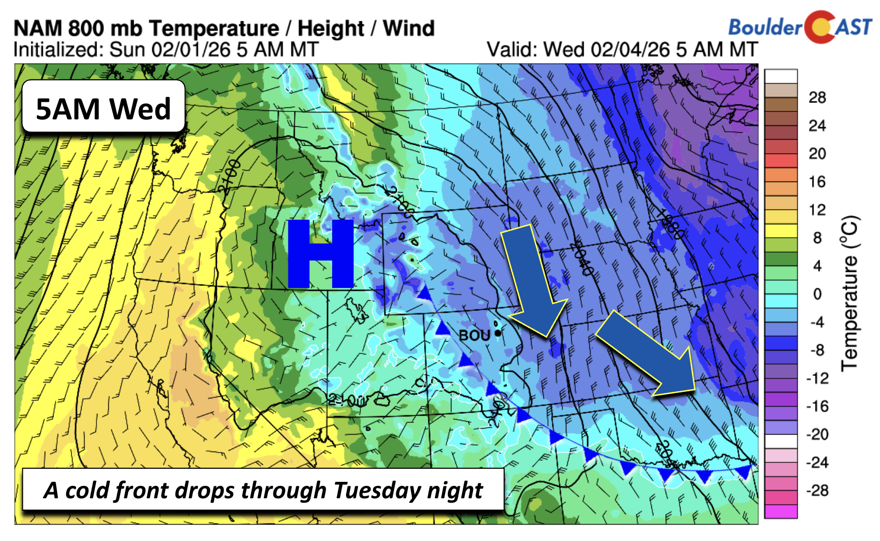
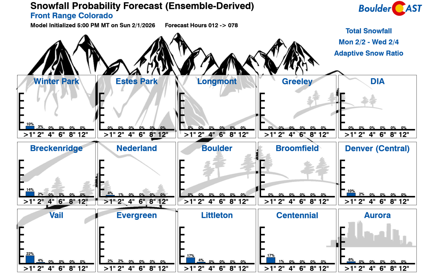
As for snow potential: guidance is lukewarm at best. Northerly winds behind the front would tend to favor southern Denver and the Palmer Divide for any light accumulation. Probabilities for one inch of snow run only 5–15% from Denver southward, and Boulder sits at essentially zero chance of reaching an inch. Unless something changes dramatically, most locations will see a dusting at most—if anything.
By Thursday, the jet stream shifts east and a warm ridge over the West begins sliding our way. Above‑normal temperatures return to finish the workweek, with highs climbing back into the low to mid‑60s.
We’ll end the week feeling like spring has spung across the Front Range.
Looking ahead to the weekend, ensemble guidance is nearly unanimous: the anomalous ridge stays parked across the Intermountain West. A somewhat closed or cutoff low lingers offshore of California, but its influence on Colorado next week is uncertain at this range.
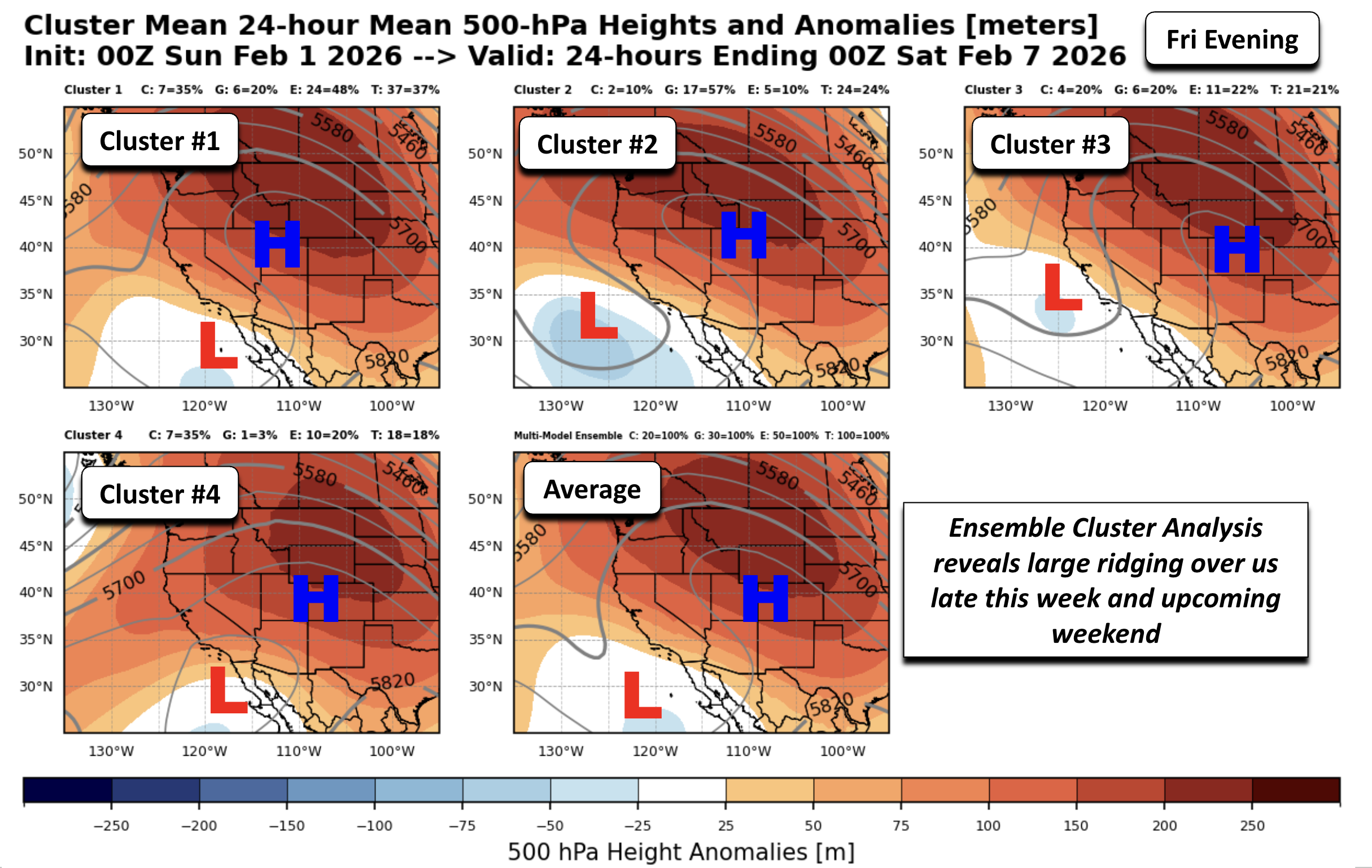
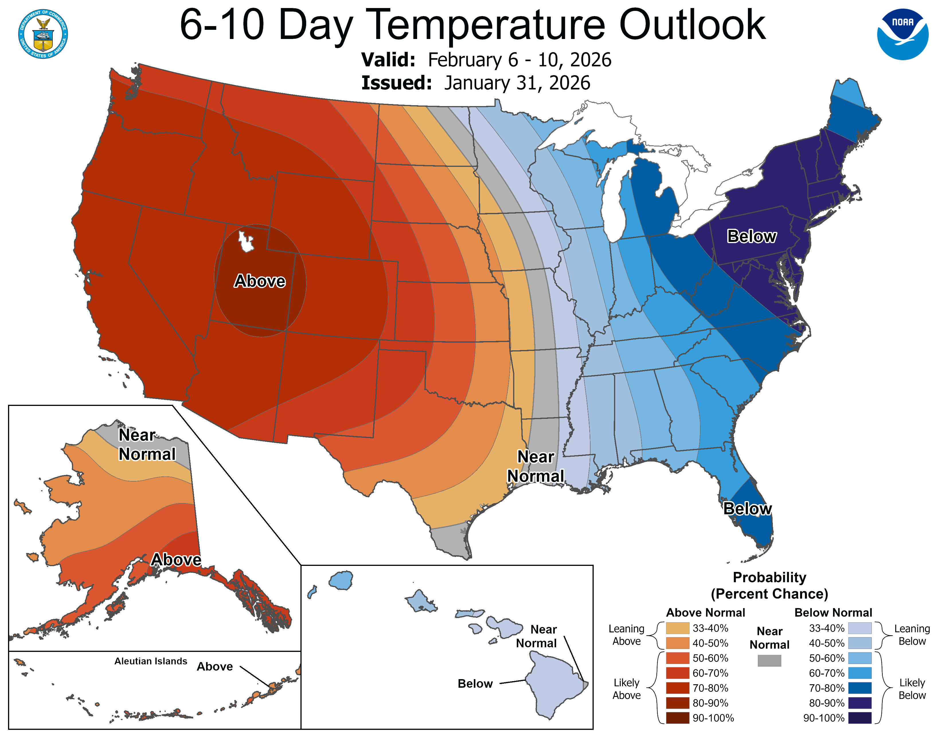
The Climate Prediction Center keeps well‑above‑normal temperature chances in place into early next week with 60-degree temperatures likely to persist through the upcoming weekend. So where’s the cold winter air? Firmly locked in the eastern US, where a deep trough has bottled up the Arctic supply. That pattern will keep winter well east of the Rockies for at least the next seven days.
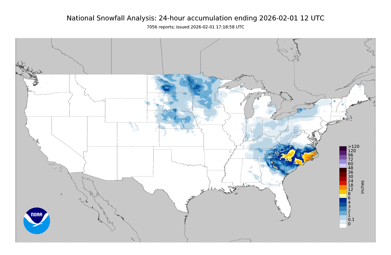
That same trough helped spawn a powerful winter storm off the Carolina coast over the weekend. Snow totals ranged from 3 inches on the low end to more than a foot in spots—especially across the western Piedmont and parts of coastal North Carolina. For many of those areas, a foot of snow is a once‑every‑25‑years event. And yes, incredibly, it’s February and parts of coastal North Carolina have now seen more snow this winter than Denver. What a time to be alive!
Stepping back, this quiet, mostly‑dry week is just another chapter in the broader west‑wide snow drought that has been unfolding since autumn. Mountain snowpack across much of the region remains well below average, and Colorado’s contribution to that deficit isn’t improving under our current pattern dominated by ridging, mild temperatures, and only glancing brushes with moisture. Until the jet stream buckles in our favor, allowing the storm track to shift meaningfully south and west, Colorado will continue adding to its snowpack shortfall, one dry week like this one at a time.
Have a great week!
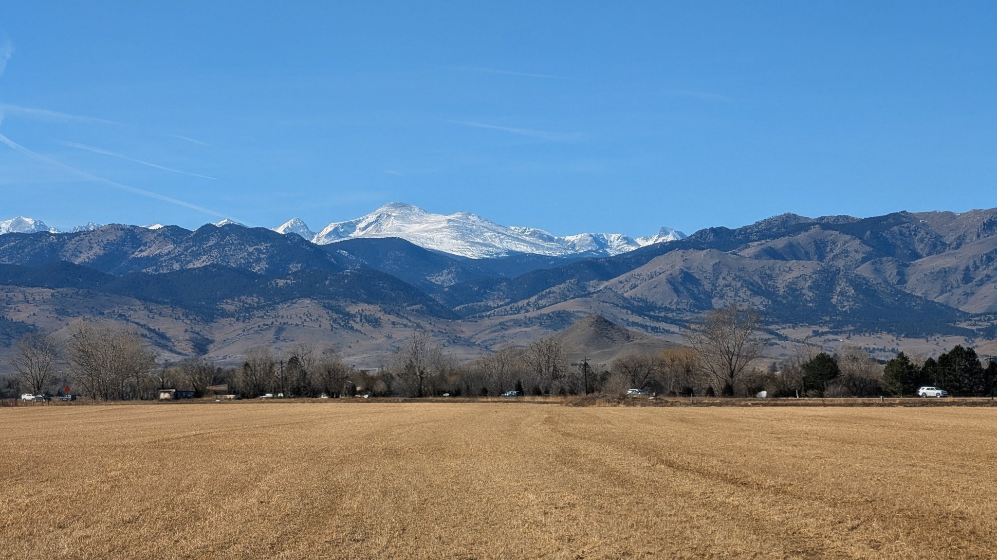
View from Niwot on Sunday February 1, 2026.
Forecast Specifics:
Monday: Overcast in the morning becoming partly to mostly sunny by afternoon. Overall pleasant with middle 50s over the Plains and middle 40s in the Foothills.
Tuesday: Mostly sunny with increasing late-day clouds and breezy northwest winds increasing as well. Gusts of 20 to 35 MPH will be possible in the afternoon/evening. Expect a slight chance of evening light rain showers changing to snow or flurries overnight. Little or no accumulation expected. Highs in the low 50s on the Plains and low 40s in the Foothills.
Wednesday: Cooler under partly to mostly sunny skies. Highs in the upper 40s on the Plains and upper 30s in the Foothills.
Thursday and Friday: Warmer with highs in the low to middle 60s for the Plains and low 50s in the Foothills. Both days will feature lots of sunshine.
Weekend: Dry and quiet weather is expected over the weekend with highs hovering in the 60s. There is a possible early weekend Arctic front, but right now it’s cold air is projected to stay east of the state.
DISCLAIMER: This weekly outlook forecast is created Monday morning and covers the entire upcoming week. Accuracy will decrease as the week progresses as this post is NOT updated. To receive daily updated forecasts from our team, among many other perks, subscribe to BoulderCAST Premium.
Go Premium, get all the perks.
Daily Forecast Updates
Get our daily forecast discussion every morning delivered to your inbox.
All Our Model Data
Access to all our Colorado-centric high-resolution weather model graphics. Seriously — every one!
Ski & Hiking Forecasts
6-day forecasts for all the Colorado ski resorts, plus more than 120 hiking trails, including every 14er.
Smoke Forecasts
Wildfire smoke concentration predictions up to 72 hours into the future.
Exclusive Content
Weekend outlooks every Thursday, bonus storm updates, historical data and much more!
No Advertisements
Enjoy ad-free viewing on the entire site.
Enjoy our content? Give it a share!


Or, Happy Yellow-bellied Marmot Day!
https://www.kunc.org/news/2026-02-01/move-over-phil-flatiron-freddy-has-the-forecast-for-groundhog-day?_amp=true
Yep, this is Flatiron Freddy’s day also!
Seems Phil and Freddy can’t agree on their prediction this year…