
We hope that each and every one of you had a great holiday so far and that it continues into the New Year. This week’s weather will feature light snow accumulations Monday into Tuesday alongside chilly temperatures for much of the week ahead. We’re also watching another system later in the week which could ring in the New Year with more snow. Read on for all the details.
This week’s highlights include:
- Light snow will fall Monday and Tuesday as a weak storm system pushes from southern California into the Great Plains
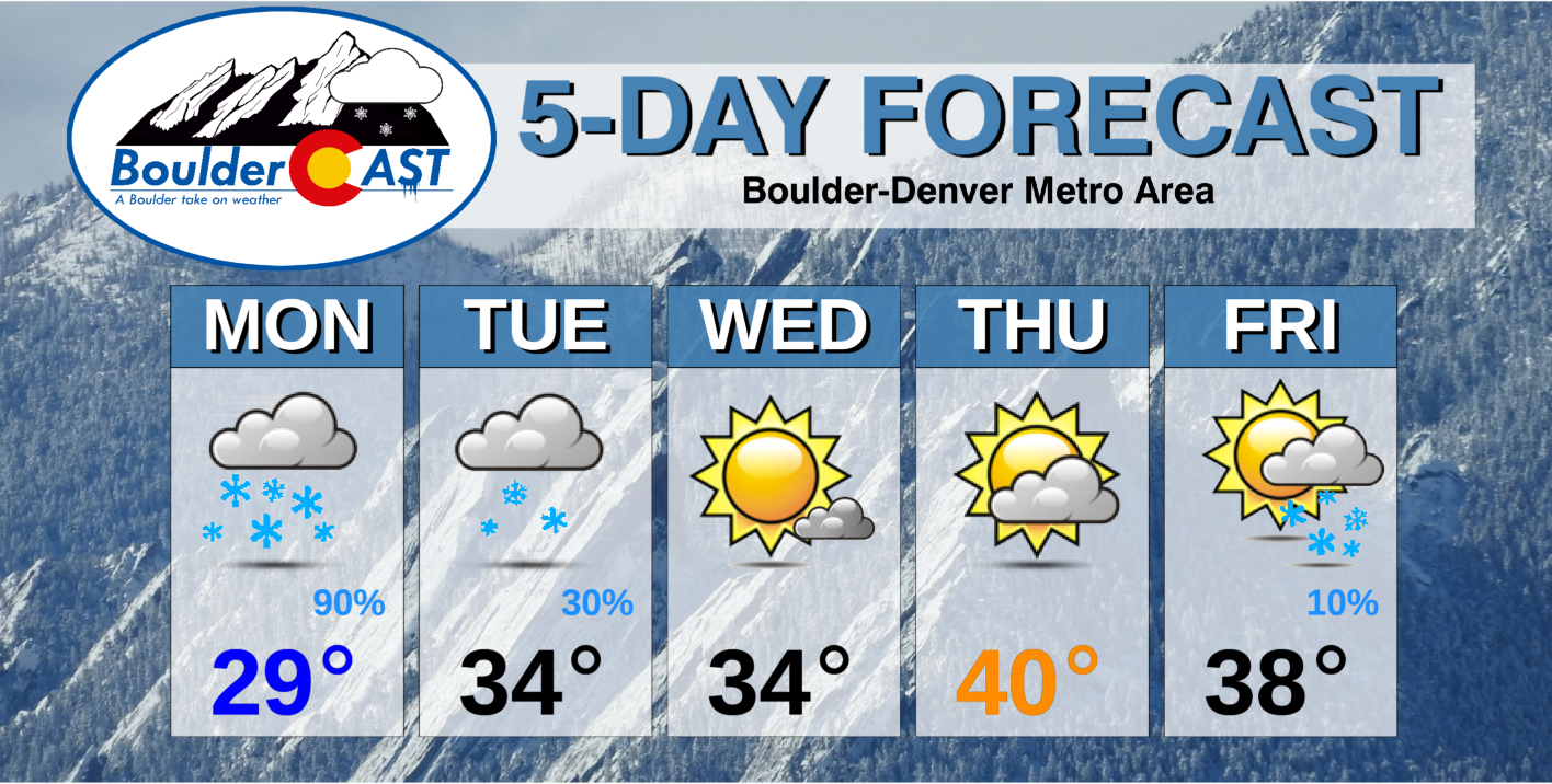
- Cold temperatures in the 30’s the entire week, maybe hitting 40 if we are lucky
- A slight chance for more light snow New Year’s Eve and Day
DISCLAIMER: This weekly outlook forecast is created Monday morning and covers the entire upcoming week. Accuracy will decrease as the week progresses as this post is NOT updated. To receive daily updated forecasts from our team, subscribe to BoulderCAST Premium.

A brown Christmas
Our 2020 Christmas was anything but white as temperatures soared more than 15 degrees above normal across the Front Range. The observed high temperature on Christmas Day was 59°F in Boulder and 60°F in Denver….the warmest Christmas since the record-setting 2005 in both cities.
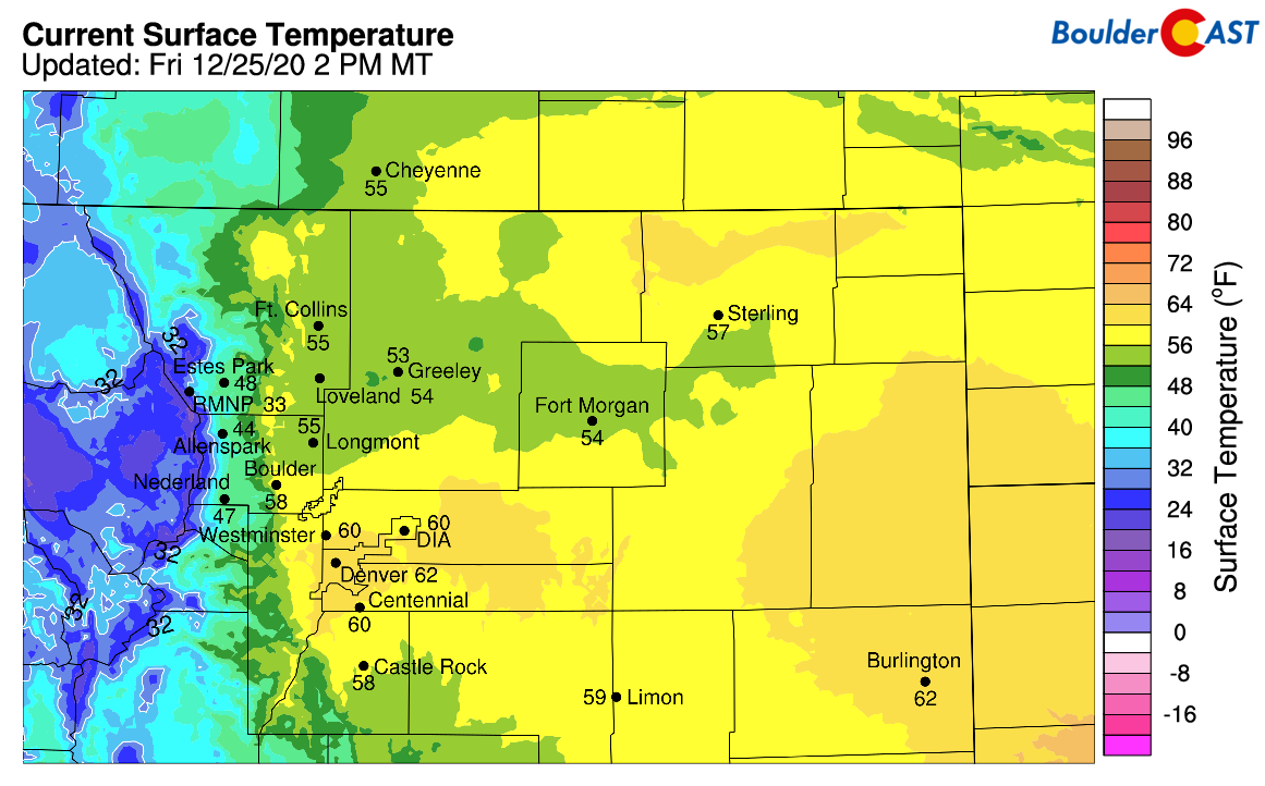
Christmas Day 2020 high temperatures ranged from the middle 50’s to lower 60’s in the Denver Metro area
Since there was no lingering snow on the ground either (on what is normally Boulder’s most snow-ridden day), this Christmas was a “brown” one. Looking on the bright side, the combination of those warm temperatures and sunshine made outdoor gatherings and activities more plausible in what otherwise could have been a very cold and snowy occasion…a welcomed trade-off during the pandemic.
More light snow to kick off the week
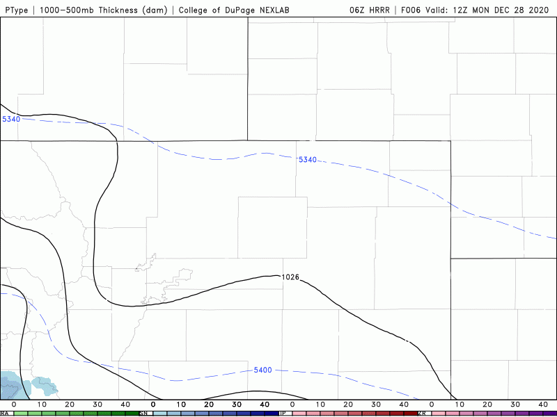
Depending on what time you are reading this post, it may already be snowing in your location as lift from our next storm system is already spreading across the region! Yet another weak system is pushing through the central Rockies as of Monday morning and will move into western Colorado later tonight. Light snow will spread from the Mountains out eastward across the Plains through the day.
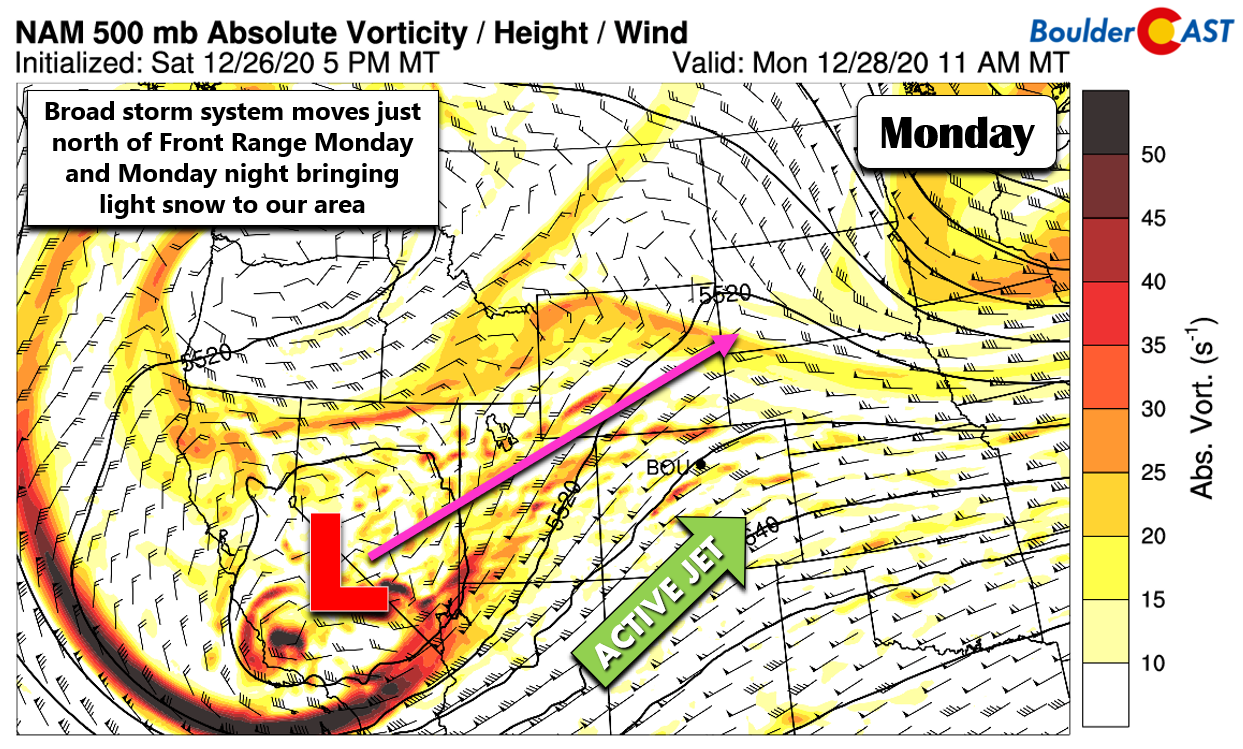
Furthermore, wrapping around the storm system from the southwest is an active polar jet stream which will setup Monday evening and night. The Mountains and possibly the northern and northwestern Denver Metro area could end up in a somewhat favorable location for added jet-forcing. This will lead to some banded snow potential heading into Monday evening and night for us.
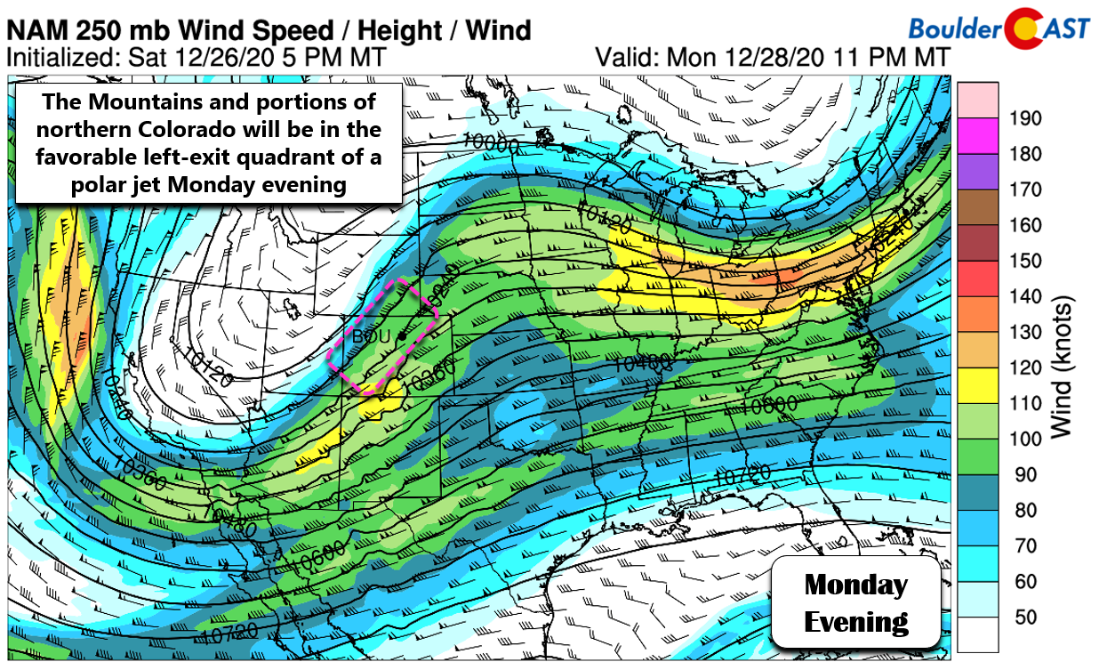
We believe that most of the bands capable of producing moderate to heavy snowfall will stay across the higher terrain of central and western Colorado which are better positioned. Our thoughts are also well-supported by the latest runs of the high-resolution weather models. However, don’t be surprised if areas northwest of Denver (Boulder to Fort Collins to Estes Park) get a few small bands here and there through the forecast period.
HRRR model simulated precipitation forecast from Monday morning into Tuesday evening.
At the surface, weak southeasterly upslope will facilitate that large-scale lift in the Boulder/Denver area, leading to a widespread, but predominantly light snowfall event as temperatures stay below freezing all day Monday. This southeasterly flow tends to favor Larimer County and hamper the southeastern Metro area. Light snow will continue through portions of your Monday and Monday night before tapering off before sunrise Tuesday morning. There may be a brief second wave of snow from mid-day into the afternoon on Tuesday, but that wave should amount to a dusting to 1″ at most. Total accumulations will generally be 1/2″ to 3″ for the entire region, but areas in the Foothills could see a little more where snow ratios will be slightly higher and banded snow potential a little better. Snowfall projections between weather models generally show good agreement breeding confidence in the outcome of the early week dusting of snow.
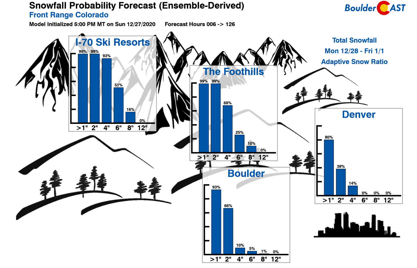
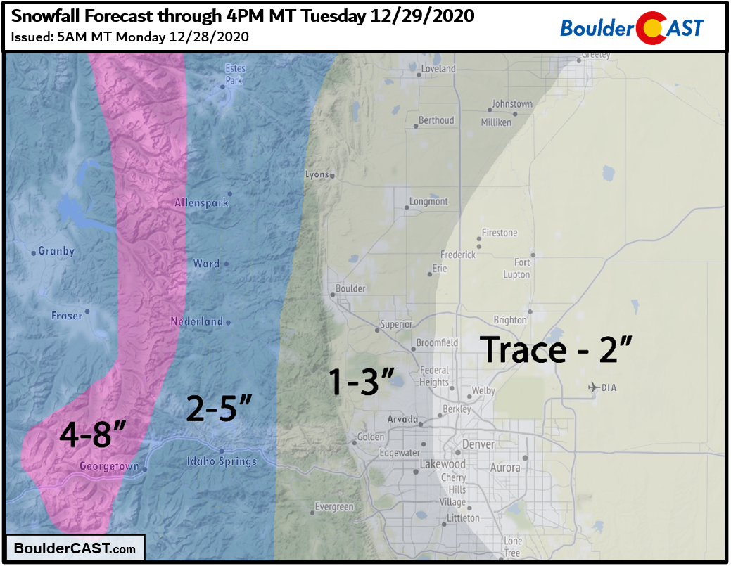
Our snowfall forecast map for the event is shown below. This covers snow falling through the day Monday and into Tuesday evening. Highs Monday will be in the upper 20’s and won’t be much better on Tuesday….middle 30’s.
One last thing worth mentioning is that snowfall will be heavier in the Mountains today and tonight where it is certainly welcomed. Areas along the Continental Divide and many of the ski resorts statewide will see 4 to 10″ from this storm with more in the San Juans. Winter Weather Advisories are posted in the Mountains statewide. Areas along the Wyoming border are also included in the highlights.
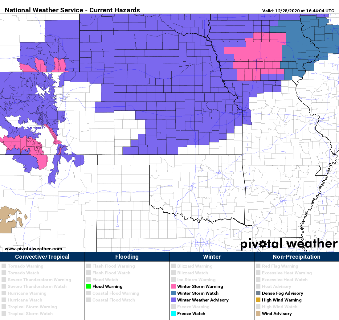
Active weather highlights from the NWS as of Monday morning
A cooler end to 2020
Dry weather will take hold as a ridge axis passes Wednesday and Thursday. We won’t warm up that much either with some snow on the ground and a shallow inversion in place. We expect highs staying in the 30’s to lower 40’s.
Models show another weak system possibly moving through Colorado late Thursday night into early Friday, but moisture looks scant with this system and little more than a few flurries or snow showers expected in the Denver Metro area.
If you don’t hear from us before the end of the week…
From all of the BoulderCAST Team,
we wish you a Happy New Year!
                                   .''.
       .''.      .        *''*    :_\/_:     .
      :_\/_:   _\(/_  .:.*_\/_*   : /\ :  .'.:.'.
  .''.: /\ :   ./)\   ':'* /\ * :  '..'.  -=:o:=-
 :_\/_:'.:::.    ' *''*    * '.\'/.' _\(/_'.':'.'
 : /\ : :::::     *_\/_*     -= o =-  /)\    '  *
  '..'  ':::'     * /\ *     .'/.\'.   '
      *            *..*         :
       *
        *
Forecast Specifics:
Monday: Cold and overcast with periods of light snow through the day and overnight. Total snowfall accumulations of 1/2 to 3″ by Tuesday morning in the Metro area. Temperatures steady in the upper 20’s through the day on the Plains and upper teens in the Foothills.
Tuesday: Mostly cloudy and continued cold with a slight chance of light snow from late morning into late afternoon. Less than 1″ of additional accumulation expected. Highs in the lower to middle 30’s on the Plains and middle 20’s in the Foothills.
Wednesday: Mostly sunny and quiet but still chilly. Highs in the middle 30’s on the Plains and middle 20’s in the Foothills.
Thursday: Increasing clouds with a chance of light snow developing overnight, mainly in and near the Foothills. Highs near 40 degrees on the Plains and upper 20’s in the Foothills.
New Year’s Day: A slight chance of light snow in the morning, then partly sunny and chilly. Highs in the upper 30’s on the Plains and upper 20’s in the Foothills.
Mountains: Widespread snow will encompass the Mountains Monday into Tuesday afternoon with generally 4-10″ expected across most ranges (slightly more in the San Juans). The rest of the week will be dry except for a few light snow showers Thursday evening and night for northern Colorado.
Help support our team of Front Range weather bloggers by joining BoulderCAST Premium. We talk Boulder and Denver weather every single day. Sign up now to get access to our daily forecast discussions each morning, complete six-day skiing and hiking forecasts powered by machine learning, first-class access to all our Colorado-centric high-resolution weather graphics, bonus storm updates and much more! Or not, we just appreciate your readership!
.
Spread the word, share the BoulderCAST forecast!
.


You must be logged in to post a comment.