This week’s weather in the Front Range will see a shift from the recent unseasonably warm temperatures to cooler conditions, with periodic light snow expected in the Mountains throughout the week. While a white Christmas is unlikely for the Denver Metro area, there will be a slight chance of rain or snow showers Wednesday evening and night. The late-week period will remain active with several disturbances bringing more light snow to the Mountains, but the lower elevations around Boulder and Denver will stay mostly dry with mild temperatures. We also look ahead to next week when we’ll likely see a longer-term transition to much colder and snowier weather for the New Year.
This week’s highlights include:
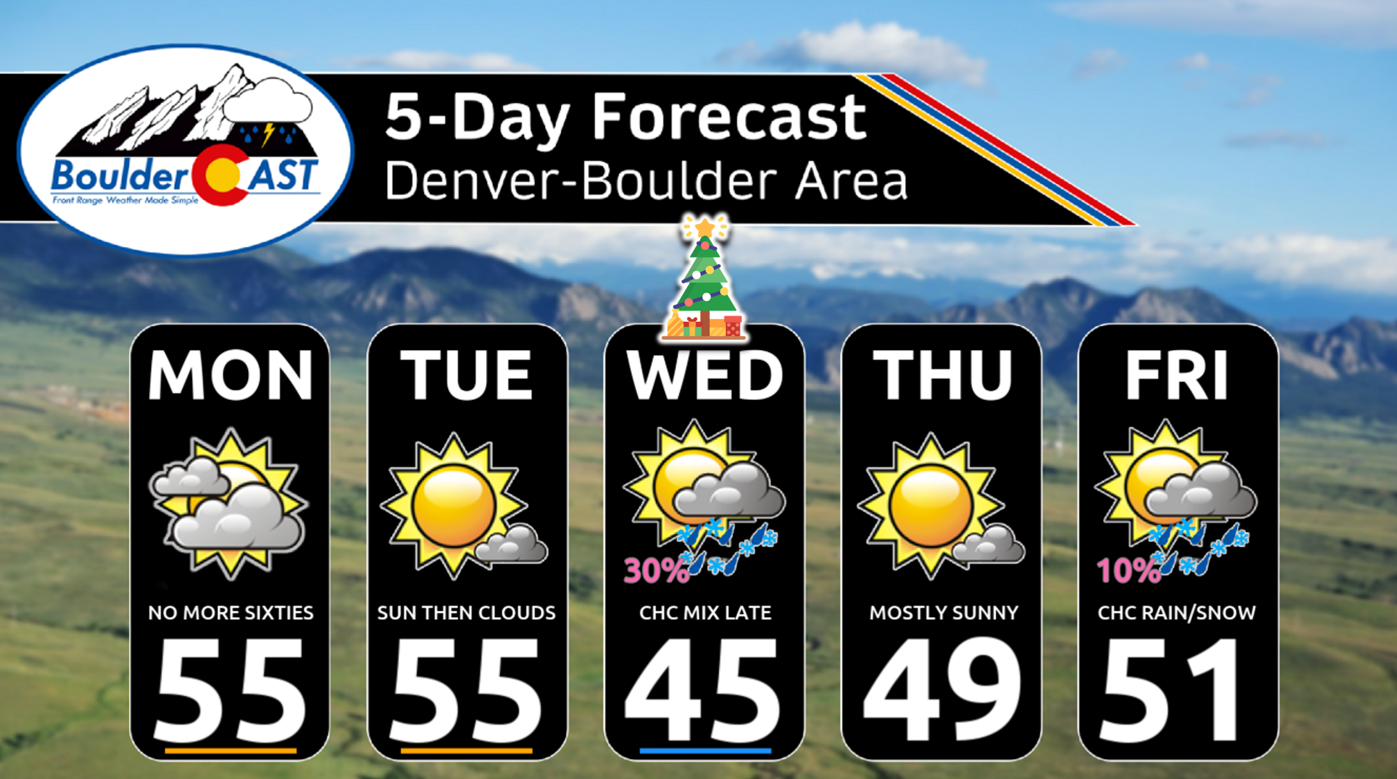
- A Cooler Week: The past six days have been unusually warm, with temperatures near or above 60 degrees. However, a weak cold front has moved in, bringing cooler temperatures in the low to middle 50s.
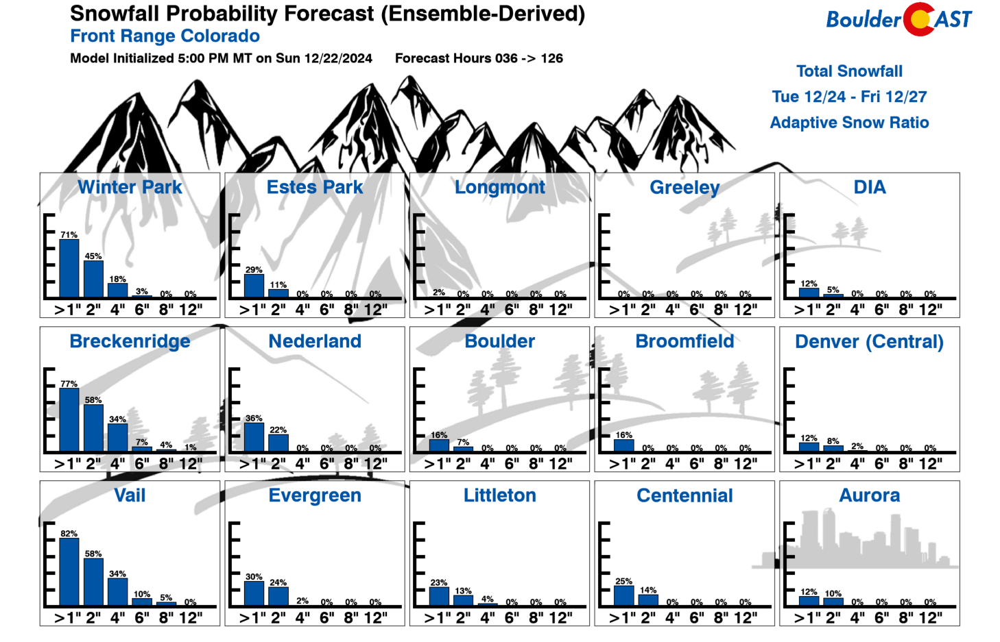
- Christmas Weather: While a white Christmas is unlikely, there is a slight chance of rain/snow showers in the Denver Metro area on Wednesday evening/night. Temperatures will be cooler in the 40s as well. The Mountains may see another wave of light to moderate snowfall, especially across the southern part of the state.
- Late-Week Weather: The late-week period will remain active with several shortwave disturbances bringing more light snow to the Mountains. The lower elevations will stay mostly dry with temperatures in the upper 40s to lower 50s.
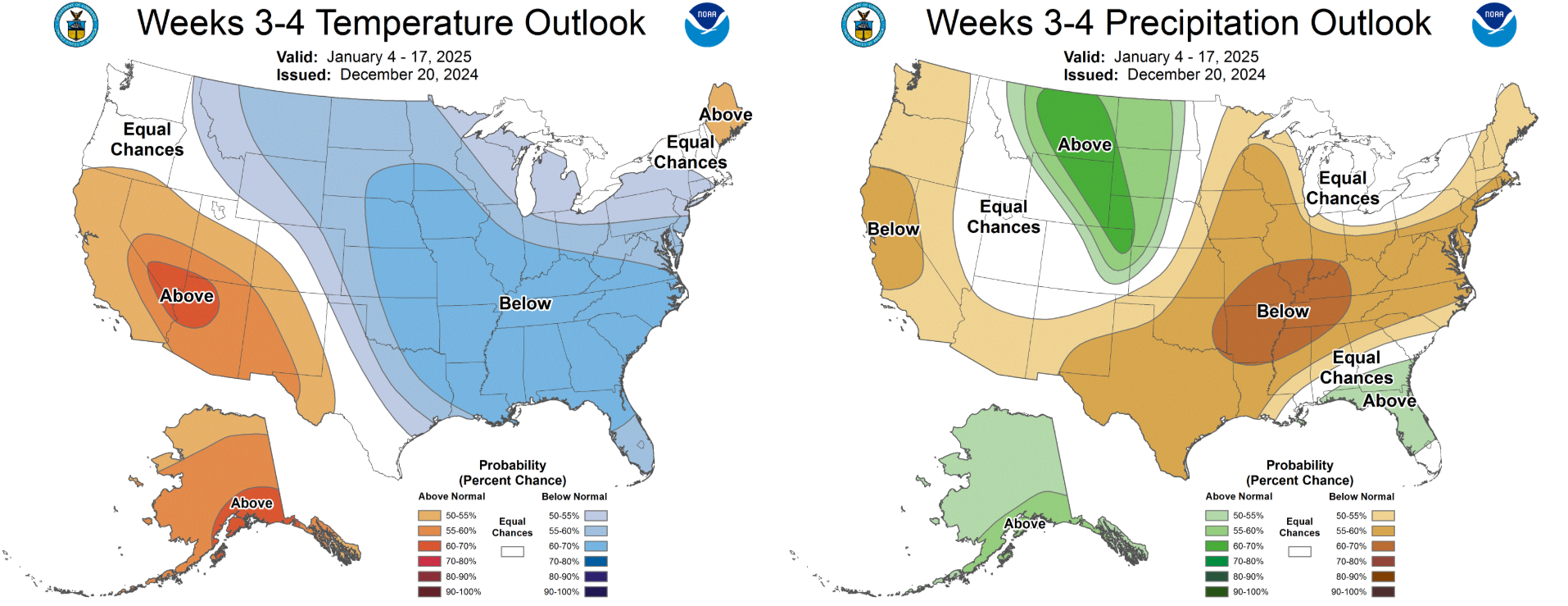
- Real Winter Begins Next Week?: Big changes in our weather may commence next week around New Years Eve, with colder weather set to linger well into January. Snow bunnies rejoice!
DISCLAIMER: This weekly outlook forecast is created Monday morning and covers the entire upcoming week. Accuracy will decrease as the week progresses as this post is NOT updated. To receive daily updated forecasts from our team, among many other perks, subscribe to BoulderCAST Premium.
Daily Forecast Updates
Get our daily forecast discussion every morning delivered to your inbox.
All Our Model Data
Access to all our Colorado-centric high-resolution weather model graphics. Seriously — every one!
Ski & Hiking Forecasts
6-day forecasts for all the Colorado ski resorts, plus more than 120 hiking trails, including every 14er.
Smoke Forecasts
Wildfire smoke concentration predictions up to 72 hours into the future.
Exclusive Content
Weekend outlooks every Thursday, bonus storm updates, historical data and much more!
No Advertisements
Enjoy ad-free viewing on the entire site.
Not as warm as recent days
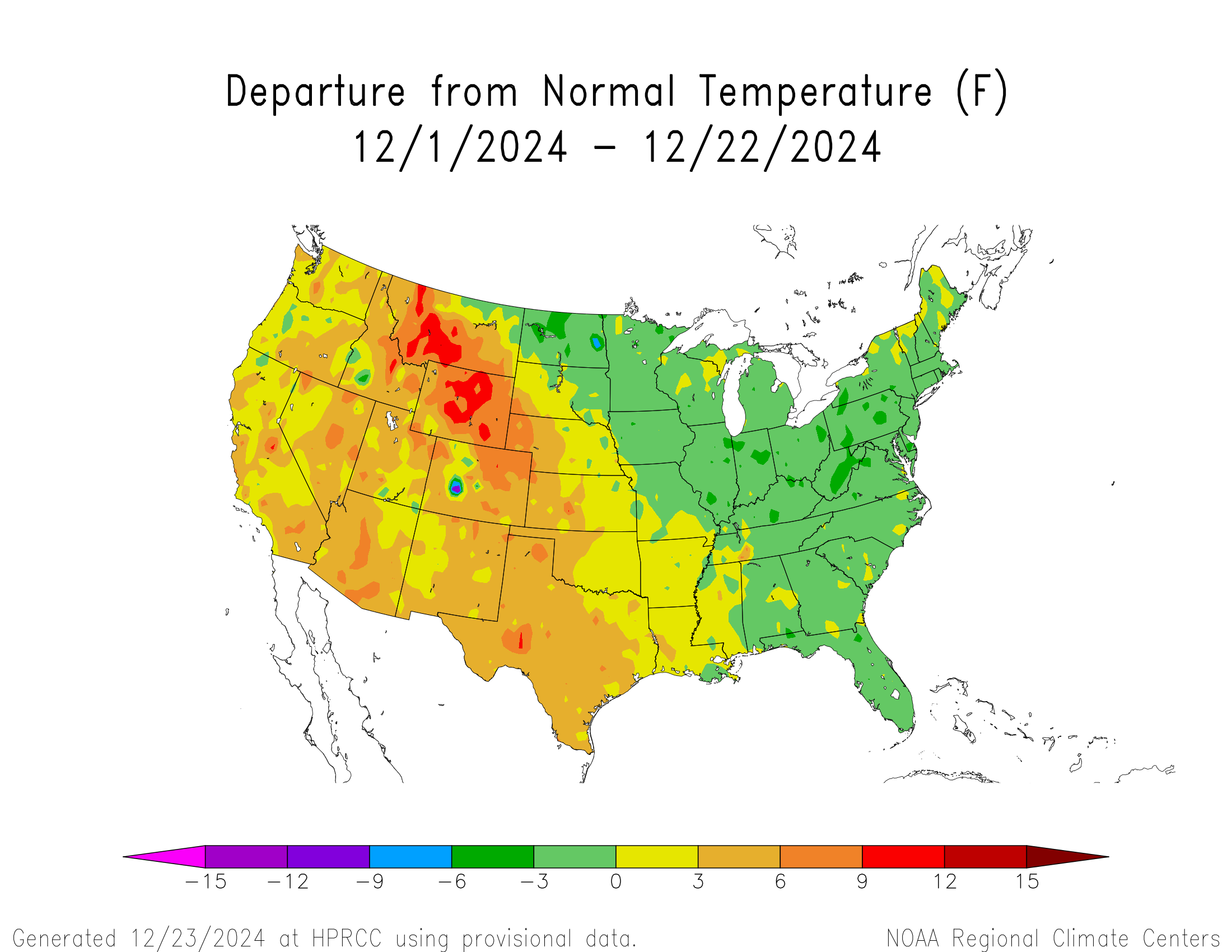
In stark contrast to the eastern United States, the West has been exceptionally warm so far in December, with most of the northern Rockies averaging 5 to 10°F above normal month-to-date. Boulder is currently on-track to notch a “Top 5 Warmest December”, and its warmest since 1980.
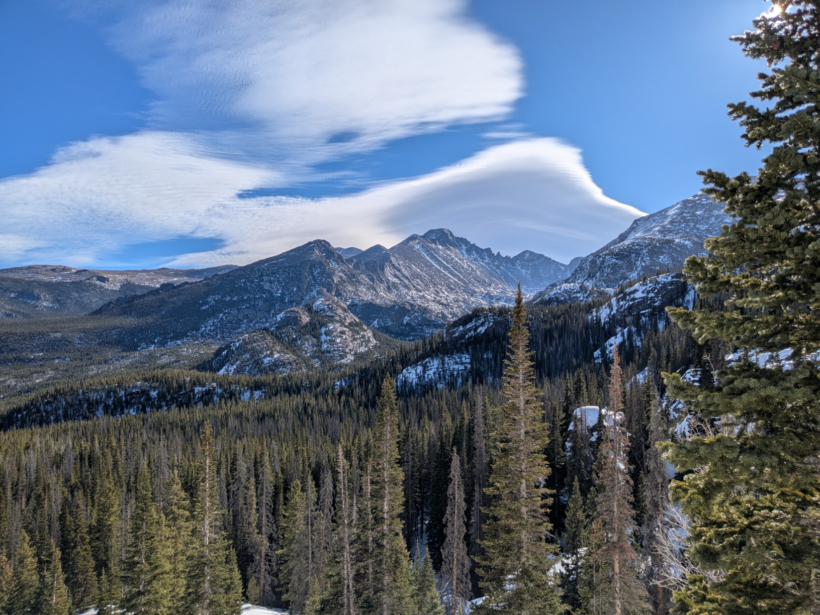
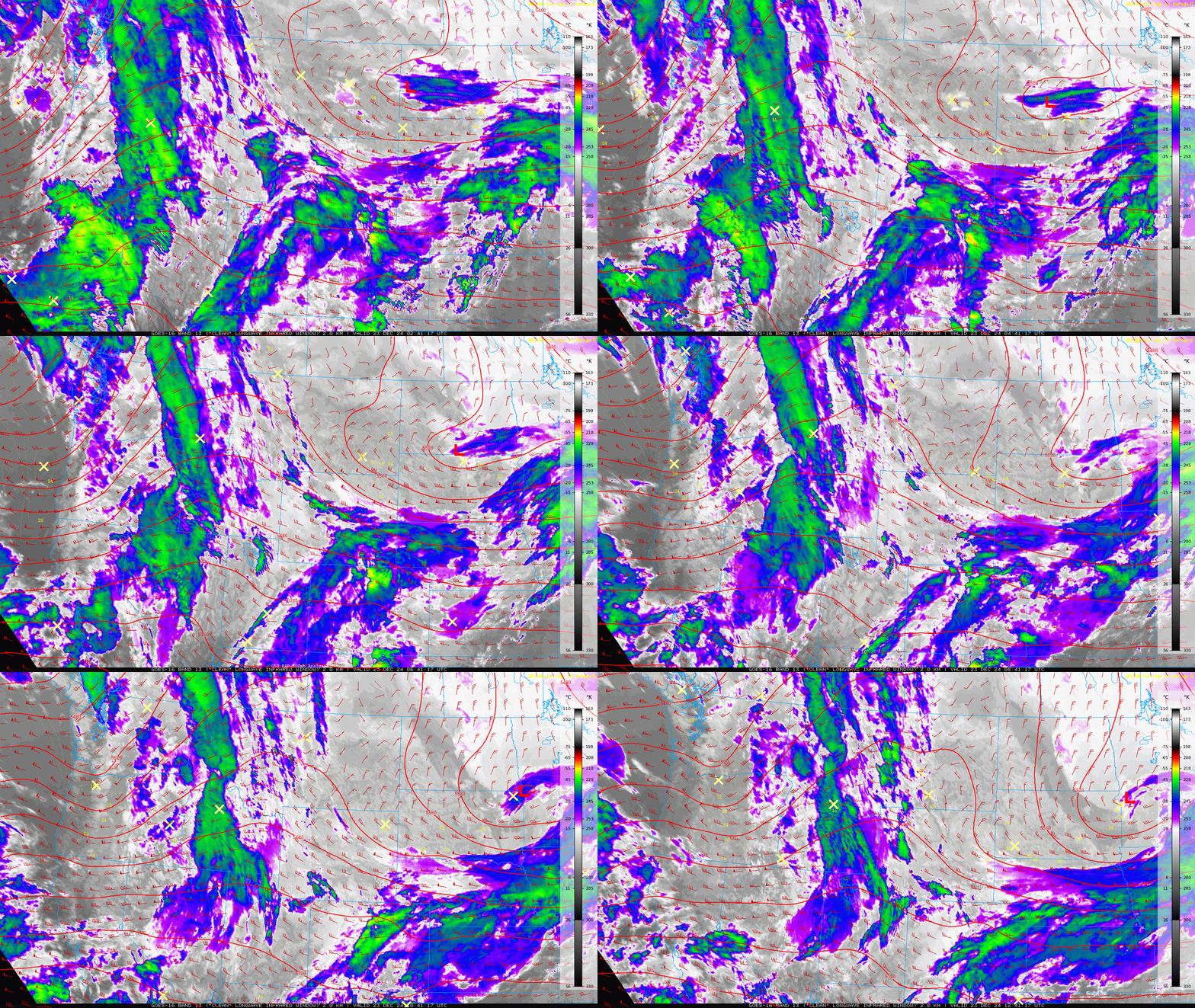
Amazingly, despite being our typically coldest time of year, the past six days have soared to near or above 60 degrees in the Denver Metro area. This sweltering streak will come to an end on Monday in the wake of a weak cold front that moved through last night. This cold front was tied to a clipper-type system passing well to our north across Montana and the Dakotas which has backstopped a plethora of wave cloud activity over the weekend, especially on Sunday.
Monday morning’s GOES-East infrared satellite animation below shows the extensive cloud cover beginning to break up somewhat across the Front Range.
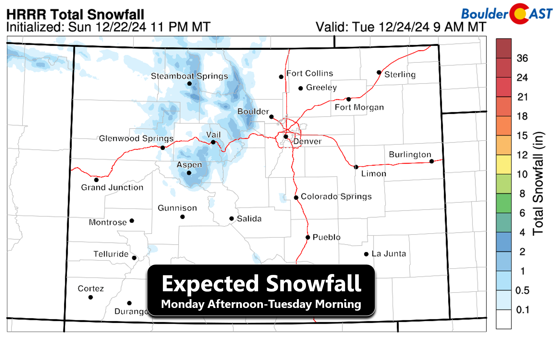
Monday during the daytime will be mostly dry across our state as the light snow showers that fell in the Mountains overnight quickly dissipate as shortwave ridging moves into the area. This calmer time will be short-lived, however, as a secondary wave of light snow will develop into the Mountains by Monday early evening leading to 1 to 3 inches of additional accumulation by Tuesday morning across the central and northern ranges:
The lower elevations will remain dry on Monday, with splotchy patches of sunshine and temperatures landing a bit cooler in the low to middle 50s.
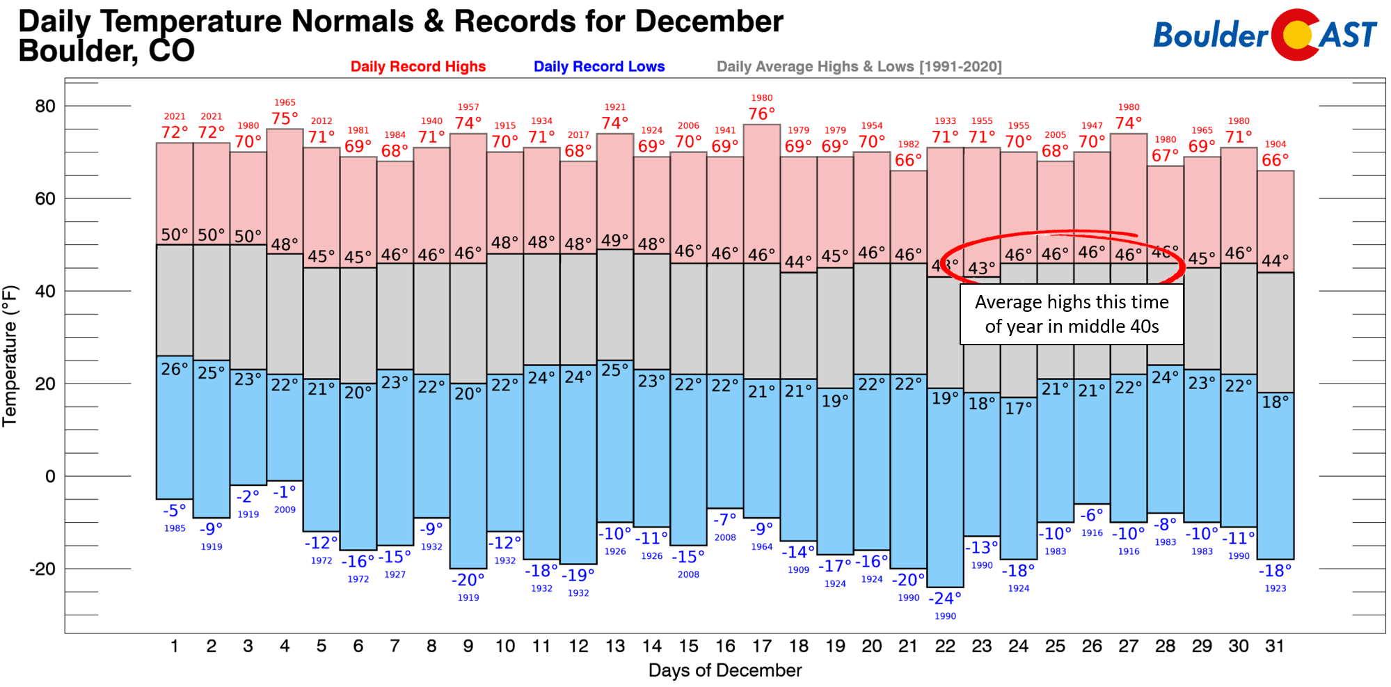
While this cooldown will bring an end to our impressive 60-degree marathon, these cooler temperatures are still five to ten degrees above normal…
Light snow will come to an end early Tuesday morning in the Mountains, with sunshine taking over across the lower elevations Tuesday and temperatures staying mild in the middle 50s for highs.
Will we have a “White Christmas” this year?
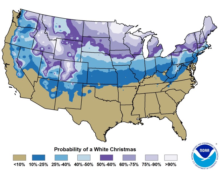
As a reminder, the official definition of a white Christmas, according to the National Climatic Data Center, is 1″ or more of snow on the ground on Christmas Day. This handy map shows the Denver Metro area has about a 40 to 50% chance of that criteria being met any given year.
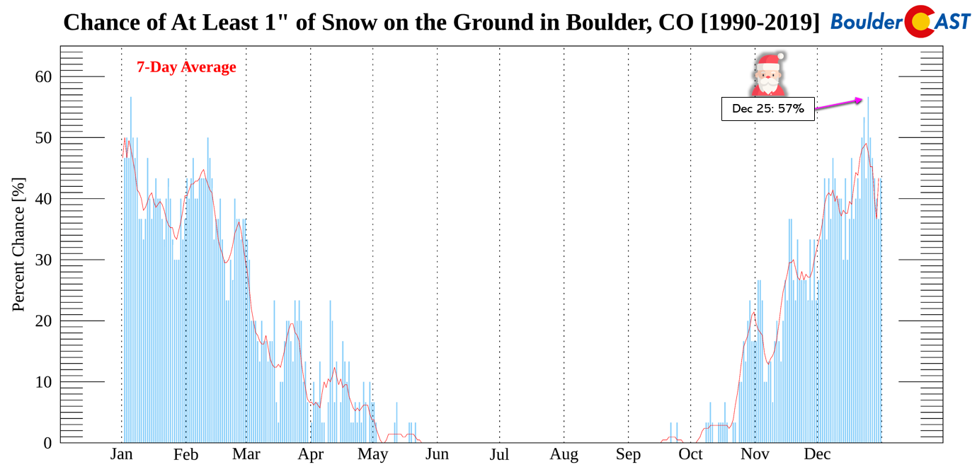
A closer look at Boulder data specifically shows Christmas having a 57% chance based on recent climatology, tied for the highest percentage out of any day in the year! If you are interested, we talked in another post previously about why Christmas-time has the best chance of snow on the ground in our area (spoiler: it’s the coldest time of year and the sun angle is at its lowest).
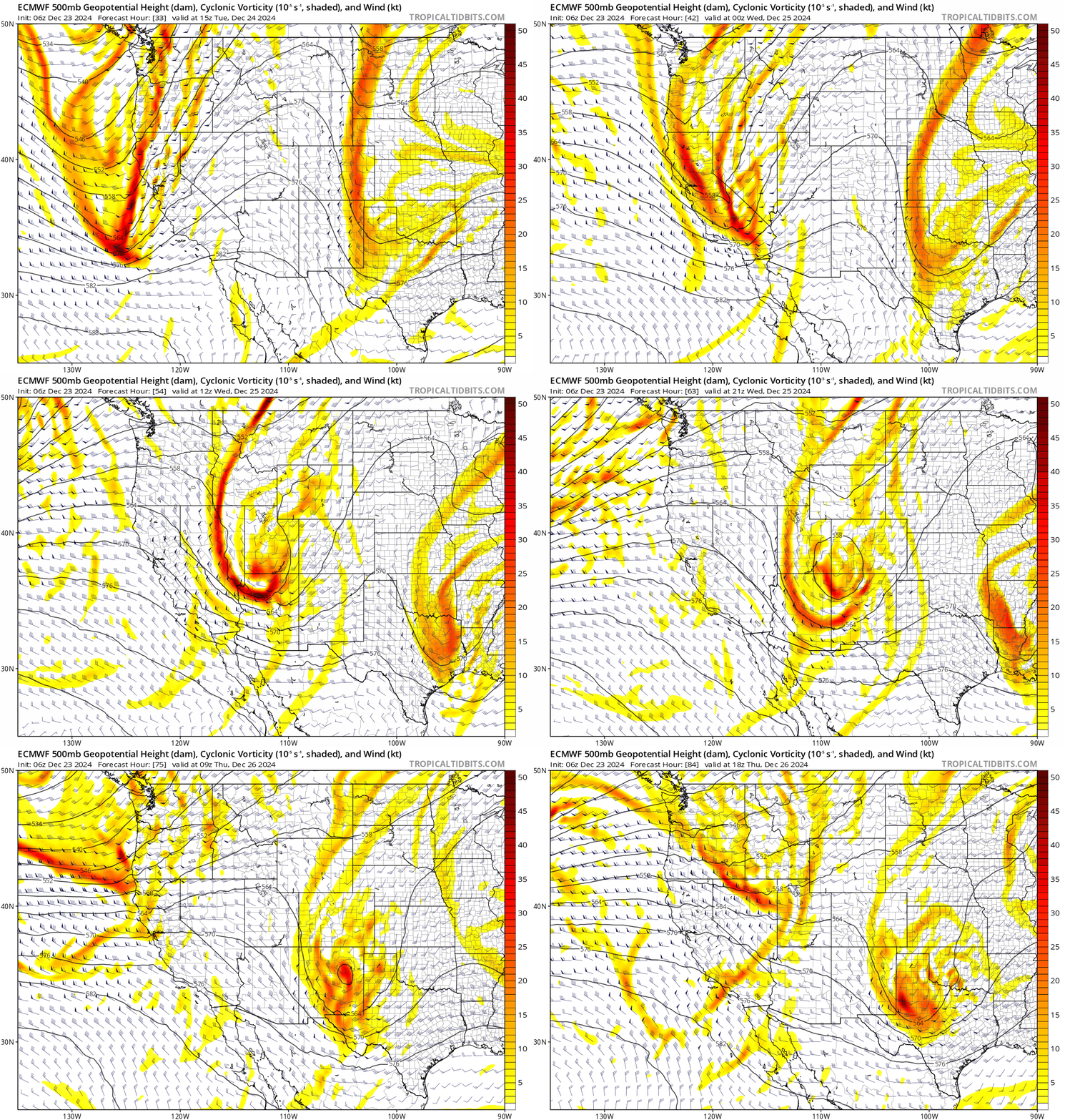
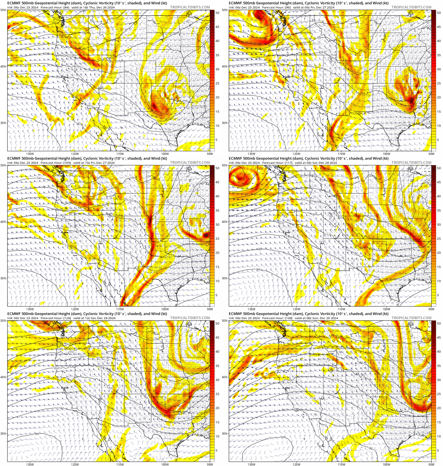
While things are not looking good for snow on the ground this Christmas, Mother Nature is at least going to make things slightly interesting with the threat of falling snowflakes! The most impressive shortwave disturbance in weeks is forecast to cut into the ridge, moving across Colorado Wednesday into Thursday:
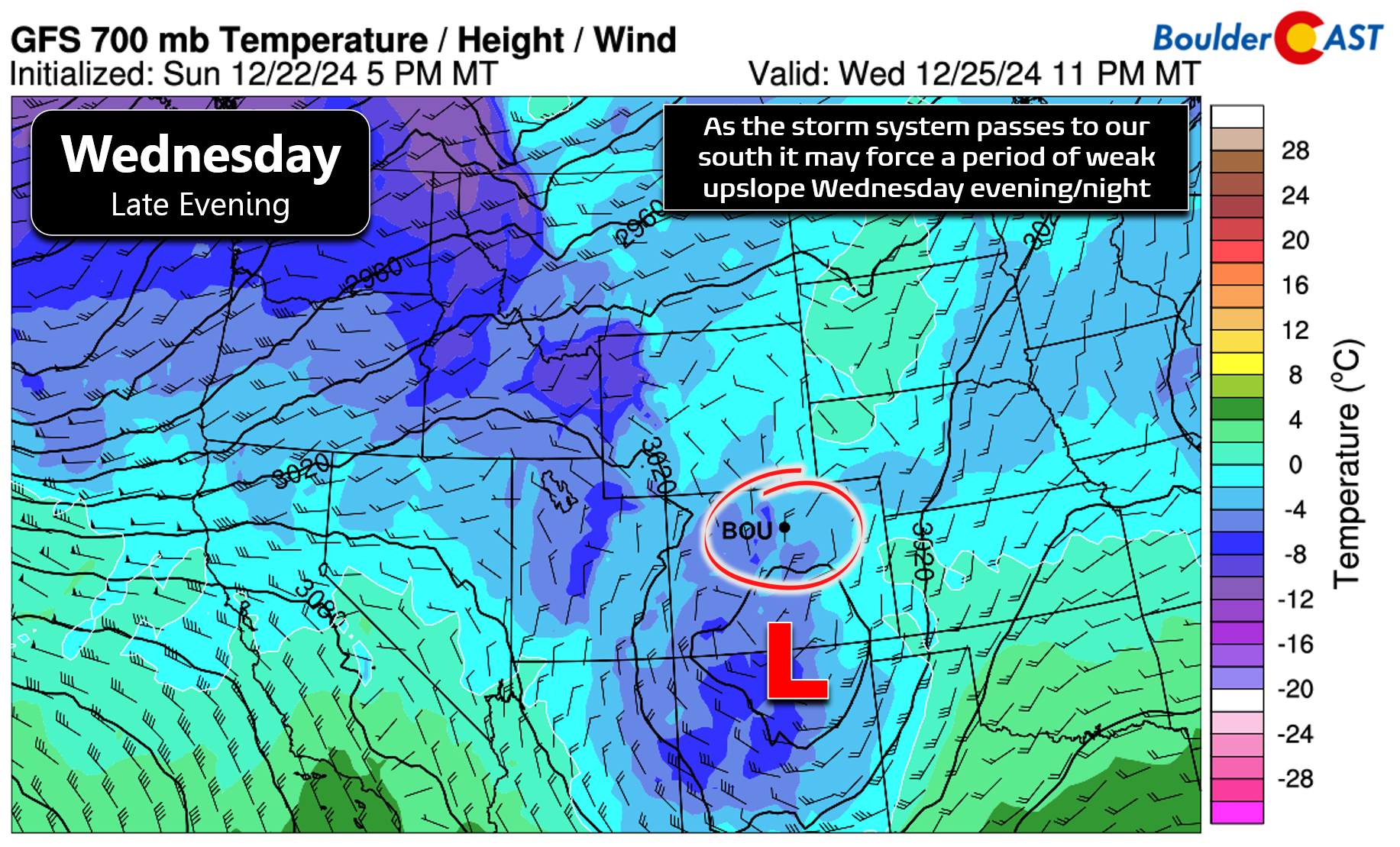
The mid-level energy in the form of a weak closed-low will reach the Four Corners area by Wednesday afternoon before digging across northern New Mexico Wednesday night into Thursday. While this setup is not very favorable for precipitation in the Front Range, the Mountains should receive a wave of light to moderate snowfall during this window, with a slight chance of rain/snow showers across the Denver Metro area late Wednesday behind a meager cold front. As the low passes to our south Wednesday evening and night, winds will turn northerly (or wishfully north-northeasterly) across the Metro area, potentially allowing a few spotty rain/snow showers to form.
Yes, we are talking about the potential for liquid precipitation to fall on Christmas (at least initially)— there’s not much cold air with this system at all. As you can see above, 700mb temperatures drop to only around -3°C over our area, probably not cold enough for accumulating snow even if any showers do end up forming. Snow levels look to remain mostly above 6500 feet elevation. Right now only about 25% of ensemble members lead to any measurable precipitation in Boulder, with a mean of only 0.03″ equating to a dusting or less of snow.
We will mention that there are a few outlier model runs, like last night’s Euro (shown below) and today’s Canadian, that produce a couple inches of snow in the Boulder-Denver area with this system Wednesday night. We just don’t see how this could verify given the lack of moisture, storm track, and warm temperatures.
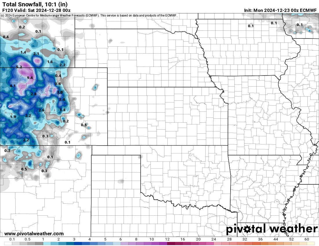
Outlier Euro model run from Sunday evening that shows accumulating snow in the Denver area Christmas evening/night. This is not our current expectation and is for demonstration only.
For now, plan on Christmas Day being mostly dry with a chance of light rain/snow showers from late afternoon into the overnight period with little to no travel impacts below 8000 feet. The one area of travel concern will be in the Mountains south of Interstate 70 Wednesday evening and night which will see a period of light to moderate snowfall.
Late-week stays busy but with little to show for it
The late-week period into the weekend ahead will remain somewhat active across the northern Rockies with several shortwave disturbances traversing through the region embedded within moderately strong northwest flow aloft. As our Christmas Day system departs eastward, secondary and tertiary disturbances will enter the picture from the northwest. The first comes Thursday night into Friday morning, quickly followed by another Friday evening and night. Both of these will likely produce waves of light snow in the Mountains. Little to no moisture is expected down here, but one or two associated cool fronts will keep our temperatures from getting back into the 60s for the time being.
Thursday should end up pretty nice with mostly sunny skies and seasonal temperatures in the upper 40s — great for returning any terrible gifts and hitting the after-Christmas sales. Friday may be a few degrees warmer, but more clouds will be around with some models hinting at a slight chance of rain/snow showers in the Metro area. Similar to Wednesday evening, we don’t expect these to amount to much of anything either. Overall, it will be a relatively quiet and mild week across the lower elevations, at least compared to what could transpire this time of year…
For those longing for more winter-appropriate weather conditions, you may not have to wait too long! We’re seeing some support in long-range forecasts for changes to begin across Colorado next week around New Year’s Eve. Colder air and some snow will likely be a staple of our weather during the first half of January. There is some chance that the coldest, Arctic air stays east of the Front Range, but it’s not likely we would be entirely spared from multiple Arctic outbreaks. Exciting times may lie ahead!
That’s all we have for you this week. Be sure to follow us on Twitter, Facebook, Bluesky and Threads for intermittent impromptu updates on Front Range weather. We’ll definitely let you know if things somehow start to trend snowier for Christmas Day evening, and keep an eye on next week for winter’s true arrival.
From all of us at BoulderCAST,
we wish you a Happy Holidays!
If you want to help support the passionate work we do here at BoulderCAST and/or wish to receive a morning weather update from us every single day for the next year, consider subscribing to BoulderCAST Premium; our 2024 holiday sale is ongoing through the end of the year.
Forecast Specifics:
Monday: Partly to mostly cloudy and cooler. High temperatures in the middle 50s on the Plains with middle 40s in the Foothills.
Tuesday: Lots of sun early in the day, but clouds increase during the afternoon. High temperature stay above normal in the middle 50s on the Plains with middle 40s in the Foothills.
Christmas Day: Partly cloudy skies becoming mostly cloudy late with a chance of rain showers changing to a rain/snow mix during the evening and overnight. Little to no accumulation is expected with minimal or no travel impacts. High temperatures will be cooler in the middle to upper 40s on the Plains with middle 30s in the Foothills.
Thursday: Mostly sunny and likely dry with highs staying cool around 50 degrees on the Plains with upper 30s in the Foothills.
Friday: Partly cloudy with a slight chance of rain/snow showers during the day but no accumulation. Temperatures top out in the lower 50s on the Plains with upper 30s in the Foothills.
Get BoulderCAST updates delivered to your inbox:
DISCLAIMER: This weekly outlook forecast is created Monday morning and covers the entire upcoming week. Accuracy will decrease as the week progresses as this post is NOT updated. To receive daily updated forecasts from our team, among many other perks, subscribe to BoulderCAST Premium.
Daily Forecast Updates
Get our daily forecast discussion every morning delivered to your inbox.
All Our Model Data
Access to all our Colorado-centric high-resolution weather model graphics. Seriously — every one!
Ski & Hiking Forecasts
6-day forecasts for all the Colorado ski resorts, plus more than 120 hiking trails, including every 14er.
Smoke Forecasts
Wildfire smoke concentration predictions up to 72 hours into the future.
Exclusive Content
Weekend outlooks every Thursday, bonus storm updates, historical data and much more!
No Advertisements
Enjoy ad-free viewing on the entire site.
Enjoy our content? Give it a share!






You must be logged in to post a comment.