Winter’s first real punch is on the way… After a quiet start to the week, all eyes turn to Wednesday as a stronger storm system sets its sights on the Front Range. Sunshine today and mild temps Tuesday won’t last long—by midweek, upslope flow and Arctic air will combine to deliver widespread snow and a chilly temperatures to the entire Denver Metro area. How much will fall, and who gets the brunt of it? We break down the latest model guidance, timing, and impacts.
This week’s highlights include:
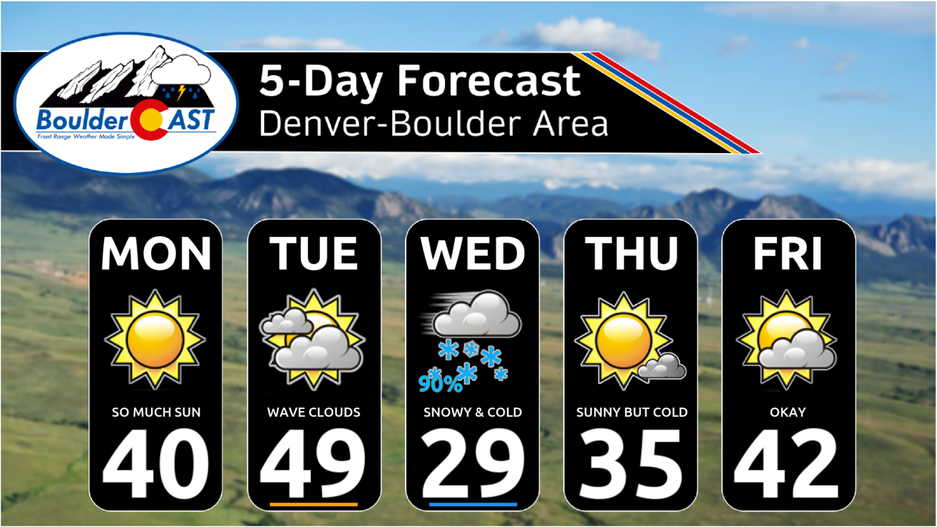
🌤️ Monday: Sunshine returns after light weekend snow; highs near 40°F.
☁️ Tuesday: Quiet start, clouds increase ahead of next storm; highs mid to upper 40s.
❄️ Wednesday: First real winter storm of the season; widespread accumulating snow (2–5″ typical, 4–7″ possible in Foothills/Palmer Divide).
🚗 Impacts: Snow begins after midnight Tuesday night, affecting the Wednesday morning commute; tapering by evening.
🥶 Cold air: Highs stuck in upper 20s–30°F Wednesday; lows in teens by Thursday morning with Arctic front.
🌨️ Late week/weekend: A few uncertain chances for flurries or light snow; temps rebound into the 30s and 40s but another Arctic push possible.
DISCLAIMER: This weekly outlook forecast is created Monday morning and covers the entire upcoming week. Accuracy will decrease as the week progresses as this post is NOT updated. To receive daily updated forecasts from our team, among many other perks, subscribe to BoulderCAST Premium.

Go Premium, get all the perks.
Daily Forecast Updates
Get our daily forecast discussion every morning delivered to your inbox.
All Our Model Data
Access to all our Colorado-centric high-resolution weather model graphics. Seriously — every one!
Ski & Hiking Forecasts
6-day forecasts for all the Colorado ski resorts, plus more than 120 hiking trails, including every 14er.
Smoke Forecasts
Wildfire smoke concentration predictions up to 72 hours into the future.
Exclusive Content
Weekend outlooks every Thursday, bonus storm updates, historical data and much more!
No Advertisements
Enjoy ad-free viewing on the entire site.
A chilly week with snow centered on Wednesday
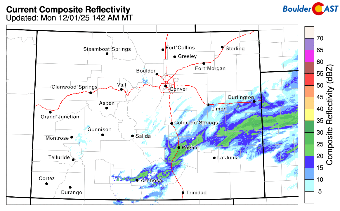
Light snow and a few embedded heavier jet bands came to and end early this morning in southern Colorado, after having dusted parts of the Denver Metro area Sunday evening.
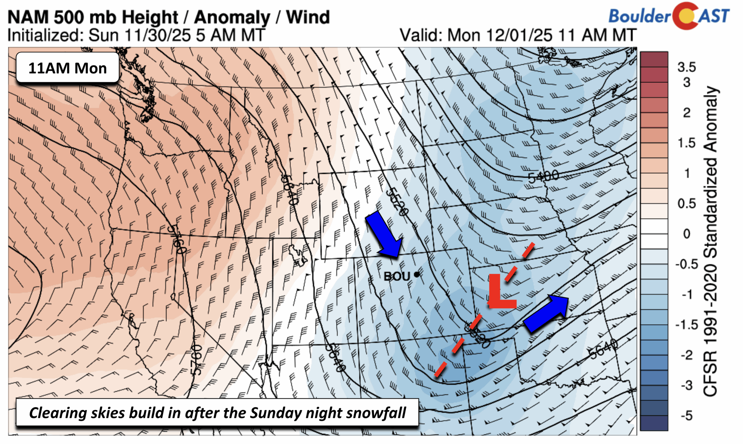
The responsible trough will exit into the Central Plains region Monday morning, while northwest flow aloft continues. Expect sunshine to take hold today with subsidence aloft and highs across the lower elevations topping out in the upper 30s to near 40 degrees.
Most of our Tuesday is quiet but clouds will be on the increase ahead of our next advertised winter storm. This one is becoming increasingly likely and centered on Wednesday, from early Wednesday morning through early to late Wednesday evening. Our Tuesday starts out quiet though in the mid to upper 40s on the Plains. A system out of the Pacific Northwest will dive south and southeast into Utah early Wednesday, then later track into New Mexico late Wednesday and the Texas Panhandle Thursday. While the system tracks well west of the state, it will provide a broad east to northeast upslope flow on the Front Range Mountains, Foothills. and Boulder/Denver area.
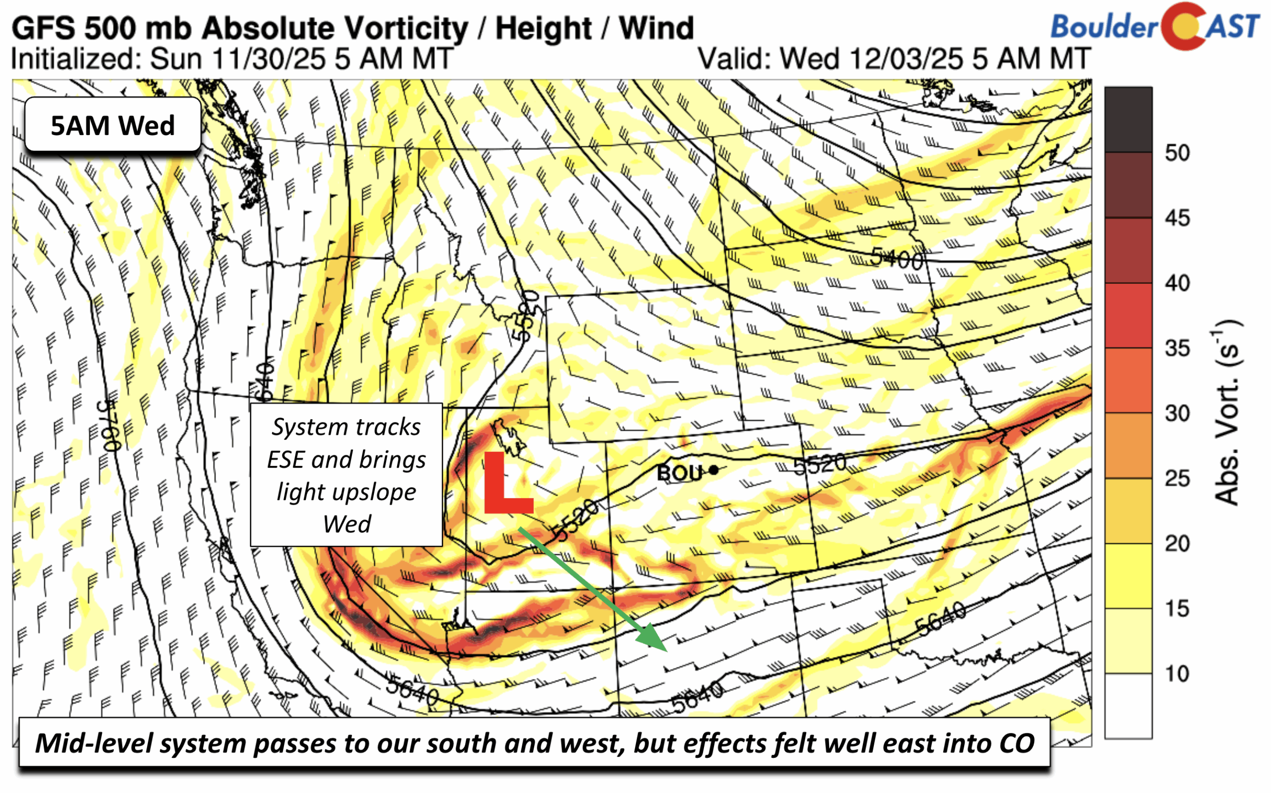
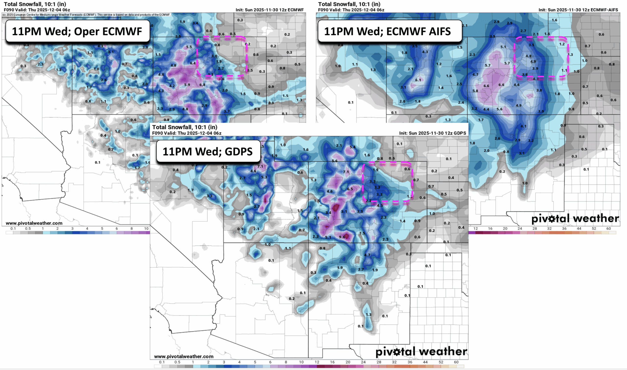
Nearly all guidance shows a very similar track, given that we are about 48-hours out from the event. That track brings the low-level circulation near the Four Corners. And while the main flow just northeast of Colorado is northwest, there is a subtle but effective light period of upslope over the Denver Metro during the day on Wednesday. This system will likely be our first marginal to moderate winter storm of the year.
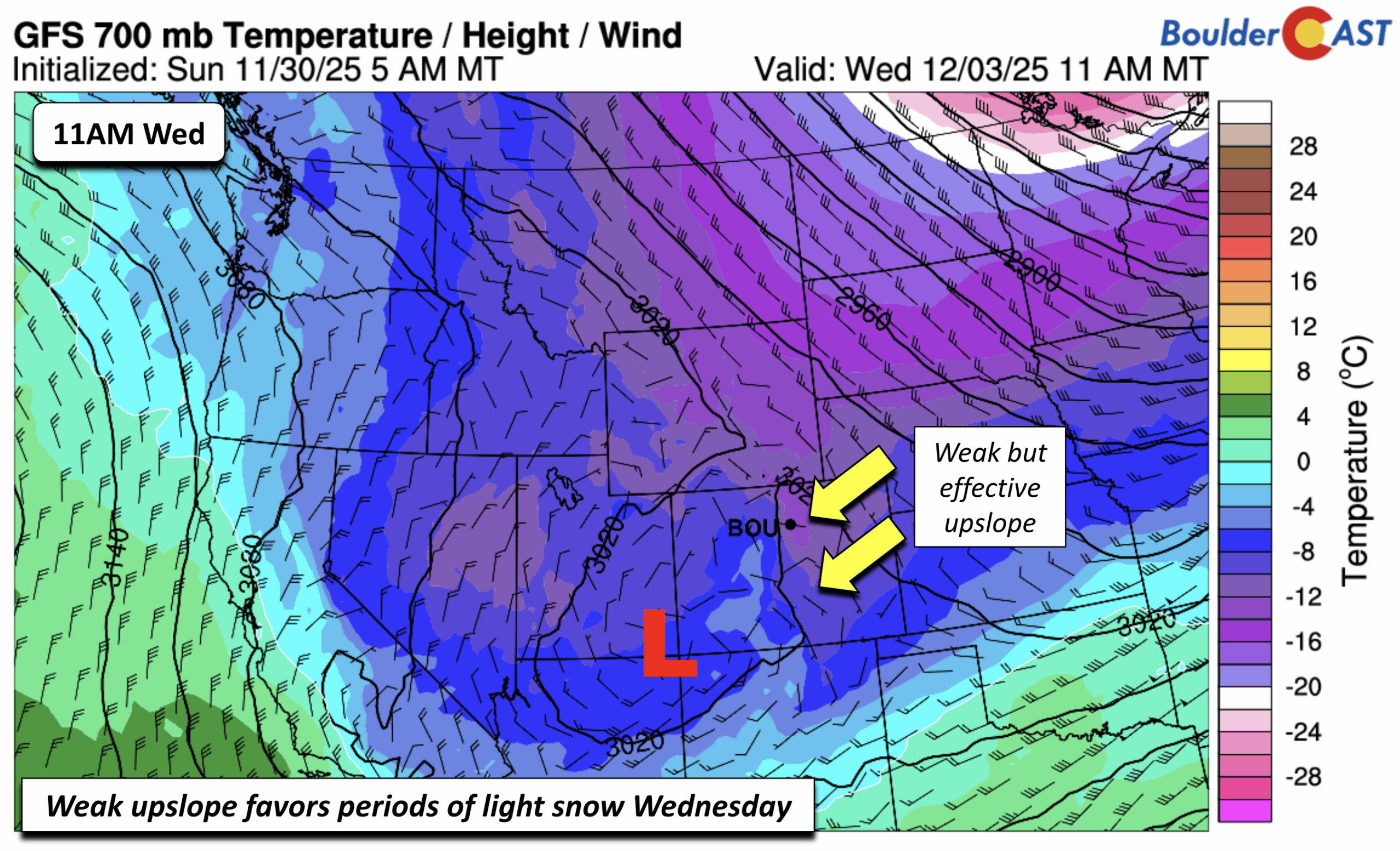
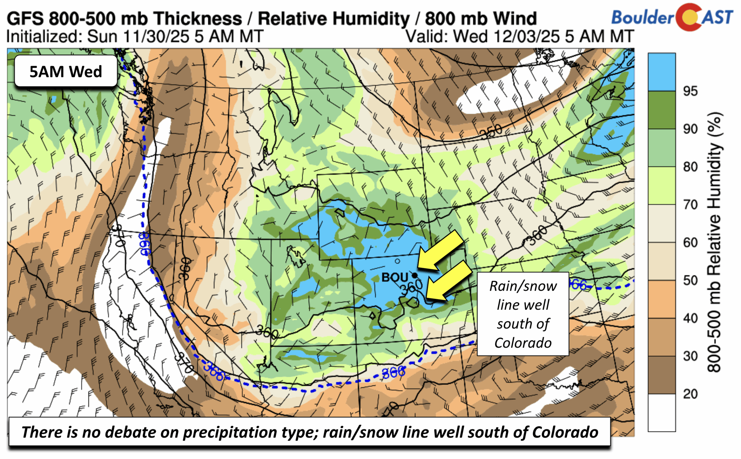
There will be plenty of cold air with 700 mb temperatures well below freezing and the rain/snow line (blue dashed contour) well to our south in northern New Mexico. Enough moisture will also be in place with relative humidity well above 90-percent and precipitable water values of 0.3 to 0.4 inches of liquid.
The latest GEFS show the broad agreement in the ensemble data, with all GEFS members indicating snowfall over Denver Wednesday. The mean liquid accumulation is around 0.25 inches. A broad brush forecast simply from this would suggest 2 to 3 inches using a 10:1 snow-to-liquid ratio. But given expected higher SLR ratios, we expect this amount to be on the somewhat low-end potential.
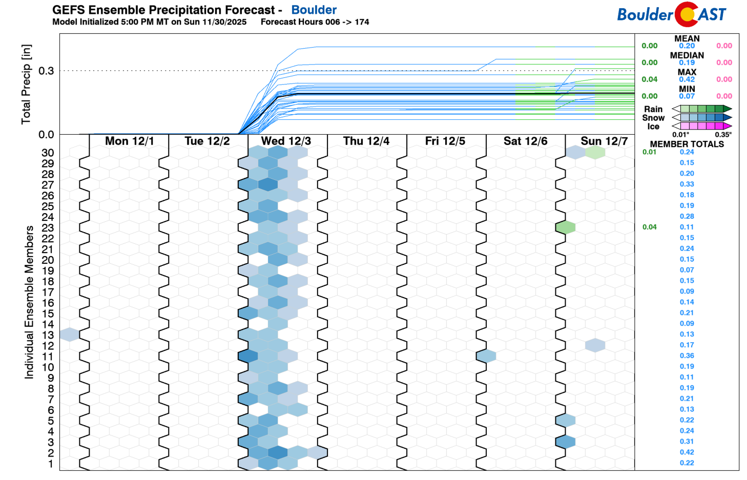
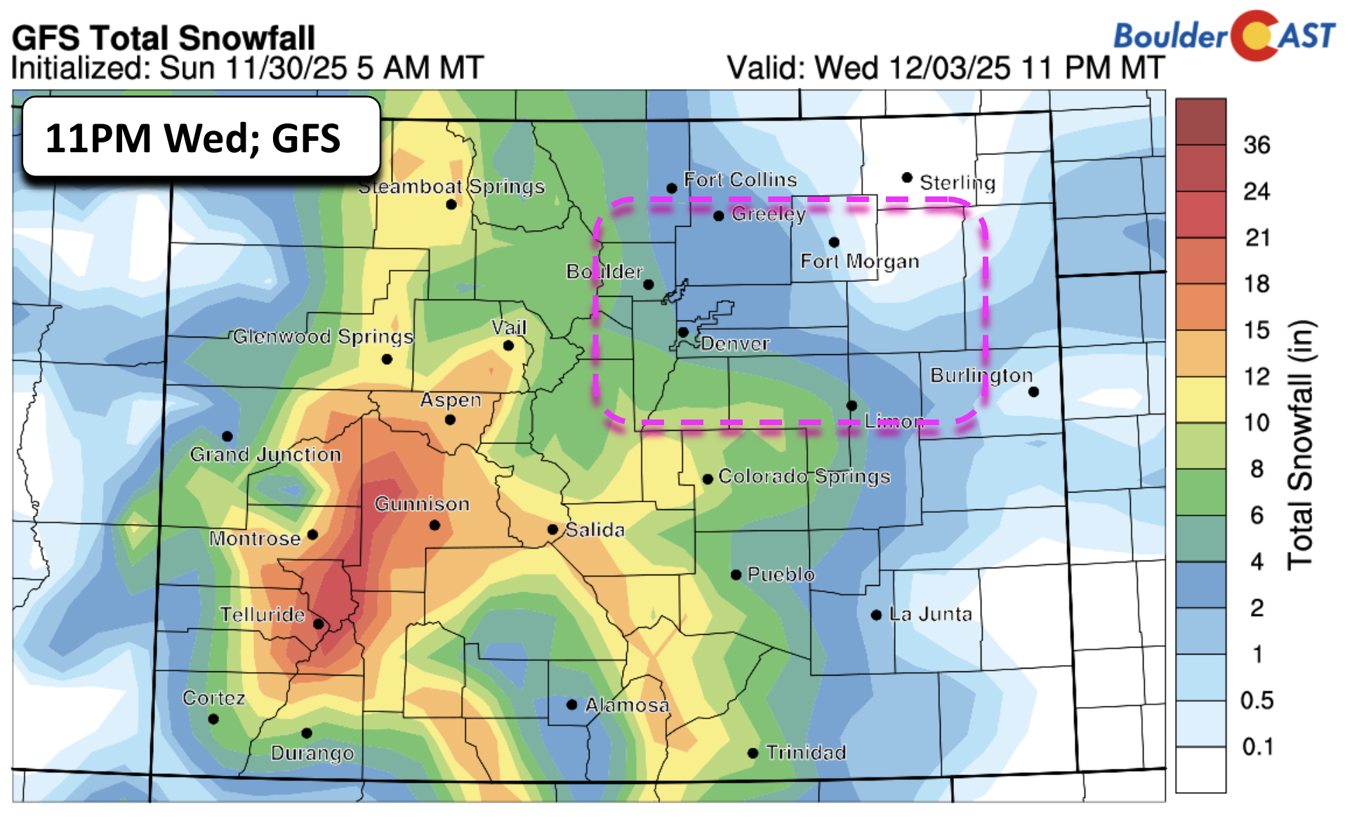
A plethora of operational models from the ECMWF and its AI version (ECMWF AIFS), as well as the Canadian GDPS and GFS, suggest a smattering of 2 to 5 inches, with higher totals over the western suburbs and Foothills and along/south of Denver near the Palmer Divide. Once we get closer to the event, we’ll issue a final snowfall map forecast using high-resolution guidance. But for now, that range of 2 to 5 inches is a good bet for now. A low-end scenario would be 1 to 3 inches, while a high-end scenario is around 4 to 7 inches.
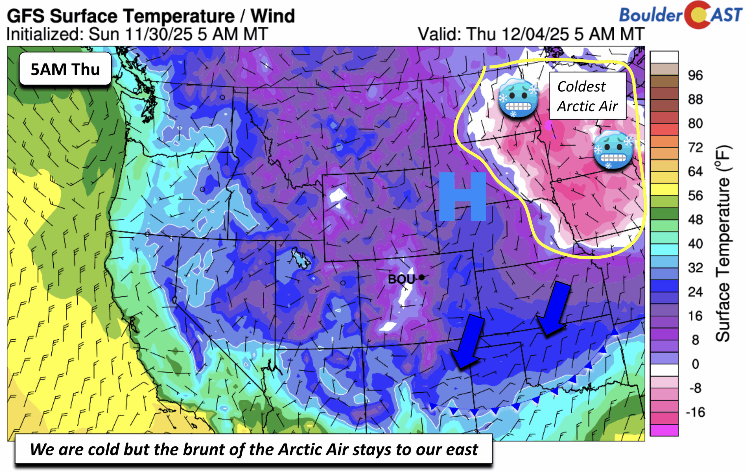
Bottom Line: It is going to snow Wednesday — we just have to narrow down the amounts as we get closer. Unlike the previous few winter systems that favored the Mountains and largely downsloped the Boulder area, this one will generate real upslope here and confidence is higher for widespread accumulating snow for everyone. As for timing, snow looks to develop Tuesday night after midnight, creating impacts for the Wednesday morning commute, with snow tapering off by Wednesday evening. Highs will roughly hover in the upper 20s to near 30 degrees with lows tumbling into the teens by early Thursday morning.
A few late-week to weekend snow chances are less certain
An Arctic cold front will move through in connection to the Wednesday snow event, dropping lows Thursday morning in the teens to perhaps some single digits. The brunt of the Arctic air, however, will stay to our north and east over the upper Mississippi Valley like Iowa, Minnesota, Wisconsin, and the eastern Dakotas. These areas will likely drop well below zero. We should see highs recover some Thursday, but with snow cover expected to be on the ground, highs should stick in the low to perhaps mid 30s. A few ensemble members show a weak system dropping down Thursday night or Friday morning at mid-levels, which could bring another round of light snow or flurries to the area. This is highly uncertain at the moment and will depend on the eventual departure of Wednesday’s system.
Temperatures should moderate some Friday with a return southerly flow in advance of our next system taking aim on the region Saturday into Sunday. Highs may reach the upper 30s to maybe low er 40s, though we may stick to the lower end for now until a better signal can be noticed. There could be another surge of Arctic Air building south Saturday night or Sunday, but the latest guidance keeps it just to our north and east with the region only somewhat chilly in the 40s. We’ll have to keep an eye on it though.
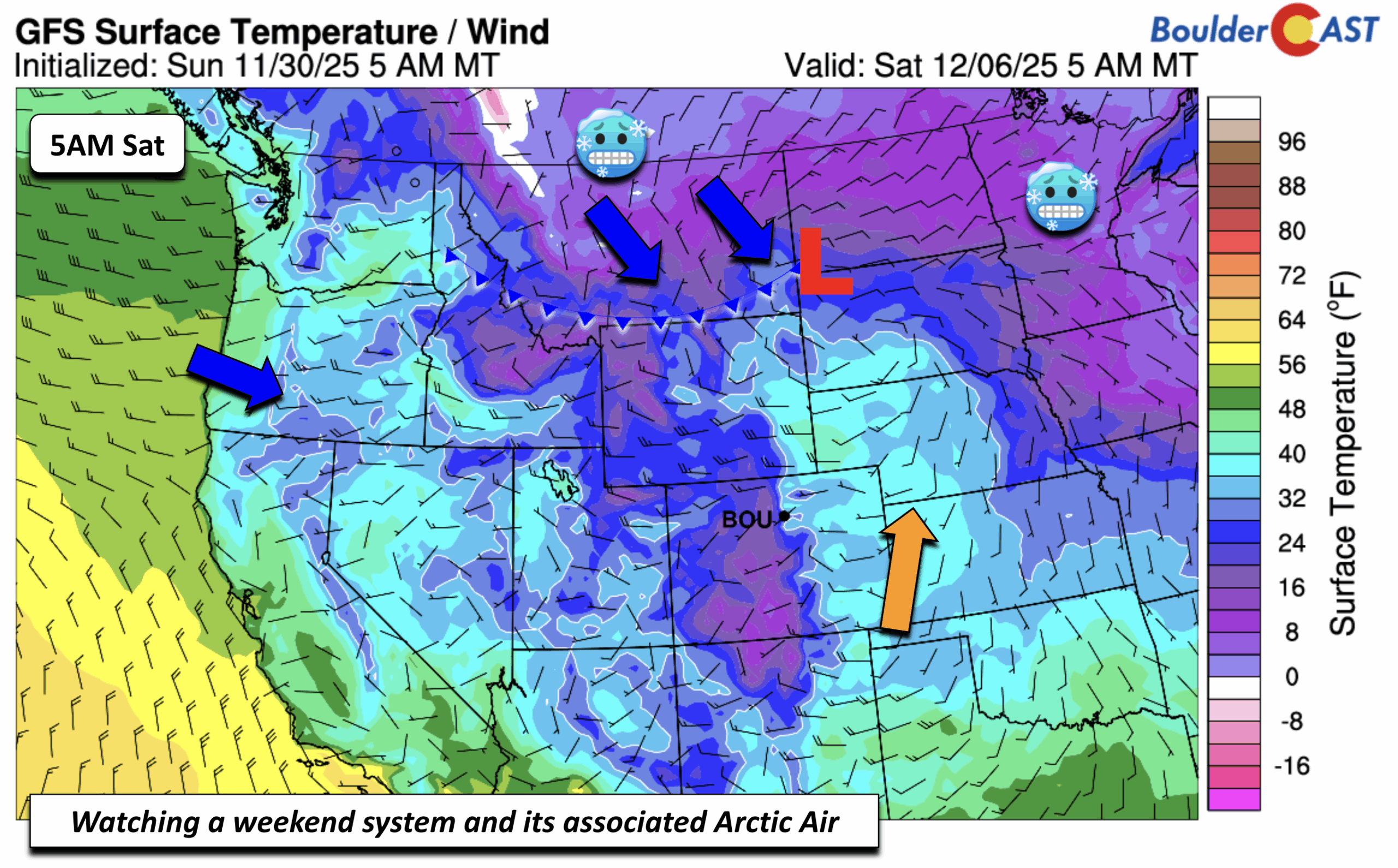
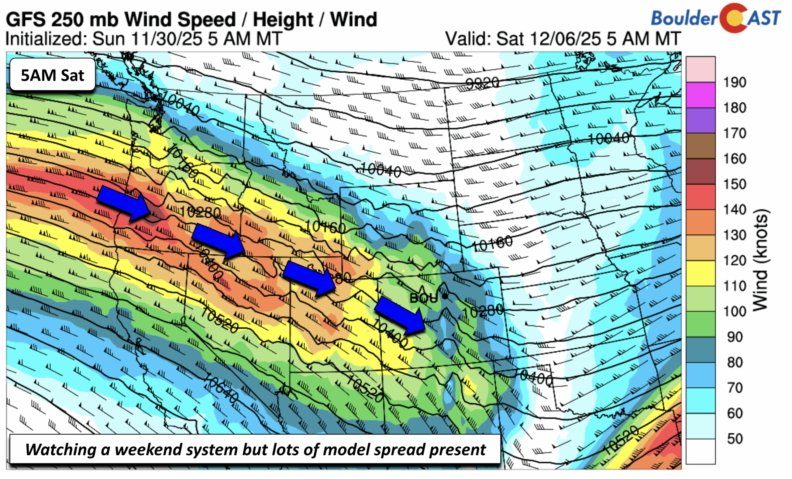
That Arctic front this weekend, depending on where it lands, may interact with another fast-moving shortwave tied to a strong jet streak stretching from the Pacific Northwest into Colorado. Right now, ensemble data keep the system weak or to our north, but a few members bring it across the state for light snow. We’ll keep an eye on it as well, but nothing hazardous is expected this far out.
Stay warm and get ready for the first real snow event of the season on Wednesday!
Forecast Specifics:
Monday: Becoming sunny with highs in the upper 30s for the Plains and upper 20s in the Foothills.
Tuesday: Becoming mostly cloudy. Highs in the lower 40s, with a few mid 40s in Denver, and lower 30s in the Foothills.
Wednesday: Light, persistent snow in the morning to mid to late evening hours. Snowfall amounts are not official yet, but 2 to 5 inches are possible over the Front Range, with higher totals in the Foothills. Highs in the upper 20s to near 30 for the Plains and upper teens to near 20 over the Foothills.
Thursday: Partly sunny skies with highs not as cold in the low to mid 30s on the Plains and low to mid 20s for the Foothills.
Friday: Increasing clouds with warmer weather in the upper 30s to near low 40s for the Plains and upper 20s to near low 30s in the Foothills.
Weekend: An Arctic cold front may build back south this weekend, but the latest guidance keeps it to our north with highs slightly below average in the middle 40s. There could be another chance of snow late Saturday or Sunday, but the model spread is too large to mention at this time.
DISCLAIMER: This weekly outlook forecast is created Monday morning and covers the entire upcoming week. Accuracy will decrease as the week progresses as this post is NOT updated. To receive daily updated forecasts from our team, among many other perks, subscribe to BoulderCAST Premium.
Go Premium, get all the perks.
Daily Forecast Updates
Get our daily forecast discussion every morning delivered to your inbox.
All Our Model Data
Access to all our Colorado-centric high-resolution weather model graphics. Seriously — every one!
Ski & Hiking Forecasts
6-day forecasts for all the Colorado ski resorts, plus more than 120 hiking trails, including every 14er.
Smoke Forecasts
Wildfire smoke concentration predictions up to 72 hours into the future.
Exclusive Content
Weekend outlooks every Thursday, bonus storm updates, historical data and much more!
No Advertisements
Enjoy ad-free viewing on the entire site.
Enjoy our content? Give it a share!


You must be logged in to post a comment.