A strong storm system in the Pacific Northwest will intensify as it moves into the upper Great Plains and into Minnesota by midweek. This system will create periods of gusty winds, fire weather concerns, and frequent temperature swings for the Front Range, as well as heavy snowfall for the High Country. The same system may bring a few rain/snow showers Tuesday into Wednesday to the Denver Metro area, but these won’t amount to much. Read on for more details.
This week’s highlights include:
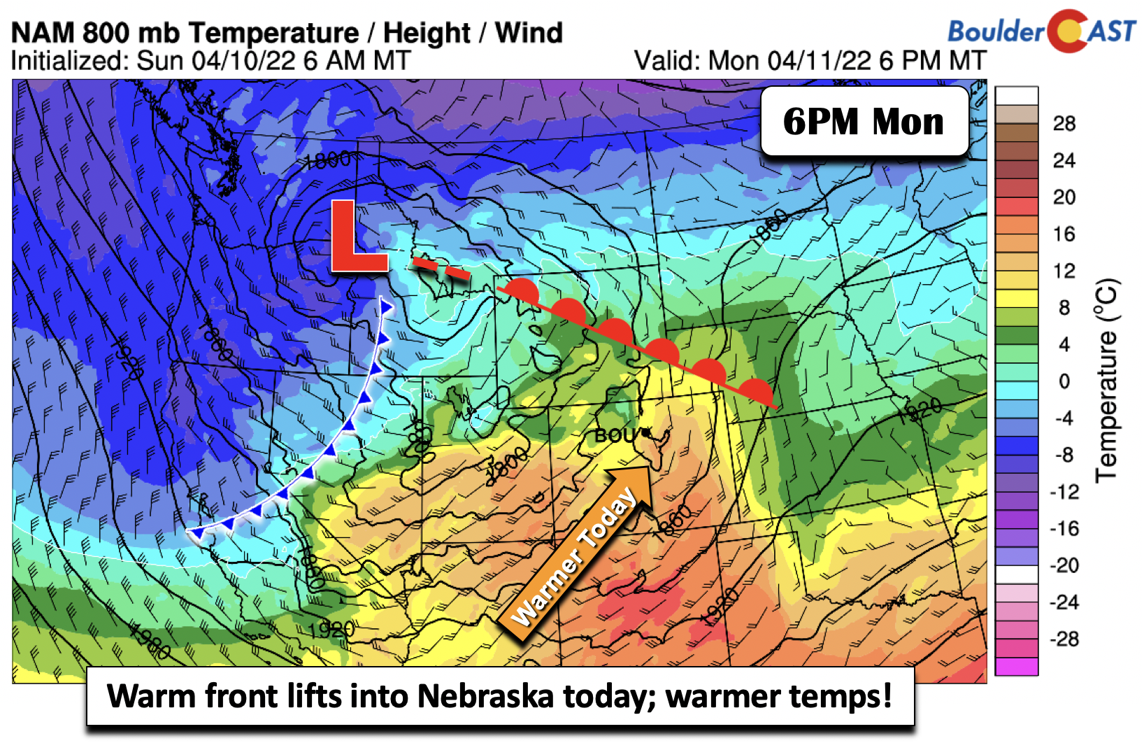
- A warm front lifts north on Monday with highs back into the 60s
- Gusty winds and mild early Tuesday ahead of a strong cold front; some showers possible during the day
- Rain showers chance to snow Tuesday night on the Plains but no accumulation expected
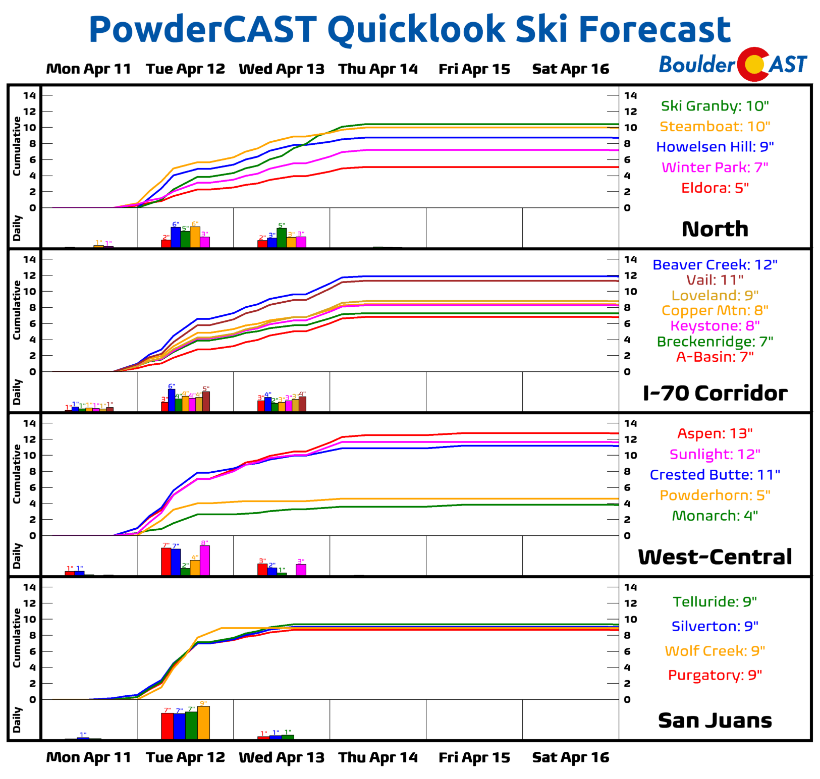
- Heavy Mountain snow Monday night through Wednesday — up to 16″ in spots
- Dry downslope and brisk northwest winds Wednesday will fuel elevated fire concerns; coldest day on Wednesday as well
- Warmer, dry, and seasonal to end the work week
DISCLAIMER: This weekly outlook forecast is created Monday morning and covers the entire upcoming week. Accuracy will decrease as the week progresses as this post is NOT updated. To receive daily updated forecasts from our team, among many other perks, subscribe to BoulderCAST Premium.

Seasonal to start
The week will be a rather active one, but at least for Monday, things will be quiet. Sunshine and a warmer airmass with a warm front lifting through the area into Nebraska and Wyoming will lead to highs rebounding into the low to middle 60s. Some gusty winds at times, especially over the far eastern Plains of Colorado, will lead to increased fire danger concerns today.
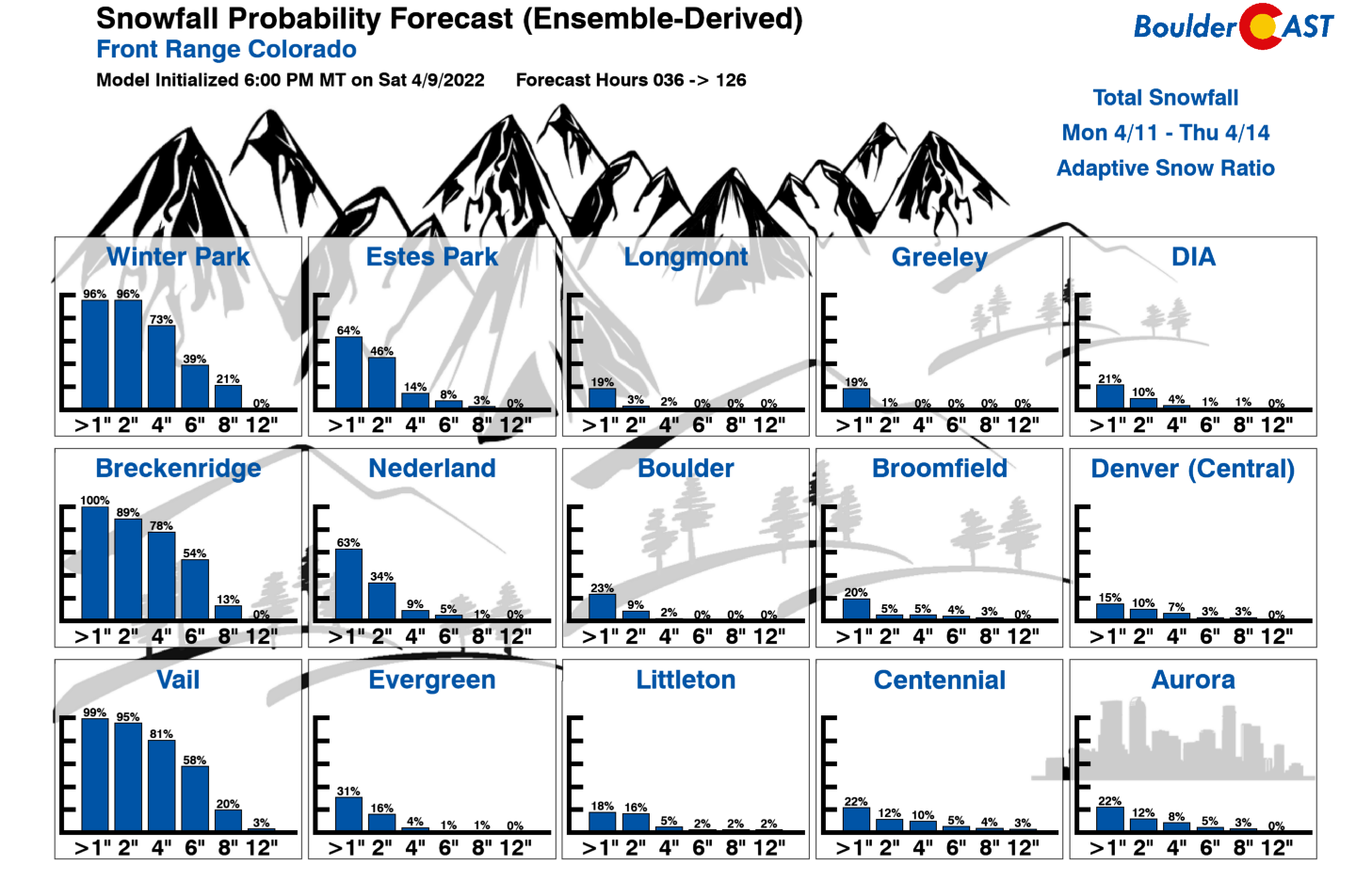
As we will discuss a bit later, we had posted on Friday the concern for a winter storm to affect the area in the Tuesday or Wednesday timeframe. Thanks a pattern shift and the track of the storm likely staying well north of our region, the ensemble guidance and snowfall probabilities have shifted dramatically, as evidenced below. Virtually every model and ensemble forecast has changed to dry conditions for the Plains, with our snow probabilities only indicating a 25% chance of 1″ in Boulder. We’ll discuss why this is the case a bit later…
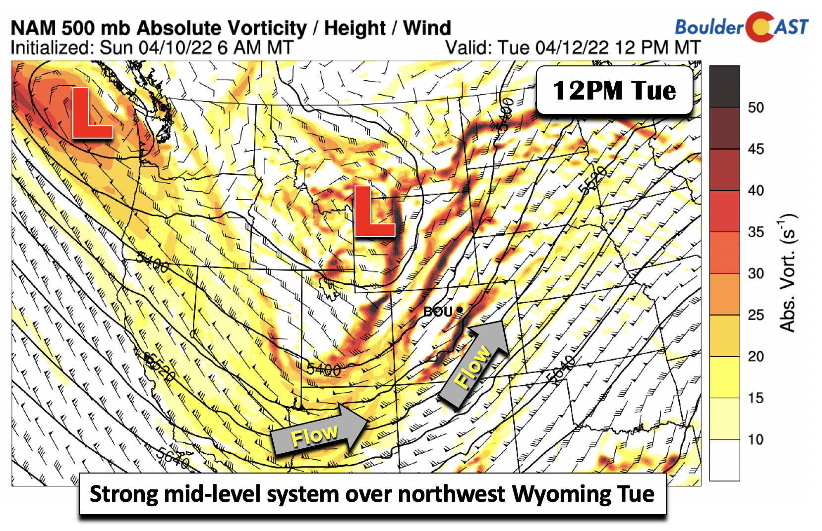
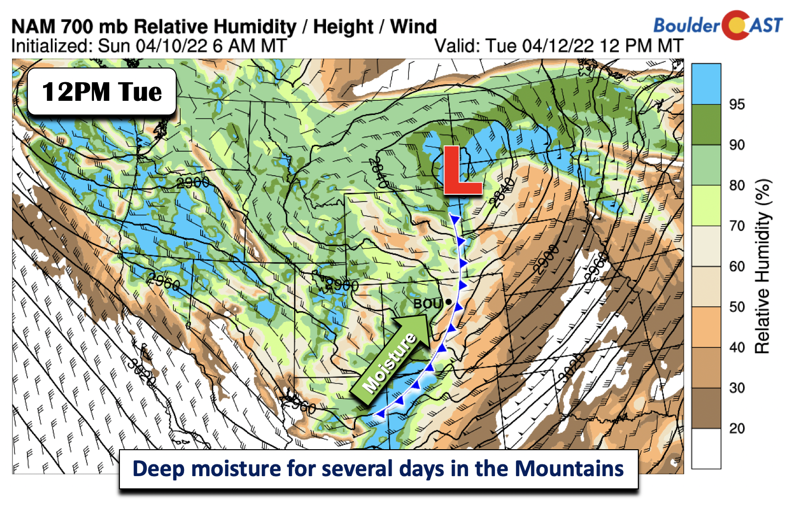
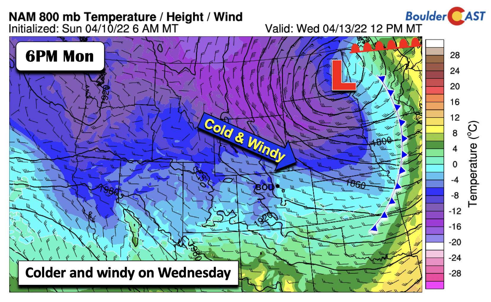
Much of our weather this week will revolve around a very potent mid-level low pressure system that will track from Idaho/northwest Wyoming Tuesday into the upper Midwest Wednesday afternoon and Wednesday night. Our sensible weather will feature a series of temperature swings, breezy conditions, and snowfall for the higher terrain. The system midday Tuesday will be located over far northwestern Wyoming (see below). The trough axis will be over eastern Utah, with deep southwest flow in Colorado.
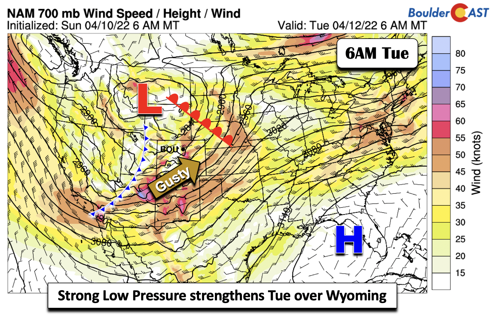
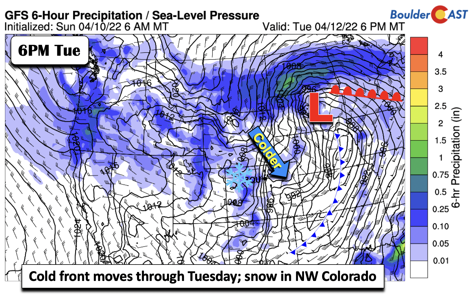
Strong cold front moves through Tuesday
On Tuesday, the early part of the day will be warm once again, but a strong cold front will move through during the morning hours. Lower down in the atmosphere, the potent low pressure will be over southwest Montana early Tuesday, with a cold front over eastern Utah. Eastern Colorado will still be in the warm sector, with brisk to strong southwest flow over the Plains. There are some concerns that ahead of the front, critical fire concerns may exist in the morning to early afternoon given the strong height gradient in place. This is more likely well southeast of Denver, though. Highs will occur early in the day and be in the 50s around Boulder and Denver.
The low pressure system will track into far northeast Wyoming by midday Tuesday. Deep moisture will be found over western Colorado and the higher terrain behind the cold front. In fact, upslope flow over the western part of the state, especially in northwest Colorado, will be in place Tuesday through early Thursday creating a long-duration period of snowfall. Steamboat fans, get excited for a dumping!
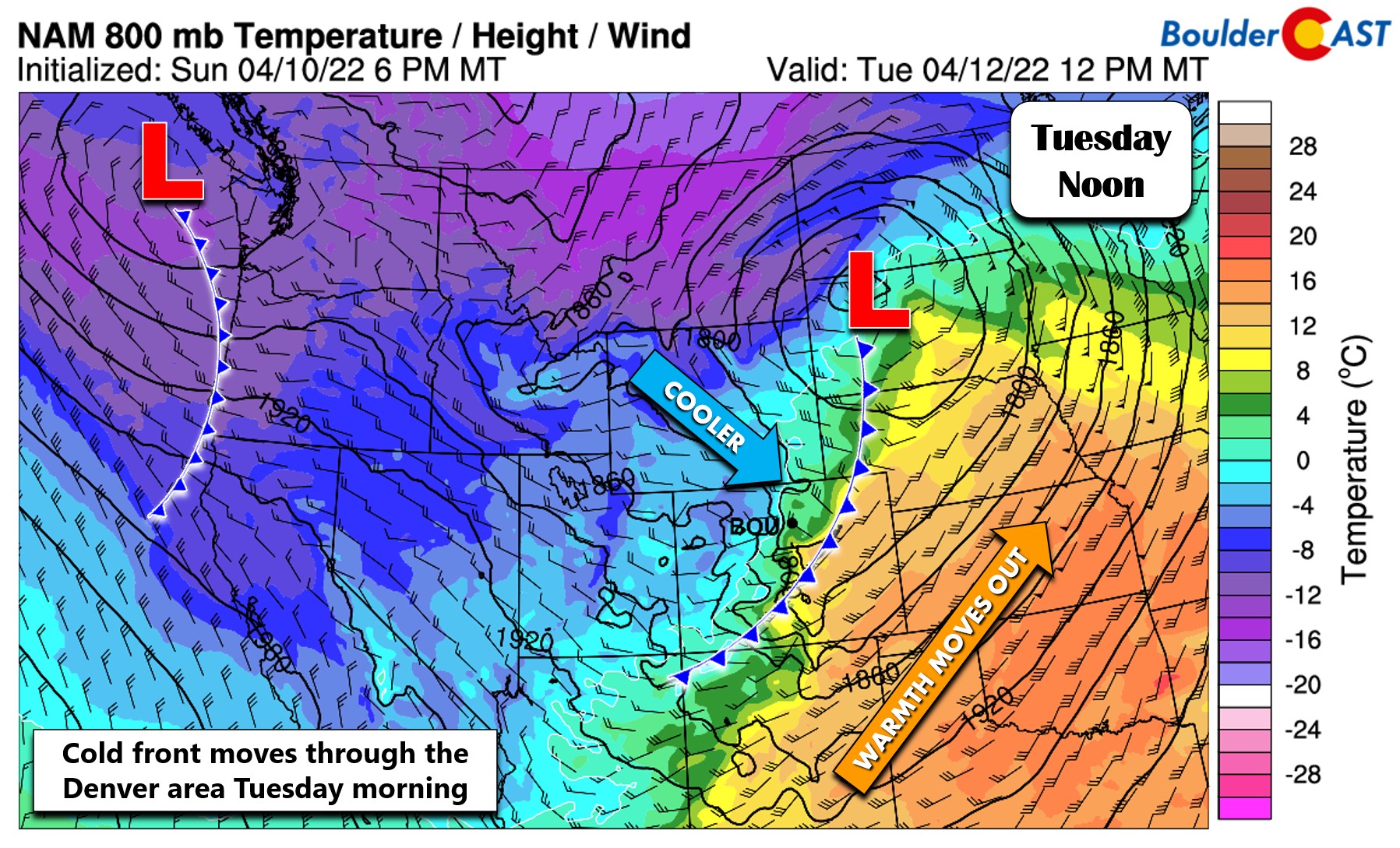
The surface cold front will move through our region sometime during the morning on Tuesday, with the warmth exiting east into the Midwest. Temperatures will plummet into the 20s by early Wednesday, brrr!
The surface low on Tuesday will create severe weather from Texas into Kansas/Missouri and Nebraska/Iowa Tuesday night with strong shear instability in place. Over the Denver Metro, some weak instability ahead of the front could touch off a few showers but we don’t expect much for our neck of the woods.
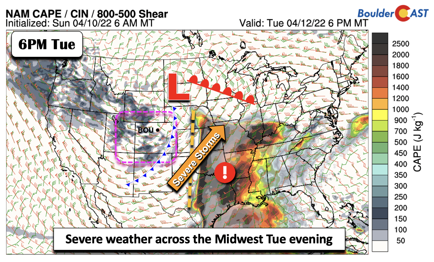
With the surface low taking a northeast track away from Colorado, from Wyoming into the Dakotas, our region will largely be in the downslope regime of the storm. This means that the Plains will be mostly dry. However, the weak instability ahead of the front, along with a brief period of upslope/frontogenesis, could bring a very short duration of rain to snow showers Tuesday during the day. Amounts, if at all, will be light. The main story will be much colder temperatures from the 50s on Tuesday to the 20s by early Wednesday. It will be brisk as well out of the north behind the frontal passage.
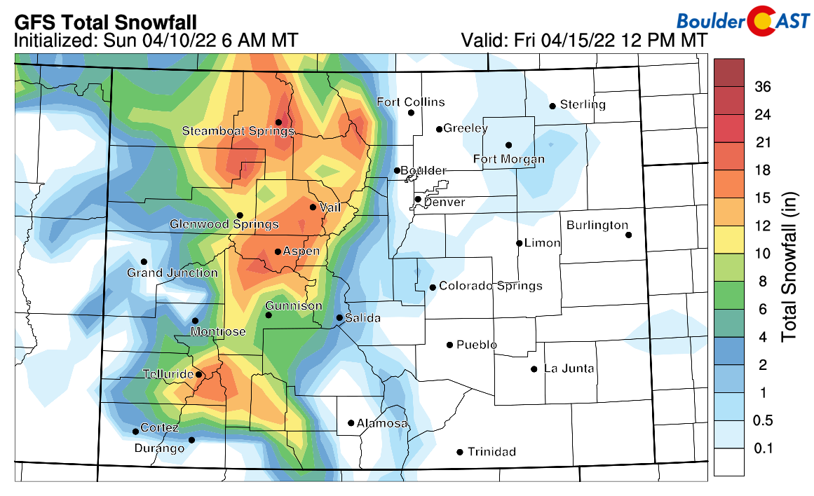
The snowfall forecast from the GFS (below) highlights our snow chances with the front. The snow accumulations are through midday Friday. Notice the pocket of no accumulation for the Denver Metro, although light accumulation near Fort Morgan with frontogenesis. Our forecast calls for just a dusting at best. The main story, as we discussed earlier, will be the mountains seeing 8-16″ of snow, commencing Tuesday and ending by midday Thursday.
Gusty winds & possible fire concerns Wednesday
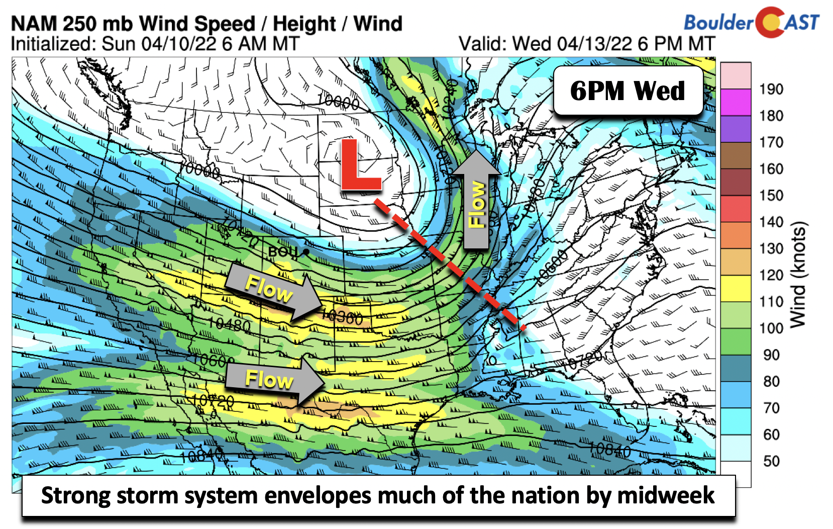
Wednesday is the day we are most concerned about for strong winds and rapid fire growth across the lower elevations. The aforementioned system will move up into western Minnesota by Wednesday evening, leaving Colorado on the backside of a strong northwesterly flow. Winds aloft will range from 30 to 45 mph, perhaps stronger as models better initialize once it develops. As a result, winds at the surface may tap into these winds during the day Wednesday for gusts up to 45 mph.
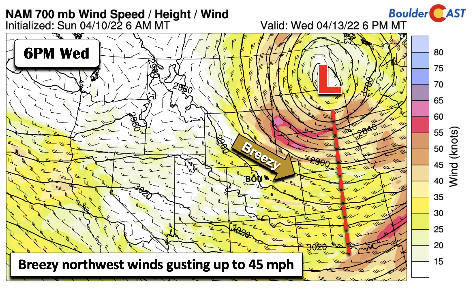
Fuels will also be dry, along with very dry air overhead, as noted by anomalously dry precipitable water values. The combination of dry and breezy conditions will lead to a concern for potential dangerous fire conditions Wednesday.
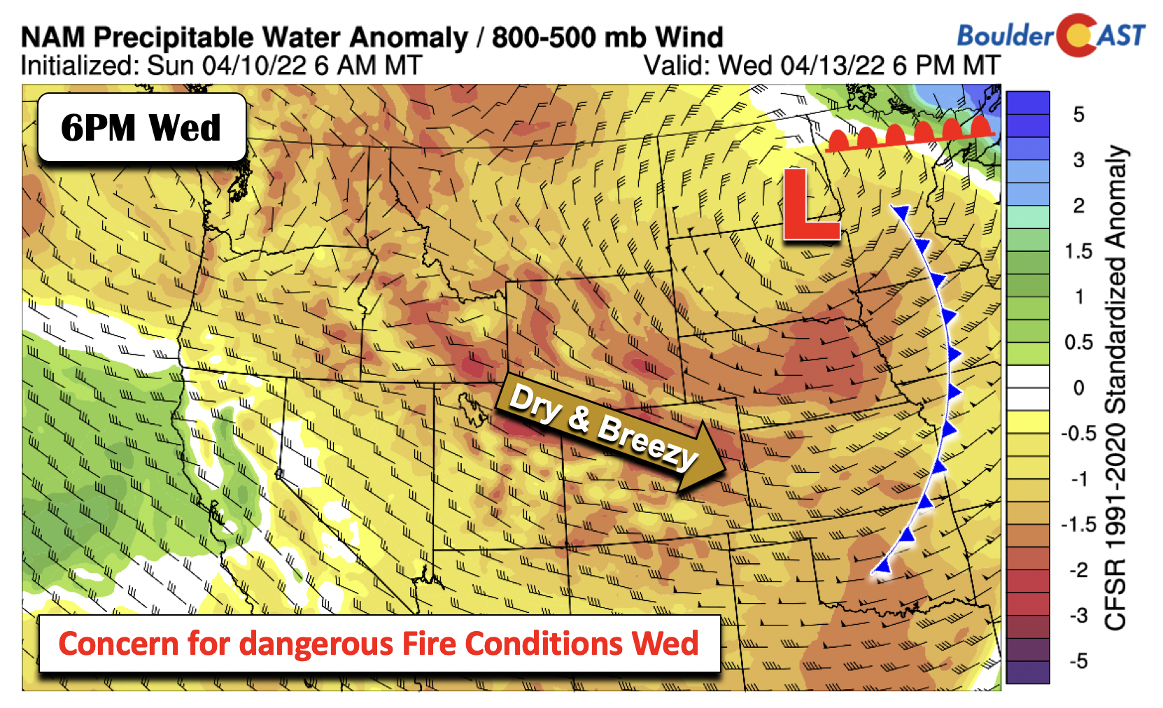
Highs will be rather chilly in the low to middle 40s on Wednesday with cold air still entrenched, from Montana into southern Colorado. A few snow showers will develop with lingering moisture across the higher terrain. Some of these weak showers could spread onto the Plains bringing a few snowflakes into Boulder and Denver as well (no accumulation).
By Wednesday evening, the upper-level jet will extend from Oregon in the northwest, to Louisiana in the southeast. Zonal-flow will start to develop over Colorado, especially by Thursday.
Warmer with seasonal southwest flow remainder of week
Zonal (west to east) flow will be in place Thursday and Friday, spelling out dry and more seasonal weather. The cold airmass should retreat northward as a result, bringing highs back into the 50s Thursday and eventually the 60s to close out the week. In the longer-term, the models are showing a persistent southwest flow over the southwest US, in response to a series of low pressure troughs moving onshore in the Pacific Northwest and tracking up into Montana. Most of these disturbances should stay north of our state, keeping conditions dry for us. However, the jet stream will eventually shift south by late in the weekend, resulting in an increased chance of precipitation, perhaps in the form of rain/snow — that’s way too far out to be concerned at this point.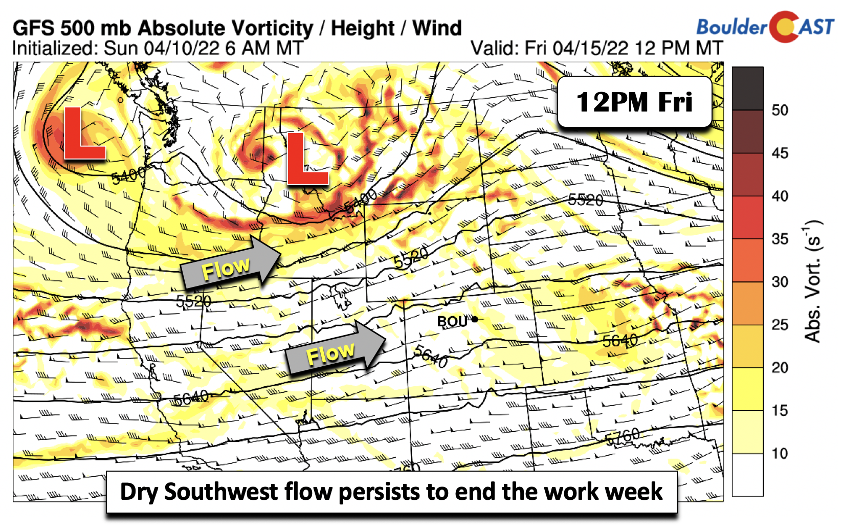
Forecast Specifics:
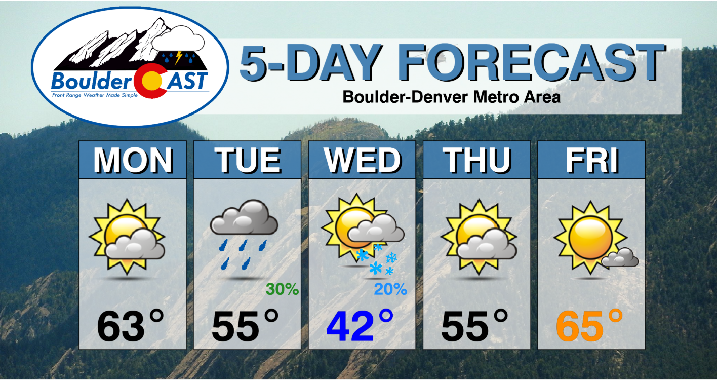
Monday: Warmer weather with highs in the low to middle 60s for the Plains and lower 50s in the Foothills. Some gusty winds at times during the afternoon, especially over southeast Colorado.
Tuesday: Mild during the morning with highs in the 50s, then steady or falling temperatures through the rest of the day. A chance of rain changing to brief snow showers Tuesday afternoon and evening, but little to no accumulation expected. Highs in the Foothills in the 40s. Temperatures plummeting into the 20s by early Wednesday.
Wednesday: Colder, partly sunny, and breezy with elevated fire danger concerns. There could be a few isolated late-day snow showers, mainly across the higher terrain with little to no accumulation expected. Highs in the low to middle 40s on the Plains and lower 30s in the Foothills.
Thursday and Friday: Trending warmer with 50s (40s Foothills) on Thursday and 60s (50s Foothills) on Friday to close out the week. Dry weather expected.
Mountains: Gusty winds will be likely on Monday, especially over the southwest part of the state. Periods of snowfall will be present from central Colorado into northwest Colorado Tuesday through early Thursday. Some areas will see 8-16″ of snow, most favored in the northwest part of the state. Quiet weather, albeit still breezy, will take over Thursday and Friday.
Help support our team of Front Range weather bloggers by joining BoulderCAST Premium. We talk Boulder and Denver weather every single day. Sign up now to get access to our daily forecast discussions each morning, complete six-day skiing and hiking forecasts powered by machine learning, first-class access to all our Colorado-centric high-resolution weather graphics, bonus storm updates and much more! Or not, we just appreciate your readership!
Spread the word, share the BoulderCAST forecast!


You must be logged in to post a comment.