
With Boulder now less than two inches away from the all-time monthly precipitation record for May, unsettled weather will continue through the week, with our next major storm system arriving by Friday.
It is safe to state that May has been fairly soggy across the Front Range. Boulder now rests at 7.57″ of precipitation (as of 8am Monday) for the month, with precip recorded on 23 out of 24 days in May. Unfortunately, the weather gods will not be letting up for at least another week.
As of 8am Monday morning, the axis of the 500mb trough is directly above Denver. This trough will rapidly move north and east by Tuesday, bringing a shortwave ridge to the region. Before this happens, another round of scattered to numerous showers and thunderstorms will commence on Monday afternoon. With the trough passed Colorado, we expect reduced convective instability and therefore less storm coverage compared to the last few days. Precipitation totals on Monday should be relatively light.
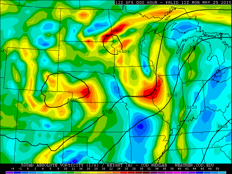
GFS 500mb map valid Monday at 6am. The 500mb low and trough axis are over eastern Colorado.
Tuesday brings a shortwave ridge and weak west-northwesterly downslope. This flow pattern will bring slightly more stable conditions to Colorado. However, with the lingering moisture, daytime heating will fire isolated storms across the area. Tuesday appears to be the driest day of the week.
By Wednesday/Thursday, the next trough is already approaching Colorado, feeding in Pacific moisture to our region. This will increase afternoon storm coverage a tad on both days, with potential severe weather reaching as far west as Boulder County on Thursday. High temperatures will be at or slightly above normal, in the low to mid 70s across the Plains, only helping to feed the storms.
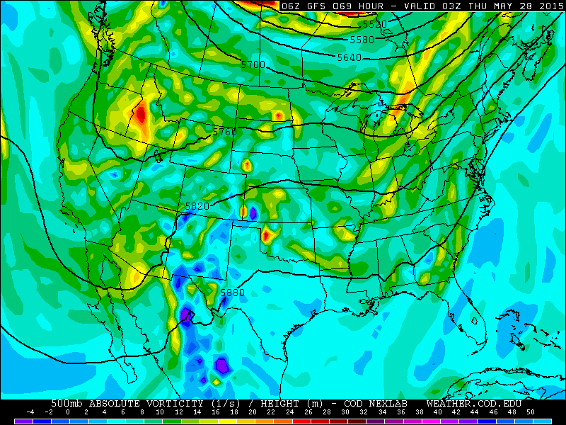
GFS 500mb vorticity map valid at 9pm Wednesday, showing a trough progged to move into the Western US.
Thursday night a cold front is slated to push through Northeast Colorado. This will bring widespread, relatively deep upslope on Friday to all areas east of the Divide. This could be a significant and prolonged precipitation event, but it is still five days out and the models are not in complete agreement right now. There is some indication that this cool upslope could persist into Sunday morning. Between now and Sunday, the models spit out anywhere from 1 to 3″ for all of Northeast Colorado. Late Friday into Saturday, the Mountains and higher Foothills above 9,000 feet may be cold enough for significant snowfall. Only time will tell.
There is a decent chance Boulder will be writing May into the record books, not just for precipitation, but potentially as one of the top five coldest Mays as well. Stay tuned to BoulderCAST for updates through the week!

GFS model cumulative precipitation through Saturday night at midnight.
The Forecast:
Monday: Sun early, with clouds building by late morning. Scattered to numerous showers and a few storms developing in the afternoon, particularly in the higher terrain. Highs in the low 60s on the Plains, mid to upper 50s in the Foothills.
Tuesday: Sun early, with some clouds building afternoon. Only a slight chance of a storm. Highs in the upper 60s, with mid 60s in the Foothills.
Wednesday: Increasing clouds and scattered afternoon thunderstorms. Warmer with highs in the mid 70s, to near 70 in the Foothills.
Thursday: Increasing clouds and scattered afternoon thunderstorms. Some storms could be severe, with large hail and isolated tornadoes being the biggest threat. Highs in the mid 70s.
Friday: Cloudy and cooler. Persistent post-frontal showers and low-clouds. Highs in the mid to upper 50s. Snow levels will be around 9,000 feet, with the potential for significant snow east of the Divide.


You must be logged in to post a comment.