Northeast Colorado could desperately use some rainfall, as we have been parched for the better part of the last two months. Despite the remnants of Tropical Depression 16-E slated to move through the state, the week ahead won’t offer much chance at a reprieve. Read on for all the details.
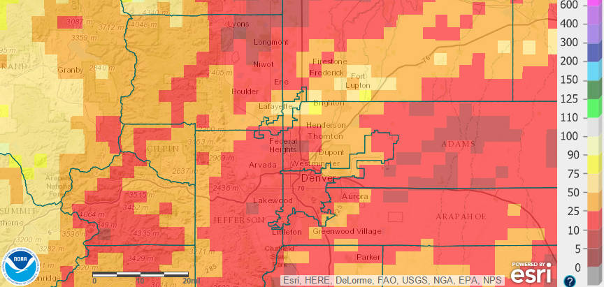
Boulder’s last measurable rainfall occurred more than two weeks ago, on September 7th. The official month-to-date precipitation is a meager 0.06″. The BoulderCAST station is fairing slightly better, at 0.19″ so far this month. Shown below is September’s precipitation, given as a percent of normal. Extremely dry conditions are not just confined to Boulder; the entire Front Range is well below normal for for the month.
As a result, the vegetation has dried out significantly, bringing a high risk of fire to the region once again. For the first time in quite a while, there were a few Red Flag warnings posted last week in the Foothills south of Denver, and today in SE Wyoming. With the current state of our forests, it will only take a little wind to breed dangerous fire weather conditions across the Front Range (which could happen next week).
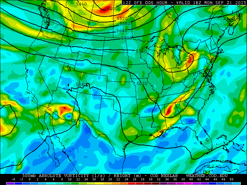
Unfortunately, the week ahead won’t bring much precipitation to our area. As of Monday morning, a broad upper-level ridge is scooting through Colorado, with a trough over the Eastern United States.
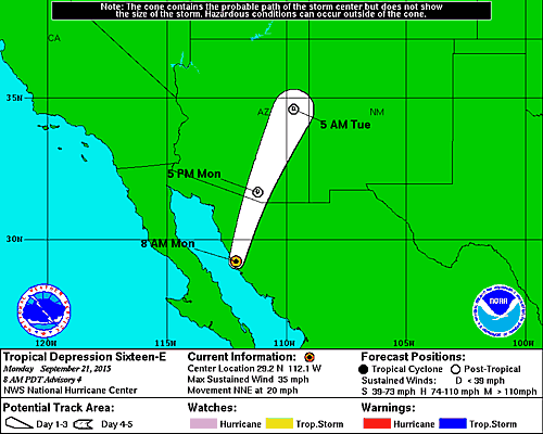
There is an area of disturbed weather, which is Tropical Depression 16-E, in Southern Arizona. The remnants of this very weak tropical system will be impacting (primarily southern and far eastern) Colorado on Wednesday.
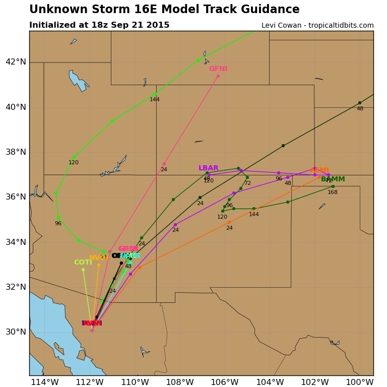
The largest uncertainty in this week’s forecast lies with the track of this system, with model ensemble tracks varying a bit (see below). Most of the guidance takes it near/through SE Colorado, but some have a more westward track. If that verifies, it could bring a little more clouds/precipitation into the area on Wednesday. Even then, it wouldn’t pack much of a punch.
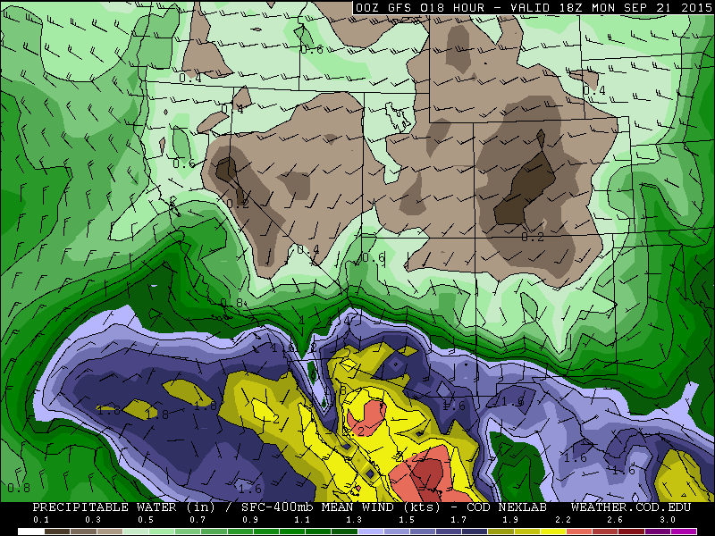
The current airmass across the Inter-Mountain West is quite dry, with Boulder’s precipitable water values around 0.3″ and surface dew points near 30 degrees.
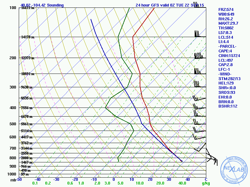
The forecast GFS model sounding for 6pm Monday is shown below.
The lack of any areas where the temperature (red) and dew point (green) lines meet, which would indicate saturated air, equates to a cloudless sky this afternoon, at least across the Plains. However, a near-saturated atmosphere at the 250 mb level may spawn a deck of cirrus clouds today. There is a huge difference between the surface dew point (upper 20s) and temperature (upper 80s), which is called the dew point depression. This will contribute to an overall very dry feeling today, and low relative humidities in the 10-15% range this afternoon. Monday will be the warmest day of the week, with highs in the upper 80s, approaching record values in Boulder (89 degrees) and Denver (88 degrees) for the date. Expect temperatures to remain above normal through the upcoming weekend.
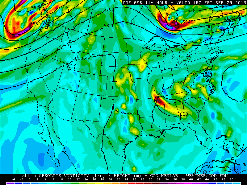
Tuesday will continue the trend from Monday. Moisture will increase slightly as the moisture from Tropical Depression 16-E moves into the state. It will be a tad cooler, in the low 80s, but skies will remain relatively sunny. Tuesday evening into Wednesday, the energy will move northeastward across Colorado (shown below). It has limited forcing, and will remain south and east of Boulder County. We can’t fully rule out a couple of isolated showers or thunderstorms over our area, but most of the action will remain south of Colorado Springs and to our east near the Kansas border. Our best chance (which is a very small chance) of any rain will come Wednesday morning. There may be some isolated to scattered activity, but that will remain confined to the Mountains.
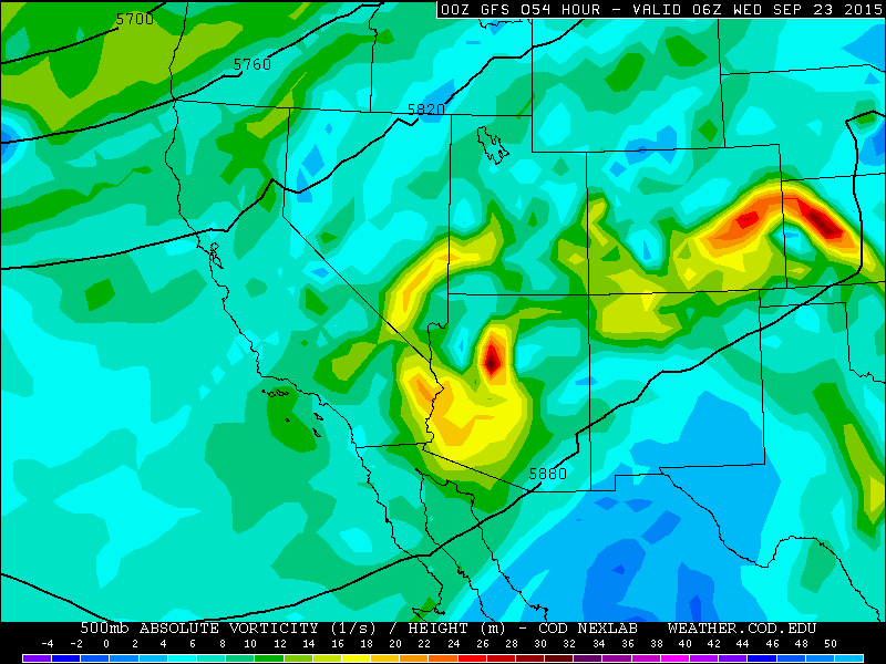
GFS 500mb vorticity map, valid at midnight Tuesday night. Notice the pockets of vorticity passing through Southeast Colorado.
With the energy east of Denver on Wednesday, conditions should remain partly to mostly sunny for Boulder County. The airmass will stay warm, with highs in the low 80s.
For Thursday and Friday, a tilted ridge rebuilds firmly across Colorado. This will keep dry and sunny conditions across the state both days, with warm temperatures in the 80s.
Looking ahead, cooler air and a chance of much-needed rain (and mountain snow!) is progged for Colorado by early next week. Our next weather system becomes visible in the upper left corner of the map above. The models have been handling this trough quite differently, which is expected since it is more than a week out. However, it looks promising, at least, that next week’s post may be more exciting!
The Forecast:
Monday: Mostly sunny and hot, with temperatures approaching record values. Highs in the upper 80s across the Plains, low 80s in the Foothills.
Tuesday: Partly sunny and warm. A very slight chance of a few isolated late-evening showers or storms, mostly south and east of Denver, however. Highs in the low to mid 80s across the Plains, upper 70s in the Foothills.
Wednesday: Extremely isolated light showers and storms will be possible, mostly in the morning. Widely scattered storms may form over the Mountains, particularly south of Interstate 70. Elsewhere, mostly sunny. High temperatures near 80 degrees with mid 70’s in the Foothills.
Thursday: Sunny and warm. Highs in the low 80s across the Plains, with 70s in the Foothills.
Friday: Mostly sunny and pleasant. Highs in the low 80s across the Plains, and 70s in the Foothills.
Source
Mon
Tue
Wed
Thu
Fri


BoulderCAST
88
83
81
83
81


NWS
88
83
76
80
80


AccuWeather
87
82
82
82
80


The Weather Channel
86
83
83
81
81
Last week’s recap:
Here are the results of last week’s forecast. First, the forecasts and observations:
The consensus was for temperatures to begin quite hot, but cool off significantly with a cold frontal passage on Wednesday night. There was no precipitation in the forecast at all, which verified, as much of Northeast Colorado struggled to even form any clouds through the week.
Now the error analysis. Shown is the amount of degrees (in Fahrenheit) that each source was off from the mean observed temperature for Boulder. Positive values indicate the forecast was warmer than what actually occurred, while negative values arise from a forecast that was cooler than what was observed.
Most days this week were forecast exceptionally well by most outlets. The day with the largest error was Wednesday. It warmed up several degrees more than expected ahead of the cold front passage. However, the post-frontal cooler air mass was forecast nearly perfect!
The bottom row of the error table shows the weekly mean error for each weather outlet, a good measure for who was the best and more consistent “forecaster” for the week. Not surprisingly, the best overall forecast for last week goes to BoulderCAST, with only 0.7 degrees of error averaged across the period. In fact, as you can tell, BoulderCAST had the best forecast each and every day of the week. This is no small feat. Way to go Andy! We look to continue this trend with our forecast this week!
—
If you haven’t already done so, follow us on Twitter or Facebook for frequent weather updates and subscribe to the site to get these posts automatically delivered to your email box (enter your email in the sidebar widget to right).



You must be logged in to post a comment.