Wednesday’s snow storm played out much as expected across the Boulder and Denver area. We review the snow totals, this morning’s sub-zero temperature readings, and look ahead to why the cold air will be lingering for a while.
BRR!
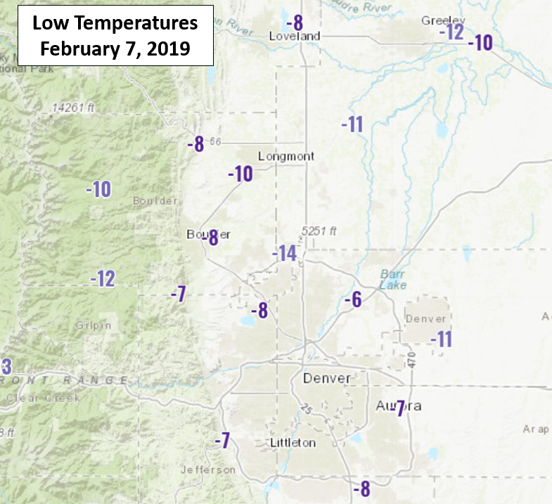
Today was coldest morning in Boulder in more than 2 years! Officially, the city bottomed out at -9 °F. We reported only a comparatively balmy -5 °F at BoulderCAST Station. Skies cleared overnight a little bit earlier than the models were showing. This allowed for excellent radiative cooling to take place with all that fresh snow on the ground. The map below shows observed low temperatures this morning across the Front Range. As is normally the case, hyper-local effects related to topography and urban heat island influences led a wide variety of temperatures. Regardless, the common theme throughout was COLD!
A timeline of Wednesday’s weather happenings is shown below.
Here are a few highlights from this eventful day:
- The high temperature for the date was at 12:00 AM (24 °F) and the low was at 11:59 PM (1 °F)
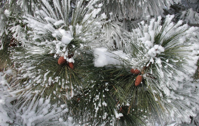
- The positioning of the pre-frontal cold air mass was something the weather models struggled with all week long. The cold air’s extra early arrival combined with an influx of moisture from the south to produce fairly widespread and dense freezing fog Wednesday morning before the snow began. The trees sure looked pretty!
- Though the snow started a little earlier than expected, ironically this is actually because the large-scale storm system was moving slower than forecast. We discussed this in a Premium Storm Update Wednesday morning. The slower storm allowed an overhead jet streak to partially overlap with moisture, leading to a localized banding at the on-set of the snowfall.
- Moderate to heavy snow began around 11:00 AM near and north of Boulder. This band eventually surged across the Metro area through the afternoon producing 2 to 3″ of quick accumulation. Lighter snow followed-up as the true “Arctic” airmass arrived around 2:00 PM and shallow upslope ensued.
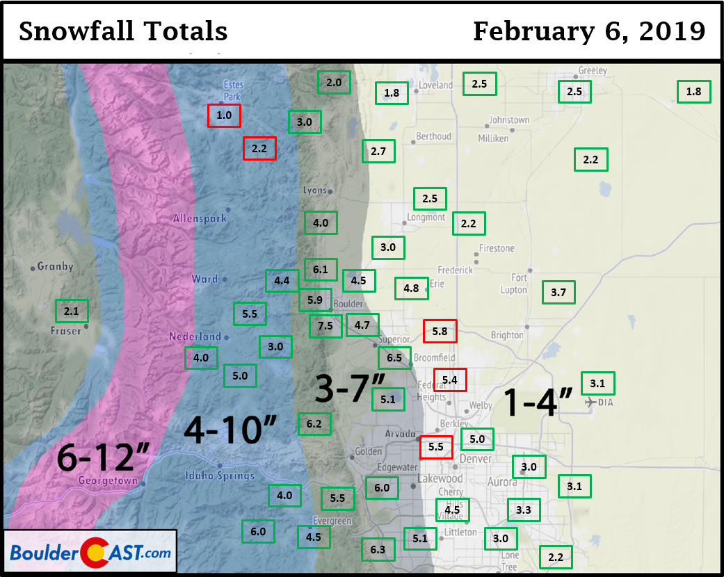
When the snow finally came to an end around midnight Wednesday night, totals looked like this:
- 1 to 3″ from Longmont northward
- 2 to 5″ in Denver east of I-25
- 4 to 7″ in Denver west of I-25
- The highest reported total was Boulder’s official observation of 7.5″
- Denver International Airport recorded 3.1″ making this the biggest snow event in Denver in over a year! Pitiful…
| Seasonal Snow Totals (Updated Feb 7 2019) |
|---|
| Boulder | Denver |
|---|---|
| 54.3" | 17.5" |
Shown below is our original snowfall forecast map (issued Tuesday evening), with the observed storm totals per location contained in boxes. Green ones indicate that the observed snowfall was within one inch of the given forecast range, while red was outside the scope of our forecast.
The cold will stick with us
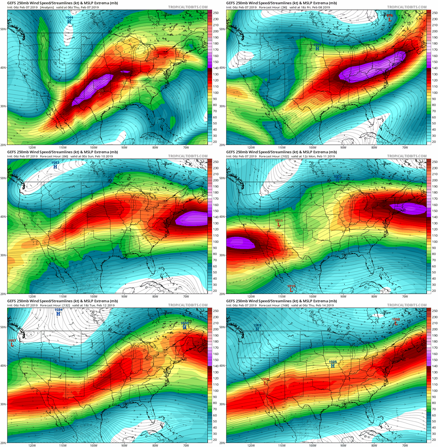
As we move through the weekend and into next week, general troughing will continue across the western United States. The animation of 250 mb winds below has the jet stream staying south of Colorado for the next week or so, with several weak and sheared troughs entering the Pacific Northwest.
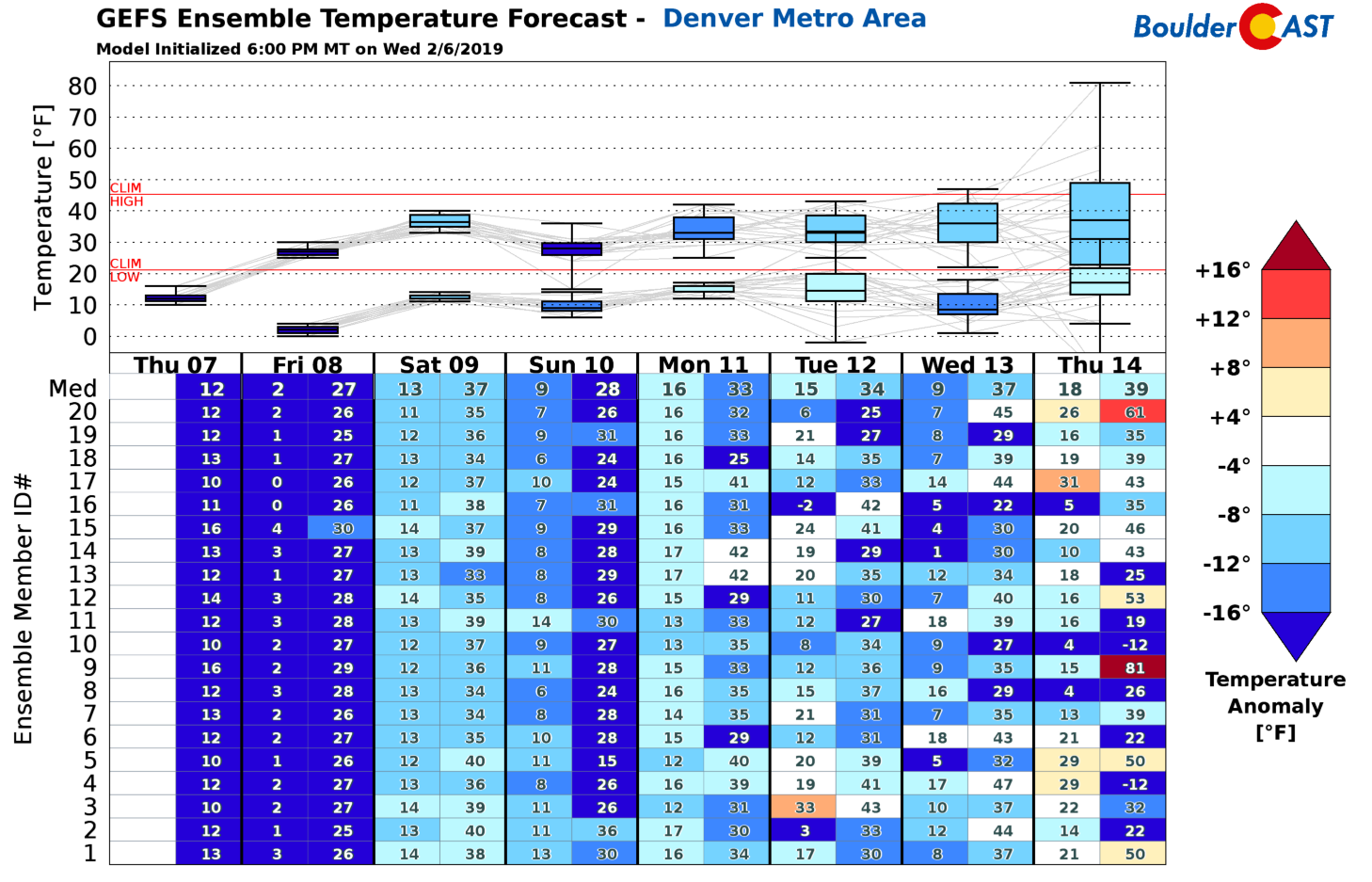
So what does this mean for our weather? Well, in the near-term, temperatures will remain below normal. Weak ridging will help moderate things some on Friday and Saturday, but another storm will be moving through early Sunday with the potential for yet another back-door Arctic front. This will curb the warming trend and likely knock temperatures back down on Sunday. The GFS ensembles depict a cold, rocky ride ahead (below).
The light at the end of the tunnel may be the middle of next week when there are hints in longer-range guidance of the possibility of some slightly warmer weather. In fact, GFS ensemble member #9 is forecasting 81 degrees next Thursday in Denver, which would be a new record high. Though, something smells fishy as that day also has a low of 15 degrees in the morning. A 65-degree diurnal swing in temperature would be in incredible, even for Colorado!
If things stay on-track, our next chance of precipitation will accompany that back-door Arctic front Saturday night into Sunday morning. Based on current model soundings, the cold air, upslope, and moisture look to be very shallow. This has us leaning towards a better chance of freezing drizzle than snow. Either way, the impacts will probably be minor and short-lived.
Have a good week’s end!
Share this winter weather update:
.




You must be logged in to post a comment.