Yesterday was absolutely wild across essentially all of eastern Colorado as dozens of supercell thunderstorms slammed the region with widespread damaging hail and flooding rains, while up to a dozen tornadoes touched down on the far eastern Plains. Fortunately, Mother Nature’s encore performance of severe weather on Thursday isn’t expect to be quite as bad, but the risk remains relatively high again for damaging hail and locally flooding downpours in the Front Range. Let’s dive in! (yes, that was a pun)
T
he shear number of discrete supercell thunderstorms present across eastern Colorado Wednesday night as the sun went down was remarkable to say the least!
The shear number of discrete supercells across eastern Colorado as the sun goes down this evening is remarkable 😲🎇 #cowx pic.twitter.com/cAM2mWlWAM
— BoulderCAST Weather (@BoulderCAST) June 22, 2023
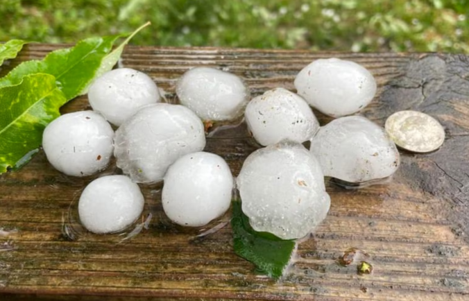
By now you’ve probably already seen the chaos that unfolded as golf ball-sized hail pummeled the unsheltered crowd at Red Rocks. It’s hard to imagine escaping this scenario without injury — and indeed many concert-goers met that fate….
Tonight was the scariest night of my life. It started pelting people with hail at Red Rocks and my sister and I luckily found shelter under a sign. I am bleeding and have huge bumps on my head from the hail. Hoping everyone made it out safely. pic.twitter.com/jong1SBuYd
— nicole (@nikkitbfh) June 22, 2023
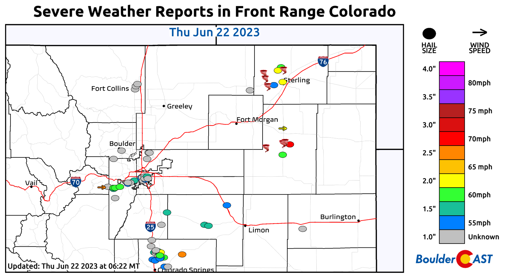
Wednesday’s severe weather reports show a superfluity of destruction across the Front Range.
We had a severe-warned storm produce a few 1″ hailstones in south Boulder, but clearly the focus was elsewhere. The line from Evergreen, through Red Rocks (sadly) and into downtown Denver got slammed by at least three different hailstorms in a row Wednesday evening.
Feel bad for those located under this train of big hail producers! 😳 #cowx pic.twitter.com/QYCv47f9gM
— BoulderCAST Weather (@BoulderCAST) June 22, 2023
This train of hail-producing thunderstorms was a feature that short-range models latched onto beforehand and something we brought attention to earlier in the evening. Hindsight is 20/20 of course…
It may be quiet in much of the Metro area now, but there is surprisingly good model consensus that this red area could get hit hard tonight with hours of heavy rain & hail of all sizes. The risk will be greatest 8PM-2AM. Sleep + dark + hail + flooding is never a good combo! #COwx pic.twitter.com/kfKa3EpxnK
— BoulderCAST Weather (@BoulderCAST) June 22, 2023
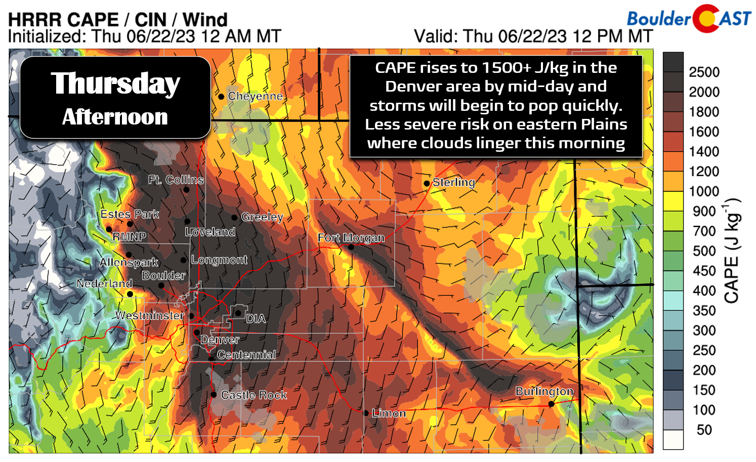
Unfortunately as bad as it was yesterday, things will unfold similarly again for us on Thursday, albeit at a less widespread scale, as the severe weather setup across eastern Colorado remains mostly unchanged. Despite an overnight push of cooler air, instability will again be through the roof this afternoon with CAPE exceeding 1500 J/kg across the Denver area, and this explosiveness will be tapped into much earlier in the day compared to Wednesday.
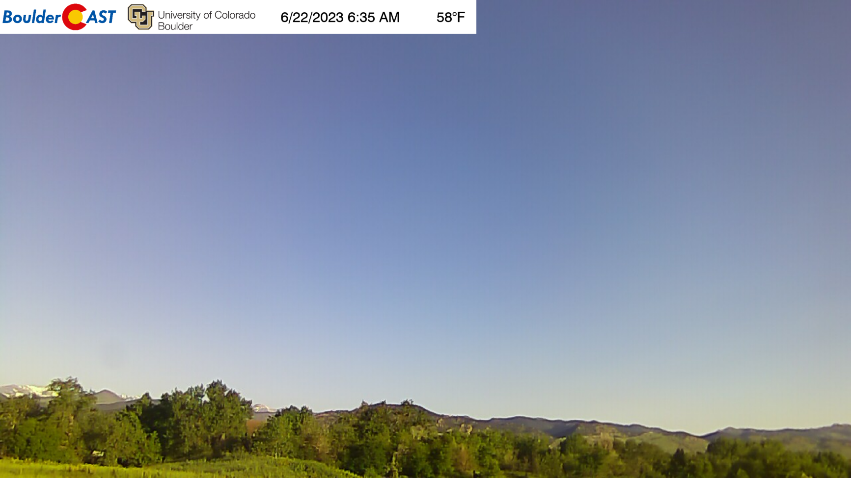
The one thing that could have helped suppress today’s severe risk — which we discussed yesterday — was morning stratus clouds. Unfortunately those have not materialized as of writing. We’ve got bluebird skies here in Boulder this morning:
GOES-East shows that there is some stratus banked up against the terrain, but that deck is only present south of the Palmer Divide from Colorado Springs to Pueblo shaded in pink below.
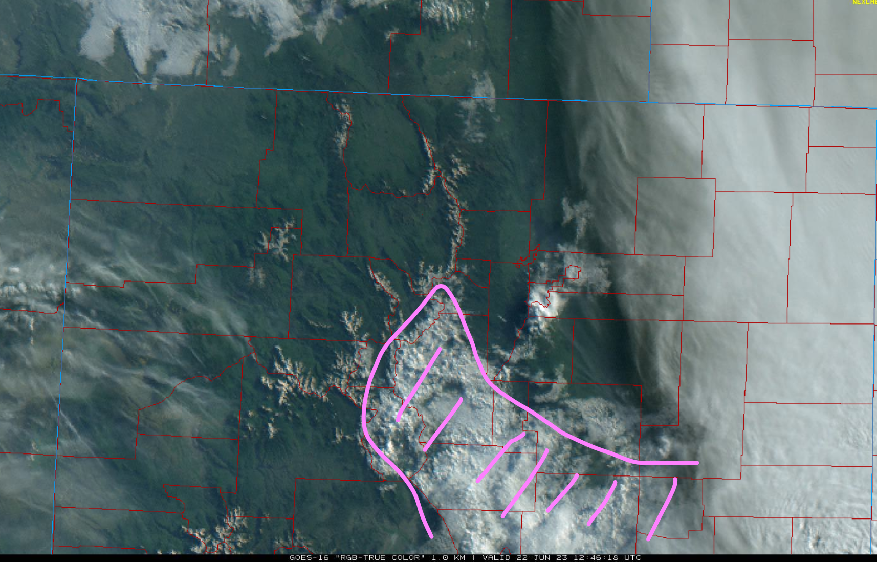
GOES-East visible satellite image from Thursday morning showing low clouds (pink) over parts of eastern Colorado (but no the Front Range!)
In any case, strong storms and a few supercells will begin to fire around midday over the higher terrain and spread eastward quickly during the afternoon hours into the Boulder-Denver area. Any of these cells will be capable of producing hail up to 2″ in diameter, heavy rain, and 60 MPH wind gusts. An isolated tornado or two is also possible. The HRRR model is leaning towards a more “typical” stormy day for us with things unfolding primarily during the afternoon to early evening. Unlike yesterday, storms should die down quickly by sunset if not earlier for our immediate area as they track off to the east and southeast becoming someone else’s problem…
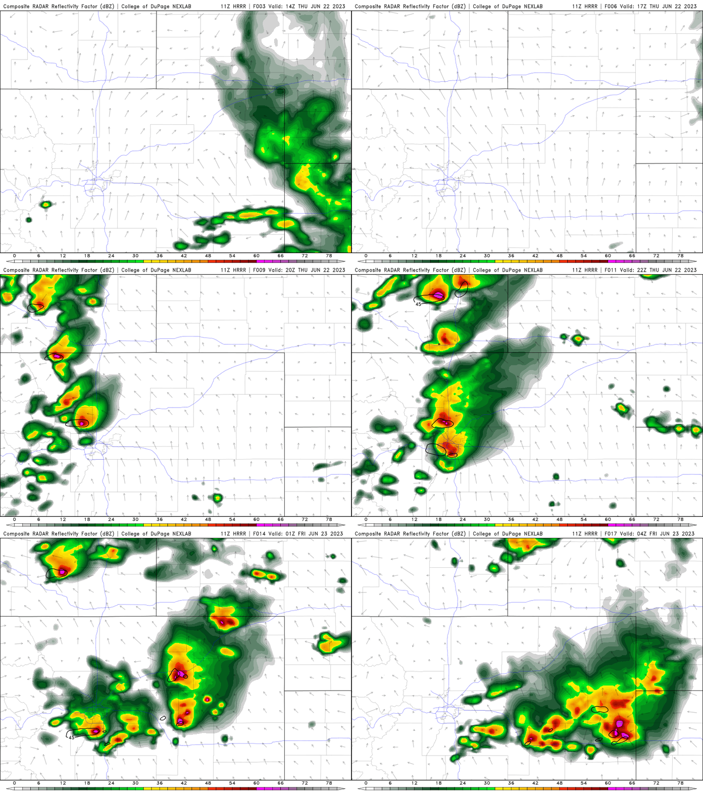
HRRR model-simulated radar animation for Thursday. Hail producing storms fire in the mountains by midday and spread eastward through the afternoon/evening
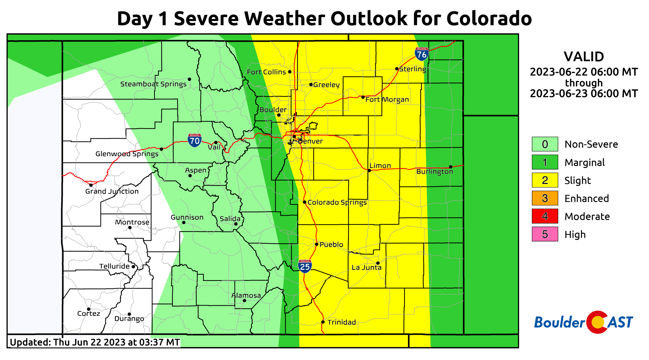
The Storm Prediction Center has a huge slice of eastern Colorado at Slight Risk for severe storms today. While not quite up to the “Enhanced” category we had yesterday, don’t let your guard down! Outside of major and rare severe weather outbreaks, today’s risk level is typically about as bad as it gets here in the Front Range!
The risk of flooding is somewhat lower today as well, except in the saturated parts of eastern Denver which picked up more than 2″ of rain already yesterday. The most likely area to see excessive rainfall from training or stalled storms today is well southeast of our area. Lucky spots could receive over 1″ of rain this afternoon/evening, but most of us will see 0.5″ or less. The main concern is damaging hail up to golf ball sized or so!
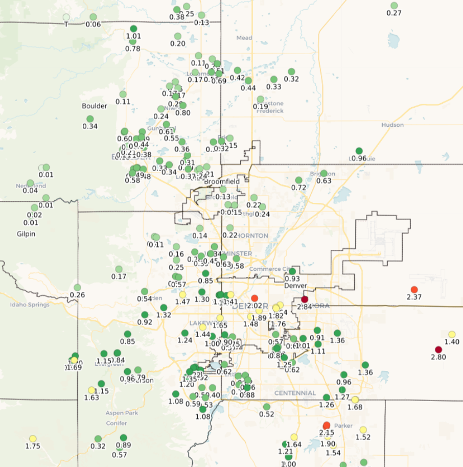
Observed rainfall totals from Wednesday and Wednesday night. 1-3″ of rain was reported in a narrow swath along the I-70 Corridor through Denver
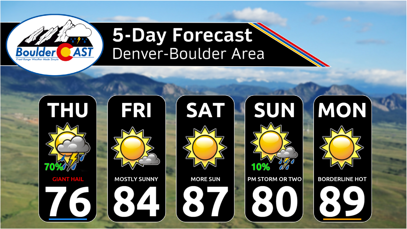
Expect morning sunshine to be replaced quickly by towering storm clouds which will continue to spread east the rest of the day. There may be some clearing before sunset for western and northwestern areas, including Boulder. High temperatures will reach the middle to upper 70s for most of us, but a few eastern areas that avoid clouds the longest may get into the lower 80s. The chance of rain is around 60%.
Fortunately the severe weather will subside in the coming days and push towards far eastern Colorado, Nebraska, and Kansas. Beyond Thursday, the extended forecast is mostly dry and warm across the Front Range as high pressure builds into the south-central United States.
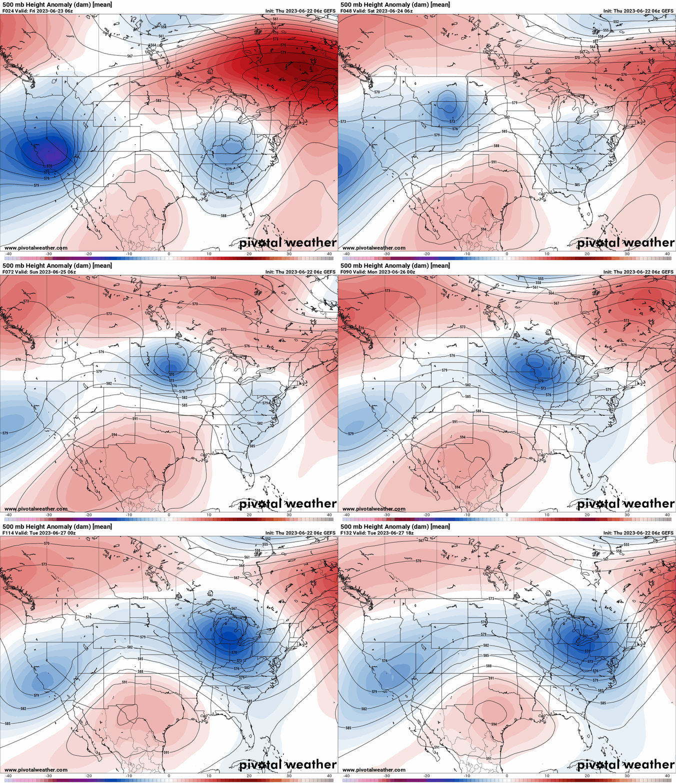
GFS ensemble mean 500mb height anomaly forecast animation from Friday through Tuesday. High pressure builds over Texas and northern Mexico.
As unlikely as it may be, we’re hopeful that everyone dodges the big hail today. Personally we’re looking forward to the drier and less chaotic weather this weekend and beyond, despite what it will mean for our temperatures (they will be shooting up next week). Stay safe and enjoy the weather!
Daily Forecast Updates
Get our daily forecast discussion every morning delivered to your inbox.
All Our Model Data
Access to all our Colorado-centric high-resolution weather model graphics. Seriously — every one!
Ski & Hiking Forecasts
6-day forecasts for all the Colorado ski resorts, plus more than 120 hiking trails, including every 14er.
Smoke Forecasts
Wildfire smoke concentration predictions up to 72 hours into the future.
Exclusive Content
Weekend outlooks every Thursday, bonus storm updates, historical data and much more!
No Advertisements
Enjoy ad-free viewing on the entire site.
Get BoulderCAST updates delivered to your inbox:
Enjoy our content? Give it a share!




You must be logged in to post a comment.