
Page 64 of 550
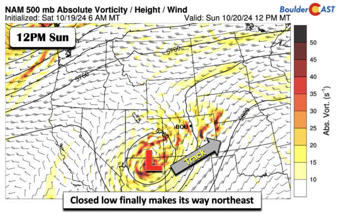
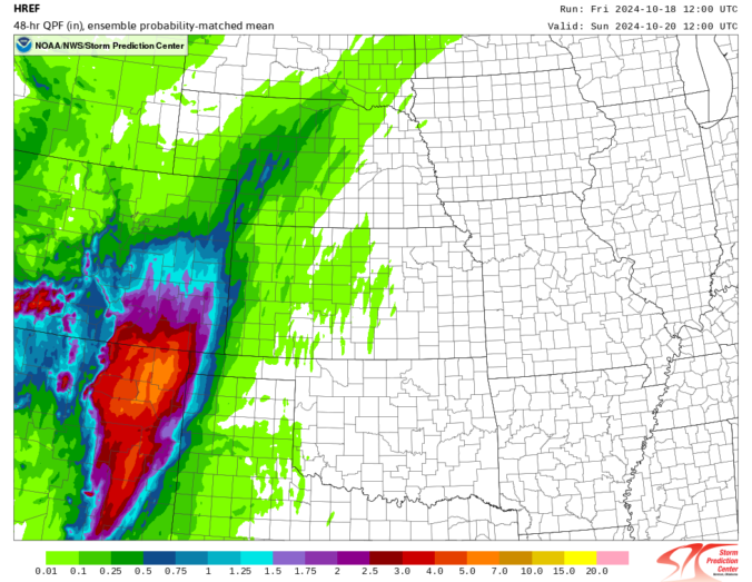
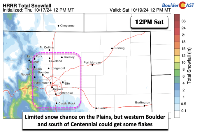
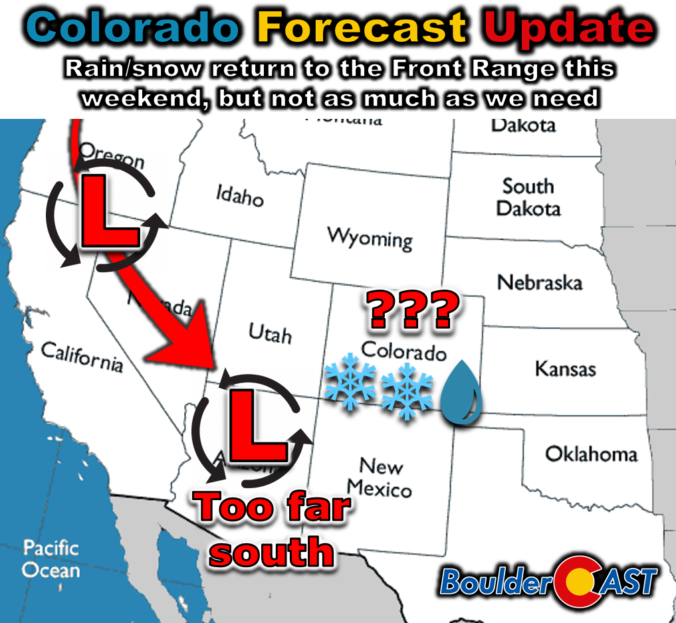
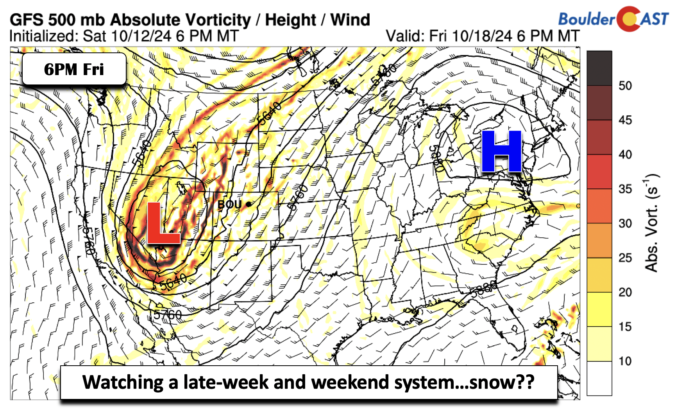
It’s been quite a long time since our last measurable precipitation in the Front Range, but that will change abruptly this weekend with the arrival of our next autumn storm system. Unfortunately the slow-moving low pressure will dive too far south into Arizona, largely fizzling out before ever reaching northeast Colorado. Nonetheless, it will bring a bit of rain, snow and much colder temperatures to our area for a few days. Read on for our latest thoughts on how the unsettled weekend ahead will play out. We also briefly review the entries to our 2024 First Snowfall Contest with predictions actually trending towards a later date than Boulder’s climatology would suggest (color us shocked!). There will indeed be some snowflakes in our forecast domain this weekend, but Boulder is not expected to see accumulating snow.
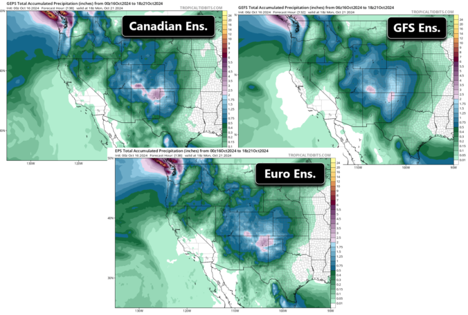
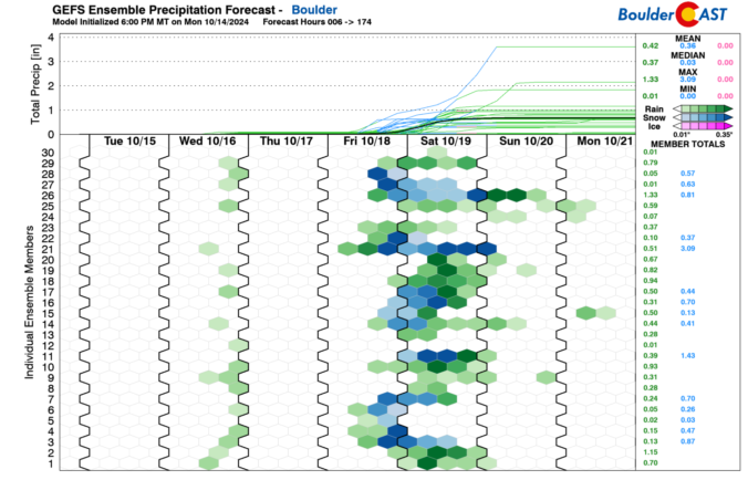
Temperatures across the Front Range will remain unseasonably warm for much of the week ahead pushing into the 70s and 80s. Precipitation will once again be vacant from the forecast early this week with no major weather systems to speak of. However, that all changes as we head into Friday and the weekend as our team is tracking a strong storm system that is taking aim on Colorado. Rather large uncertainty still remains in the exact outcome for us, but we discuss the odds of seeing our first snow and/or much-needed rainfall.

Live View of Boulder

Current Conditions

Live Radar

Recent Premium Posts

BoulderCAST Daily – Thu 01/15/26 | Fire Danger Today Before a Cold Front Tonight
🔥 Fire danger rising — Warm and windy today ahead of a strong …
BoulderCAST Daily – Wed 01/14/26 | A gorgeous Wednesday ahead of increasing fire danger & a stronger cold front tomorrow
🌬️ Weak front overnight — A weak cold front slipped through around 9:30 …
BoulderCAST Daily – Tue 01/13/26 | A thick blanket of high clouds won’t stop us from reaching the 60s again
☁️ Thick cloud deck overhead — Moisture streaming in aloft brings widespread mid‑ …
3-Day Forecast

Trending Content

© 2026 Front Range Weather, LLC