



Page 57 of 585
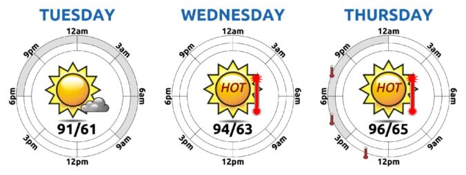
If you’ve been quietly rooting for a late-season monsoon comeback, it might be time to recalibrate. Boulder’s summer has been historically dry, and this week won’t offer much relief, at least initially. A persistent ridge of high pressure is set to lock in more heat and keep moisture at bay. But don’t tune out just yet—there’s a subtle pattern shift coming that could open the door to cooler temps and better storm chances by the weekend. Let’s take a closer look.
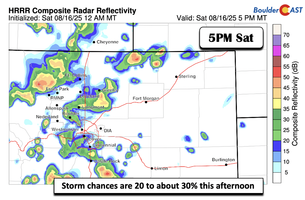
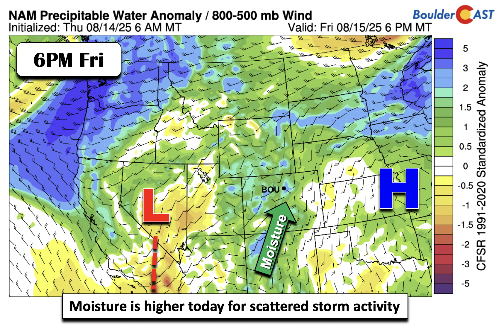
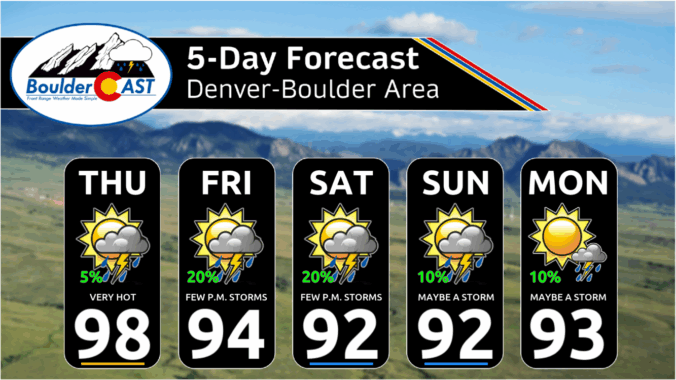
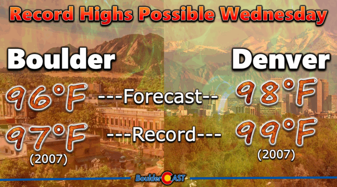


After a weekend of thunder and cooler air, the Front Range is catching its breath under clear skies and a brief spell of dry northwest flow. But don’t get too comfortable—heat, haze, and a few storm chances are already lining up for a return later this week. In this update, we break down the shifting ridge pattern, what it means for temperatures, and when wildfire smoke and monsoon moisture might make a comeback.

Live View of Boulder

Current Conditions

Live Radar

Latest Smoke Forecast

Recent Premium Posts

BoulderCAST Daily – Sun 09/27/26 | A Mild Sunday, Followed by Wet Weather This Week
☀️ Mild Sunday — Highs well into the lower 80s with a few …
BoulderCAST Daily – Sat 09/26/26 | Quiet Weather, But Wet Weather Is Brewing Next Week Tied To A Tropical System
☀️ Weekend calm — Weather is quiet this weekend in the lower 80s …
BoulderCAST Daily – Fri 09/25/26 | A Stormy Friday, Followed by a Quiet Weekend
🌧️ Friday storms — Another wave brings afternoon scattered showers and storms ☀️ …
3-Day Forecast

Trending Content



© 2026 Front Range Weather, LLC