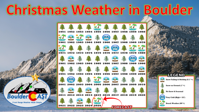
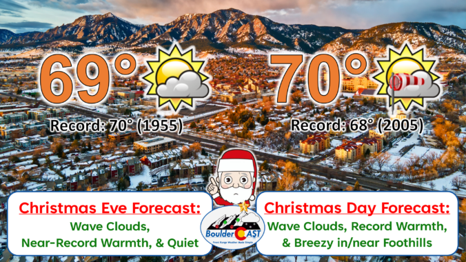
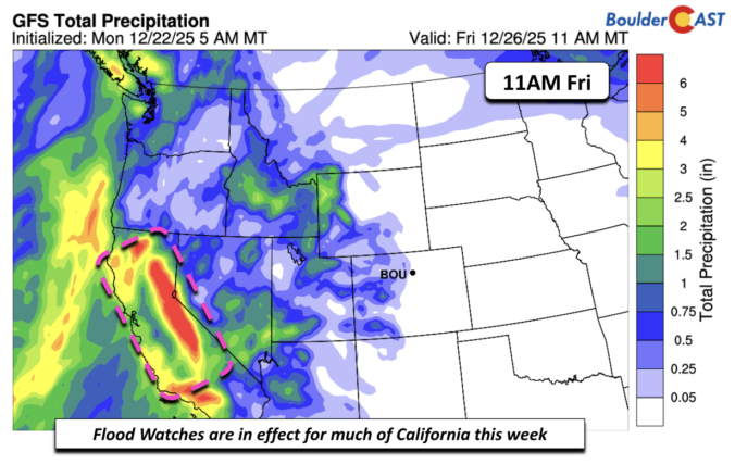
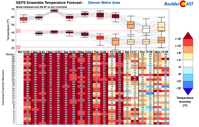
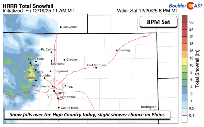
December has been anything but typical along the Front Range, with Boulder shattering warmth records and enduring weeks of bone‑dry weather that have fueled fire danger and stressed our local trees. As we head into Christmas, the holiday will feel more like patio season than sledding weather, with record highs likely and no snow available outside of the Mountains. But don’t pack away the winter gear just yet—a sharp cooldown and even a chance for light snow are on the horizon this weekend. We take a closer look this historically warm and dry December, the scorching Christmas forecast, and peek ahead to what’s next.

Page 4 of 549
As we head into what’s normally the coldest stretch of the year along the Front Range, the atmosphere has other plans. Instead of Arctic air and snow globe conditions, we’re staring down a week of springlike warmth, fire weather concerns, and multiple shots at breaking long‑standing temperature records—including on Christmas Day. We’ll walk you through why this pattern is so unusual, what it means for Boulder and the Foothills, and where you can still find real winter this week if you’re craving it.

Winds are howling across the Foothills this morning, with gusts topping 70+ MPH and fire danger at historic levels. For the first time ever, Colorado is under a Particularly Dangerous Situation Red Flag Warning—an extraordinary designation from the National Weather Service. While Boulder itself could dodge the absolute most extreme winds, conditions remain somewhat uncertain overall, and things will definitely be highly volatile in the Foothills. We breakdown the latest model updates and step through how this dangerous Friday will unfold across the area.
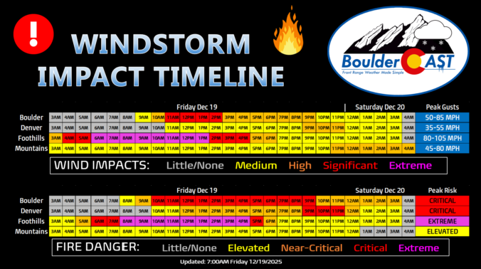
Updated (7AM Friday 12/19): Updated based on latest guidance adjusting timings and intensity of wind/fire impacts, and also made a stronger case for the extreme winds (and fire danger) to potentially stay mostly in the Foothills or very close to there. Lowered wind/fire risk in Boulder proper. This is still a very dangerous situation.
—
Boulder, the far western suburbs of Denver, and the Foothills are bracing for yet another powerful mountain wave windstorm Friday, with gusts likely topping 75–100 MPH and, this time, extreme fire danger will be layered on top. Forecast models show the strongest winds during the morning into the afternoon, coinciding with critically dry air and record‑challenging warmth. Power shutoffs, downed trees, and blowing dust are all on the table, but the bigger story is the fire risk—conditions are primed for rapid spread if any ignition occurs. Fortunately it now appears that most of the intense winds will stay largely in the Foothills, but there is some uncertainty how far downhill and east they will reach. Read on for the full breakdown of timing, impacts, and what you need to know to stay safe. We also briefly review the damaging wind event that just occurred on Wednesday.

Live View of Boulder

Current Conditions

Live Radar

Recent Premium Posts

BoulderCAST Daily – Sat 01/10/26| Widespread sunshine and moderating temperatures this weekend as our recent snow melts off
🌤️ Calm Saturday: Winter storm systems have departed the state, leaving behind a …
BoulderCAST Daily – Fri 01/09/26| Snow ends quickly this morning with a quieter weekend in store
❄️ Overnight snow bands: A second push of upslope after midnight sparked narrow …
BoulderCAST Daily – Thu 01/08/26 | Snow develops today but still some uncertainty, amounts have been lowered
❄️ Snow develops today: Snow develops today, but uncertainty still lingers with two …
3-Day Forecast

Trending Content

© 2026 Front Range Weather, LLC