
Page 19 of 577


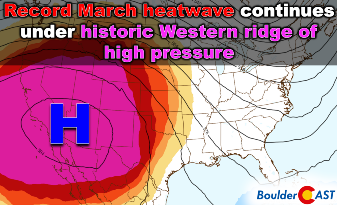
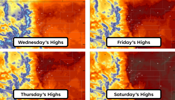
Wednesday’s remarkable 80° warmth marked the start of a stretch that’s far more reminiscent of early summer than mid‑March here in Colorado. An unusually strong ridge of high pressure is now locked over the region, setting the stage for several more days of exceptional heat with widespread record temperature destruction and increasing fire concerns. A brief cooldown will arrive over the weekend, but the broader pattern remains firmly tilted toward above‑normal temperatures the rest of the month, including a secondary heatwave already brewing for next week. Here’s a look at how this historic heatwave setup will unfold across the Front Range in the many days ahead.
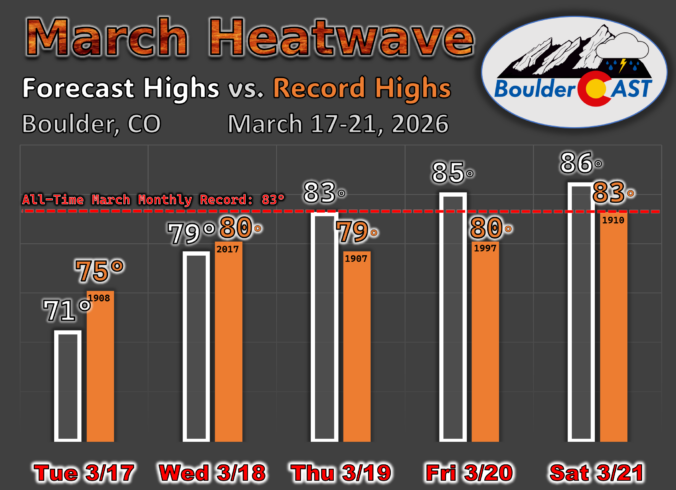
Colorado may be easing into the week on a calm, cool note, but the atmosphere has no intention of staying quiet — and the shift ahead isn’t the one you might expect. While a major storm system pounds the eastern half of the country, a powerful ridge is quietly taking shape off the West Coast, ready to drive an exceptional, record‑shattering March heatwave straight into the Front Range. With gusty downslope winds on the way and the strong likelihood of multiple all‑time records falling, this week is all about the heat. How hot will it get and when will the heatwave end? Let’s take a look.

Saturday’s storm didn’t quite live up to its wind hype, but it still delivered a sharp overnight front and a quick burst of convective snow before sunrise on Sunday.

Live View of Boulder

Current Conditions

Live Radar

Latest Smoke Forecast

Recent Premium Posts

BoulderCAST Daily – Sat 08/01/26 | Hot Temperatures Build This Weekend
🌡️ Dangerous Heat and Air Quality — Boulder and Denver return to triple …
BoulderCAST Daily – Fri 07/31/26 | Marginal Risk of Severe Storms with Smoke and Haze
🌧️ Isolated Storms — This afternoon and evening, with a marginal risk of …
BoulderCAST Daily – Wed 07/29/26 | Final Storm‑Filled Afternoon Before an Expanding Desert Southwest Heat Dome Takes Over
🌧️ Lingering Monsoon Moisture — Lingering Tap One last day of beneficial rainfall …
3-Day Forecast

Trending Content

© 2026 Front Range Weather, LLC