
Page 111 of 569
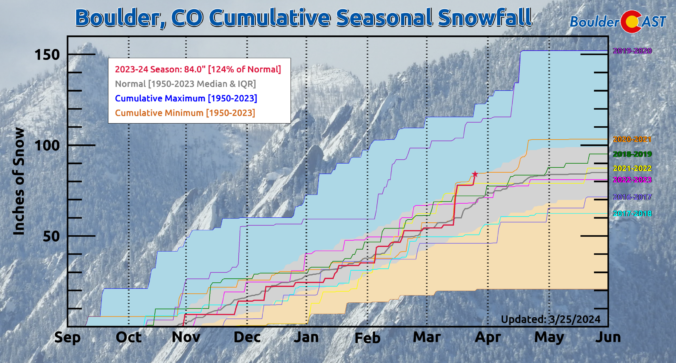
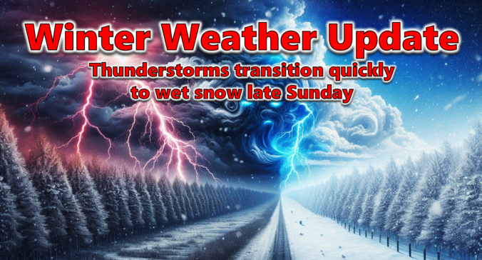
After a solid dump of springtime snow Sunday night, including widespread thundersnow, things will turn quiet for the week ahead with temperatures trending from downright chilly back to t-shirt weather by week’s end. We recap last night’s snowstorm, check the snowfall totals, and detail the Front Range forecast for the next seven days. Let’s dive in!
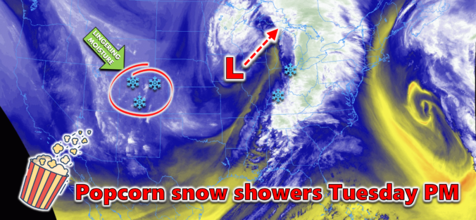
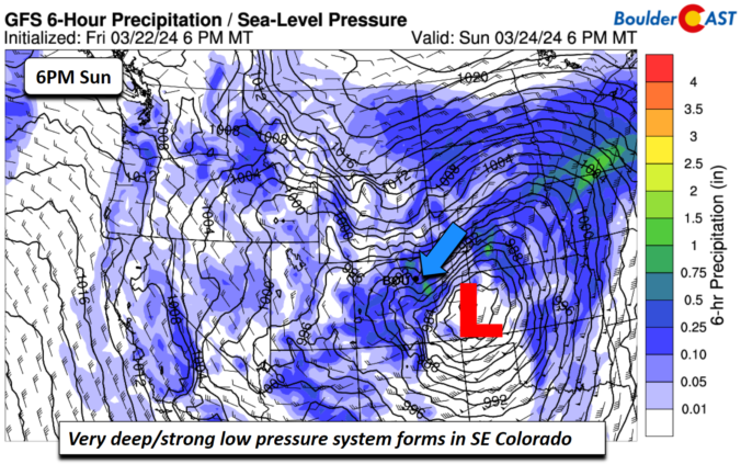
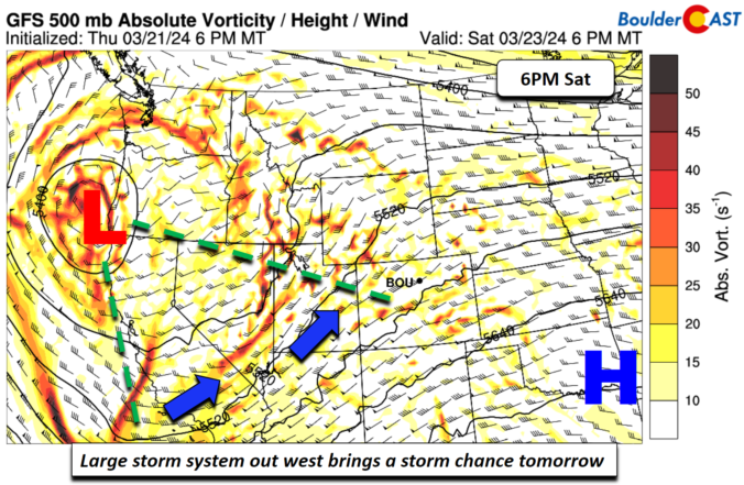
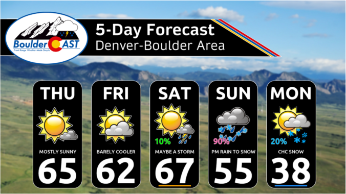
After a lengthy stretch of relatively quiet weather this past week as we officially transitioned from winter to spring, things are set to change on Sunday as a quick-moving storm system races into Colorado from the west with rain, hail, and thunder Sunday afternoon transitioning to heavy snow by Sunday evening. Several inches of accumulation will be possible with this storm, favoring the Palmer Divide and southern Foothills, but for the most part it’s moving too quickly to generate significant snow in our area. Winds will gust upwards of 45 MPH at times Sunday evening and night creating brief near-blizzard conditions in some locations. Read on as we discuss the latest forecast details, timing, and our projected snowfall amounts.
UPDATE (Sun 3/24/2024 8AM): Snowfall amounts were adjusted upwards an inch or two in some areas. Check our updated snowfall forecast map near the end of the post. Otherwise, the going forecast looks fine with afternoon thunderstorms quickly changing to snow after 6PM. Snow could be very heavy at times Sunday evening with 2″/hr snowfall rates. Gusty winds will create blowing snow and reduced visibility as well. Snow is still expected to end late Sunday night after midnight.

Live View of Boulder

Current Conditions

Live Radar

Recent Premium Posts

BoulderCAST Daily – Sun 05/31/26 | Dry and warm today but rain chances increase this week
🌦️ Overall dry and warm Sunday, though cannot rule out a very widely …
BoulderCAST Daily – Sat 05/30/26 | A stray shower today as most activity resides well east of Denver
🌦️ Spotty showers today, mainly well east of the Denver Metro area, where …
BoulderCAST Daily – Fri 05/29/26 | A Marginal Risk of Severe Isolated Storms
🌦️ Spotty showers this afternoon, mainly noon and 4 PM, with highs in …
3-Day Forecast

Trending Content

© 2026 Front Range Weather, LLC