
Page 109 of 569
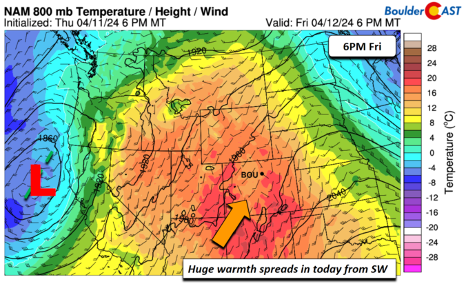
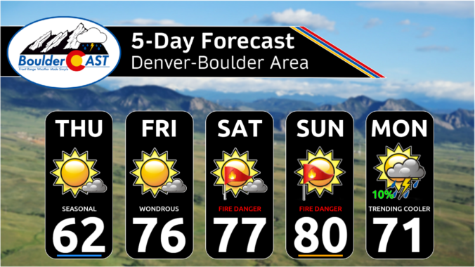
After the very windy weekend, our weather in the Front Range will turn much quieter for the week ahead. Temperatures will fluctuate between the 50s and the 70s throughout the week with only one minor chance to pick up any precipitation. The upcoming weekend will see temperatures soar towards 80 degrees with fire danger unfortunately on the rise. Read on for all the details.
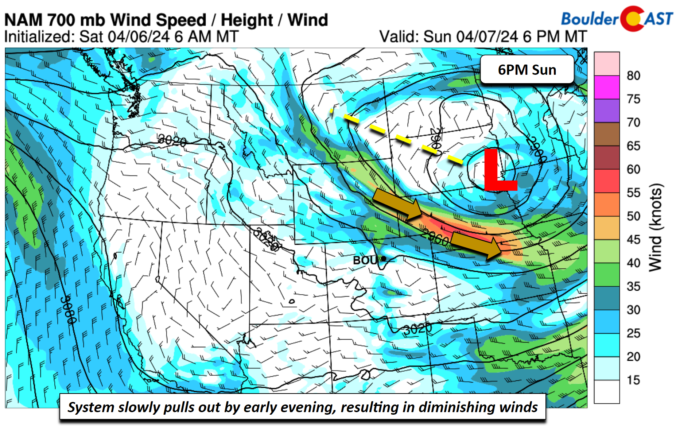
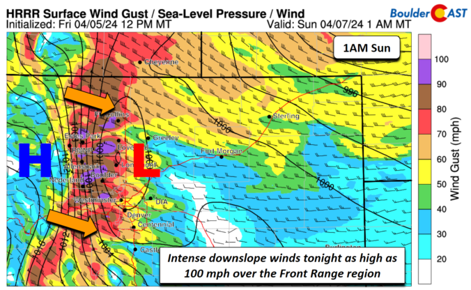
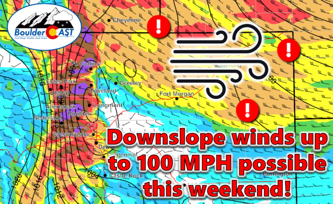
An exceptionally strong spring storm is approaching Colorado which will develop into a big ol’ blizzard in the coming days. However, unlike the last few storms which have been direct hits on the Front Range, this one will track further north leading to more wind than precipitation in our area. After a warm and gusty Friday with high fire danger, the incoming storm will bring colder temperatures and a brief chance of rain/snow showers on Saturday. The biggest impacts from this system, though, will come in the form of prolonged damaging downslope winds. We take a look at the large-scale atmospheric setup and discuss the potential snowfall amounts and which unlucky areas have a chance at wind gusts up to 100 MPH this weekend.

Live View of Boulder

Current Conditions

Live Radar

Recent Premium Posts

BoulderCAST Daily – Sun 05/31/26 | Dry and warm today but rain chances increase this week
🌦️ Overall dry and warm Sunday, though cannot rule out a very widely …
BoulderCAST Daily – Sat 05/30/26 | A stray shower today as most activity resides well east of Denver
🌦️ Spotty showers today, mainly well east of the Denver Metro area, where …
BoulderCAST Daily – Fri 05/29/26 | A Marginal Risk of Severe Isolated Storms
🌦️ Spotty showers this afternoon, mainly noon and 4 PM, with highs in …
3-Day Forecast

Trending Content

© 2026 Front Range Weather, LLC