Several factors are coming together this afternoon for a fairly significant severe weather outbreak. Though the focus will be well northeast of the Front Range in Nebraska and South Dakota, storms that develop this afternoon and evening across the Metro area will have the potential to be strong and borderline severe, with hail and strong winds the main threats. We take a look at the forecast for a stormy Friday and the cooler weekend ahead.
M
uch of our weather so far this week has been dictated by a ridgy pattern, something that was headlined in our weekly outlook on Monday. Though isolated thunderstorms formed each and every day this week, a very dry lower atmosphere meant that the bark of those storms was much worse than their bite. Generally only sprinkles were observed across the Front Range this week, including in Boulder which reported a trace of rain each day, but nothing measurable.
This all changes today as a potent Pacific storm system churns towards Colorado. The models have remained fairly consistent with their solution throughout the week, with our early prediction that most of the energy will pass north of the Front Range largely verifying.
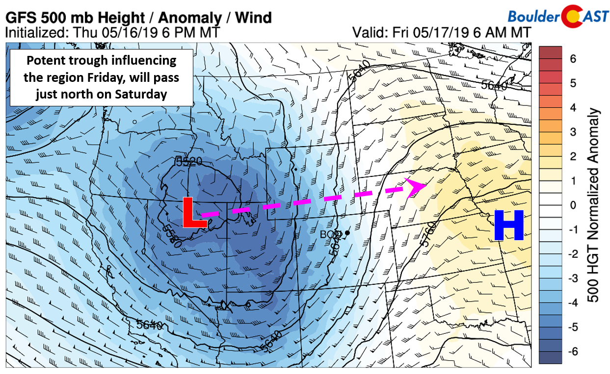
GFS 500mb height anomaly forecast for Friday. The Pacific storm approaches but will pass north of Colorado
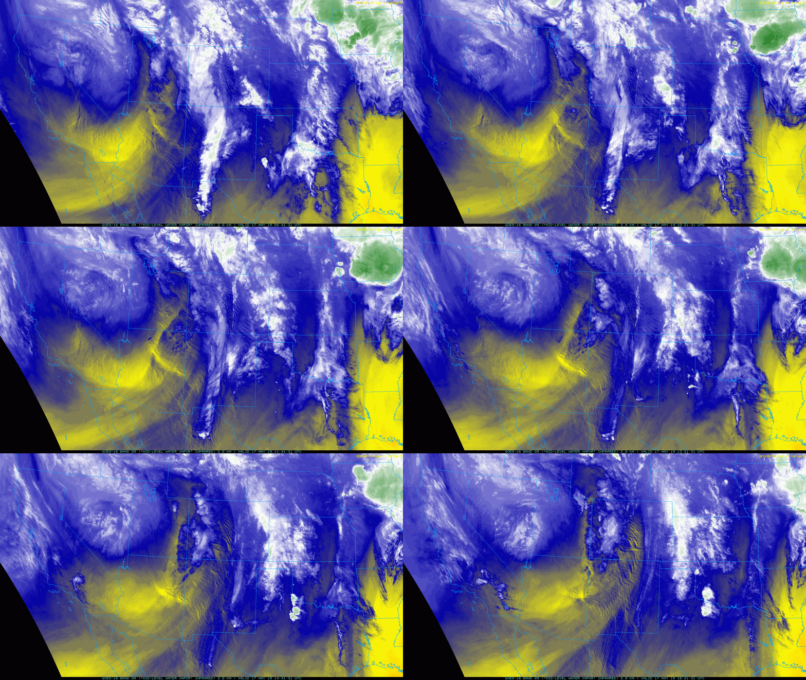
You can see the strong storm system spinning across Nevada in the GOES water vapor animation below.
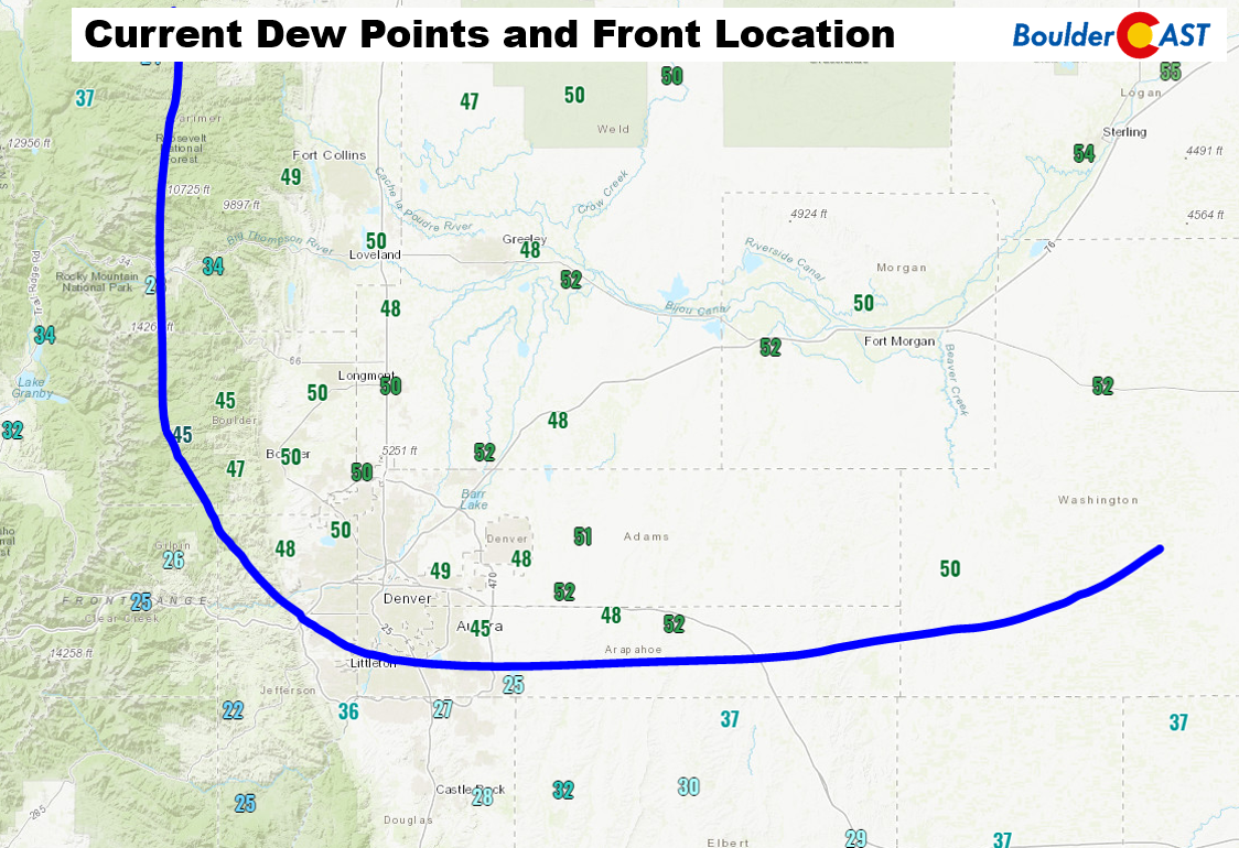
Ahead of this trough, a “cool” front backed into the Front Range this morning from the northeast, easily visualized by the low clouds that were banked-up against the Foothills earlier this morning (and a sharp decline in air quality!). Though we’re now situated in a cooler airmass as a result, the “cool” front also advected in a very juicy airmass at the surface. Dew points have jumped into the lower 50’s across our region, which is a first for 2019 and a sign that severe weather season is here for northeast Colorado! Current dewpoint observations across the Denver area are shown below. It’s easy to pinpoint the location of the front. The air is very dry to south and moist to the north.
A combination of the moist unstable airmass, the approaching trough, lift from a nearby jet streak, and added forcing from the frontal boundary will lead to our best chance of storms for the week. Anywhere north of the cold front has a possibility to see thunderstorm development this afternoon and evening, with CAPE values between 700 and 1200 J/kg thanks to the moist airmass.
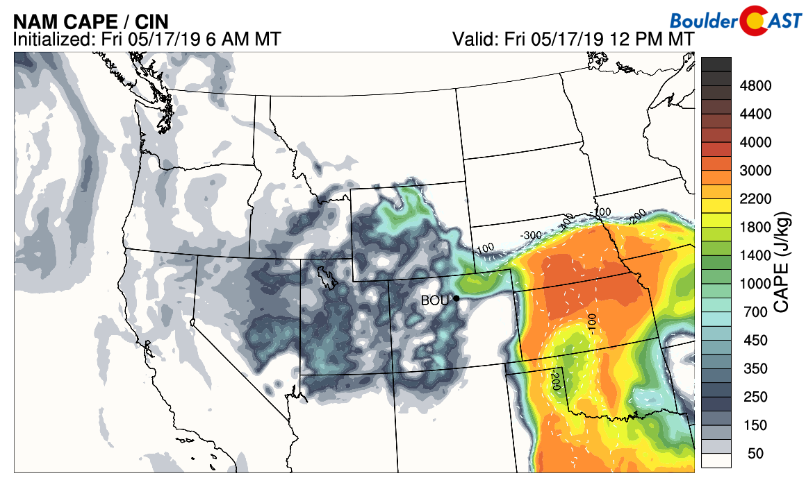
NAM CAPE forecast for mid-day today. Lift exists north and east of Denver for explosive thunderstorm growth
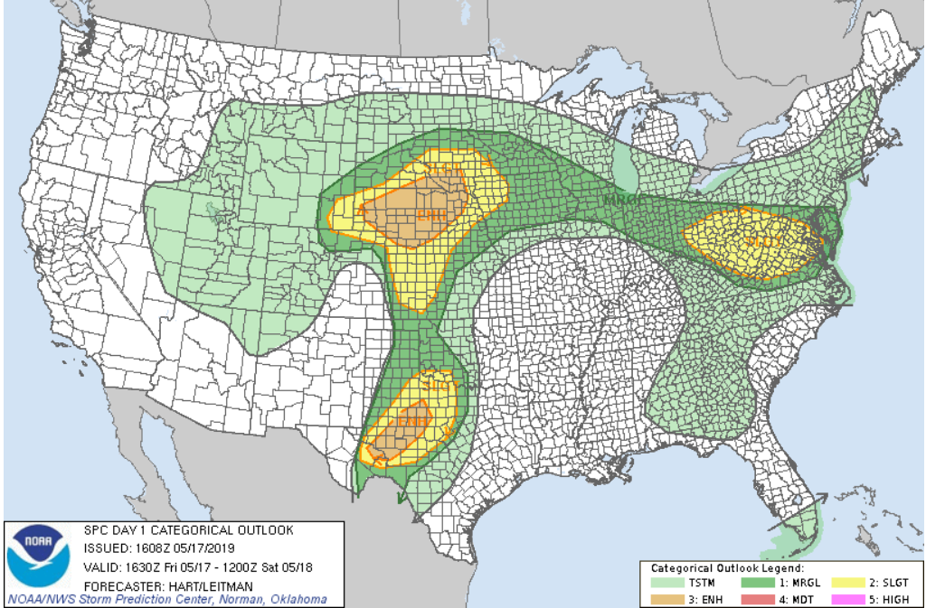
Some of these thunderstorms could border on severe across northern portions of the area, with approximately 1″ diameter hail and 50+ mph wind gusts our main concerns. The Storm Prediction Center highlights primarily the area well north and east of Denver. However, the city of Boulder is included in the “Marginal Risk” zone today for severe storms (Denver is not).
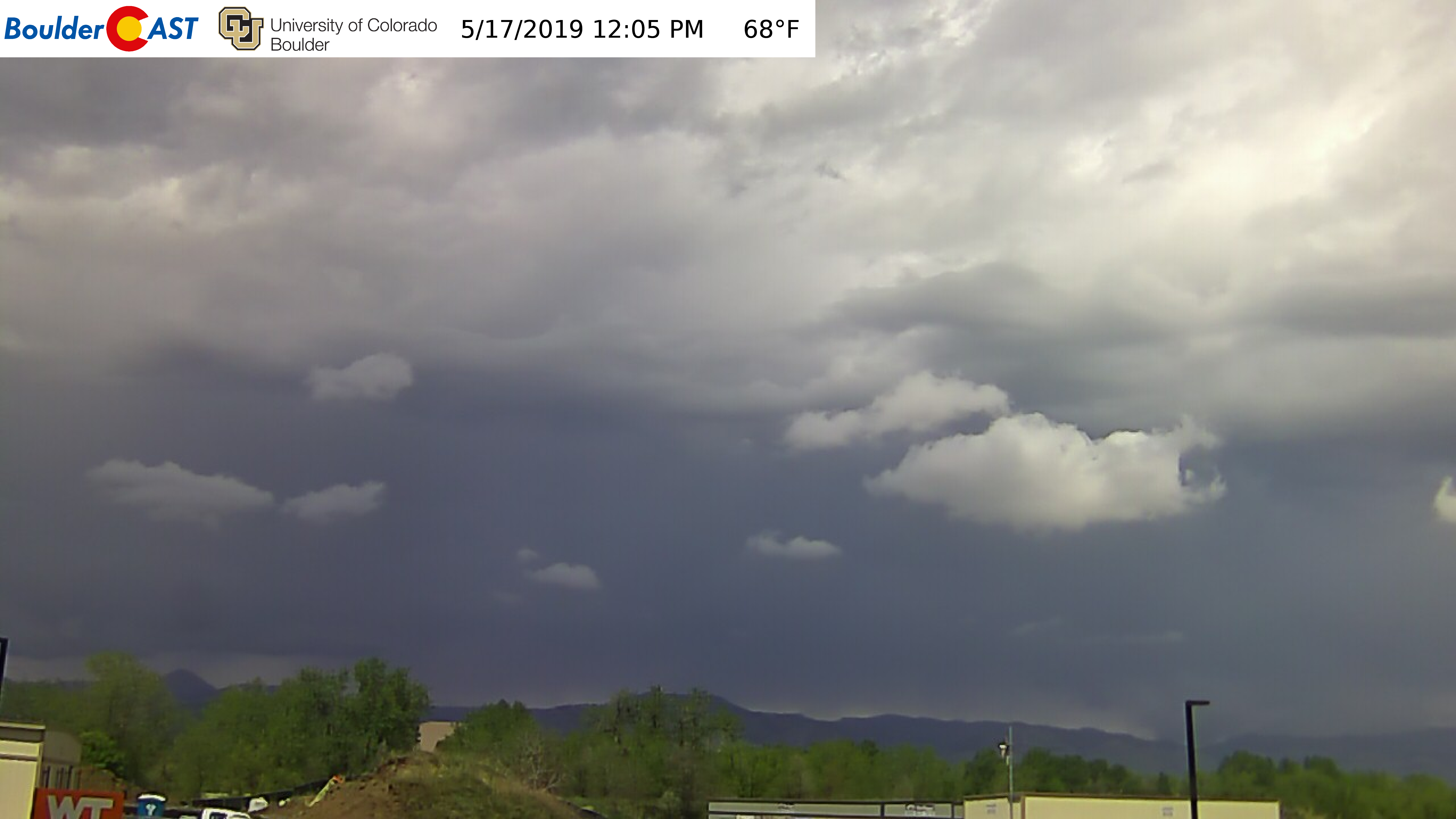
It’s going to be an active day! We’re already seeing widespread development of thunderstorms across the Mountains and Foothills before the lunch-hour this morning. The live look from the BoulderCAST webcam looks grim.
High-resolution models show two waves of storms developing today.
- The first initiates around mid-day and only clips northwest portions of the area, potentially including Boulder.
- The second wave fires very late in the afternoon and continues into the evening hours. This second wave has a better chance to impact most of the Metro area.
Regardless, everyone should keep an eye to the sky this afternoon and evening, primarily around Boulder, Longmont, and Greeley where borderline severe storms are most likely to form. Conditions will remain primed for storms through about 10:00 PM when the main cold front arrives from the northwest with drier air on the backside. Until then, brief heavy rain, lightning, hail, and strong winds are ALL on the table.
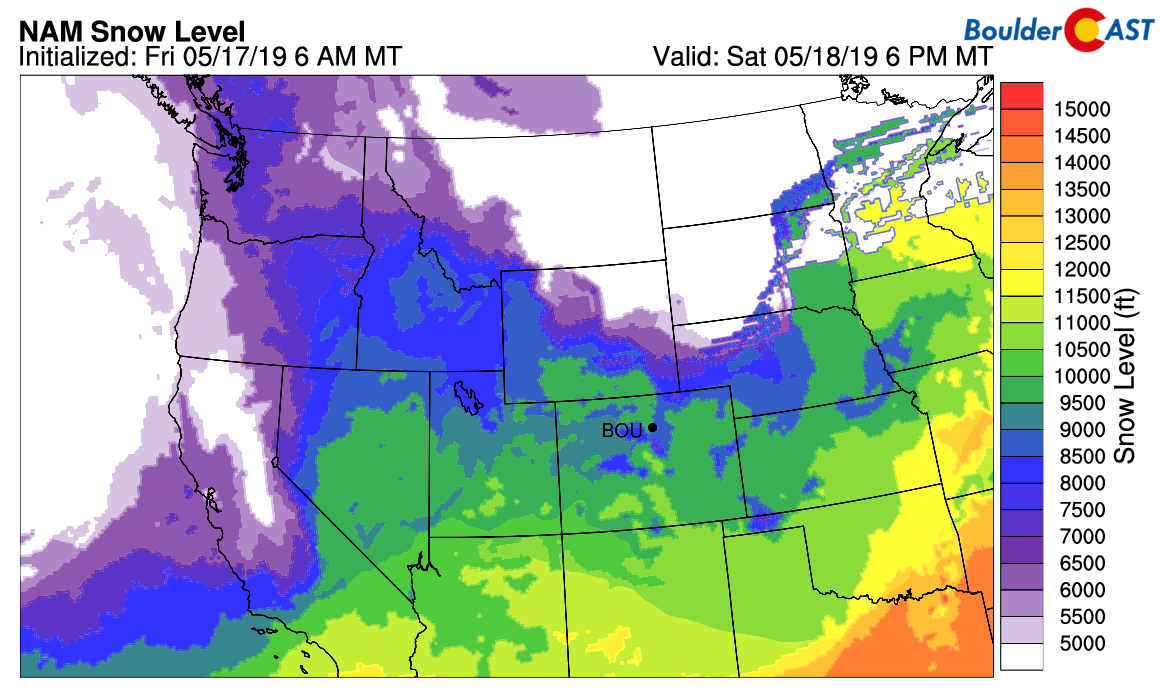
Post frontal passage, the weather this weekend will be cool but not too bad overall. The trough will be directly overhead, so we do expect diurnal showers to form across the Mountains and Metro area. The coldest air will be in place as well, with snow levels meandering between 9000 and 10500 feet elevation. This will equate to rain showers for most of us, but light snow accumulations in the Mountains this weekend.
Highs Saturday and Sunday in Boulder and Denver will be chilly in the upper 50’s to lower 60’s, but patchy sunshine should at least make it bearable. Expect increasing clouds both days with about a 20% chance of afternoon and evening showers.
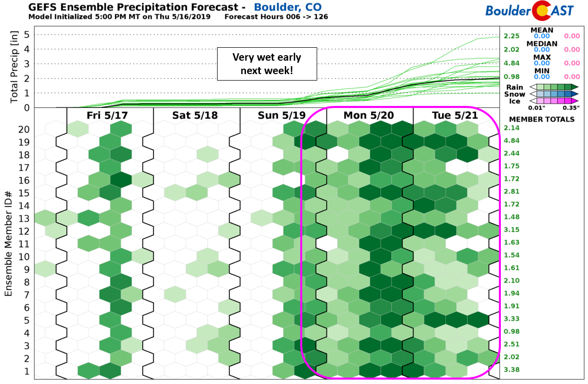
Beyond this weekend, there is yet another strong Pacific storm in the pipeline. At this juncture, models are leaning towards a more southern track, possibly a slow-moving Four Corners storm, which would be more favorable for precipitation in northeast Colorado. Given this, we’re rather sure that conditions will remain cool and gloomy into the middle of next week, but the precise rainfall potential is TBD.
The active pattern at-hand will also help to bolster the rapidly declining snowpack in the Mountains. The few ski resorts that remain open will likely benefit from decent late-season snow, especially from the next Pacific system which is on-deck for early next week.
Have a good weekend! We’ll be back on Monday with our usual outlook for what appears to be a rather gloomy next week…
Spread the word, share our forecast:
.



You must be logged in to post a comment.