Are you tired of the warm and sunny spring weather? If so…you’re in luck! We’re seeing strong indication from all the weather models that winter will return in a hurry this weekend with very good chances of snow Saturday night through Sunday alongside near-record cold temperatures lingering into the upcoming week. Here’s our initial thoughts.
Key Forecast Highlights:
- Big weather changes are coming this weekend in the form of snow and very cold temperatures
- 60’s Saturday –> 20’s Sunday
- Snow is extremely likely Saturday night and early Sunday, possibly lingering into late Sunday
- 4 to 10″ of fluffy snow is not out of the question
T
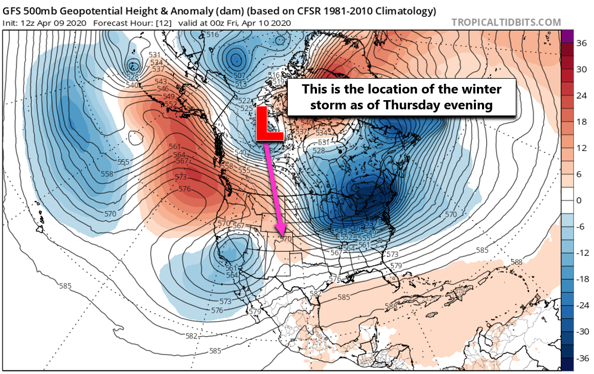
he drastic change in weather we brought to your attention on Monday is taking shape for the upcoming weekend, even more so than anyone expected! While it may not look like much right now, a small disturbance currently located near the Arctic Circle just east of Alaska is forecast to drop south and rapidly intensity in the coming day or two before slamming into Colorado this weekend.
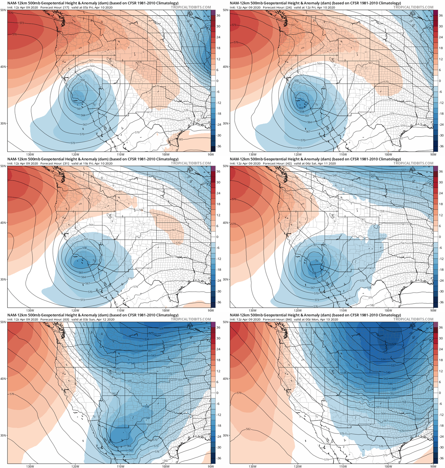
Here’s an animation from one model (the NAM) showing just how quickly things will change as the deepening trough drops out of Canada and into Colorado.
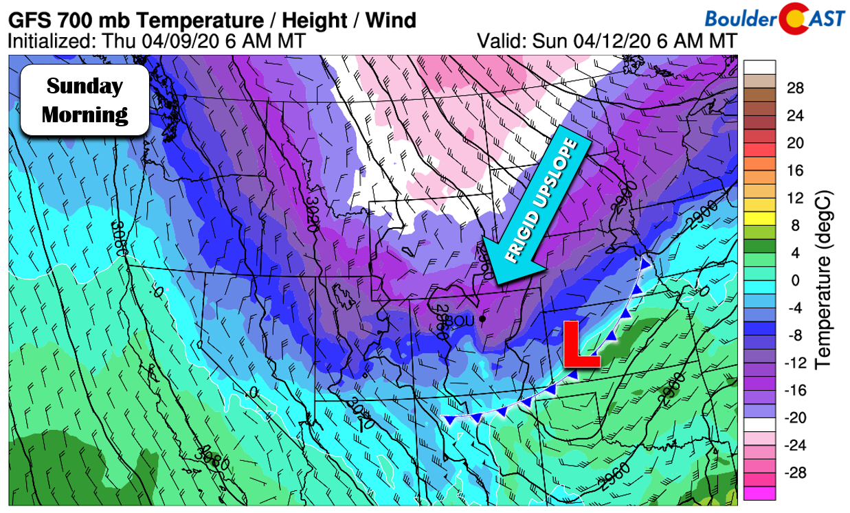
As you’ve seen, the storm itself is still rather far away, both spatially and temporally, so we can’t talk with any certainty about the exact timing of when the bottom will drop out or snow amounts. We can say with high confidence that this this system is indeed going to hit northern Colorado with a blast of cold Canadian air that could linger for several days. The GFS model prediction for early Sunday morning at 10,000 feet elevation is shown below. In addition to the upslope, note those temperatures… -15°C (~5°F) over Denver! This is exceptionally cold for mid-April and will definitely do the trick to quell any concerns about rain. This will indeed be a mainly snow event for us.
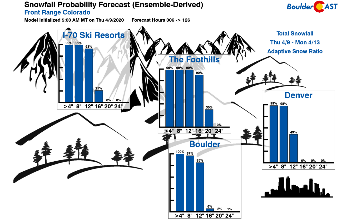
Along with this drastic drop in temperature, there is also a near-certainty of accumulating snow up and down the Front Range at all elevations. The frontal push will be accompanied by a period of moderate to strong northeasterly upslope in the Denver Metro area, coinciding with large-scale lift from the trough and vigorous energy from the overhead jet stream. It’s the combination of all these factors that lends to our forecast confidence strictly in the occurrence, not amount, of accumulating snow. With that said, the GFS, Euro, and NAM models all show a cornucopia of moisture landing on the Front Range Saturday night through Sunday…between 0.5 and 1.0 inch worth. Given just how cold it will be and the expectation of everything taking place Saturday night into early Sunday, this could be a 4-10+” snowstorm for the area. The combination of the overhead jet and springtime instability may potentially produce localized higher amounts. This is the largest uncertainty right now: how widespread will the heavier bands or cells of snow be?
Current runs of our Snowfall Probabilities indicate high chances that this will be a significant storm for the Metro area and the Mountains alike!
At this point, it’s safe to say we’re not going to dodge this wintry bullet. Expect warm days in the 60’s to lower 70’s Friday and Saturday before things go sideways late Saturday afternoon into the evening. Any rain will quickly change to snow and continue through Saturday night into Sunday. Temperatures will likely stay in the 20’s or colder all day Sunday while intermittent snow falls. A great day to spend at home by the fireplace with some hot cocoa. Get your outdoor activities taken care of early in the weekend as waiting isn’t really an option!
As of writing this Thursday evening, our storm is still near the Arctic Circle and we will likely see a few changes by the time it arrives on Saturday evening. We’ll keep you updated. Be sure to subscribe to stay in the loop.
Subscribe to receive email notifications for BoulderCAST updates:
We respect your privacy. You can unsubscribe at any time.

Help support our team of Front Range forecasters by joining BoulderCAST Premium. We talk Boulder and Denver weather every single day. Sign up now to get access to our daily forecast discussions each morning, complete six-day skiing and hiking forecasts powered by machine learning, first-class access to all our Colorado-centric high-resolution weather graphics, bonus storm updates and much more! Or not, we just appreciate your readership!
.
Spread the word, share the BoulderCAST snow forecast!




You must be logged in to post a comment.