
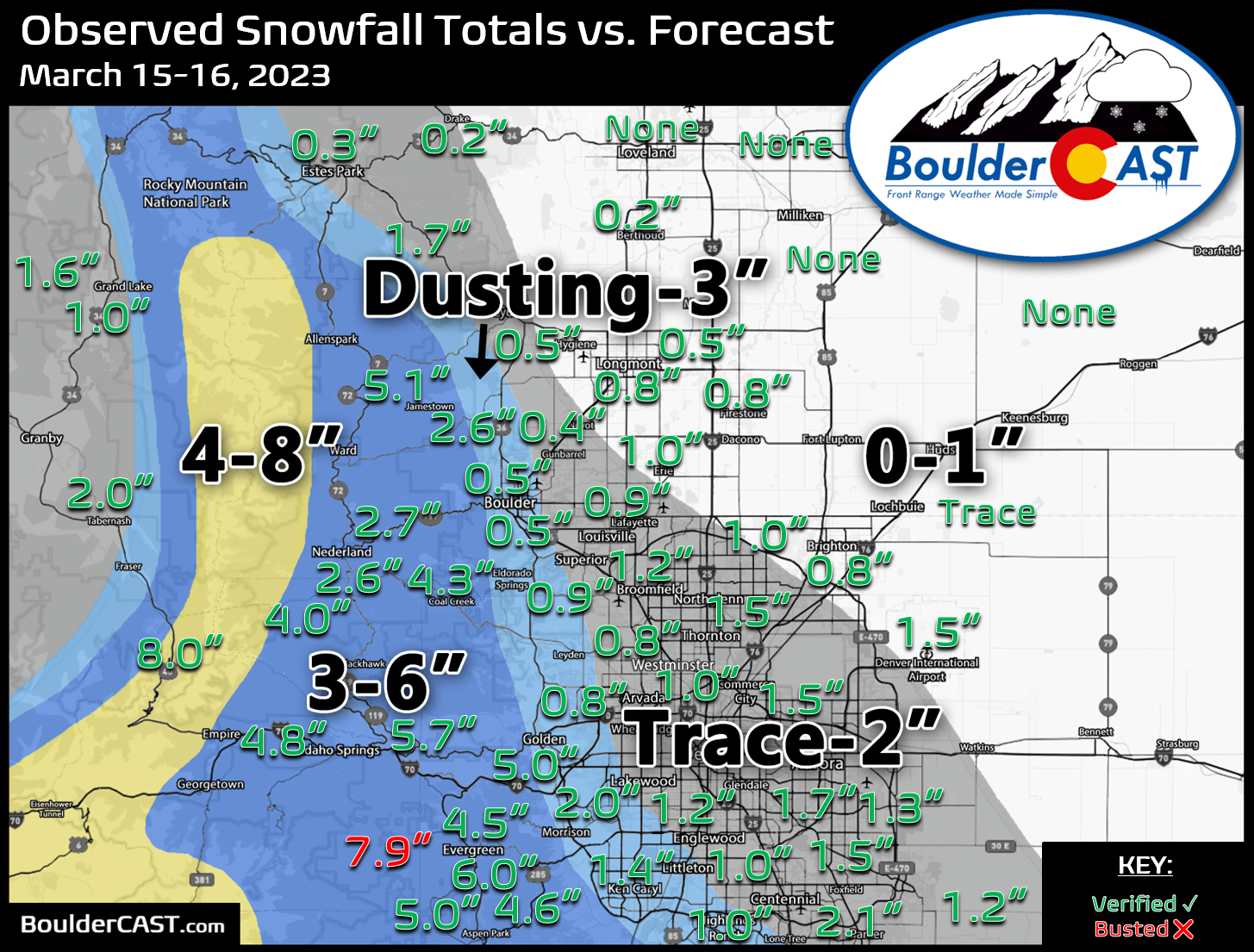
Shown below is our snowfall forecast map issued Wednesday morning with actual storm totals overlaid. Green values indicate that our forecast verified to within one inch of the observed snowfall total. Red numbers did not. A dying atmospheric river flooded our area with record-breaking amounts of atmospheric moisture this week, but ultimately there was minimal forcing accompanying it to take advantage of it. Some areas received up to a half inch of rain before changing over to snow. Officially 0.5″ of snow was reported in Boulder on Thursday before sunrise, while 1.5″ fell in Denver (both Downtown and at DIA).
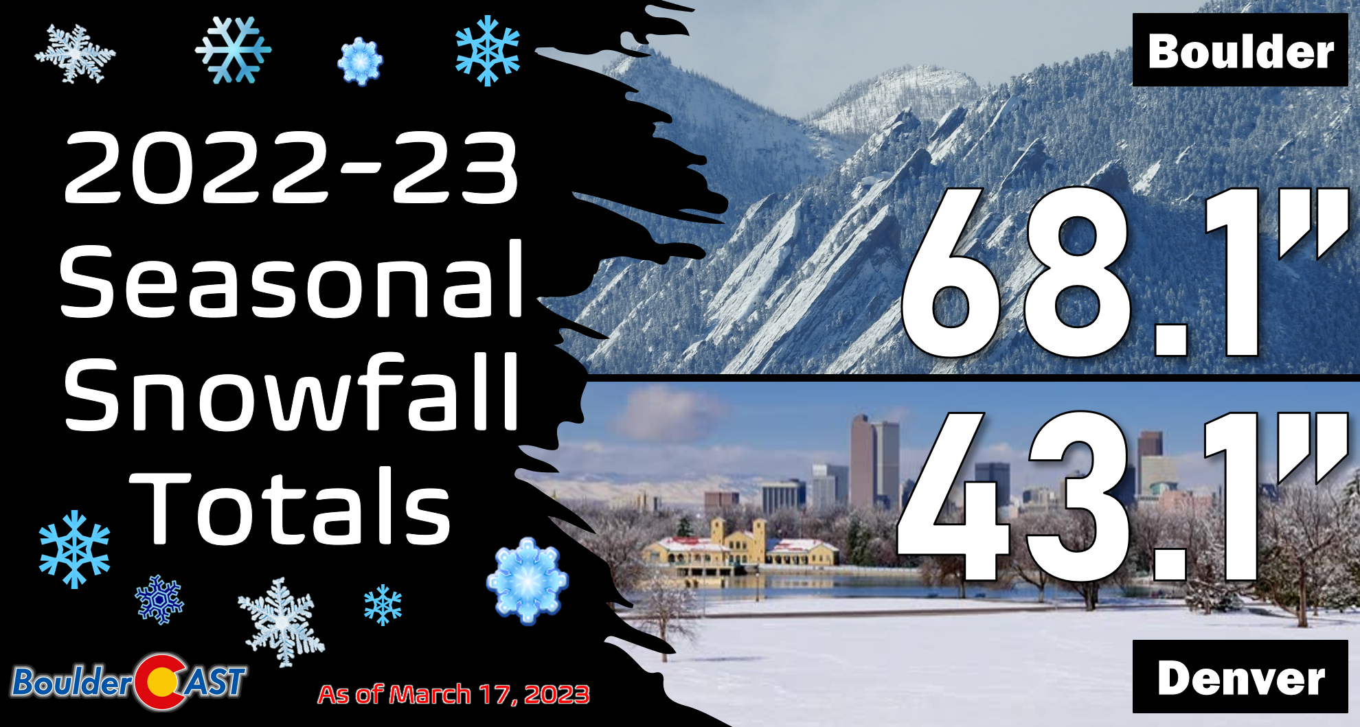
This was Denver’s first measurable snowfall since in more than three weeks — the last coming all the way back on February 22nd! As time continues to pass with minimal snowfall occurring in what should be our snowiest month of the year, we will soon be turning below normal on snowfall for the season…


You must be logged in to post a comment.