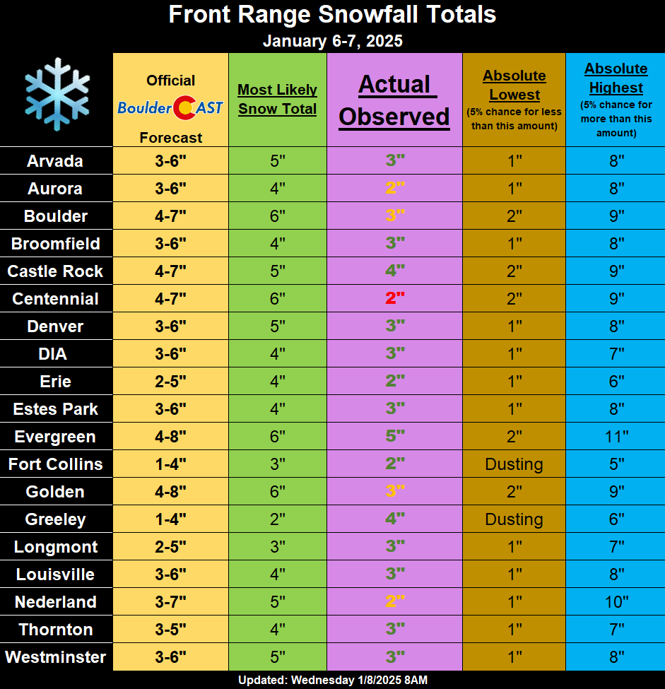
Light snow fell once again across the entire Front Range Monday night into Tuesday, with most locations picking up 2 to 5 inches of fluffy accumulation, a tad less than forecast in some spots. We briefly review both the snow totals from this single storm and the seasonal ones.
T
he storm was a bit delayed in getting going Monday night, with almost no snow falling in Boulder before 4:00 AM Tuesday. Our forecast included the expectation for the more intense snowfall to hold off until Tuesday morning, but that ended up being all of the snow.
4PM Update: Some stray flurries falling early this evening in #Boulder. Sct'd light snow will begin to spread into the area through the evening. However, short-range guidance continues the story that the heaviest snow will occur Tuesday morning (4-10AM). 3-6" looks good #COWx https://t.co/znzI5wU2V9 pic.twitter.com/a8E5OC7qCl
— BoulderCAST Weather 🏔️❄️ (@BoulderCAST) January 6, 2025
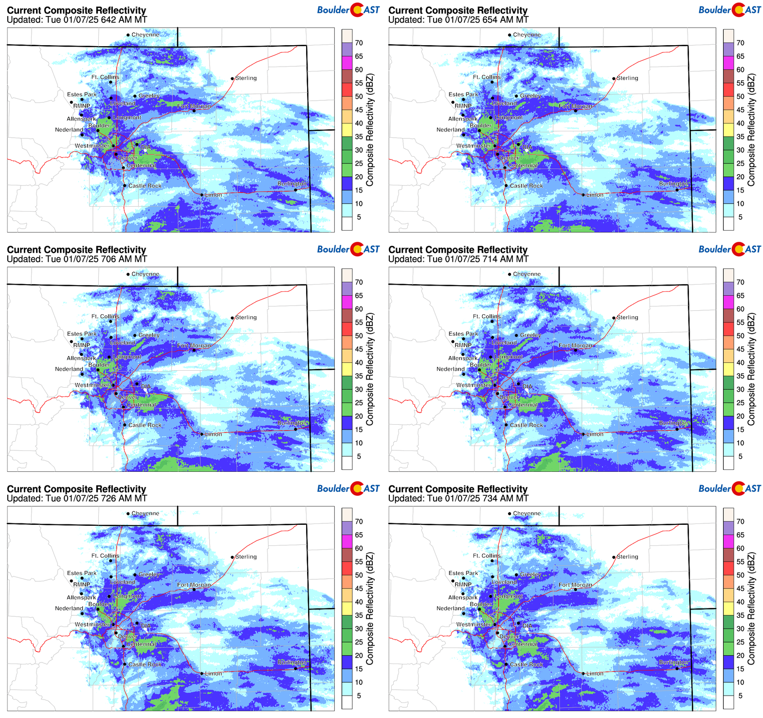
Eventually the expansion of light to moderate snowfall did unfold Tuesday morning on time, making for a very slick morning commute with nearly every road covered in a shallow layer of snow, from side streets to interstates. The radar animation below is from Tuesday morning around 7AM.
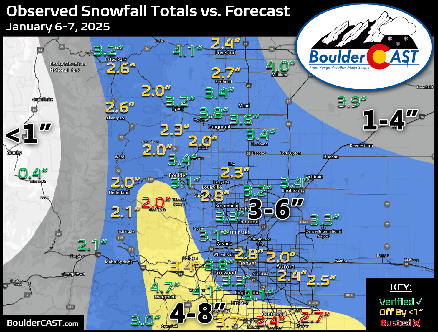
Our snowfall forecast map issued Monday morning is shown below with storm totals overlaid. Green values indicate our forecast verified, Yellow values mean the observed total was just outside our forecast, while Red was a busted forecast (more than 1″ off). In general, most areas received low-end snowfall amounts of 2 to 5 inches, either just below or within the lowest end of our forecast ranges.
A few cities were below expectations, but overall not a terrible forecast. Median model guidance was generally off by about 50% (too high), which certainly didn’t help with forecast accuracy here. There seemed to be a bit of downslope/drying coming off the Foothills most of Monday night which kept things in the Metro area mostly dry. The snow we did receive was quite fluffy though, with snow ratios generally 15:1 or higher in the Metro area. This isn’t great for the drought situation, but it made for easy shoveling Tuesday afternoon!
Officially, Boulder received 3.1″ of new snow from the early week storm, while Denver (DIA) recorded 3.3″. Seasonally, Denver is still holding onto a rare lead over Boulder, including this storm being the fourth time Denver recorded more snow than Boulder. This is exceptionally rare for this many events to unfold like this!
| Seasonal Snow Totals (Updated January 8 2025) |
|---|
| Boulder | Denver |
|---|---|
| 24.3" | 28.5" |
You can find a recap of all the winter storms so far in the 2024-2025 snow season HERE.
By the way, more light snow is on tap for Wednesday night into Thursday afternoon, but it shouldn’t amount to much…


You must be logged in to post a comment.