The entire Front Range woke up to picturesque conditions today on Sunday as overnight light snow and freezing fog coated nearly every surface in a dusting of ice crystals — turning local communities into unique snow globes. We review the snow totals from the wintry event, one which produced at most a dusting in the Denver Metro area, but up to several inches in the Mountains and areas to the east.
B
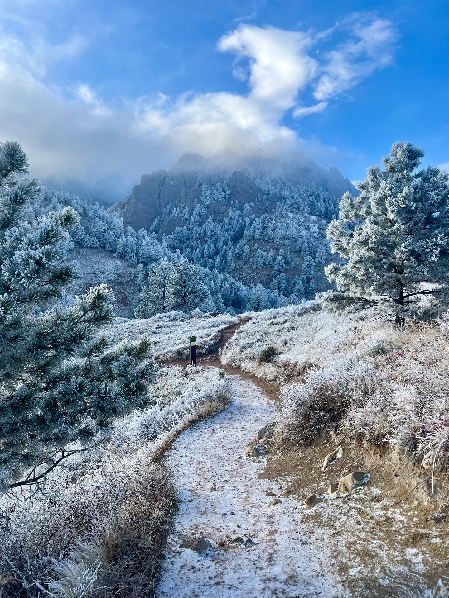
elow is a view from Boulder Sunday late morning as the freezing fog began to clear! Most of the white stuff you are seeing here is what is known as rime ice, the result of supercooled (i.e. below 32°F) liquid fog droplets freezing on contact with things inside the fog layer, though there is a light dusting of snow on the ground as well. This was not hoar frost, though we have seen some outlets incorrectly identify it as such. Do you know the difference between rime ice and hoar frost?
The vegetation sure was pretty out there!
The trees are prettier this morning following thick freezing fog overnight. Just a light dusting of snow on the ground. #cowx pic.twitter.com/E4AYpMa0Cf
— BoulderCAST Weather 🏔️❄️ (@BoulderCAST) January 5, 2025
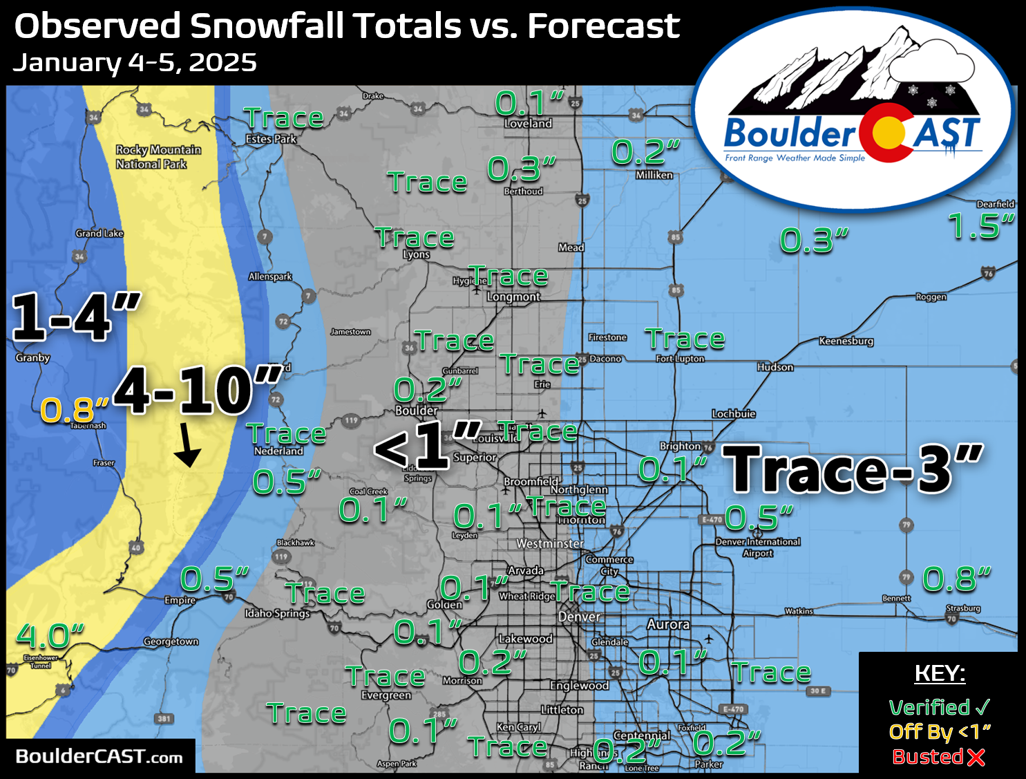
Our snowfall forecast map issued Saturday morning is shown below with storm totals overlaid. Green values indicate our forecast verified, Yellow values mean the observed total was just outside our forecast, while Red was a busted forecast (more than 1″ off). In general, most areas saw just a trace or light dusting of snow this past weekend.
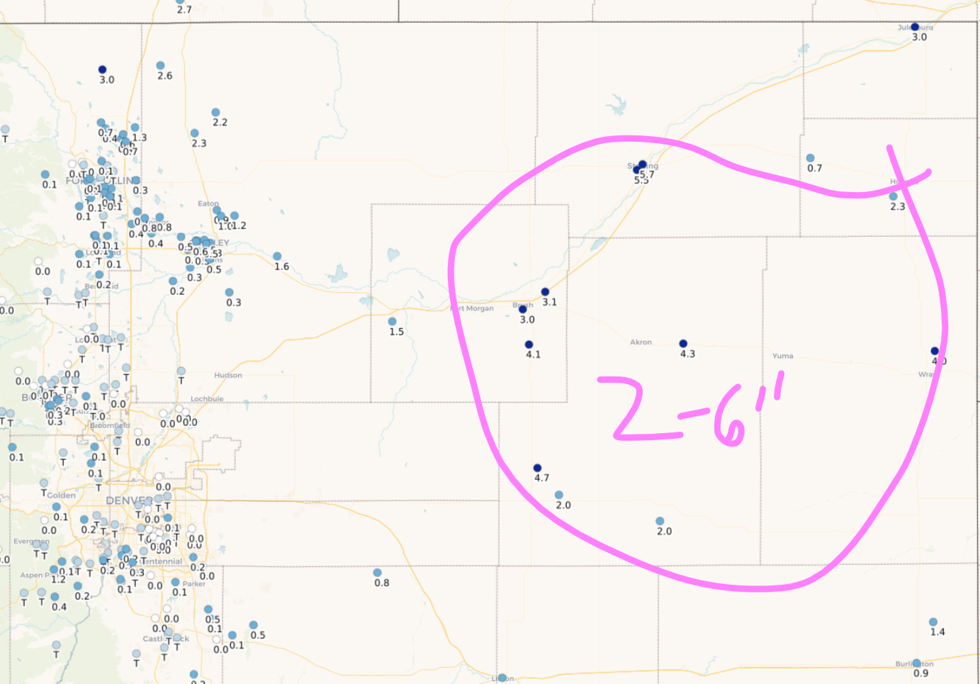
There was some uncertainty in the forecast regarding exactly how far westward the banded snow would form. That is the main reason we included areas east of Interstate 25 at risk for up to three inches. Ultimately the bands didn’t make it this far west, but areas just east of DIA did see 1-2″. In the bullseye of banding across the eastern Plains, 2 to 6″ of snow was reported from Fort Morgan, to Yuma, to Sterling.
Officially, Boulder received 0.3″ of new snow from this weekend’s event, while Denver (DIA) recorded 0.5″. Seasonally, Denver is still holding onto a rare lead over Boulder!
| Seasonal Snow Totals (Updated January 5 2025) |
|---|
| Boulder | Denver |
|---|---|
| 21.2" | 25.2" |
You can find a recap of all the winter storms so far in the 2024-2025 snow season HERE.


You must be logged in to post a comment.