
Much-needed snow piled up across all of the Mountains of Colorado this week, but once again Boulder and Denver missed out on almost all of the action.
O
ur snowfall forecast map issued Monday morning is shown below with storm totals overlaid. Green values indicate our forecast verified, Yellow values mean the observed total was just outside our forecast, while Red was a busted forecast (more than 1″ off). As expected, this was mainly a week of snow in the Mountains, with little of that moisture making east of the Continental Divide. Higher Foothills locations picked up a couple inches, with generally 0.1″ or less across the lower elevations (outside of the super narrow snow band that briefly hit parts of Loveland one night. Boulder and Denver only received a trace, with no measurable snow yet to occur in the month of February.
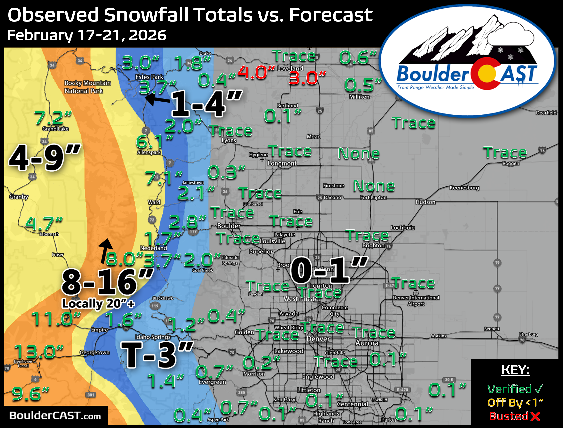
State totals reveal a hefty dumping of snow across Colorado’s many Mountains this week, lead by the San Juans which saw totals of 2 to 4 feet. If you believe the snow reports from Wolf Creek, they received 70 inches or nearly 6 feet of snow this week. Huzzah!

You can find a recap of all the winter storms so far in the 2025-2026 snow season HERE.


Leave a Reply
You must be logged in to post a comment.