Enjoy the beautiful weather Sunday while you can! We are watching an approaching trough and Arctic cold front that will bring winter back to the area tonight and early Monday. In this forecast update, we discuss when you can expect the front and the change-over from freezing drizzle to snow. We also provide our snowfall forecast map.
We discuss Boulder and Denver weather every single day on BoulderCAST Premium. Sign up today to get access to our daily forecast discussions every morning, complete six-day skiing and hiking forecasts powered by machine learning, access to all our Front Range specific weather models, additional storm updates and much more!

oth Boulder and Denver broke their 92-year-old daily record high temperatures on Saturday with most areas soaring into the upper 70’s under mostly sunny skies. Considering we’ve already had four different snow events and more than two feet of snow total in Boulder, this might have been the first chance many of you had to clean up those leaves that fell over the last few weeks; they’ve been buried in snow for quite a while. I definitely took advantage of the brief stretch of nice weather yesterday to clean up the landscaping, rake leaves, and spread autumn lawn fertilizer.
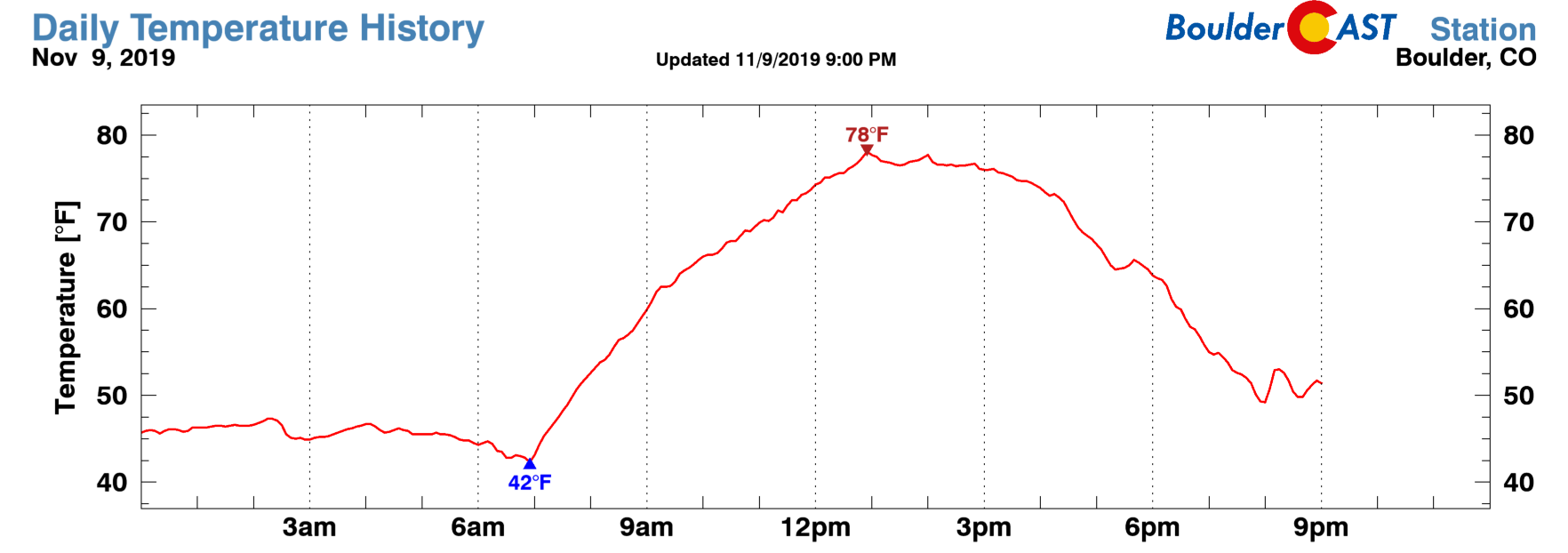
Temperature observations from Saturday at BoulderCAST Station when a new record high was set for November 9th
Big weather changes take hold quickly this evening with the arrival of an Arctic cold front. It’ll be dropping south through Wyoming during the day today and eventually dribble into the Denver Metro area later tonight. This timing means that we will squeeze out one more beautiful day before things turn to winter after dark. While temperatures will remain above normal, it won’t be nearly as warm as Saturday. Expect a general increase in wave clouds through the day Sunday with highs in the middle 60’s.
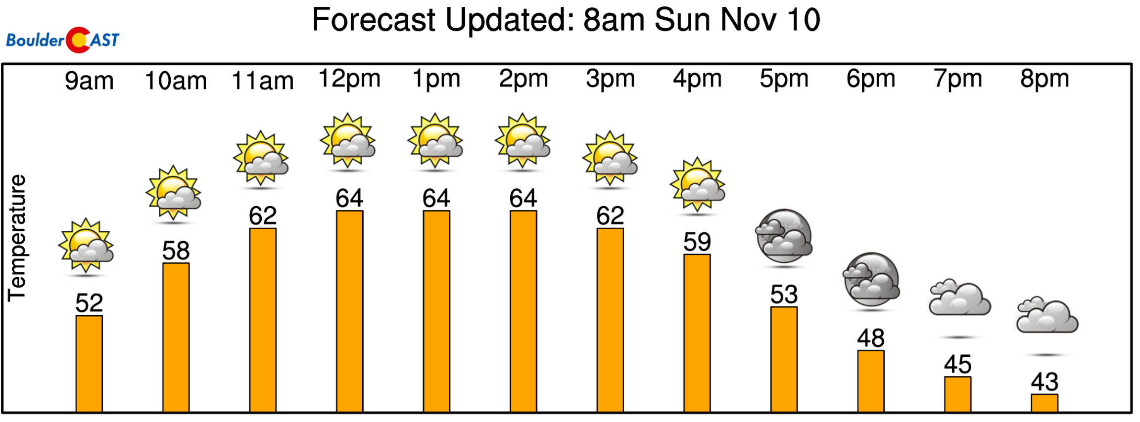
Sunday’s weather looks great!
Models have been trending later and later with the front’s arrival, but it now appears to move in around 8:00 PM tonight, if not just a bit before. There will actually be two waves of colder air. The first will be weaker and consists of a cooler airmass that has been stewing in Wyoming for a while. The second one is the truly Arctic front and it will plummet temperatures into the 20’s and teens overnight. This won’t show up until near or slightly after midnight. Both fronts can be seen in the NAM 800 mb temperature forecast for 11:00 PM tonight shown below.
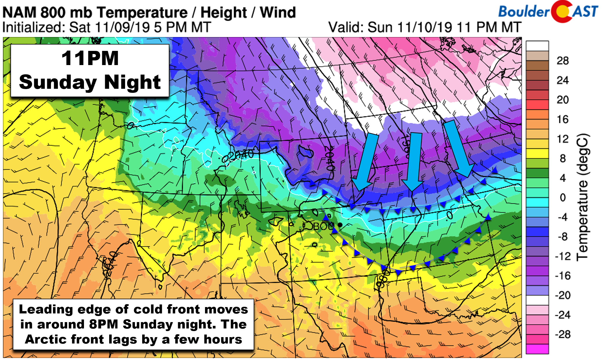
NAM 800 mb temperature and wind forecast map for 11PM Sunday night. Two cold fronts will be moving through
We will initially see a period of drizzle and then freezing drizzle since the initial post-frontal airmass won’t be cold enough right away to crystallize any snowflakes. For that we need temperatures somewhere in the moist atmospheric layer above Denver to be colder than -8°C. Models don’t show this happening until between 1:00 to 3:00 AM tonight. Once the moist layer deepens and cools sufficiently, light snow is expected to overtake any lingering freezing drizzle and continue into the morning hours on Monday.
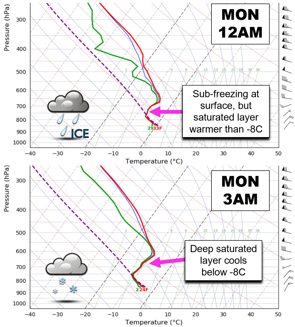
HRRR model forecast soundings for the Denver Metro area for 12AM (top) and 3AM (bottom) showing the transition from freezing drizzle to snow
We can’t lie… There’s not a lot of snow potential for this system. It’s moving so rapidly that the window for snow will only be about 6 to 9 hours at most. That’s not a lot of time to put down much white stuff. Also, Arctic airmasses almost by definition lack moisture, and this one will be no exception. The one wildcard here is that there may be an overhead jet streak embedded within this system to produce isolated moderate snow bands across the Front Range early Monday morning.
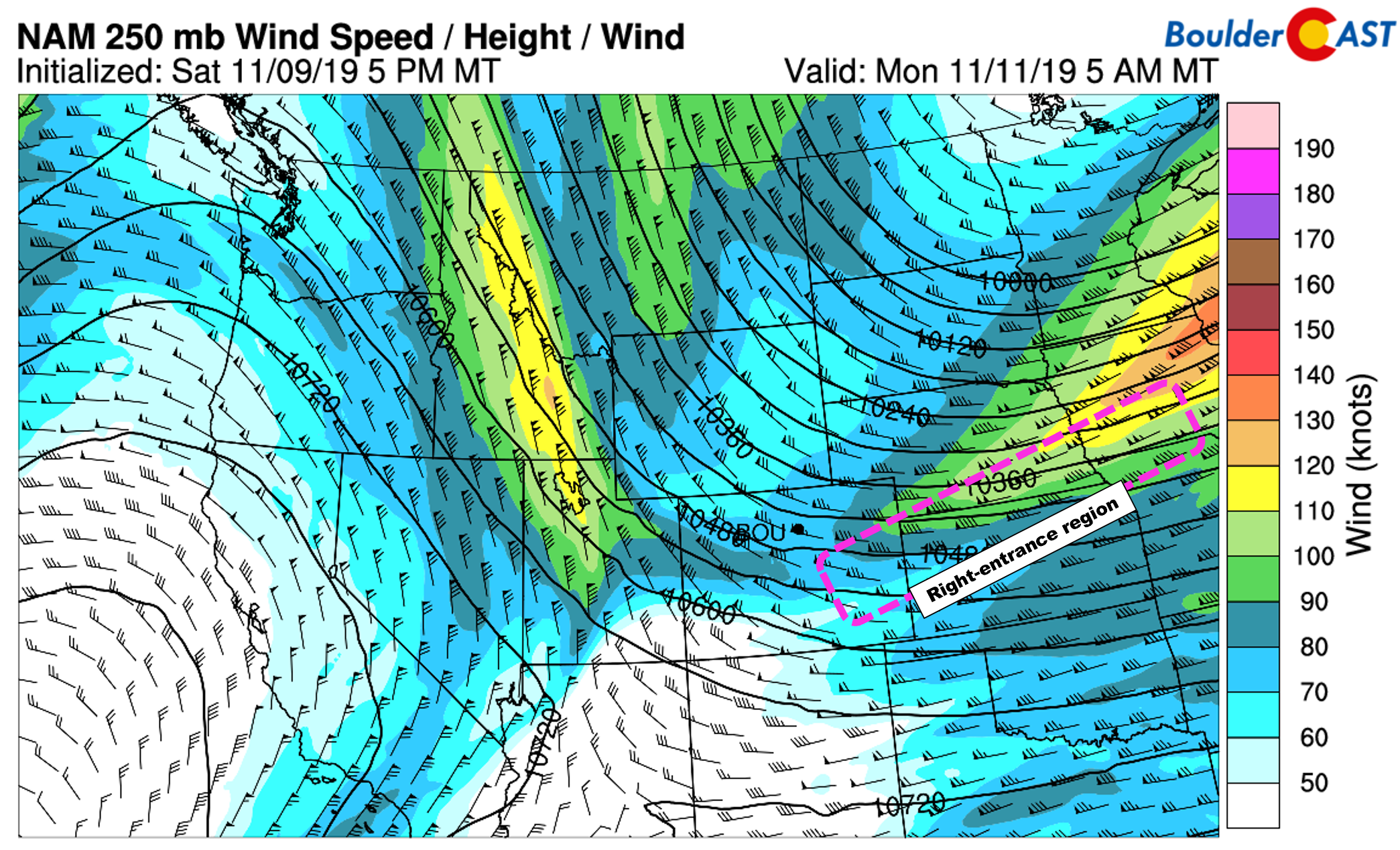
NAM 250 mb wind speed forecast for Monday morning. Northern Colorado will briefly be in the right entrance region of a passing jet streak. Emphasis on briefly
Even if the orientation of the passing jet stream does line up, which by the way not all models are showing, its passage will be swift leaving just a few hours for this potential increased lift anyways. The most likely timeframe for jet-forced snow bands would be from 3AM to 7AM early Monday morning. If you squint REALLY hard, you can see evidence of this banding in the HRRR simulated radar image below.
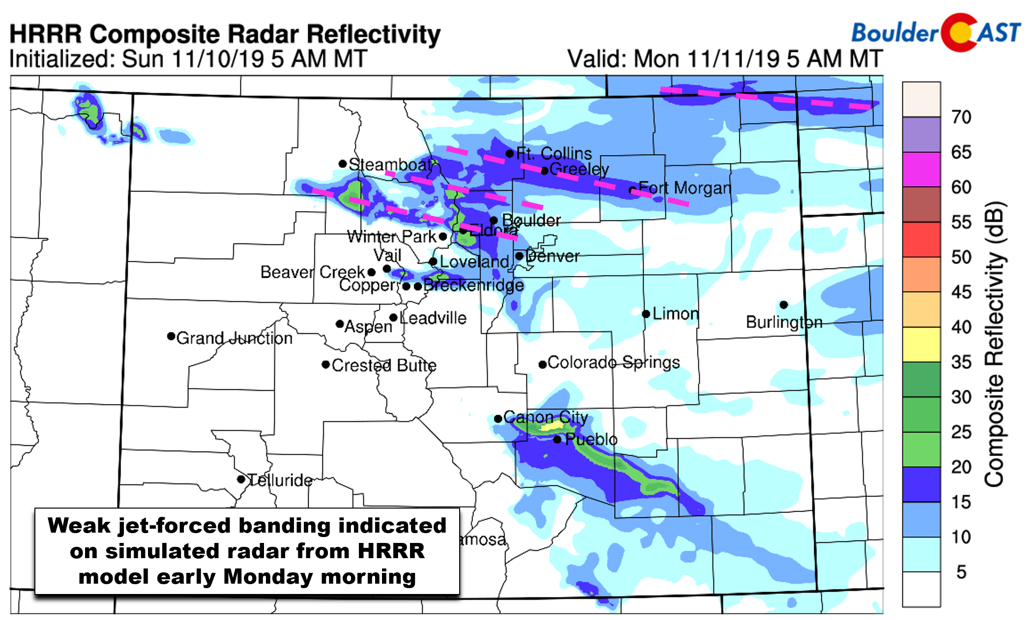
HRRR model simulated radar for 5AM Monday. Slight banding from the overhead jet is evident
All in all, everyone across the Front Range should pick up at least an inch of snow by Monday morning, but not much more. Areas near Boulder and north stand the best chances of seeing a little extra….up to a few inches. Our latest Snowfall Probability Charts follow this same line of thinking.
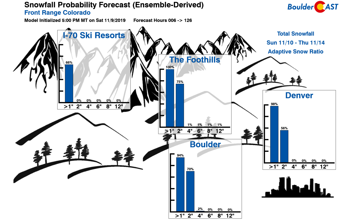
Our snowfall forecast map for this very quick event is shown below. Given the overnight and early morning timing, expect minor impacts on the morning commute for Monday. The fact that is a federal holiday should help things along, though.
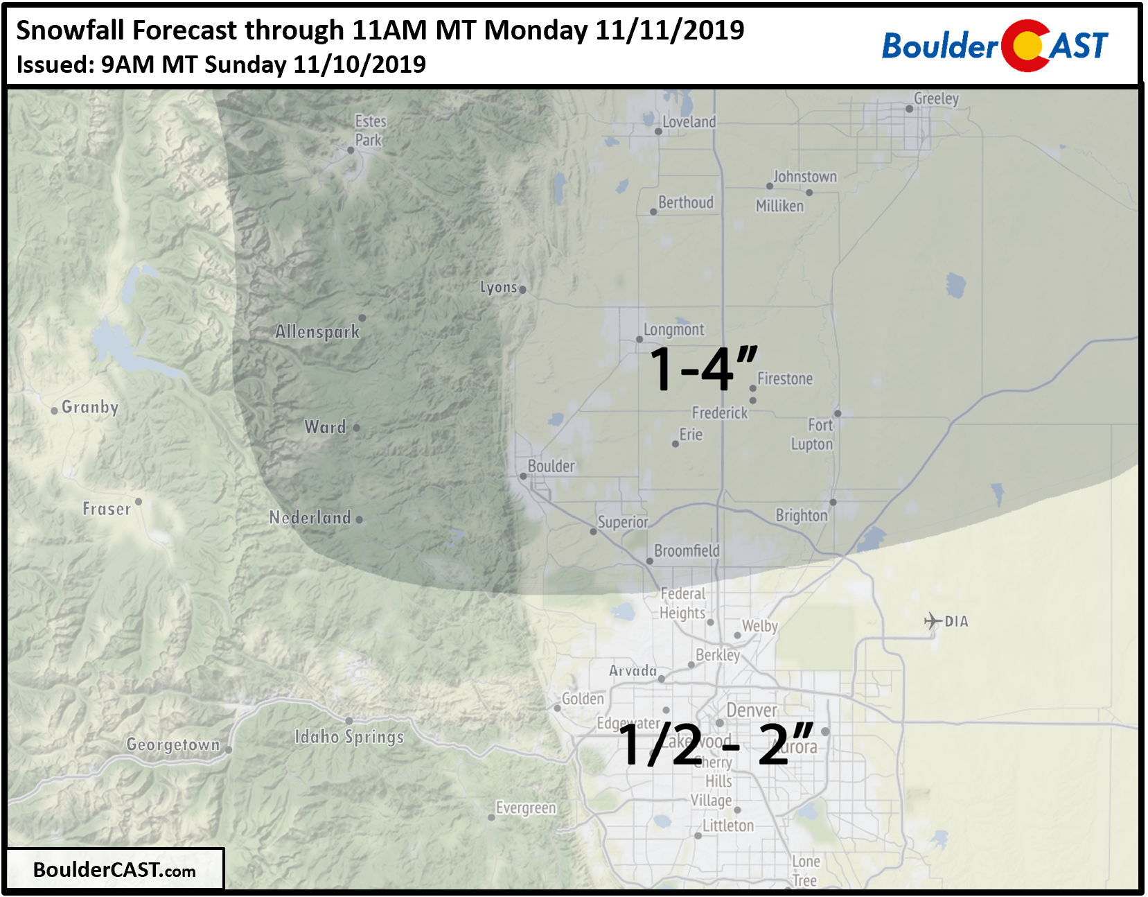
Snow showers will taper off quickly from north to south through the morning hours Monday. Drier air and high pressure will take-over leading to swift clearing and sunny skies by afternoon. It will be a cold Veterans Day though: highs in the low to middle 30’s can be expected.
Fortunately the Arctic surge will be short-lived for northeast Colorado. Downslope is anticipated back across the area by Tuesday morning. Does it seem impossible that we’ll get back near 60 degrees on Tuesday? It’s not…believe it!
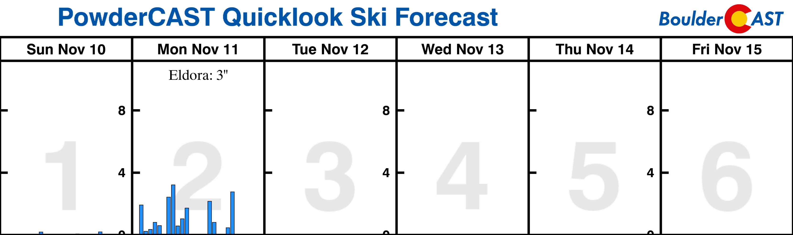
POWDER UPDATE: The outlook is bleak for “natural” powder the next five to seven days. It’s a bad sign when Eldora is leading the way for all Colorado ski resorts at just 3 inches. Check our PowderCAST page for daily updated ski forecasts for all the resorts.
We discuss Boulder and Denver weather every single day on BoulderCAST Premium. Sign up today to get access to our daily forecast discussions every morning, complete six-day skiing and hiking forecasts powered by machine learning, access to all our Front Range specific weather models, additional storm updates and much more!
.
Spread the word, share our forecast:
.


You must be logged in to post a comment.