
It’s been a tricky week for the weather models — and for us forecasters trying to make sense of it all. Our latest storm system has kept everyone on their toes, thanks to a complicated dance between two low-pressure systems across the Southwest. Each new model run seemed to rewrite the story, with big swings in outcomes and plenty of disagreement between guidance. But now that the storm is closing in, confidence is finally improving: we’re looking at a light precipitation event for the Front Range, with rain the only worry across the lower elevations.
What You Need to Know
- Storm setup: A small upper-level disturbance moving from Arizona toward Kansas is interacting with a larger low in California, making for a tricky forecast but one that is trending drier overall.
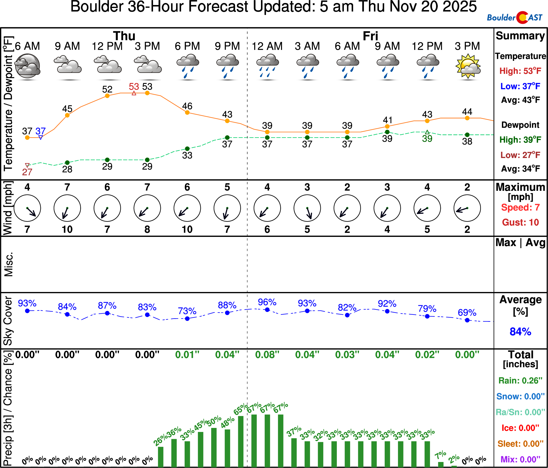
- Clouds & timing: Thick clouds linger Thursday into Friday, with scattered showers arriving in Boulder–Denver Thursday evening and continuing overnight into Friday.
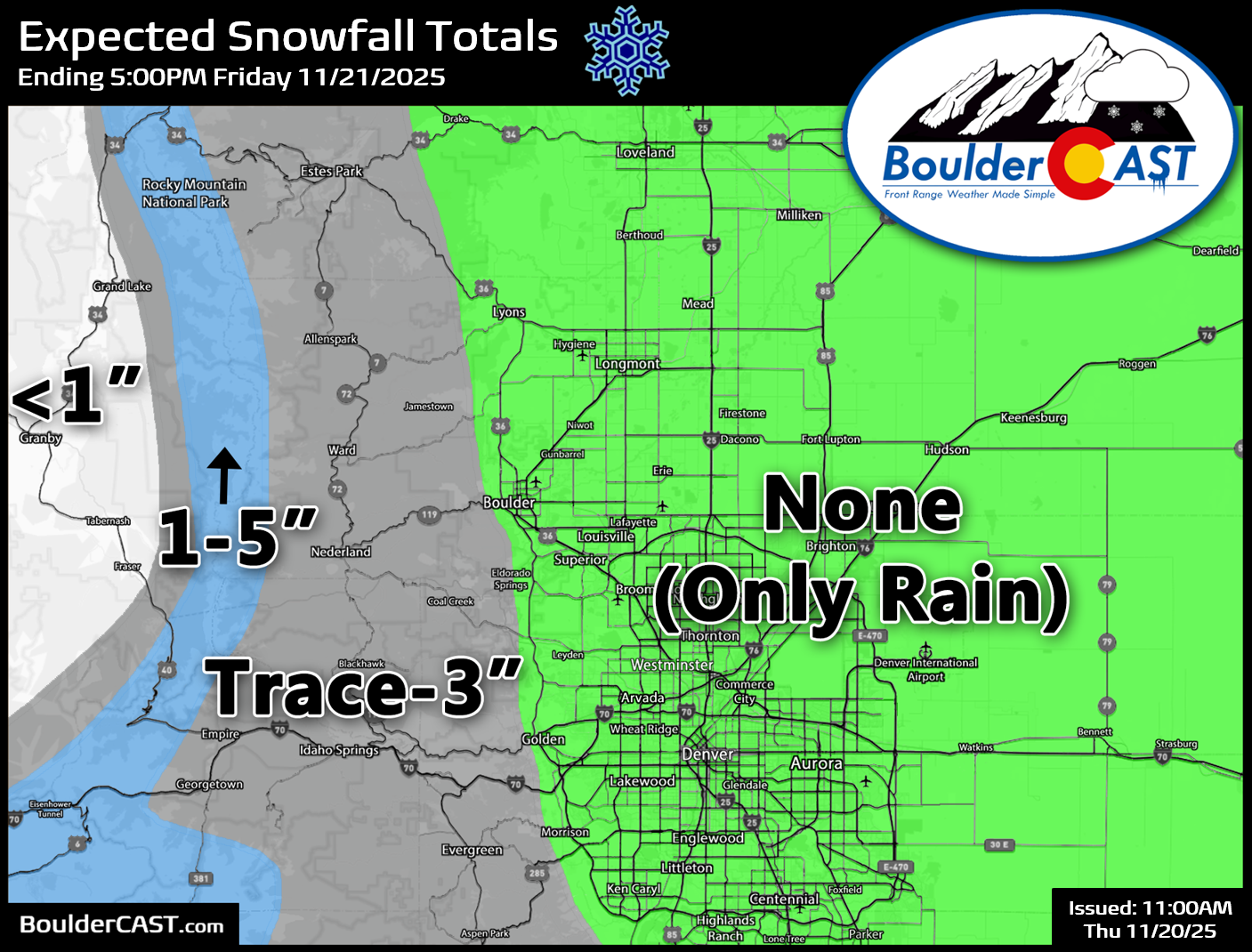
- Precipitation type: All rain below ~7,000 feet; light snow accumulation possible in the higher Foothills and the very top of the Palmer Divide.
- Expected amounts: Boulder/Denver under 0.30″ of rain; Foothills/Palmer Divide trace–3″ snow; Mountains east of the Divide 1–5″ snow.
- Looking ahead: Another rain chance comes Sunday from a similar tracking storm, followed by colder northwest flow next week that could bring light snow to the Mountains — and possibly the lower elevations in time for Thanksgiving.

Go Premium, get all the perks.
Daily Forecast Updates
Get our daily forecast discussion every morning delivered to your inbox.
All Our Model Data
Access to all our Colorado-centric high-resolution weather model graphics. Seriously — every one!
Ski & Hiking Forecasts
6-day forecasts for all the Colorado ski resorts, plus more than 120 hiking trails, including every 14er.
Smoke Forecasts
Wildfire smoke concentration predictions up to 72 hours into the future.
Exclusive Content
Weekend outlooks every Thursday, bonus storm updates, historical data and much more!
No Advertisements
Enjoy ad-free viewing on the entire site.
Forecast confidence increases for light rain Thursday evening into Friday
As of Thursday morning, the upper-level disturbance driving this change is spinning over central Arizona, slowly migrating toward Colorado. Ahead of it, thick clouds are already spreading across the state and they’re here to stay through Thursday and much of Friday. In other words—get used to the gloom for the next couple days!
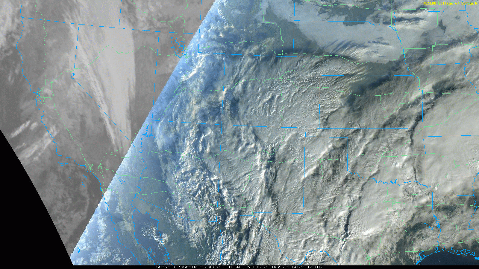
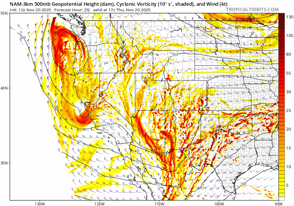
The good news: models are finally converging on a consistent solution for how this tricky storm evolves over the next 48 hours. The not-so-good news: the consensus is leaning drier for the Front Range. Our storm is relatively small and not particularly strong, which means it’s being steered by the larger low dropping into California. That interaction is the most fascinating part of this setup, but it’s also what made the forecast so challenging. At this point, though, the track looks clear: the system will swing into western Kansas by Friday morning before getting sheared apart and swept away by the jet stream across the Upper Midwest on Saturday.
There were several ways this storm could have delivered more moisture to the Front Range, but most of those opportunities have fizzled:
- The upper low could have tracked closer to us, but instead it’s sliding southeast into the Oklahoma Panhandle and western Kansas.
- Strong lee cyclogenesis could have developed as it passed, but instead we’re only seeing a weak surface low — and it’s too far away to help.
- A deformation zone could have stalled over the Front Range, pulling Gulf moisture into the terrain for an extended period. Instead, it sets up farther north near the Wyoming border and doesn’t last long.
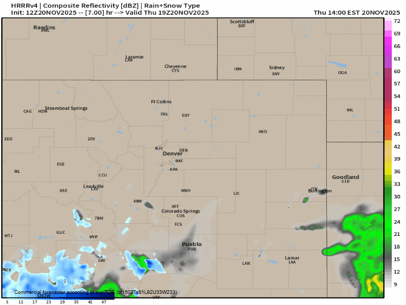
Even so, we’re not completely out of luck. Showers are still expected to spread into the Boulder–Denver area Thursday evening, possibly as early as 3–5 PM. Scattered showers will linger through the evening and overnight, with a few stragglers hanging on into Friday.
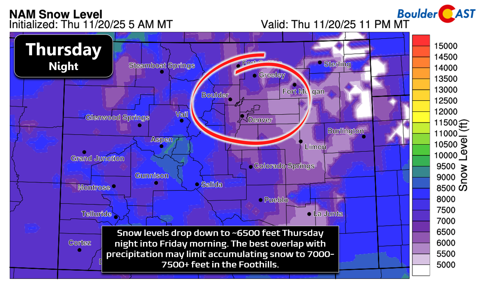
One important note: as we mentioned in our update yesterday, this is strictly a rain event for the lower elevations. The southern track of the low means it doesn’t have access to much cold air. It is close, as any storm would be in late November, but all precipitation is expected to be rain below 6,500 feet. Snow levels bottom out near 7,000-7,500 feet Thursday night, so light accumulations will be limited to the Foothills and highest parts of the Palmer Divide.
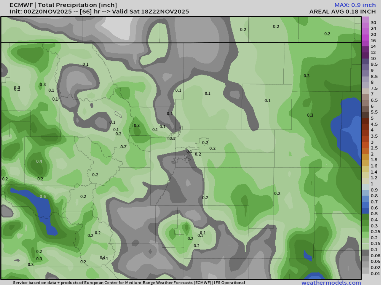
Precipitation amounts are trending on the low side. The Euro model keeps totals under 0.25″ for most of the Metro, with far northeast Colorado possibly reaching 0.5″+.
High-resolution models are a bit more bullish, pulling heavier precipitation westward into the Metro area thanks to a stronger low in western Kansas.
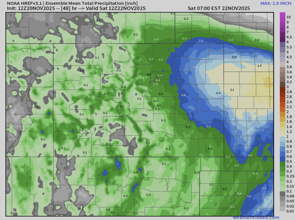
That scenario would mean deeper southeasterly flow into the Front Range, but we’re skeptical it will pan out. For now, we’re siding with the drier solution:
- Boulder & Denver: Less than 0.30″ of rain, with some spots perhaps seeing very little.
- Foothills/Palmer Divide (7000+ ft): Brief rain/snow mix at onset, then trace to 3″ of snow.
- Mountains along and east of the Divide (10,000+ ft): 1–5″ of snow.
Friday stays cloudy and chilly, with highs only in the low to mid-40s. There will be a slight chance of rain showers, mainly in the morning.
Looking ahead, our next shot at precipitation comes Sunday as that larger California low sweeps eastward. It’s expected to follow a similar track as tonight’s storm into far southeastern Colorado, though it may nudge a bit farther north. Either way, temperatures don’t look cold enough for snow for the lower elevations, so light rain is again the favored outcome late in the weekend.
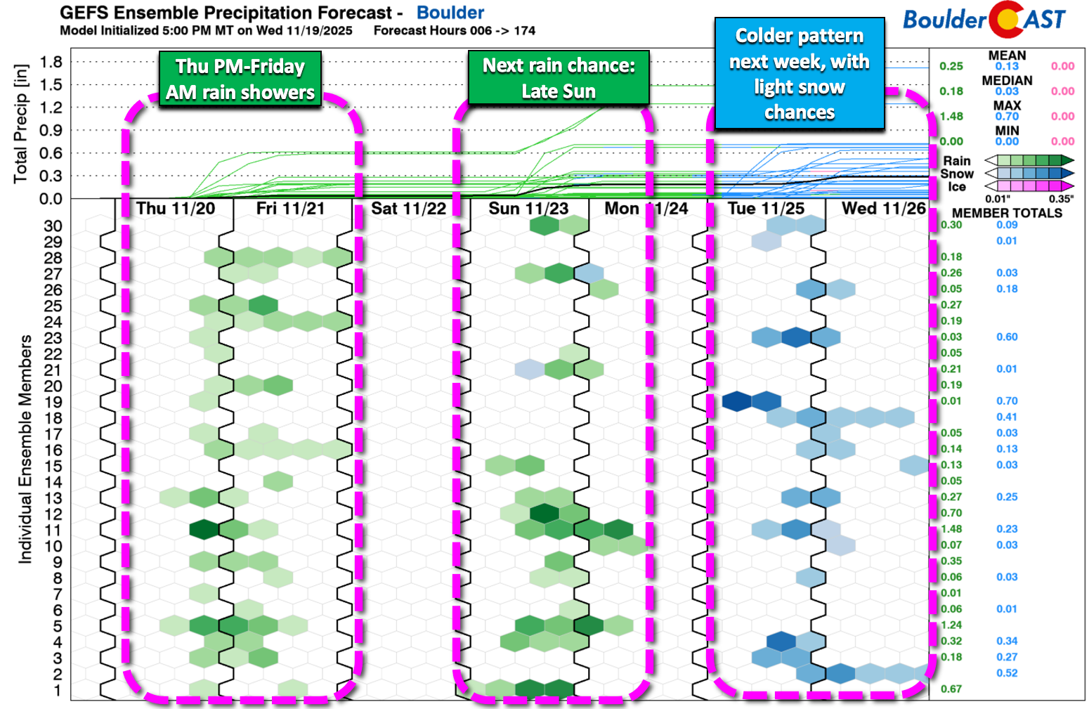
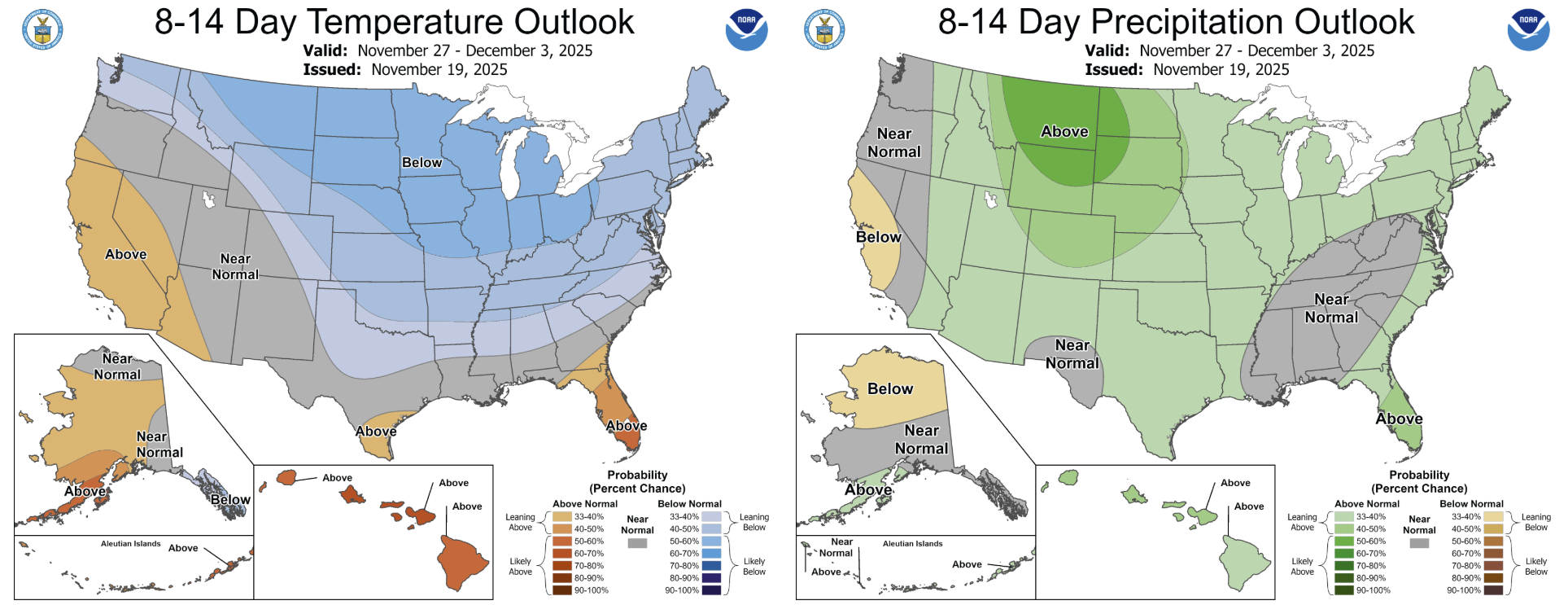
Beyond that, northwest flow sets up behind that storm, ushering in a colder pattern for next week. Weak disturbances riding that flow could bring one or two rounds of light snow to the Mountains — and maybe even the Boulder area. It’s too early to pin down specifics, but the setup is supportive of at least a couple of light snow threats depending on what shakes out of the northwest flow. For better or worse, those unseasonably warm temperatures that were a staple in November for us are over and done with. Cooler weather moves in heading into Thanksgiving and beyond.
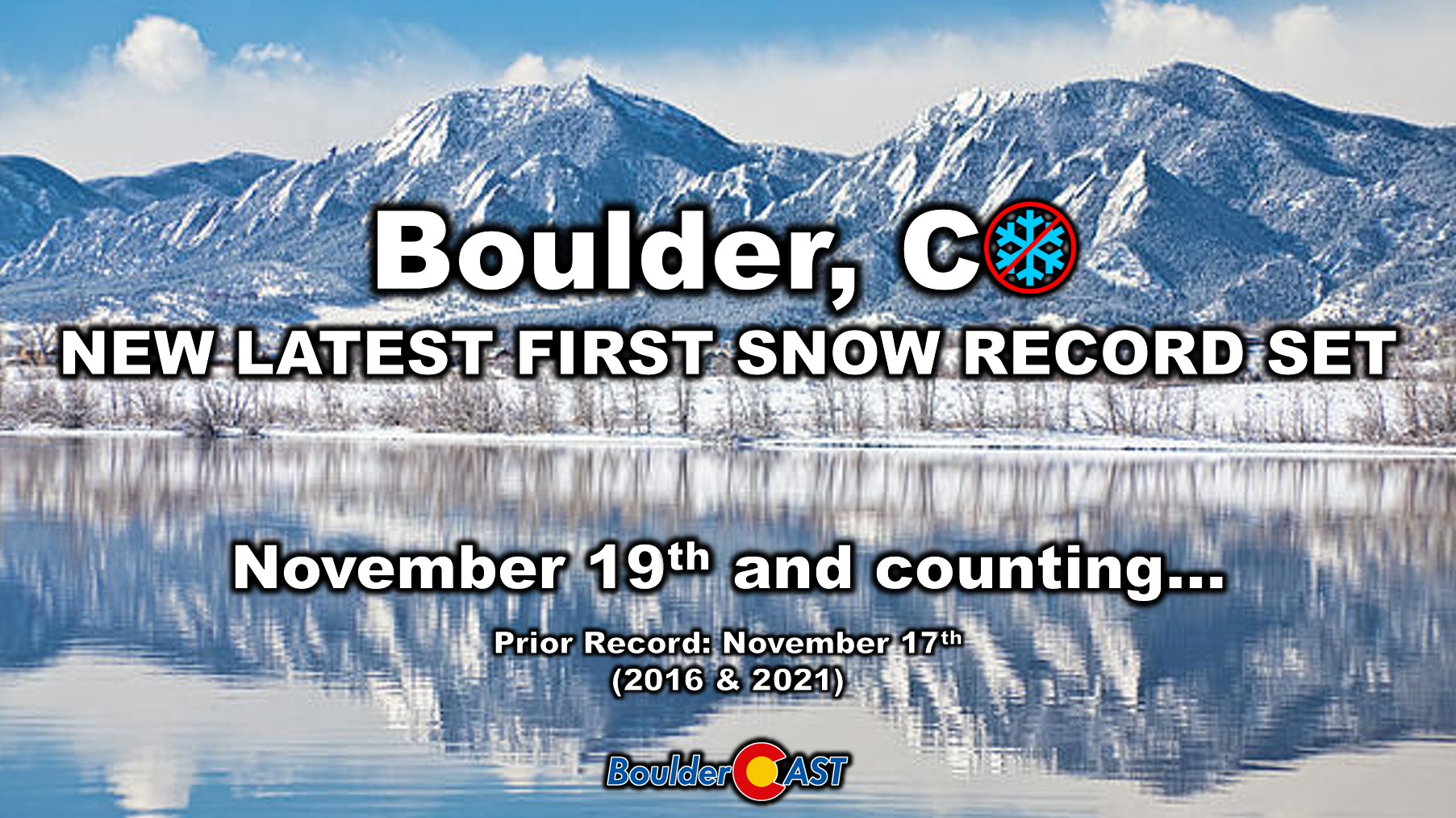
Boulder and Denver both await their first snow of the season — now being the latest on record for Boulder since at least 1948. For now, there’s no end to our First Snow Contest on the immediate horizon, and there’s only a handful of contestants left in contention. Turns out a lot of people didn’t have “Record Late First Snow” on their bingo cards.
That’s all for now. Enjoy the return of rain to the Front Range tonight, light as it may be. Soon enough we will be able to tell you about potential snow totals — just not today!
Spread the word, share our crazy Colorado weather:
Go Premium, get all the perks.
Daily Forecast Updates
Get our daily forecast discussion every morning delivered to your inbox.
All Our Model Data
Access to all our Colorado-centric high-resolution weather model graphics. Seriously — every one!
Ski & Hiking Forecasts
6-day forecasts for all the Colorado ski resorts, plus more than 120 hiking trails, including every 14er.
Smoke Forecasts
Wildfire smoke concentration predictions up to 72 hours into the future.
Exclusive Content
Weekend outlooks every Thursday, bonus storm updates, historical data and much more!
No Advertisements
Enjoy ad-free viewing on the entire site.


You must be logged in to post a comment.