Premium Storm Update (Thu May 3 at 6:00 AM) Strong cyclogenesis and upslope: Moderate lower elevation rain and heavy snow in the Foothills is falling this morning as 40 mph upslope briefly surges into the Metro area. READ NOW
—
We provide a quick forecast update as a vigorous storm system bears down on Colorado. Our forecast includes widespread soaking rain, borderline severe thunderstorms, and a snowfall forecast map for the higher elevations.
Ingredients
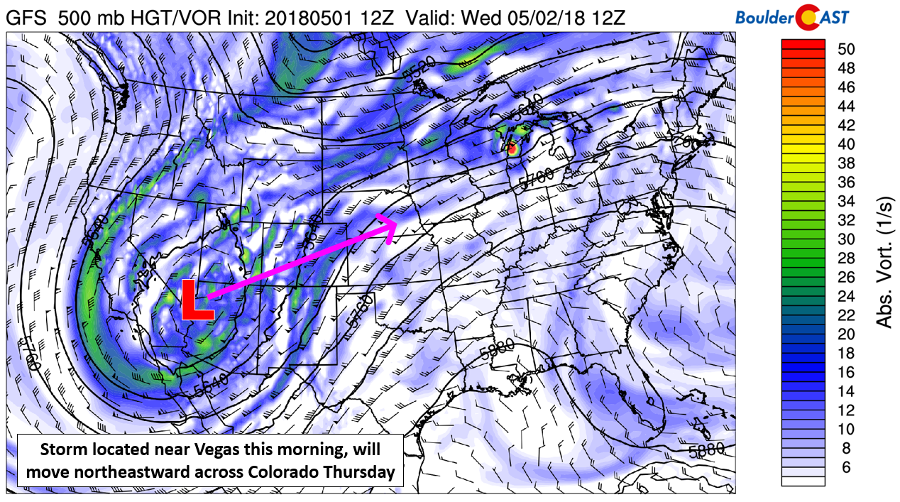
The forecast remains largely unchanged from what we described on Monday. The cut-off low pressure is located just east of Las Vegas this morning. It is expected to track northeastward and be almost directly over Boulder by sunrise Thursday.
This storm will bring favorable conditions for precipitation to the Front Range for the next 36 hours all the way through Thursday evening.
The key ingredients coming together are…
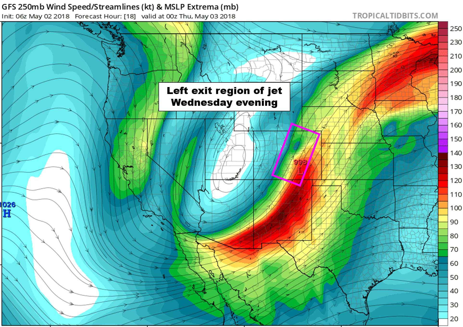
Jet forcing: A slow-moving jet streak across southern Colorado and New Mexico will put the Front Range in the left exit region of the jet Wednesday afternoon into Thursday morning.
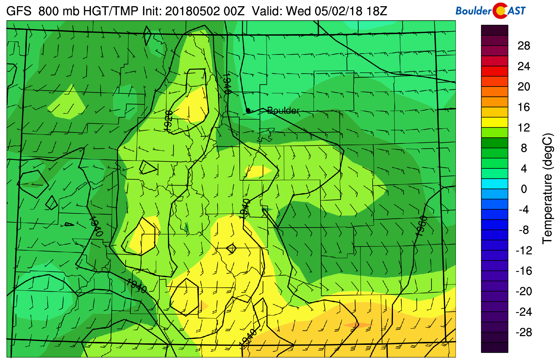
Upslope: We’re already seeing low clouds and upslope in place Wednesday morning with rain and snow developing across the Front Range. It’s currently a southeasterly upslope flow. We expect the direction to turn counter-clockwise through the day, becoming easterly by afternoon and eventually northeasterly by Wednesday evening. The upslope is not strong, but it is fairly deep and will help to focus precipitation along the Foothills of Boulder and Larimer Counties through the day and night.
An influx of Pacific AND Gulf of Mexico moisture: The storm system will be tapping into deep moisture with multiple sources converging on northeast Colorado.
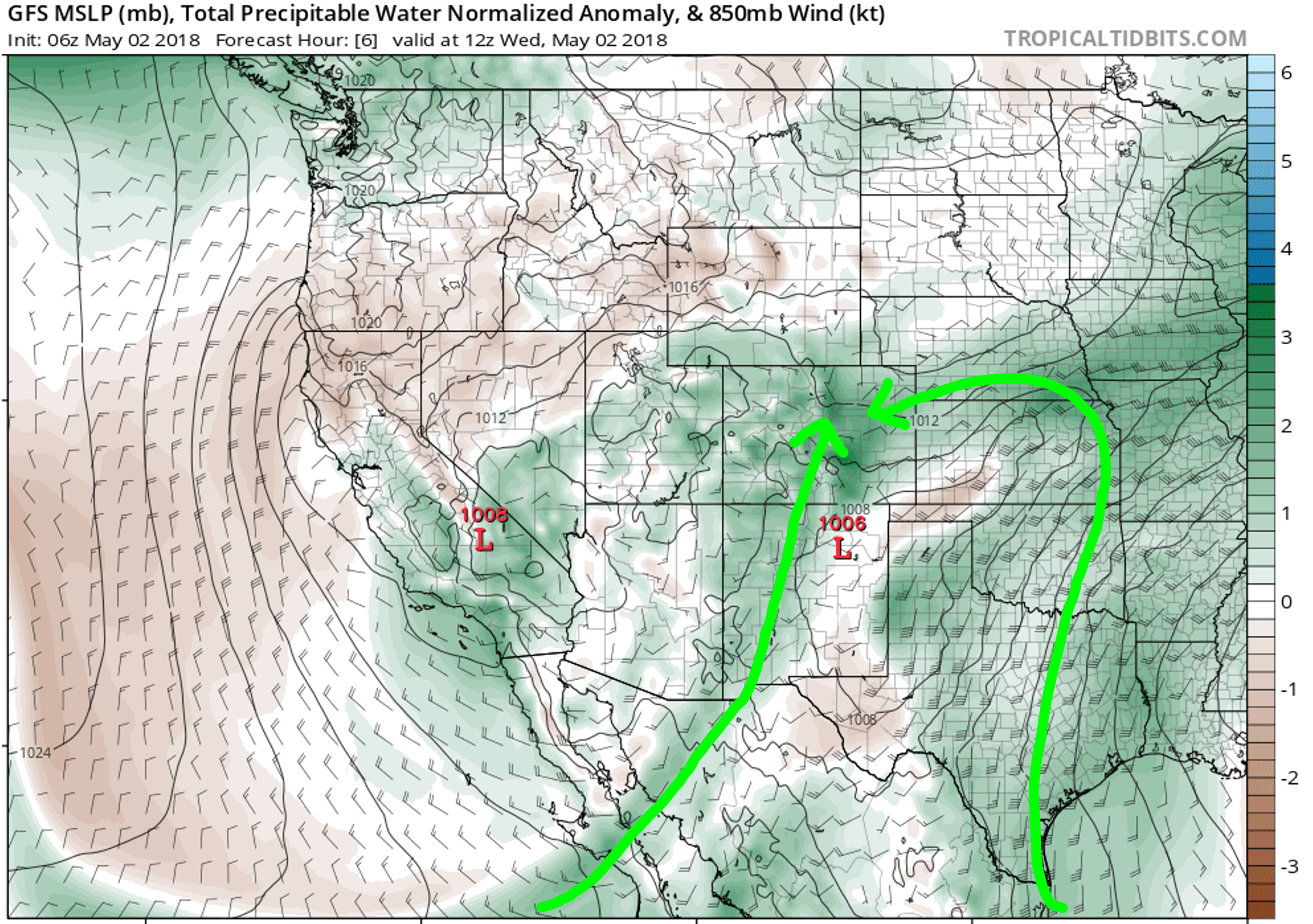
GFS moisture anomaly forecast for Wednesday showing to pipelines of moisture streaming into the Front Range.
Cyclogenesis: This ingredient is one which usually doesn’t directly impact Boulder and Denver in our spring storms, particularly the snowy ones. However, the track of this system is rather far north. Because of this, it appears we’ll be able to cash-in on strong lee cyclogenesis Thursday morning. As the upper-low moves over the Rockies, a potent surface low is expected to form in northeast Colorado, somewhere just northeast of Denver. This will provide added lift/convergence along with an influx of colder air from the north wrapping in. Models are also indicating at least a brief period of very favorable 30+ knot northeasterly winds. We could really see precipitation rates jump Thursday morning in and around Boulder thanks to this developing low.
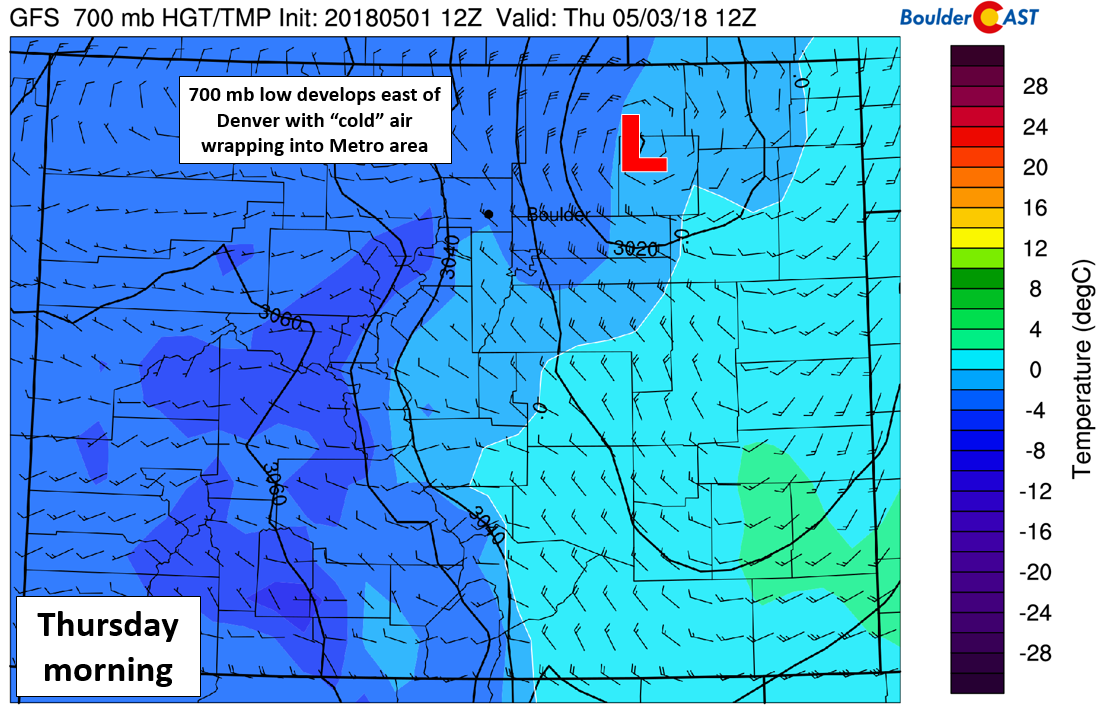
GFS 700 mb temperature and wind forecast for Thursday morning. A deepening surface low is seen across northeast Colorado.
Impacts
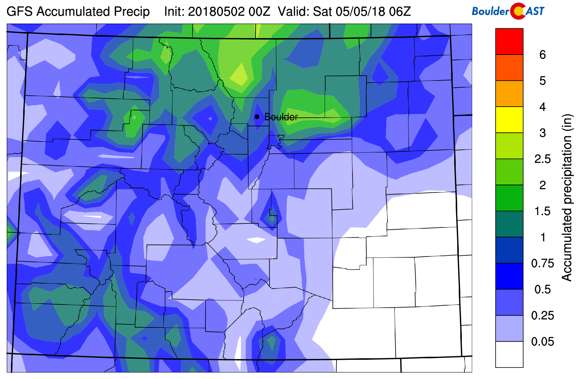
As we mentioned earlier, the track of this storm is a little bit further north than we would like by about 100 miles. The best forcing will exist across Larimer County, from Boulder north to the Wyoming border. These areas could see more than 2″ of precipitation from this storm. For the Metro area, we’re forecasting 0.5 to 1.5″ of rain. The higher amounts will be skewed north and west of Denver due to the track of the storm. We may see a break in the action around lunch-time Wednesday, but showers and storms should redevelop through the afternoon/evening and continue into Thursday.
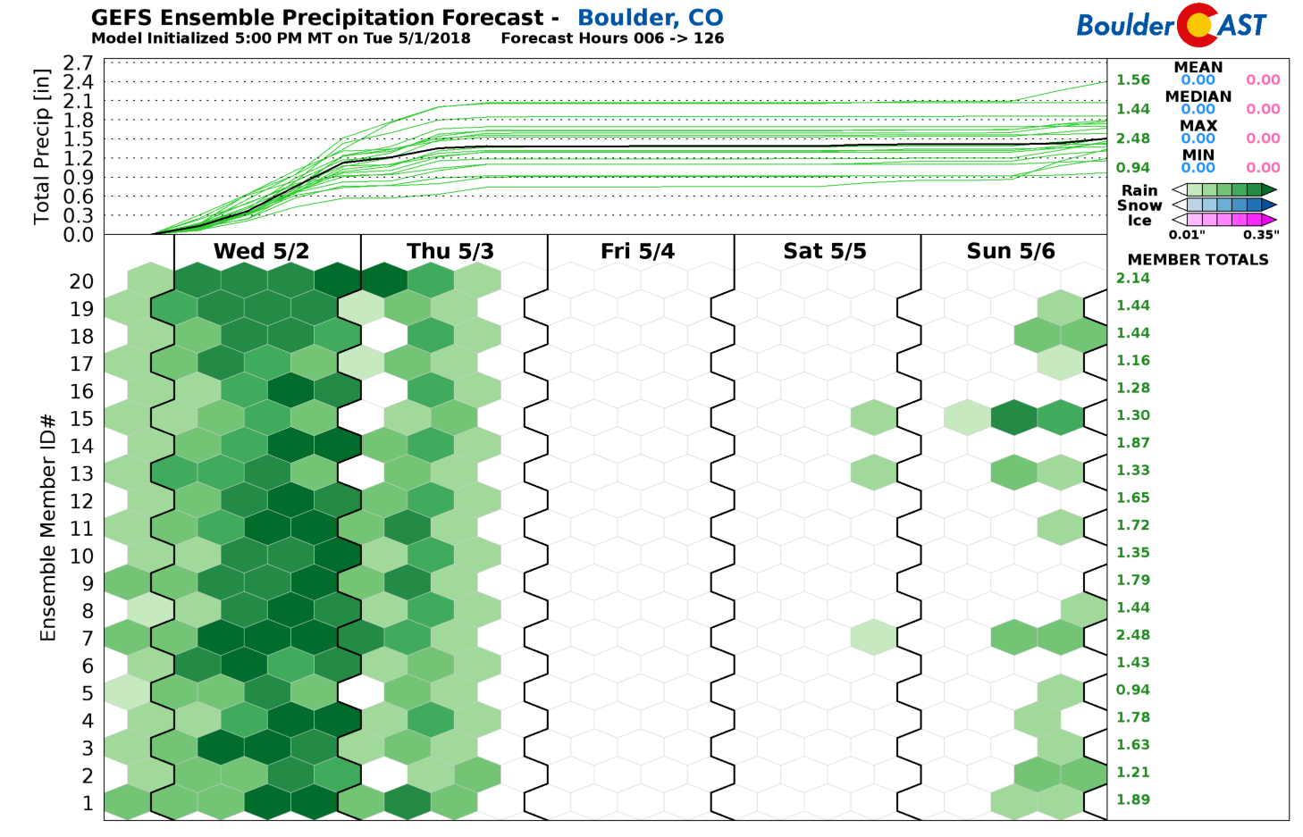
The GFS ensemble median and mean rainfall forecast is right around 1.5″ in Boulder (shown below), with near 1″ in Denver.
We’re also watching for a few strong to borderline severe thunderstorms to form just east of Denver Wednesday afternoon and early evening. CAPE values (if the sun comes out and stays shining) will approach 1000 to 1200 J/kg Wednesday afternoon. Combined with good shear, thunderstorms capable of producing hail up to 1″ in diameter, frequent lightning, and heavy rain will be possible. The red circled area below is the region of concern. Parts of the eastern Metro area should keep an eye to the sky later today. Areas on this zone that see a few storms hit will also see 1 to 2″ rainfall totals.
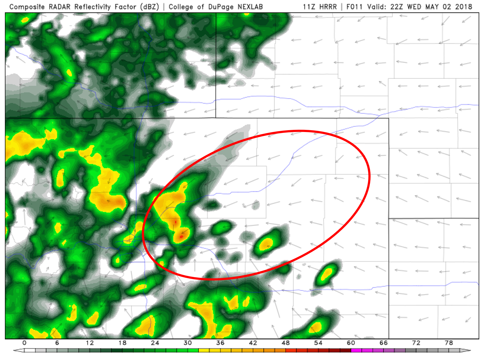
HRRR simulated radar reflectivity for 4:00 PM Wednesday evening. The area we’re watching for potential hail-producing thunderstorms is circled in red.
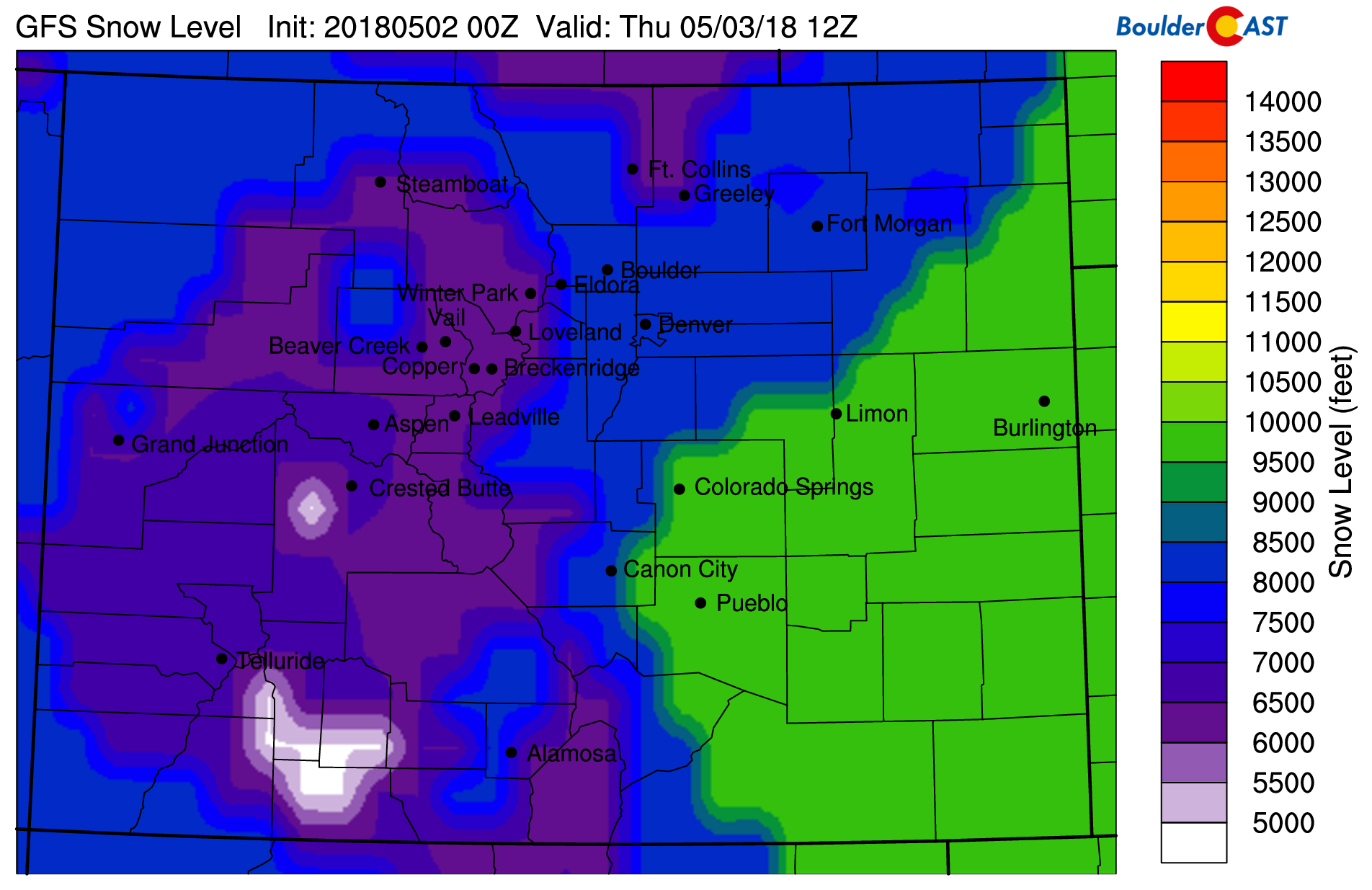
While not unusual for early May, this storm will be too warm for snow across the lower elevations and even much of the Foothills. The one exception to this will be late Wednesday night and Thursday morning as the surface low forms and pulls in colder air. This will force snow levels down to around 7000 or 7500 feet.
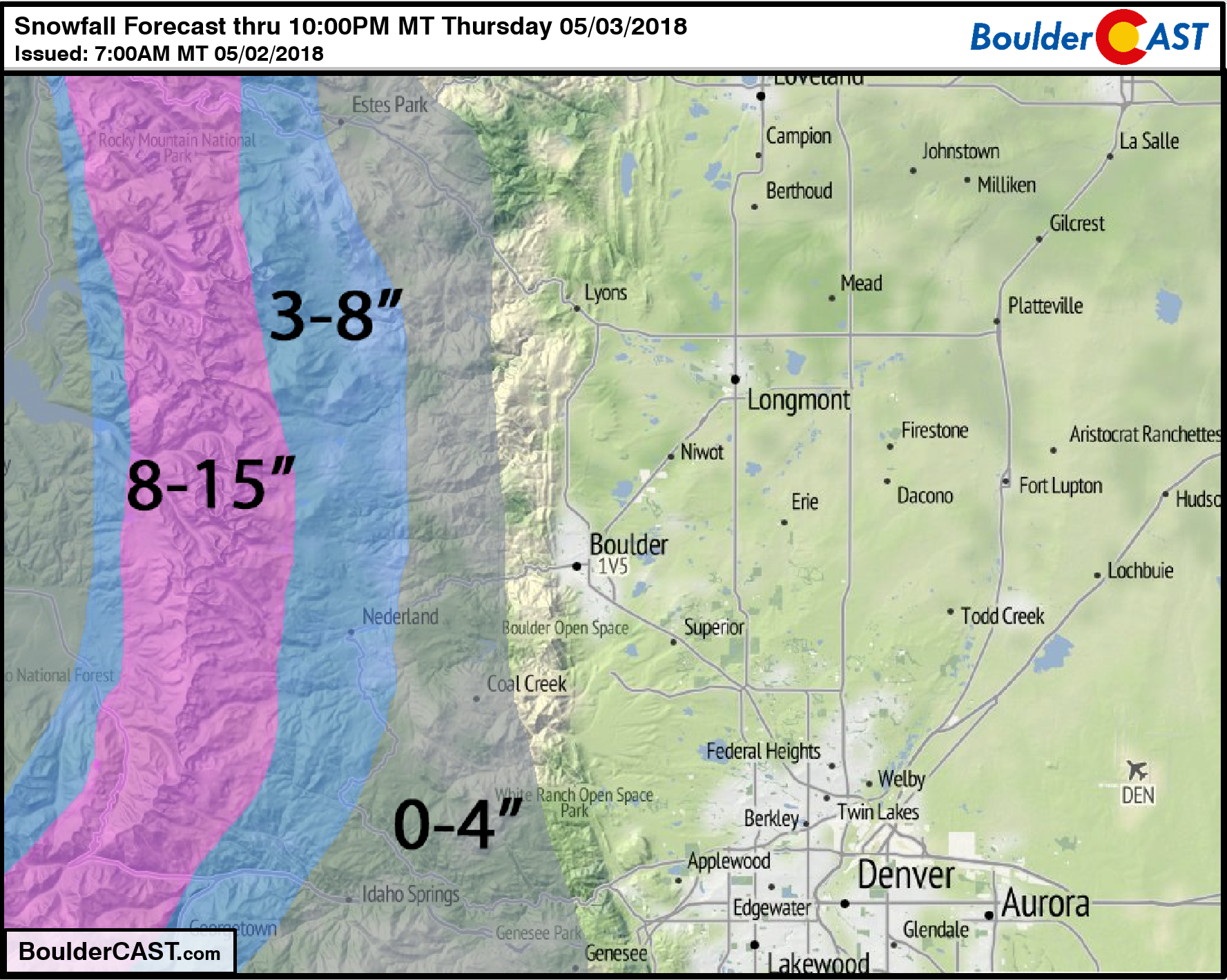
Still, snow accumulation between 7000 and 8000 feet is marginal and will largely depend on finer details of the storm as it exists early Thursday morning. In these areas, we are forecasting up to 4″ of heavy wet snow. For areas above 8000 feet, it’s already snowing (!) and it will be colder through the day and night. While the snow level should rise slightly during the day today, it will drop back down this evening and especially after midnight Wednesday night. We’re expecting 3 to 8″ in these locations, with most of this snow falling Thursday morning. This includes Nederland, Ward, and Allenspark.
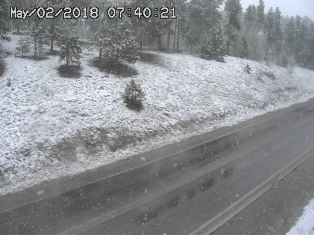
Snow is already falling near Nederland this morning. This webcam is at 8,500 feet elevation along Peak-to-Peak Highway.
Our snowfall forecast map is shown below.
The light at the end of the tunnel? Sunshine and warmer weather return for Friday and Saturday with highs in the 70’s to lower 80’s! Our next chance of rain comes Sunday in the form of scattered afternoon thunderstorms.
Enjoy the nice change of pace these next few days. Let’s hope that all this rain helps get the currently insane pollen-count under control…
.
Did you find our forecast helpful? Please share:
.



Best weather forecasting and reporting on the Front Range. Thanks!!!