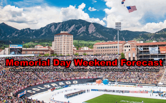
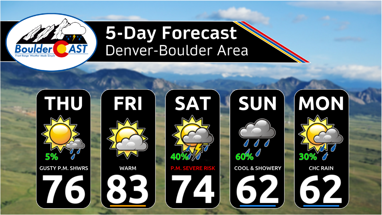
As we roll briskly into Memorial Day weekend, the forecast is shaping up to be a mix of weather conditions across the Front Range. Thursday and Friday will be pleasant, but by the weekend, a slow-moving weak storm system will shake things up, bringing cooler temperatures and a higher chance of showers and thunderstorms, including some severe risk. If you’ve got outdoor plans, definitely stay weather-aware, but don’t let a little rain spoil the holiday fun!

Go Premium, get all the perks.
Daily Forecast Updates
Get our daily forecast discussion every morning delivered to your inbox.
All Our Model Data
Access to all our Colorado-centric high-resolution weather model graphics. Seriously — every one!
Ski & Hiking Forecasts
6-day forecasts for all the Colorado ski resorts, plus more than 120 hiking trails, including every 14er.
Smoke Forecasts
Wildfire smoke concentration predictions up to 72 hours into the future.
Exclusive Content
Weekend outlooks every Thursday, bonus storm updates, historical data and much more!
No Advertisements
Enjoy ad-free viewing on the entire site.
Wednesday’s Wind
The strong winds yesterday ended up being less of an annoyance than expected. Gusts of 20 to 30 MPH were common during the afternoon and evening hours, but barely anything near 40 MPH was observed across the entire Denver Metro area. The graphic below shows the last 24 hours of wind at NCAR Mesa Lab in Boulder — just one measly gust near 40 MPH!
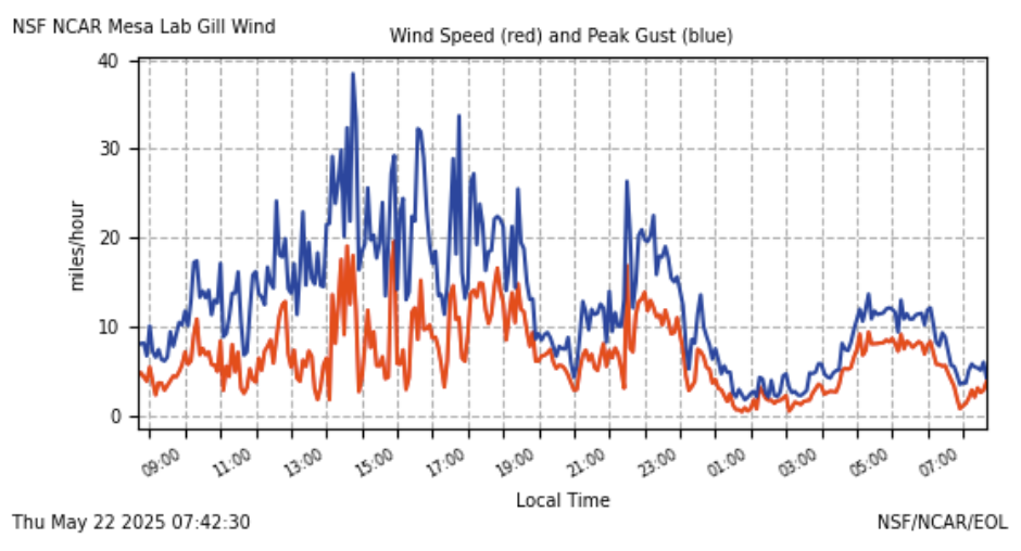
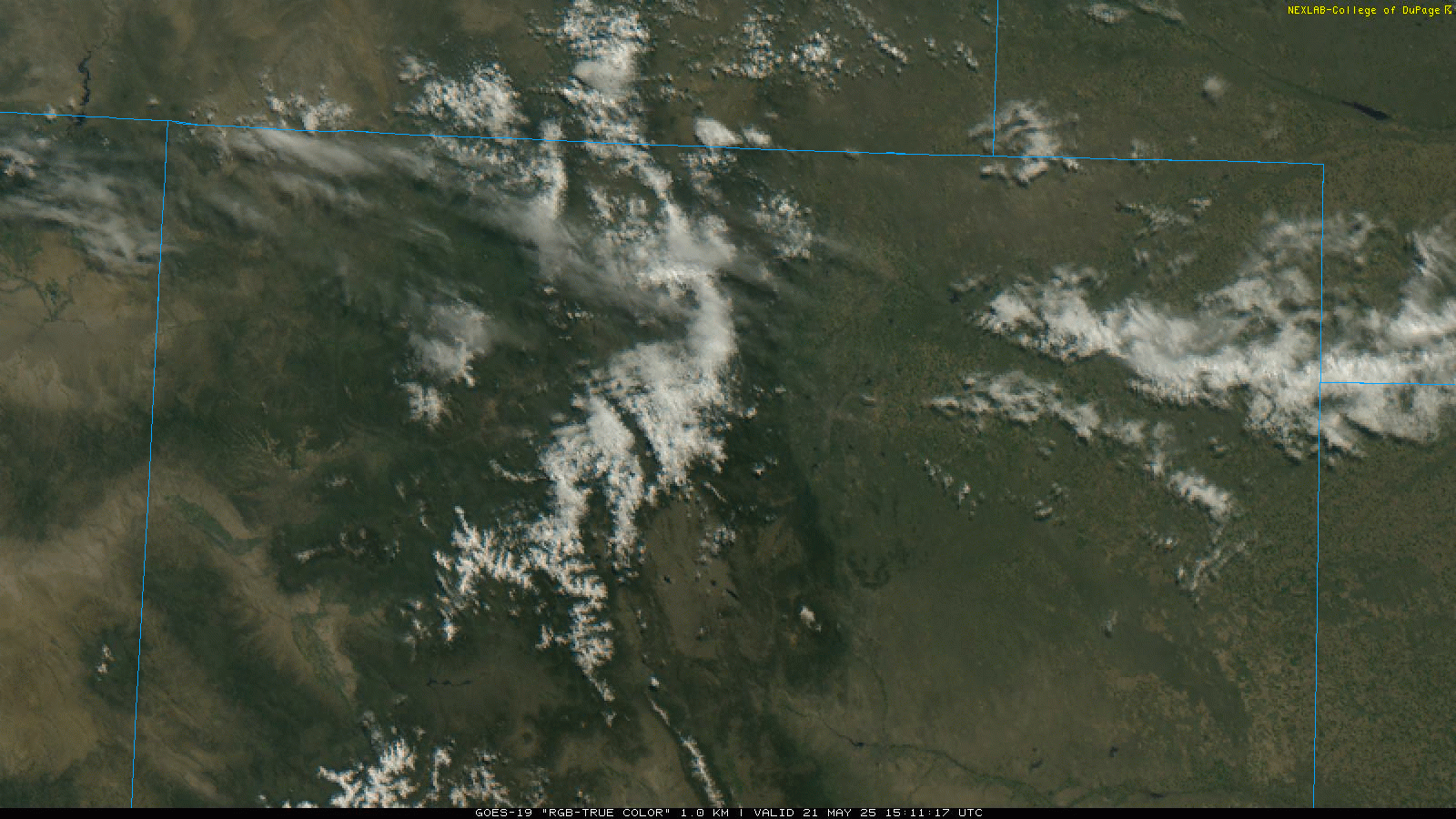
The models were quite clear regarding how windy it would be but ended up being too bullish. My guess is that the full mix-down of the winds across the Front Range was interrupted by the area being in the left-exit region of the jet where rising motion occurs. This jet interaction also helped to spawn more extensive high cloud cover yesterday over northern Colorado which would also act to limit mixing. Yesterday’s satellite animation shows some of these wispy clouds forming overhead during the day.
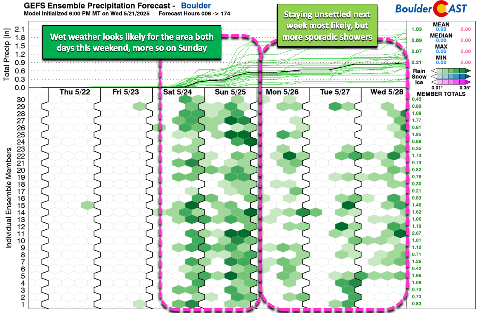
A rainy Memorial Day weekend
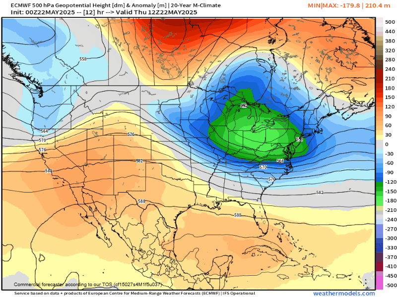
Looking ahead, Thursday and Friday will bring warmer temperatures and lighter winds as a weak ridge moves over the southern Rockies before shifting into the southern Plains. The animation below shows the mid-level height anomaly pattern through Monday—notice the weak ridging over Colorado at first, but by the weekend, a small trough rolls in from the West Coast and stalls over the Four Corners. This system will bump up our rain chances and bring cooler temperatures for the weekend.
Until then, though, Thursday and Friday will be beautiful! Expect highs in the mid-70s Thursday and low to mid-80s Friday. There could be a few afternoon showers forming off the mountains, especially Thursday, but since the air is pretty dry, they likely won’t amount to much. However, inverted-V profiles mean any showers could bring gusty outflow winds of 30+ MPH. The best chance for these lies between 2 PM and 8 PM on Thursday.
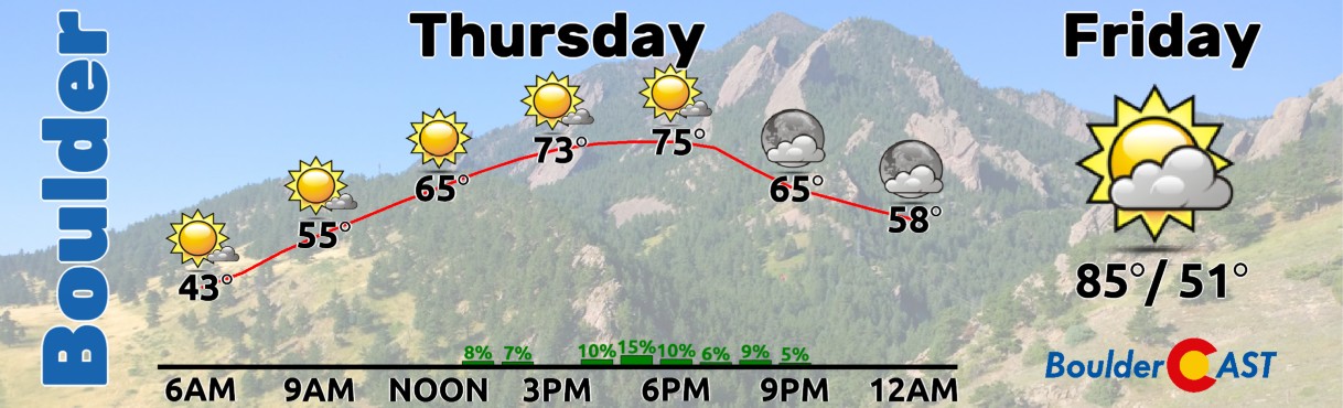
By Friday, there should be fewer weak showers, but late in the day, supercell thunderstorms could return to far northeast Colorado, with large hail as the biggest threat.
If you’ve got outdoor plans for the holiday weekend, keep an eye on the forecast—rain chances will rise significantly on Saturday and Sunday as the aforementioned storm system moves in from the west.
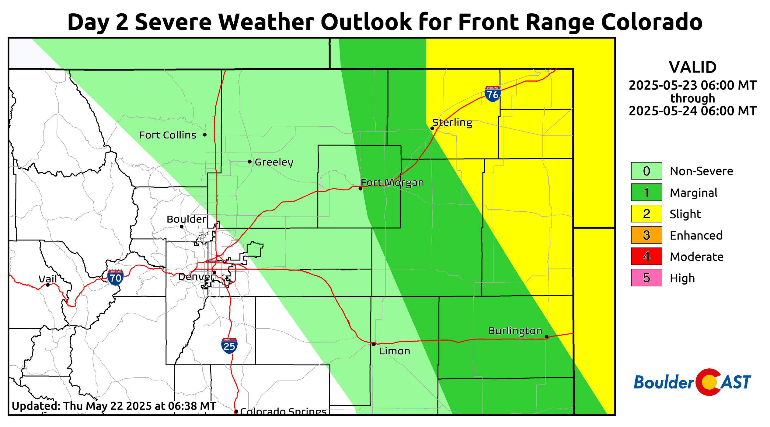
After a preliminary cold front passes through Friday evening, Saturday will bring a better chance for storms as the lingering frontal boundary sparks afternoon convection. A shallow front will be stretched across eastern Colorado, with moist southeasterly flow meeting warm, dry air from the southwest. The exact setup is still uncertain, but this could lead to a Denver Cyclone pattern, bringing cooler, stable conditions near Boulder and stronger storms just east of I-25.
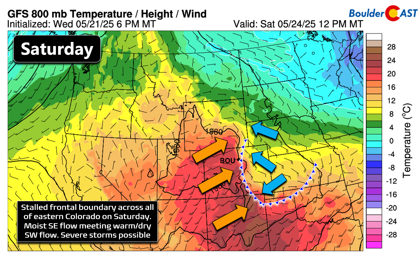
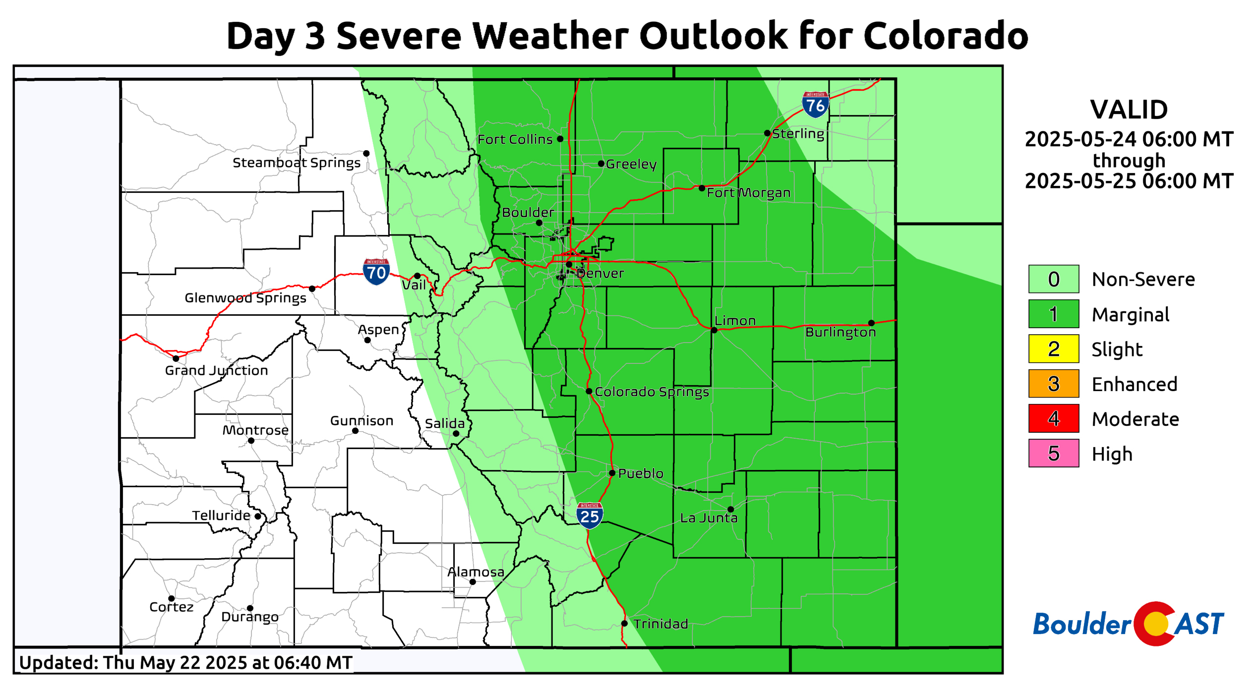
We’ll have to wait a bit longer to see how it all plays out, but for now, the Storm Prediction Center has all of eastern Colorado in a Marginal Risk for severe storms Saturday, mainly in the afternoon and evening. Depending on cloud cover and the Denver Cyclone pattern, northern areas could top out near 70 degrees, while southern spots reach closer to 80.
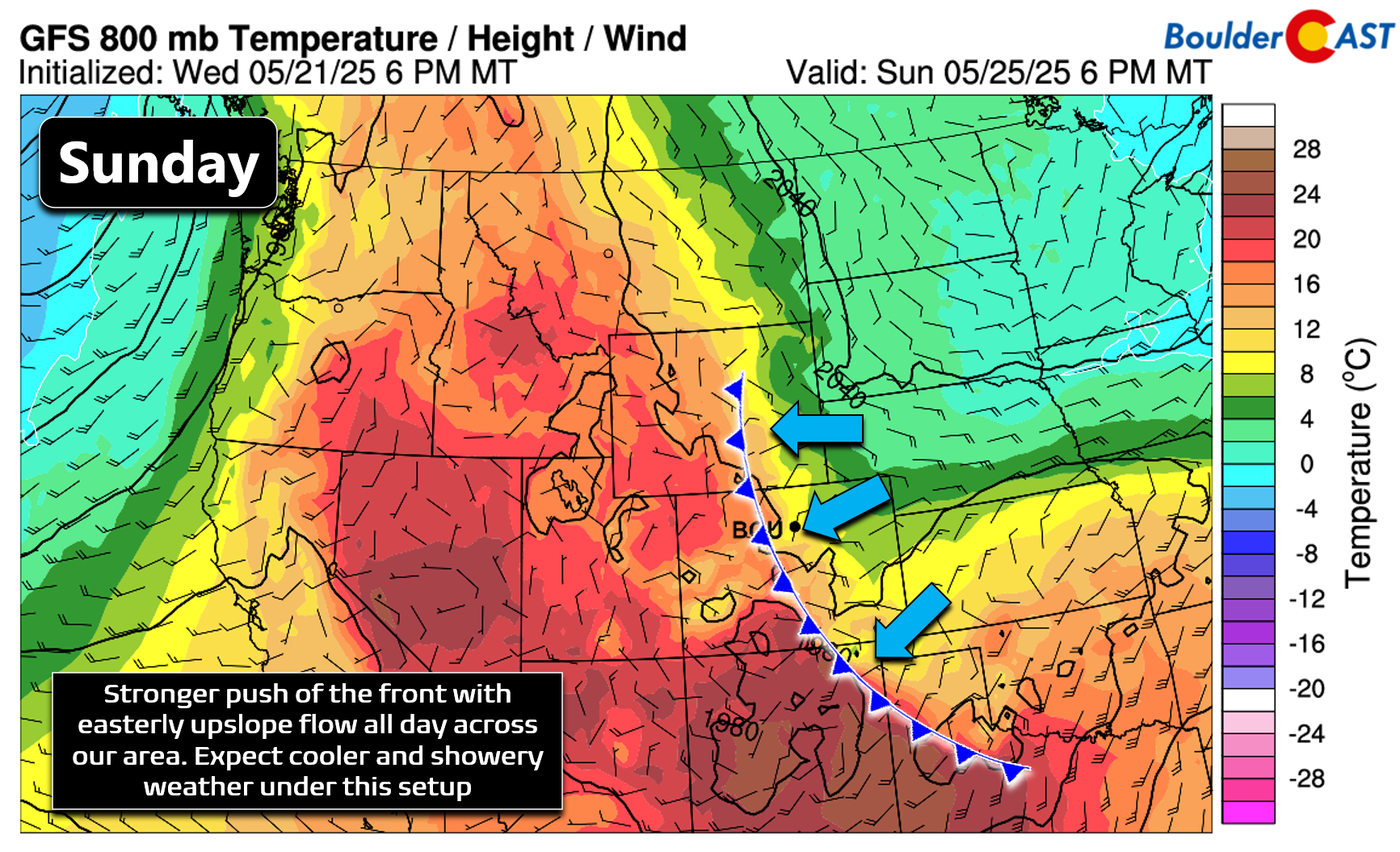
By Sunday, low-level winds will strengthen and shift to a more favorable upslope direction (from the east/northeast). This will bring more clouds and widespread showers, with highs likely in the lower 60s—potentially cooler if low clouds develop.
Rain chances will linger into Monday and much of next week, as Colorado finds itself caught between a strong ridge over western Canada and several cut-off troughs. For now, Monday looks cool with a continued chance of showers in the late-day period.
Despite the rainy outlook, there’s still plenty to enjoy this Memorial Day weekend. Whether you’re heading out for a family gathering, watching a parade, running in the BolderBoulder 10k, or just relaxing at home, hopefully the showers won’t put too much of a damper on your plans. Keep an eye on the forecast, grab an umbrella if needed, and make the most of the long weekend. Enjoy!
Enjoy our content? Give it a share:


You must be logged in to post a comment.