Denver’s temperature soared past the century mark on Thursday for the fourth time this summer, but Boulder came up short again. Near-record hot temperatures will again be possible on Friday ahead of a cold front which will set the stage for a pleasant weekend ahead. We discuss the cause of this heatwave, which cities will again be challenging records on Friday, and why we should consider ourselves lucky it wasn’t hotter this week.
Key Highlights from This Post:
- Denver reached 100 degrees for the fourth time this year on Thursday, but Boulder came up short again
- The heatwave continues with near-record high temperatures on Friday around 100 degrees
- A cold front arrives Friday night setting the stage for a cooler weekend
- The Front Range once again has dodged the worst of this heatwave as it has done twice before this summer
Help support our team of Front Range weather bloggers by joining BoulderCAST Premium. We talk Boulder and Denver weather every single day. Sign up now to get access to our daily forecast discussions each morning, complete six-day skiing and hiking forecasts powered by machine learning, first-class access to all our Colorado-centric high-resolution weather graphics, bonus storm updates and much more! Or not, we just appreciate your readership!
O
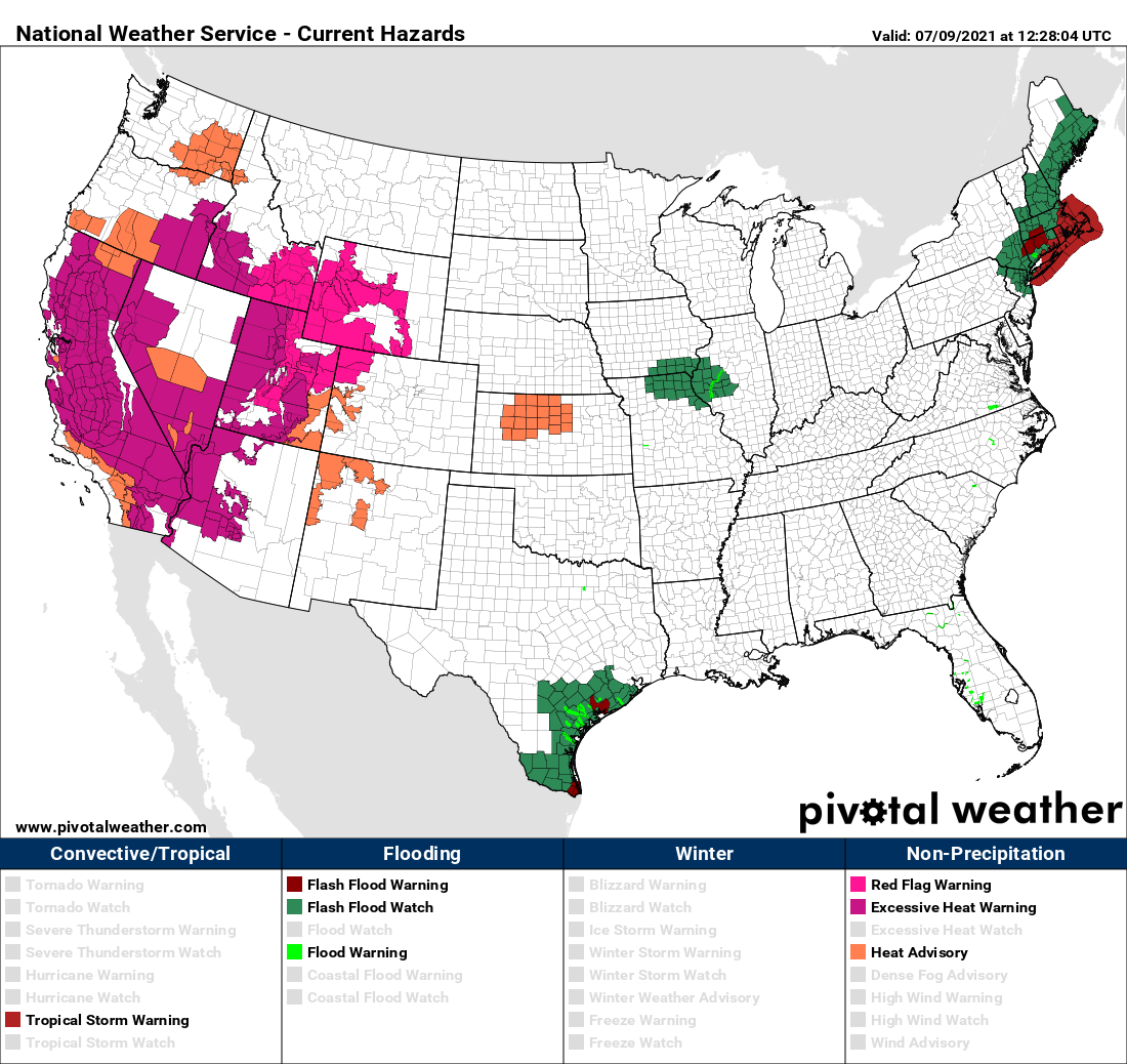
ne look at the current weather highlights posted across the country and it’s clear that another widespread heatwave is underway across the western United States. Heat-related warnings and advisories are in effect from southern California northward into Washington and eastward into parts of Kansas. Though the Front Range is excluded from any highlights right now, it will be a very hot day ahead. If you didn’t realize it, heat-related advisories for the Denver Metro area are very rare due to our high elevation and low humidity.
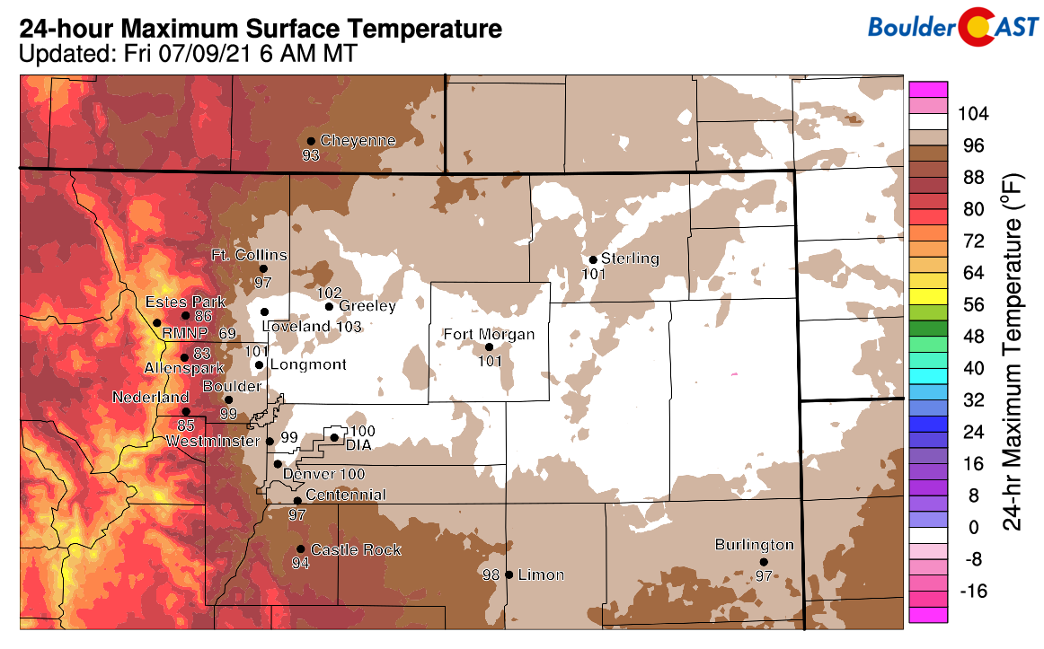
Of course you already know this: temperatures soared close to 100 degrees across the Front Range on Thursday nearing records in many cities. Denver rose to its hottest temperature in 2021 peaking at 102°F Thursday afternoon. However, for the fourth time this summer, Boulder failed to reach the century mark on a day where Denver did. The city’s official high temperature was a cool 98°F.
In addition to the official observation, we were unable to find any reports of triple digit maximum temperatures from other data sources in Boulder either:
-
BoulderCAST Station: 99.4°
-
Boulder Airport: 99°
-
CU East Campus: 99.2°
-
NCAR Foothills Lab: 98.2°
At our station in north Boulder, the temperature hovered between 97 and 99°F most of the afternoon, until about 3:45PM when temperatures began to decline.
What happened at 3:45PM? Thick storm clouds and cool outflow gusts arrived! The transition from a hot and sunny afternoon to a cooler, ominous-looking evening is shown in the timelapse below.
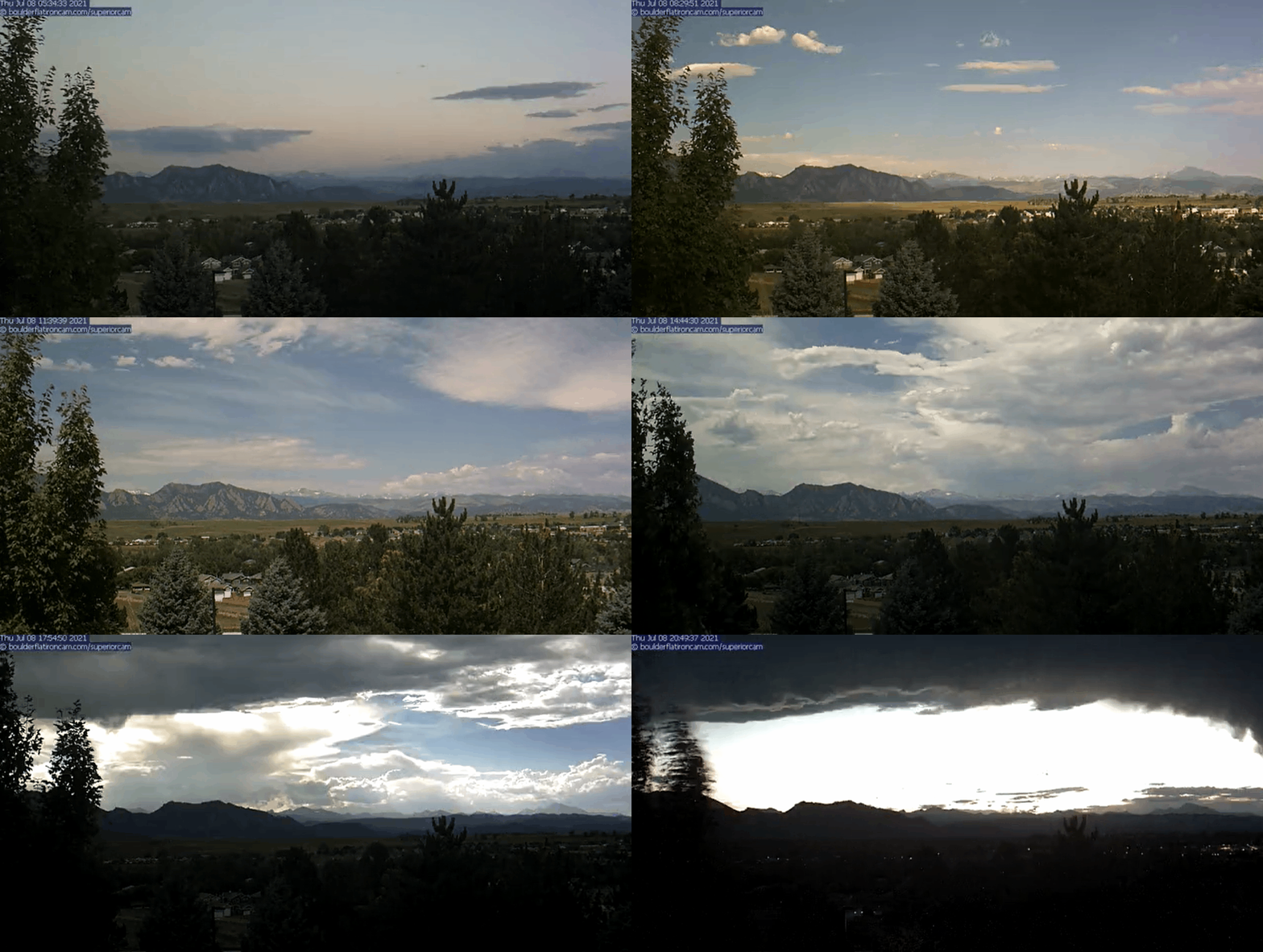
Timelapse from all of Thursday showing the increasing late-day storm clouds that prevented Boulder from hitting 100 degrees | Source: Boulderflatironcam.com
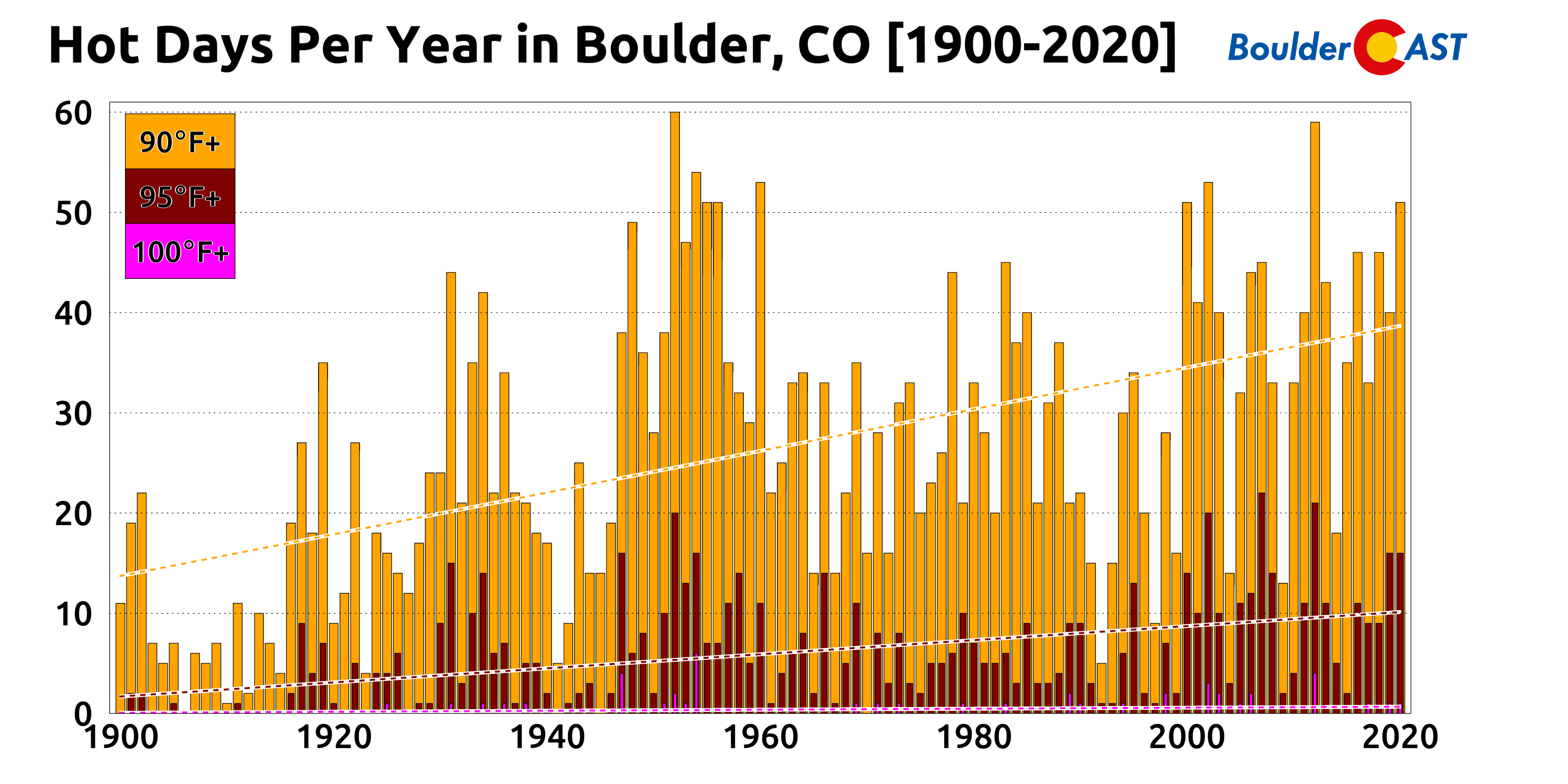
Boulder’s historical count of 100-degree days thus remains at 45. Climate records for Boulder date back to 1897, giving an average of about one 100° day every three years.
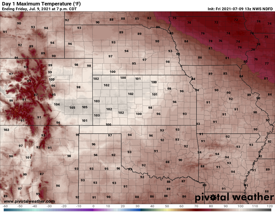
Let’s not completely write off this heatwave yet, though! Friday will offer a final chance at triple digit heat for the Denver Metro area as the hot airmass remains locked across the southwestern United States. Forecast high temperatures are in the upper 90’s to low 100’s once again.
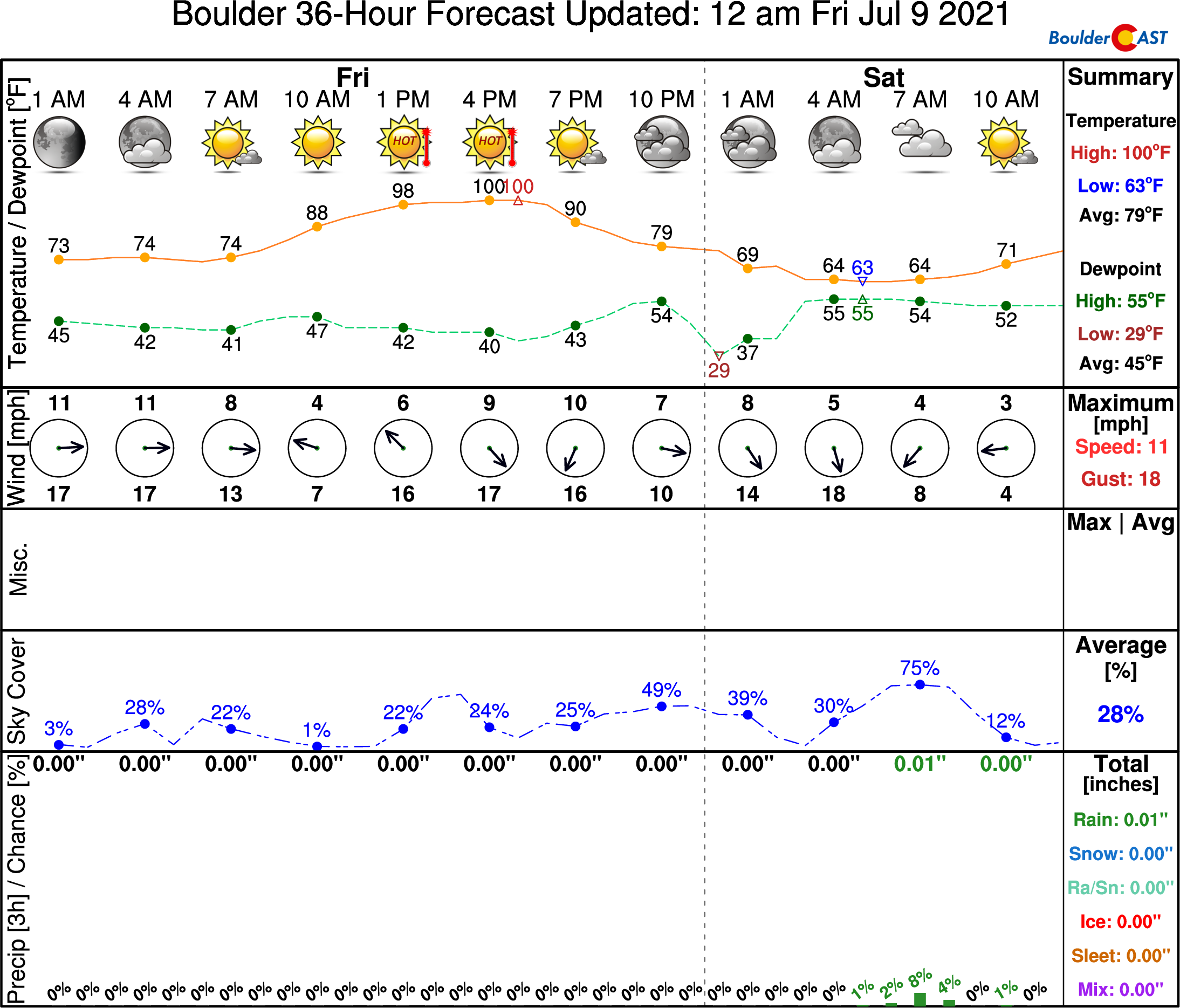
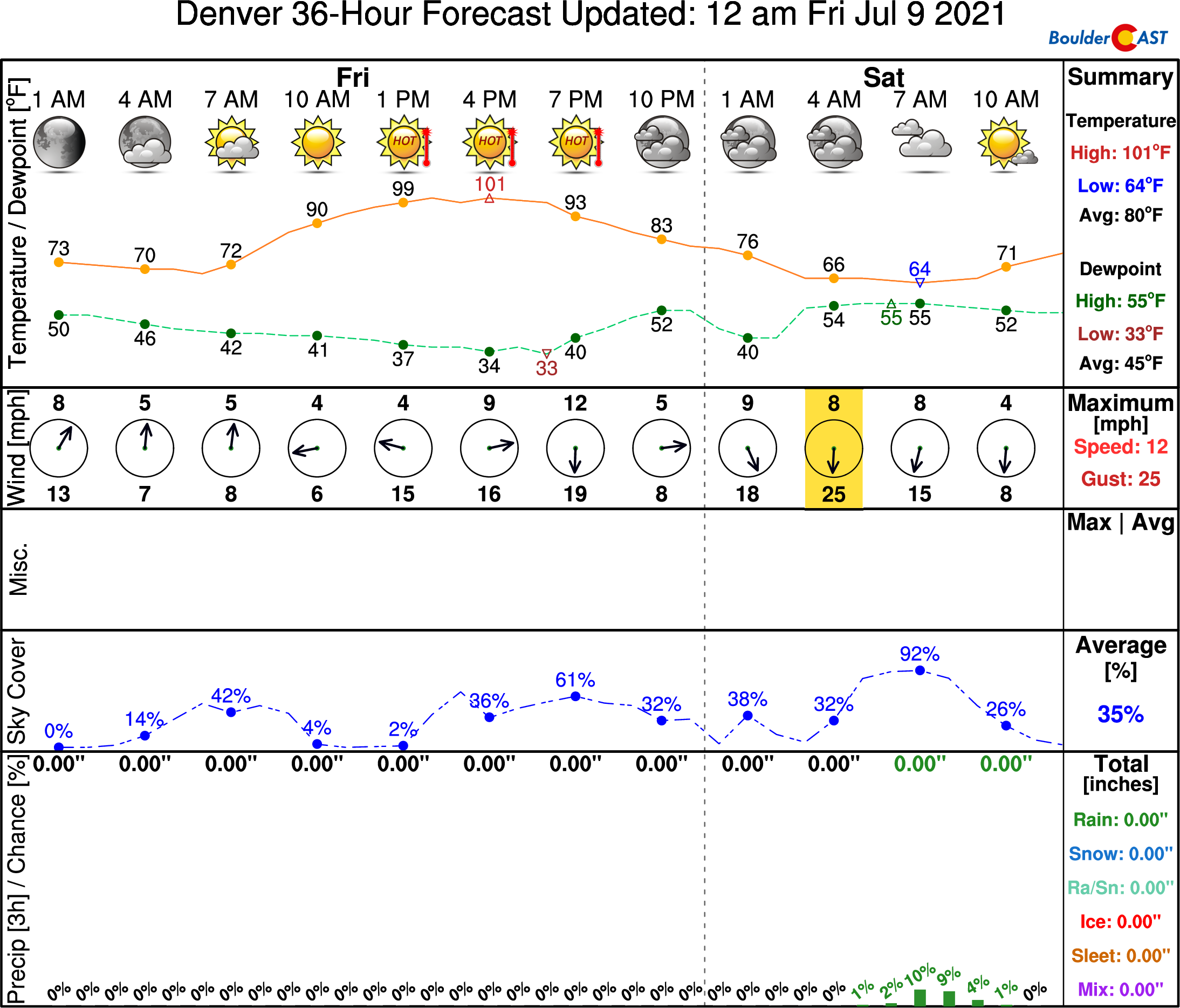
Our NowCAST timeline forecast has Boulder reaching 100 degrees on the dot Friday afternoon. The record high for July 9th is 99°F set back in 1976 so we do have a shot at tying or breaking this record today. We are, however, expecting that thickening storm clouds and cool outflow gusts may prevent triple digits again today in Boulder as was the case on Thursday, but we shall see!
Similarly, NowCAST has Denver soaring to a toasty 101°F, which would also break the city’s existing record high for the date of 98°F. Triple digits seem like a safe bet in Denver today!
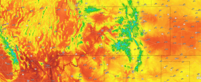
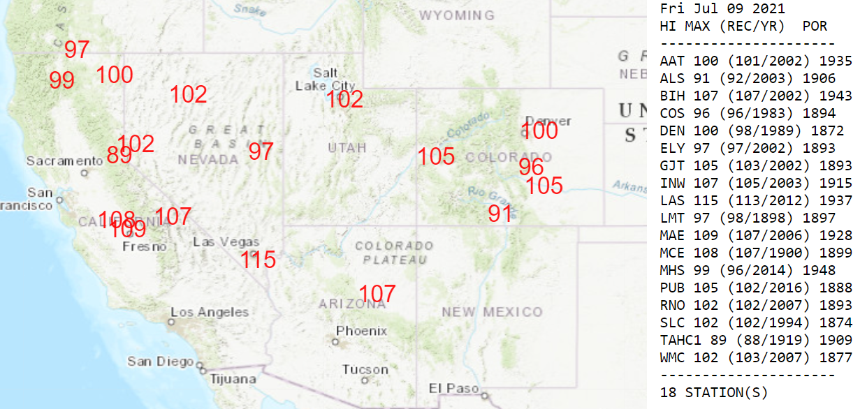
Other locations poised to eclipse record values today across the state include Pueblo (105°) , Colorado Springs (96°), Alamosa (91°), and Grand Junction (105°):
The heatwave will continue through the upcoming weekend for areas west of the Continental Divide, but fortunately not for eastern Colorado. A somewhat shallow cold front is on-track to arrive to the Front Range after midnight Friday night setting the stage for a cooler weekend ahead. High temperatures will drop back into the 80’s for both Saturday and Sunday with little to no chance of rain and sunny skies.
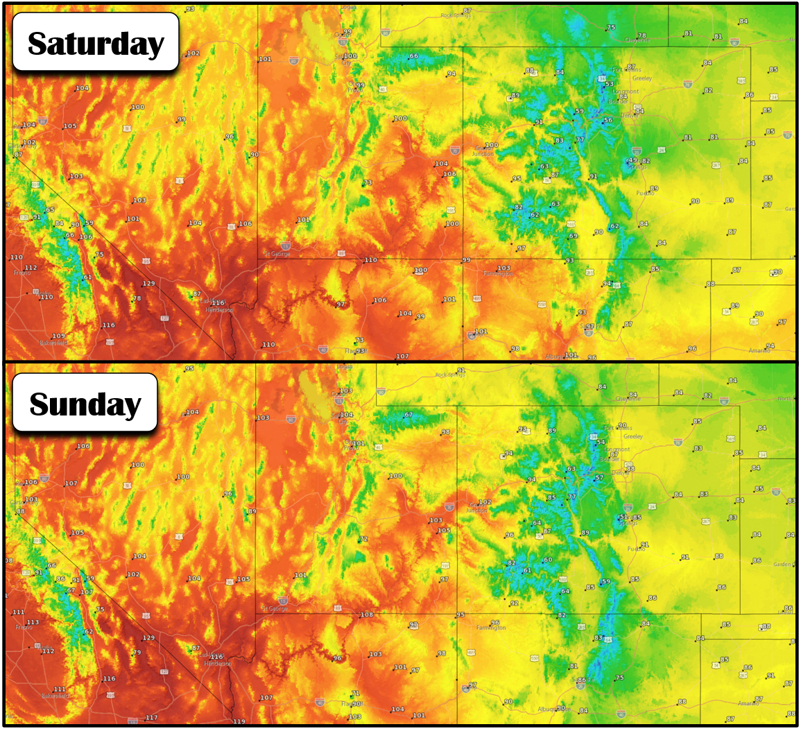
Forecast high temperatures for this weekend — notably cooler for eastern Colorado as the heatwave continues further west!
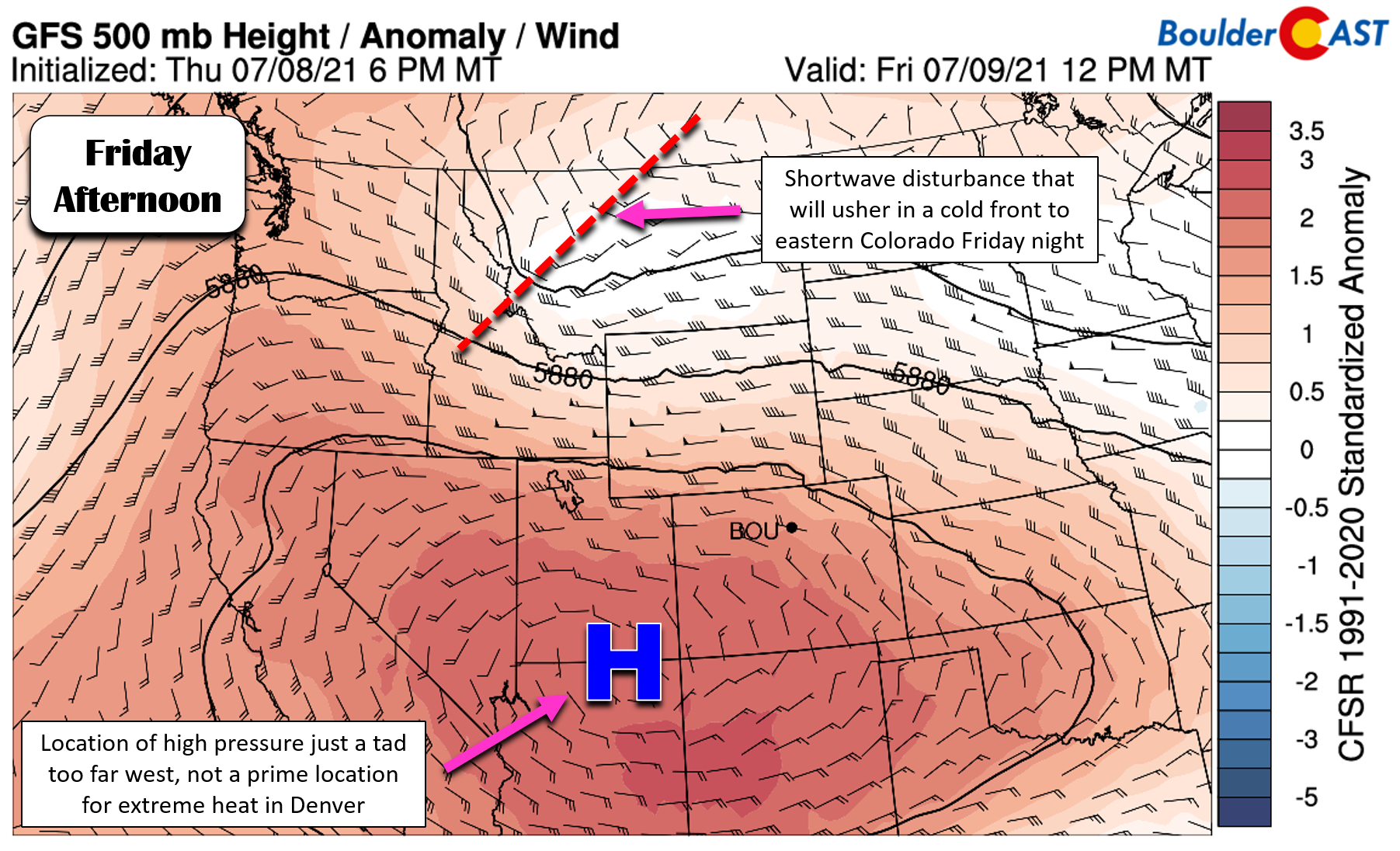
Just like during the more extreme hot spell that occurred one month ago, the high pressure center responsible for this heatwave is positioned along the Arizona/New Mexico border. This isn’t the absolute prime location for extreme heat in our area, being just a tad too far west.
As much as it feels like this summer has been very hot at times, we’ve actually dodged several bullets already with atmospheric conditions aligning in a way that spared the Front Range from the most intense and historic heat. This heatwave, and those before it, could have been a lot worse for our area (e.g. Seattle and Portland fiasco from a few weeks ago). We should consider ourselves lucky…
Stay up to date with Colorado weather and get notified of our latest forecasts and storm updates:
We respect your privacy. You can unsubscribe at any time.
Help support our team of Front Range weather bloggers by joining BoulderCAST Premium. We talk Boulder and Denver weather every single day. Sign up now to get access to our daily forecast discussions each morning, complete six-day skiing and hiking forecasts powered by machine learning, first-class access to all our Colorado-centric high-resolution weather graphics, bonus storm updates and much more! Or not, we just appreciate your readership!
.





You must be logged in to post a comment.