
Two, yes two, storm systems combined to produce a period of wet snow across the Front Range Tuesday afternoon and night. Let’s take a look at the totals.
Moist upslope flow and cold air aloft from the departing storm system in the Great Plains combined with some weak lift from an approaching storm in Arizona to produce snow showers Tuesday afternoon in the Foothills and Tuesday night across the entire Denver Metro area. Both storms are shown in the infrared satellite animation below.
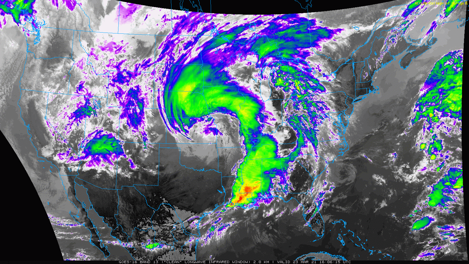
GOES-East infrared satellite animation covering Tuesday morning (3/23/21) into Tuesday night
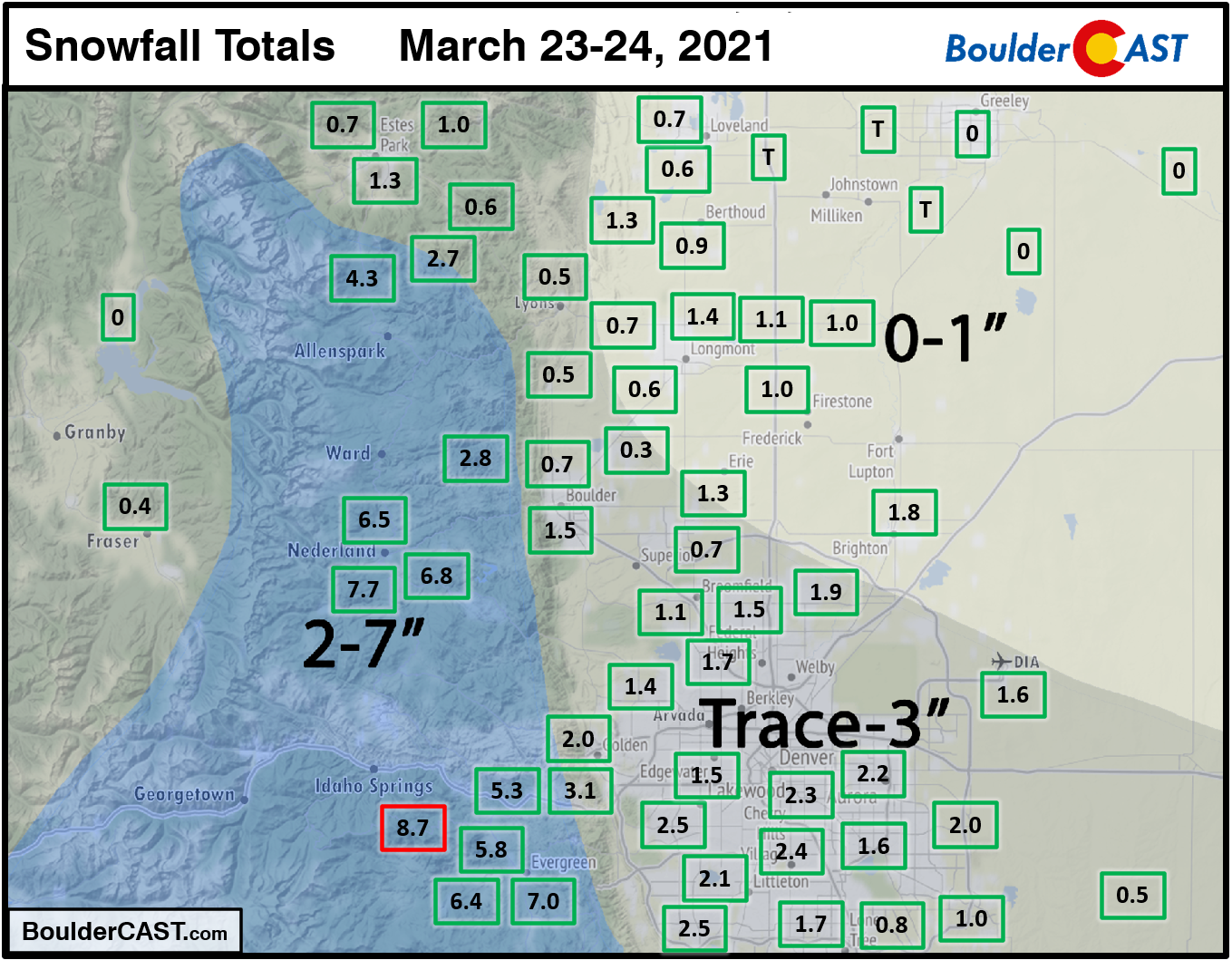
Shown below is our snowfall forecast map issued Tuesday morning with actual storm totals overlaid in boxes. Green boxes indicate that our forecast verified to within one inch of the observed snowfall. Red did not. Officially Boulder reported 1.5″ of snow and Denver reported 1.6″. The highest totals of 4 to 8″ were observed in the Foothills of Boulder and Jefferson Counties.
Continue to 2020-2021 Winter Snow Summary


You must be logged in to post a comment.