Category: Winter Weather (Page 37 of 139)
These posts contain some discussion of the white stuff, whether it be mountain snow pack or a Front Range snowstorm.
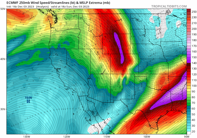

Most of the week ahead in the Front Range will feature dry weather with well above normal temperatures for early December. However, we are closely tracking our next storm system set to arrive on Friday with much colder temperatures returning alongside a good chance of snowflakes. Read on for the latest details on what should be yet another spirited week in Colorado weather!
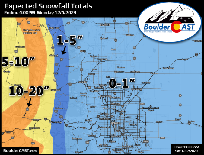
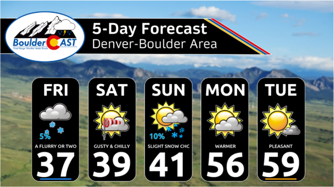
After the holiday cold and dumping of snow, temperatures this week will trend back above normal by midweek with low to perhaps middle 50s taking hold. A cold front moves south late Wednesday into Thursday, with temperatures then falling back below average to close out the week. While chances of precipitation appear limited at this point, we do have to keep our eye on two potential systems late in the week and into the weekend. Read on for more details.

Live View of Boulder

Current Conditions

Live Radar

Recent Premium Posts

BoulderCAST Daily – Tue 06/02/26 | Storms Reload This Afternoon, But With Noticeably Less Bite
❄️ Monday delivered lots of hail to northeast Colorado, with one supercell tracking …
BoulderCAST Daily – Sun 05/31/26 | Dry and warm today but rain chances increase this week
🌦️ Overall dry and warm Sunday, though cannot rule out a very widely …
BoulderCAST Daily – Sat 05/30/26 | A stray shower today as most activity resides well east of Denver
🌦️ Spotty showers today, mainly well east of the Denver Metro area, where …
3-Day Forecast

Trending Content

© 2026 Front Range Weather, LLC