Category: Winter Weather (Page 21 of 134)
These posts contain some discussion of the white stuff, whether it be mountain snow pack or a Front Range snowstorm.
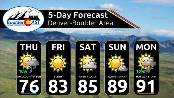
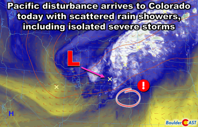
September is finally upon us — what a great time of the year this is in Colorado! Mother Nature will deliver rather varied weather this week in the Front Range. Hot temperatures and high pressure will give way to a Pacific trough by midweek. Clouds will be on the increase alongside the risk of severe thunderstorms for Wednesday, with even a touch of snow in our highest elevations. Things will clear out nicely for the upcoming weekend leading to gorgeous and seasonal late-summer conditions. Read on for all the details.
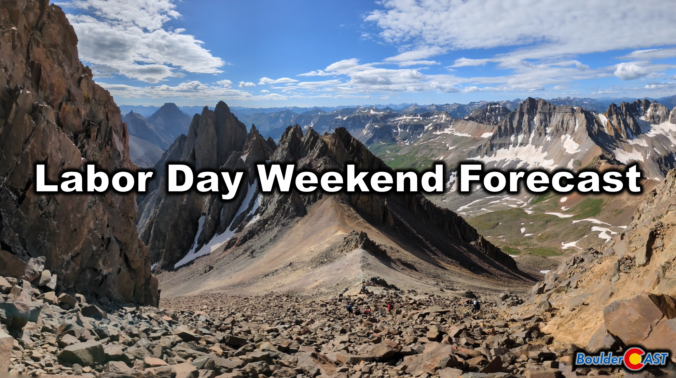
Labor Day Weekend won’t be quite as hot as it was on Wednesday, which was Boulder’s 40th 90° day of the year, but we are expecting warm and dry conditions to persist, perfect for any outdoor activities you may have lined up. The weather pattern will shift slightly early next week with the potential for isolated storms returning to the area. Whether you’re planning a trip into the Mountains or are staying comfortably down low in the city this holiday weekend, read on for the latest forecast details!
Mother Nature will continue to pummel the western United States with storm systems this week, including plenty of activity here in the Front Range. Monday will provide the most substantial severe weather outbreak in Colorado so far in 2024, but fortunately that will go down east of the Denver Metro area. Another system will bring a good chance of widespread rain for us Tuesday alongside chilly temperatures. The rest of the week into the weekend will stay somewhat active with daily chances for showers and thunderstorms. Read on for all the details.
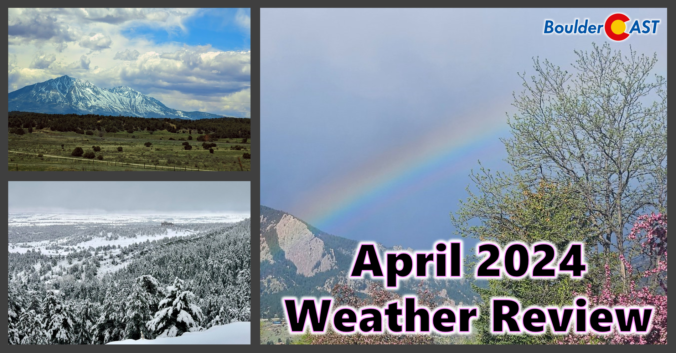
Despite having a two-week-long dry stretch thrown into the mix, the month of April concluded wetter than normal for most of the Front Range. However, much of this moisture came from a soaking rainstorm (with a little snow) near the end of the month. Nonetheless, 2024 has begun as one of the all-time wettest in Boulder. We also endured an intense downslope windstorm near the beginning of April, but who could forget that? Xcel Energy customers sure wouldn’t! Here’s a quick and colorful graphical recap of our weather during April and how it relates to climatology.

The weather pattern across the western United States stays exceedingly active throughout the week ahead with impacts across Colorado ranging from Mountain snow, to cooler than normal temperatures, to elevated fire danger to days of strong downslope winds. Here in the Front Range, we will catch a little bit of everything this week. Read on for all the details.

Live View of Boulder

Current Conditions

Live Radar

Recent Premium Posts

BoulderCAST Daily – Thu 01/15/26 | Fire Danger Today Before a Cold Front Tonight
🔥 Fire danger rising — Warm and windy today ahead of a strong …
BoulderCAST Daily – Wed 01/14/26 | A gorgeous Wednesday ahead of increasing fire danger & a stronger cold front tomorrow
🌬️ Weak front overnight — A weak cold front slipped through around 9:30 …
BoulderCAST Daily – Tue 01/13/26 | A thick blanket of high clouds won’t stop us from reaching the 60s again
☁️ Thick cloud deck overhead — Moisture streaming in aloft brings widespread mid‑ …
3-Day Forecast

Trending Content

© 2026 Front Range Weather, LLC