
Happy First of May! Last week’s wintry weather will indeed be a tough act to follow. The week ahead will be quieter for sure, but the threat of rain and higher elevation snow is still a concern. We also see 80-degree temperatures and a stellar weekend on the horizon. Read on for our complete forecast of the upcoming week.
Category: Winter Weather (Page 119 of 139)
These posts contain some discussion of the white stuff, whether it be mountain snow pack or a Front Range snowstorm.
Winter has made quite the return across the Front Range this weekend! Snowfall totals from this weekend’s storm ranged from a couple of inches to a couple of feet. Continue reading as we provide a brief recap of what could potentially be our last snow event until Autumn.
As we have been relaying to you all week, another spring snow storm is on the way this evening and will linger into Saturday afternoon. Read on as we detail our final thoughts on the storm and snow amounts for the Foothills and Plains.
Another storm is on the way! These late-season spring systems are almost always a messy forecast with a high potential to bust. The upcoming storm will NOT be an exception to this general rule. We detail the set-up for the storm and provide some initial thoughts and expectations for rain and snow set to begin Friday afternoon and continue into Saturday.

After a gorgeous weekend with sunny skies, the weather turns more active this week with a series of storm systems moving through, along with a general trend of colder weather each successive day. This is all thanks to the jet stream meandering southward. Read on for our weekly outlook, including whether we may see snowfall on the Plains late in the week…
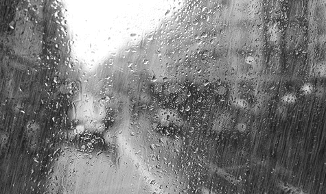
As advertised earlier in the week, wet weather is set to invade the region this afternoon and linger through the day Friday as a strong storm plows across Colorado. While the lower elevations will see all rain, potentially lots of rain, the Foothills and Mountains will be cold enough for snow. Read on for our complete forecast covering the next two days and the upcoming weekend.

Thanks to everyone who entered our “2017 Late Season Snow” contest. We briefly review the entries. Not surprisingly, most of you are less than optimistic for additional snowfall by the end of May.

After an extended period of meteorological tranquility, unsettled weather returns this week as a couple of systems are projected to impact the region. We discuss warm temperatures, windy conditions, and a late-week spring storm that bares watching for widespread rain and snow. Read on for all the details in our weekly outlook.

Live View of Boulder

Current Conditions

Live Radar

Recent Premium Posts

BoulderCAST Daily – Sat 06/06/26 | Isolated afternoon storms as the heat continues
🥵 Middle 90s dominate today and Sunday 🌩️ Front Range storms each afternoon/evening …
BoulderCAST Daily – Fri 06/05/26 | A streak of 90s set in through the weekend
🥵 A streak of 90s today through the weekend with low to middle …
This Weekend in Colorado Weather: Early-Season Heat Ramps Up — First 90s of the Year on the Horizon
🌬️ West–northwest flow Thursday supports high‑based convection with gusts to 35 MPH; virga …
3-Day Forecast

Trending Content

© 2026 Front Range Weather, LLC