Boulder picked up nearly 19″ of snow from the cluster of storms earlier this week and now has a very good chance of breaking its century-old seasonal snowfall record. We discuss why Boulder has seen so much more than Denver this snow season, and also comment on our next winter storm knocking on the door Wednesday night into Thursday.
Category: Weather in the News (Page 7 of 16)
These posts cover interesting weather phenomena from around the world, and won’t be specific to Boulder County. However, Earth is very diverse in the world of weather, so you will surely learn a thing or two.
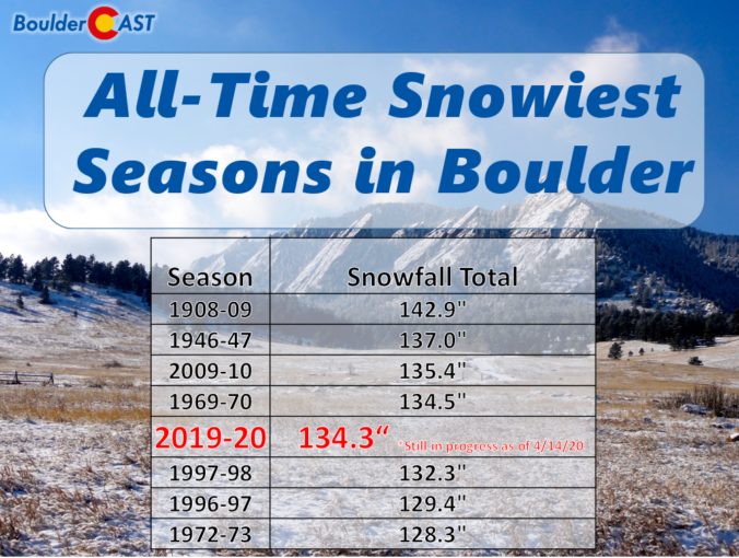
With the conclusion of last night’s quick-hitting snow event, our fourth in just the last eight days, Boulder has now officially eclipsed the typical amount of snow that falls in an entire season, and we’re not even half way through the month of February! We take a look at how this fits into Boulder’s history, what it might tell us about the potential for snow the rest of the winter, and give a quick and dirty forecast for our next chance of snow coming on Wednesday.
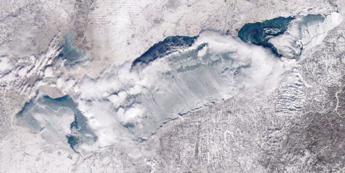
It has been an extraordinarily warm winter thus far for much of United States, eastern Colorado included. The lack of extended cold has kept the surface of the Great Lakes largely ice-free so far, which is quite atypical. We discuss the implications this can have on regional weather and how it relates to our warming climate.
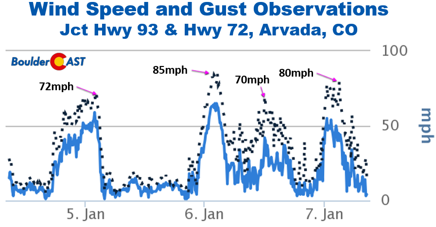
Time series of winds from west Arvada at the junction of Hwy 93 & 72

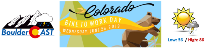
The last Wednesday in June has arrived, the day when thousands of hard-working citizens take to the bike paths for their morning and evening commutes. Yes, it’s Bike to Work Day 2019 on Wednesday! Five out of the last twelve Bike to Work Days have seen measurable precipitation in Boulder. How does tomorrow’s forecast look for the Metro area? Read on to find out if the bikers will be getting wet this year….


Live View of Boulder

Current Conditions

Live Radar

Recent Premium Posts

BoulderCAST Daily – Sat 01/10/26| Widespread sunshine and moderating temperatures this weekend as our recent snow melts off
🌤️ Calm Saturday: Winter storm systems have departed the state, leaving behind a …
BoulderCAST Daily – Fri 01/09/26| Snow ends quickly this morning with a quieter weekend in store
❄️ Overnight snow bands: A second push of upslope after midnight sparked narrow …
BoulderCAST Daily – Thu 01/08/26 | Snow develops today but still some uncertainty, amounts have been lowered
❄️ Snow develops today: Snow develops today, but uncertainty still lingers with two …
3-Day Forecast

Trending Content

© 2026 Front Range Weather, LLC
You must be logged in to post a comment.