Category: Severe Weather (Page 12 of 21)
The posts contain discussion of severe weather in our region, including forecasts, outlooks, and recaps of events involving large hail, damaging winds, and tornadoes.
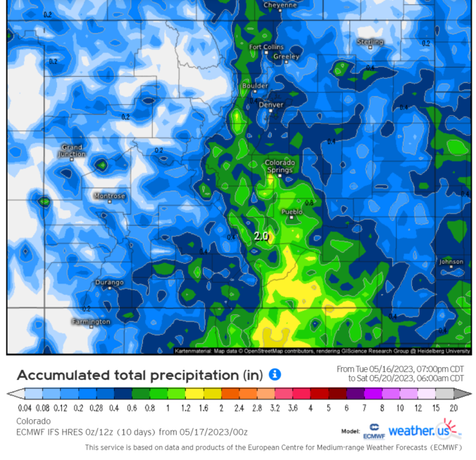

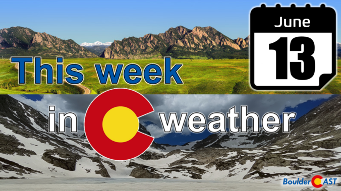
After a cool and wet weekend, this week starts out with a trend toward the drier and warmer side as a departing trough will give way to ridging across the Rockies. While chances of showers and storms will exist each and every day, the best chance won’t arrive until later in the week as a cold front and deep trough dig down from the north on Thursday. This front could also bring the threat of heavy rainfall, flash flooding, and a slight risk of severe weather to eastern Colorado. Temperatures will tumble back below normal to end the week.
This was undoubtedly a wild week in Front Range weather — but one which resulted in multiple good outcomes. The extreme severe weather outbreak planned for midweek got partially busted by low clouds and fog which may have ultimately saved it from becoming the costliest hailstorm in state history. Further, the deluge of rain that dumped to close out the week will go a long way towards eradicating much of the ongoing drought in the eastern half of the state. Let’s take a look back at this crazy week in Colorado weather!

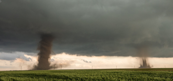
Overnight severe storms produced tennis ball-sized hail in parts of eastern Boulder County, acting as an appetizer for what will unfold later today as the greatest risk of severe weather in years may develop across the Denver Metro area. Low clouds lingering during the morning may delay the severe weather ignition today, but huge hail, damaging winds and a few tornadoes are still in the cards for the afternoon and early evening hours for some area. After the severe weather threat diminishes, soaking rain becomes the story Thursday into early Friday with areal flooding possible.
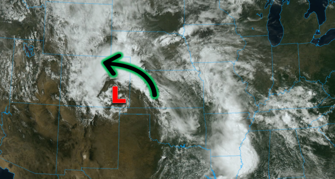
One of the most widespread Front Range severe weather outbreaks in recent memory is taking shape on Wednesday, though we still have some concerns. Two-inch hail, damaging winds and a few tornadoes are likely across eastern Colorado on Wednesday. Before that however, there will be another more uncertain bout of severe weather Tuesday night for the northern Front Range with big hail the main concern. Let’s get into this two-folded complex forecast!

Hint: All of the clues are related to Boulder, Denver, and/or Colorado weather. OK, well most of the clues…
We hope you had a great Fourth! The Southwest monsoon remains active through the middle part of the week with good chances for rain in Boulder and Denver, especially Tuesday and Wednesday. Unfortunately, the pattern shifts late in the week suppressing the flow of monsoon moisture into Colorado. This will cause drying for us, but also a spike into triple-digit temperatures for the weekend. Read on for our full outlook of the week and weekend ahead.
The ongoing heatwave will last through Monday with near-record high temperatures expected once again. A welcomed cold front Monday night will offer a reprieve from the heat for a couple days, but the sizzling temperatures return in full-force later in the week. We’ll largely be dry the entire week ahead. However, signs are pointing towards a surge of subtropical moisture during the upcoming weekend into the Four Corners region. This will bring the chance of late-day thunderstorms back into the Front Range.

Live View of Boulder

Current Conditions

Live Radar

Recent Premium Posts

BoulderCAST Daily – Sun 01/11/26 | A mild Sunday with readings reaching the 50s
🌤️ Mild & Melty Sunday: Light winds and patchy clouds, with lingering snowpack …
BoulderCAST Daily – Sat 01/10/26| Widespread sunshine and moderating temperatures this weekend as our recent snow melts off
🌤️ Calm Saturday: Winter storm systems have departed the state, leaving behind a …
BoulderCAST Daily – Fri 01/09/26| Snow ends quickly this morning with a quieter weekend in store
❄️ Overnight snow bands: A second push of upslope after midnight sparked narrow …
3-Day Forecast

Trending Content

© 2026 Front Range Weather, LLC