
This week’s Front Range weather headline is yet another late-season spring storm system moving directly across Colorado on Tuesday. This will lead to a couple of very chilly days and more widespread rainfall and clouds for the Metro area. We’re even still talking about snow in the Foothills just west of Boulder. While conditions will improve as the week progresses, the chance of rain remains each day. Read on for our complete forecast of the shortened work-week ahead.
Chilly Tuesday & Wednesday
After being brushed by severe weather over the elongated holiday weekend, conditions across the Denver Metro area shift today as a major cut-off storm system has moved into Colorado. These type of organized low pressure systems become much more rare for our region as we move into June. This could very well be Spring’s “last hurrah” for the Front Range, which does appear to be the case based on mid and long-range model guidance developing a very “summer-like” ridge across the Rockies.
The storm system at-hand’s position around mid-day Tuesday is shown in the 500 mb height anomaly forecast below.
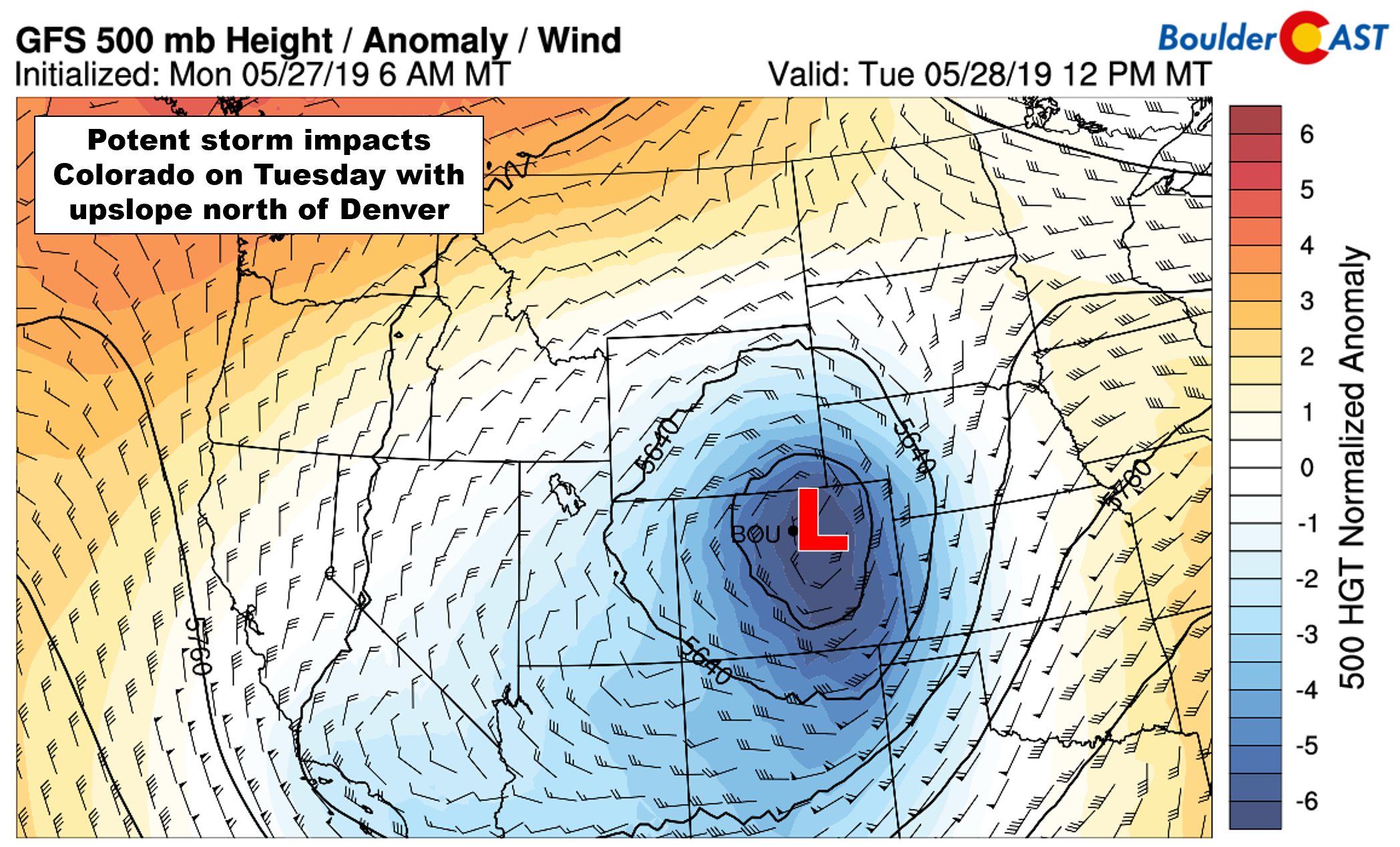
GFS 500 mb height anomaly forecast for Tuesday mid-day. The upper-low moves directly over Denver
Notice that the center of the low is almost directly over Denver. The latest water vapor animation from GOES-East confirms this positioning as well.
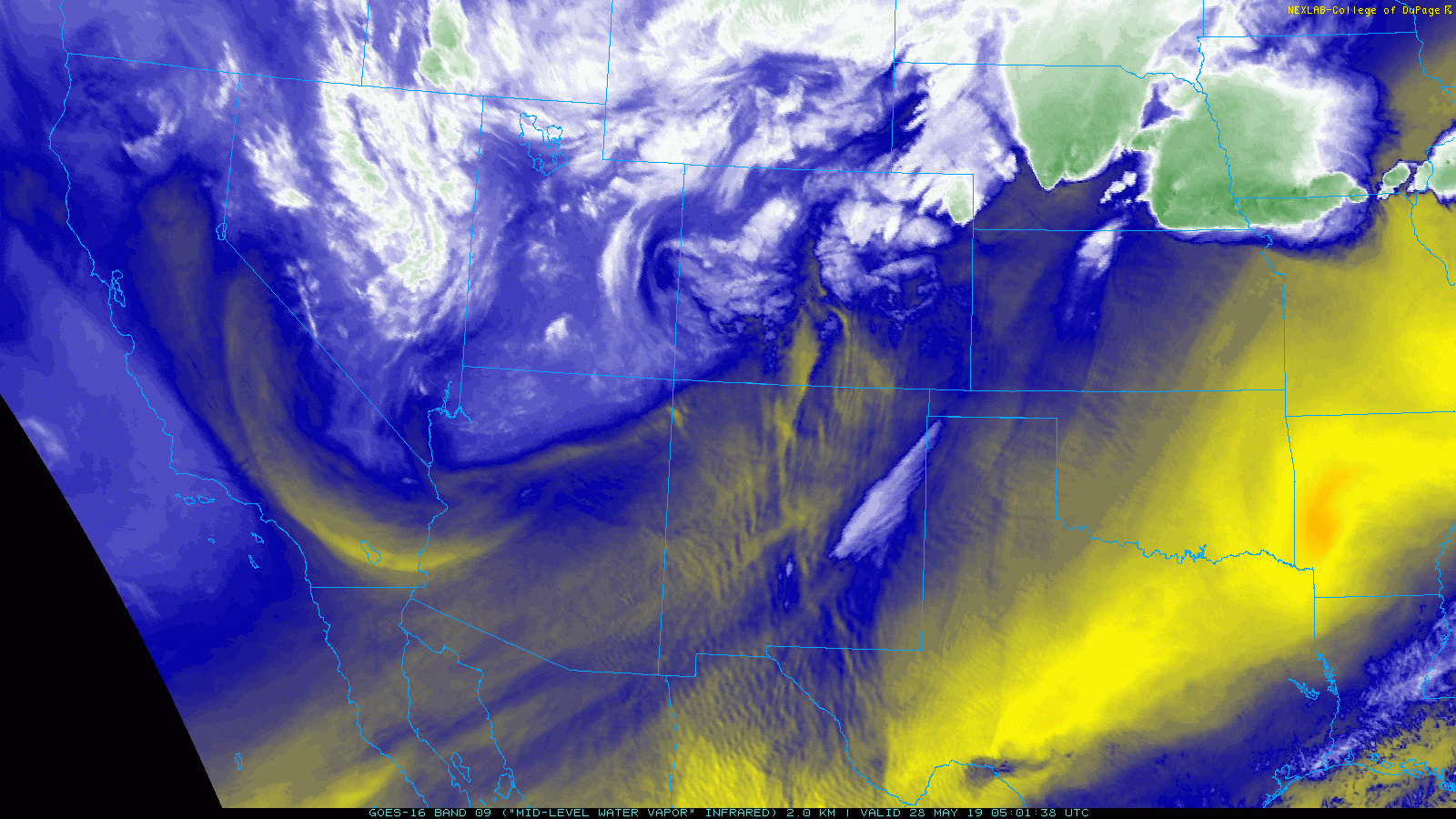
GOES-East water vapor animation showing early Tuesday
Also note the clearly-defined dry slot infiltrating the Denver area from the south. Models have continued to struggle with placement on this dry slot which will have broad implications on the forecast for Tuesday into Tuesday night.
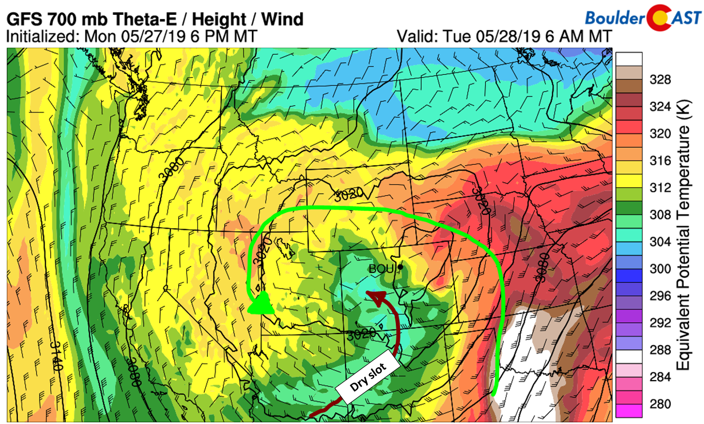
GFS 700 mb equivalent potential temperature forecast for Tuesday morning showing the dry slot
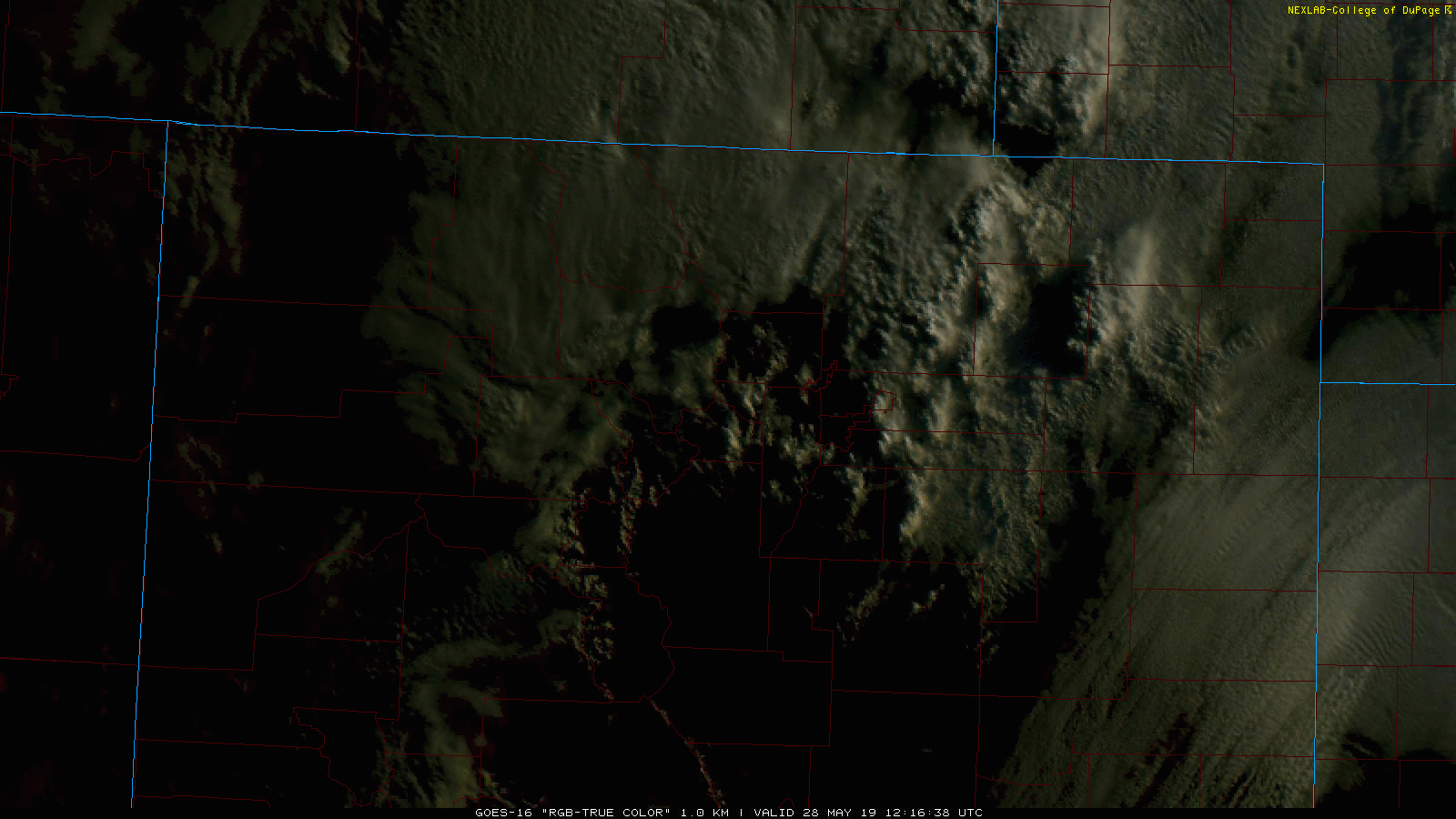
The visible satellite animation this morning is quite impressive!
A cold front moved through overnight with winds turning northeasterly in extreme northern Colorado and Wyoming. This of course is upslope for our area. It doesn’t appear that this upslope will make it southward into the Denver Metro area, though; a consequence of the upper-low and developing surface low being too far north.
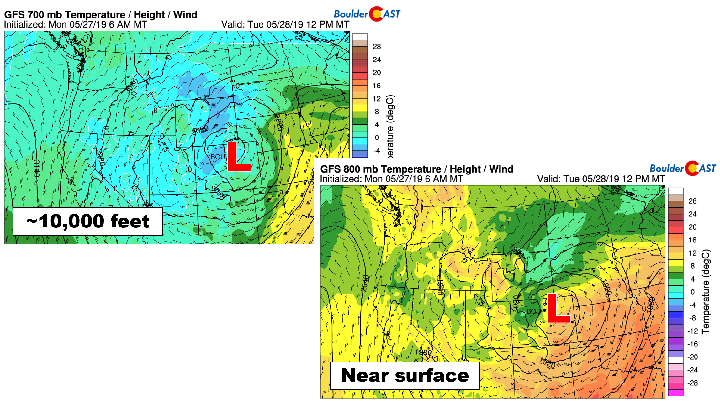
GFS temperature and wind forecasts for mid-day Tuesday at 700 mb (left) and 800 mb (right)
This doesn’t mean today won’t be partially wet and gloomy, however. Plenty of wrap-around moisture will be funneling back into the Front Range with widespread off-and-on rain showers likely through the day (and even a few rumbles of thunder this afternoon). Small hail could accompany any thunderstorms. Given the clouds, rain, and cool air mass, highs will barely make it out of the 40’s, about 20 to 25 degrees below normal for late-May in Boulder.
This airmass isn’t quite cold enough to support snowfall across the lower elevations. That is not true in the highest Foothills, though. The NAM model is forecasting snow levels near 8000 feet much of the day today, falling as we go into the evening hours. Up to 2″ of accumulation is possible above 8500 feet by late tonight, with higher amounts in the Mountains above 11000 feet.
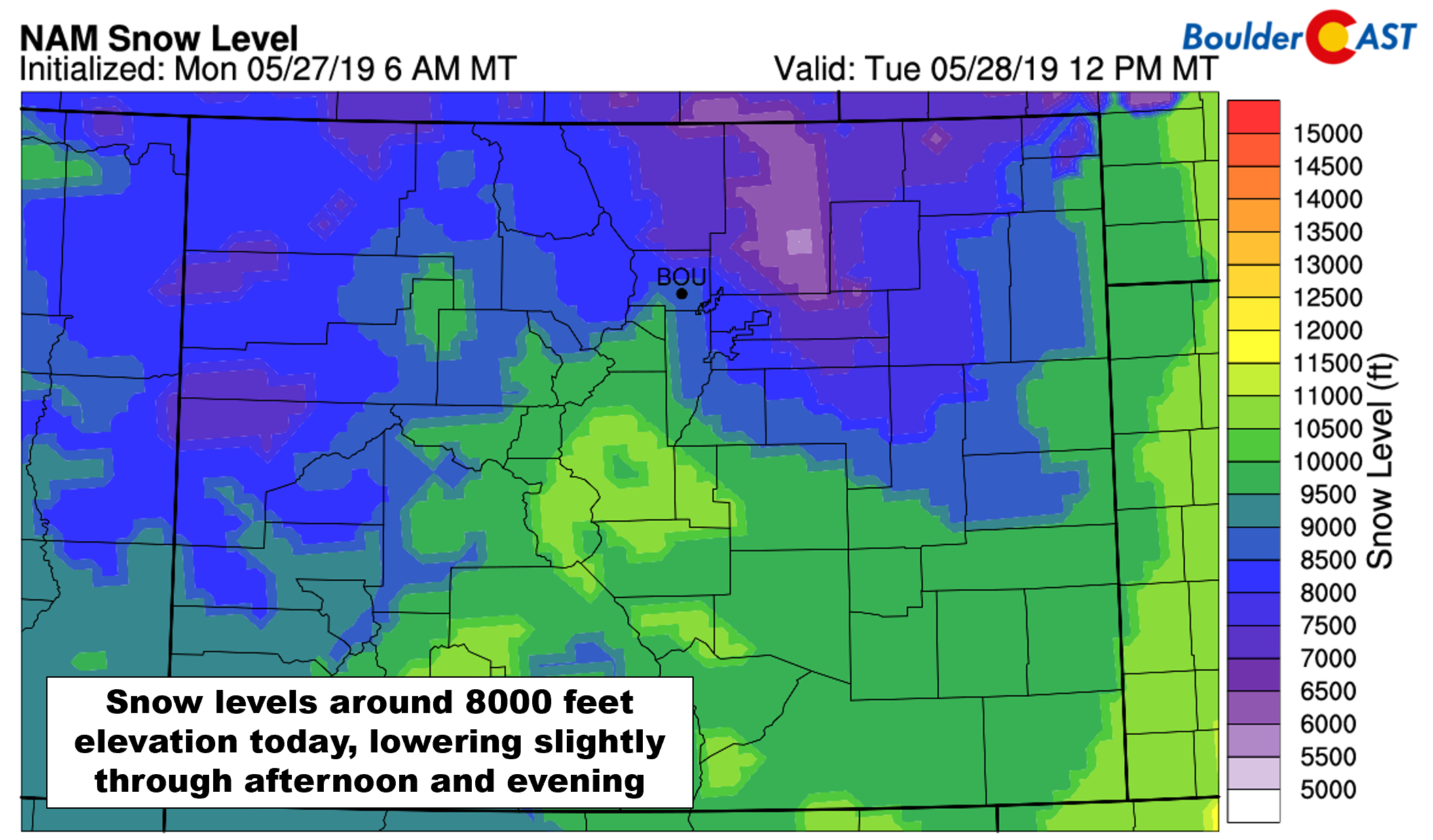
NAM mode-derived snow level forecast for mid-day Tuesday
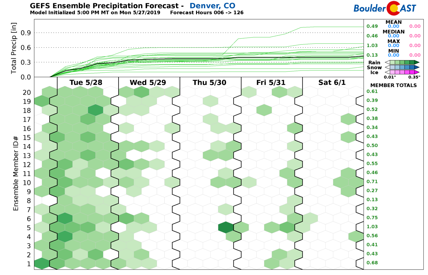
Overall, this will be a rain event for most of us, with 0.25 to 1.0″ of rain possible from Boulder northward to Fort Collins. This includes some moderate precipitation which has already fallen before sunrise Tuesday morning. Areas south of Interstate 70 will mainly catch the dry slot of the storm and see noticeably less rainfall from this event. Still we do expect scattered showers to redevelop in these locations later in the day Tuesday, ironically spurred-on by the clearing skies accompanying the dry slot.
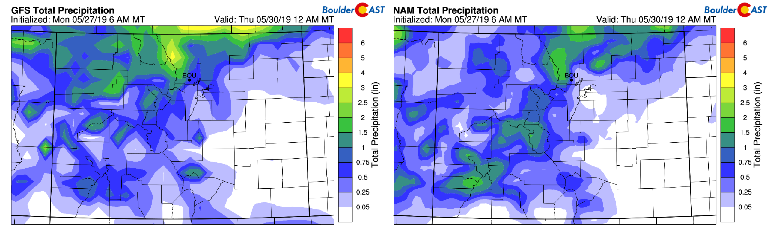
Total precipitation forecast through Wednesday evening from the GFS model (left) and NAM model (right)
By Wednesday, the low pressure will not have made much eastward progress, stalling across the Nebraska Panhandle.
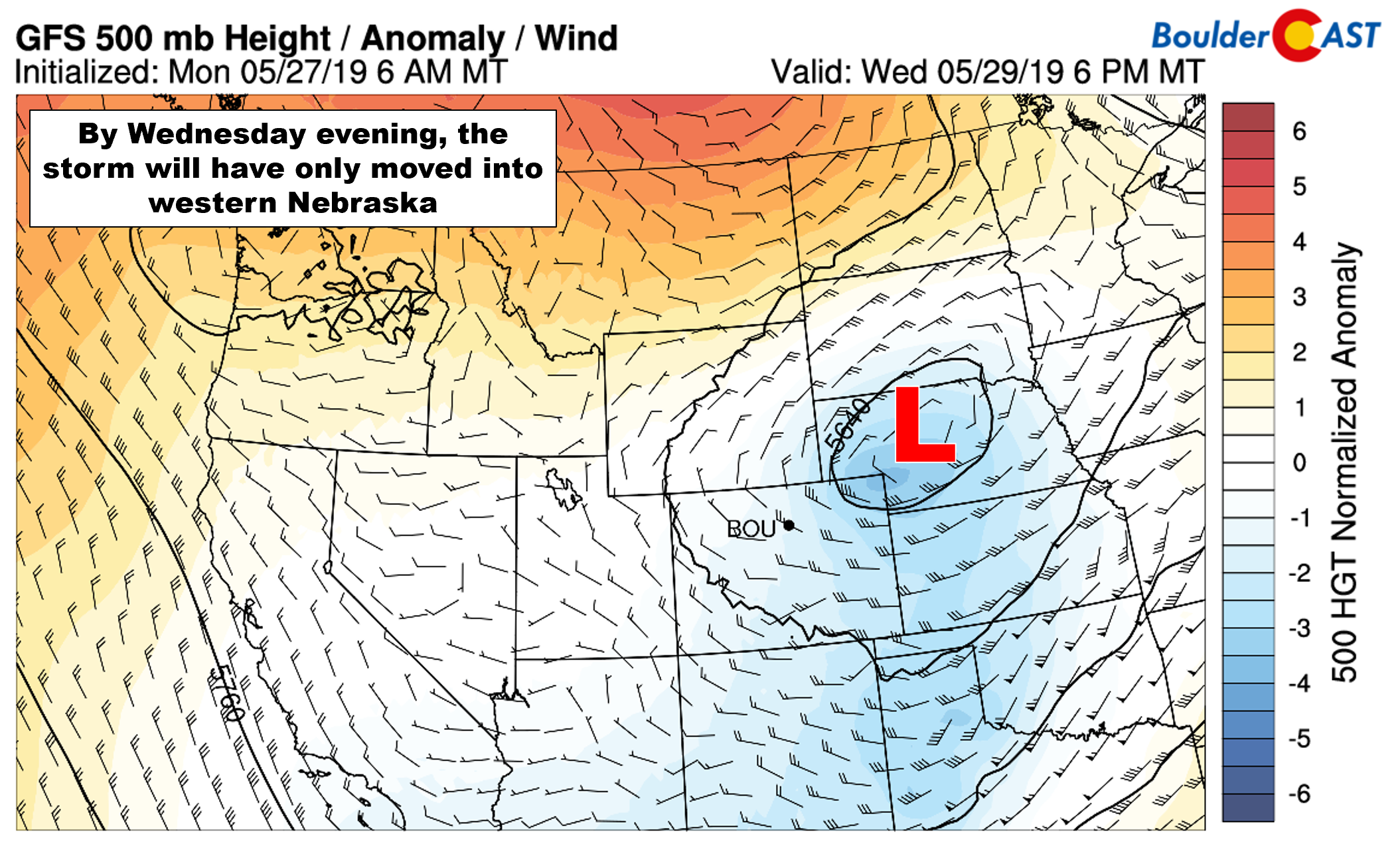
GFS 500 mb height anomaly forecast map for Wednesday. The low has barely moved into Nebraska
Eastern Colorado will sit in the very chilly northwestern quadrant of the low for an extended period with cold air advection the main weather player (see below). For Wednesday, our forecast calls for mostly cloudy skies, cool temperatures, and only isolated showers through the day.
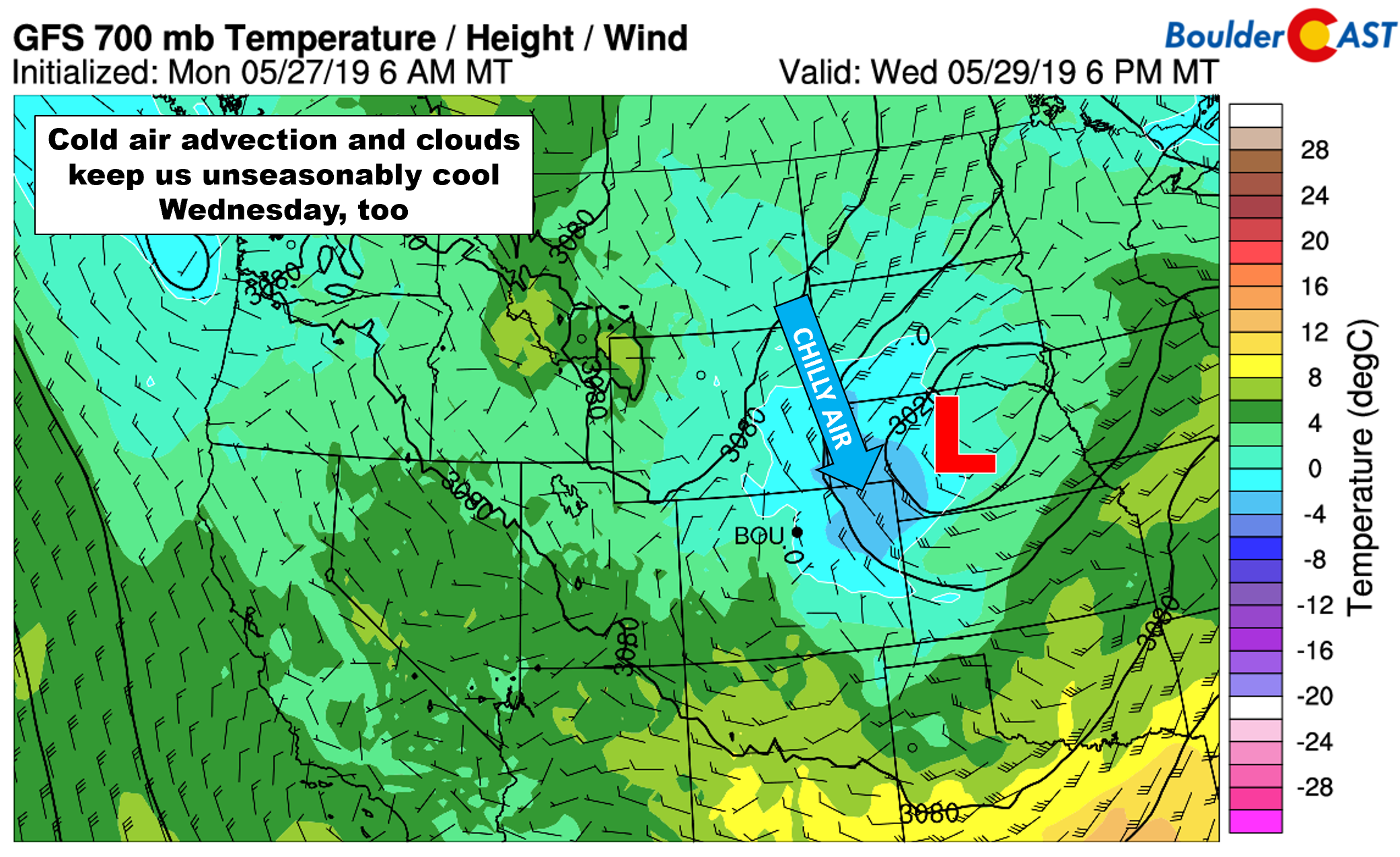
GFS 700 mb temperature and wind forecast for Wednesday. The stalled low continues to filter chilly air into eastern Colorado.
Improving weather late in the week
The rest of the week will see weak troughing give way to weak ridging across Colorado. In turn, this should lead to clearing skies for Thursday and especially Friday, though the lingering cold air aloft will likely allow for thunderstorm development across the higher elevations each day. Thursday will have very minimal steering flow aloft so any storms that do form should remain across the Mountains. West winds increase on Friday aloft offering a better chance for storms to drift eastward into the Metro area off of the higher terrain. All in all, though, beyond Tuesday the week will only bolster minor chances for rain.
With all of the moisture that has graced our presence these last few months and a healthy remaining snow pack, water is not a concern heading into early summer for the state. In a recent post, we discussed how Colorado is now drought free for the first time in nearly two years. Considering where we are now and the predicted wet outlook for the next three months (see below), all signs point to a reduced wildfire season across the state this summer and fall.
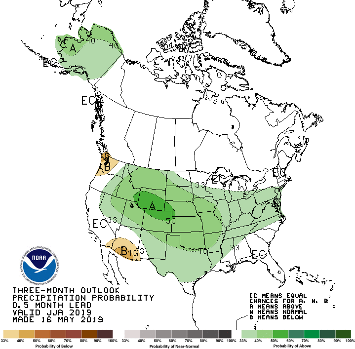
Climate Prediction Center outlook for the JJA 2019 period (June, July, and August). Northern Colorado is given the best odds in the entire country of seeing above normal precipitation this summer.
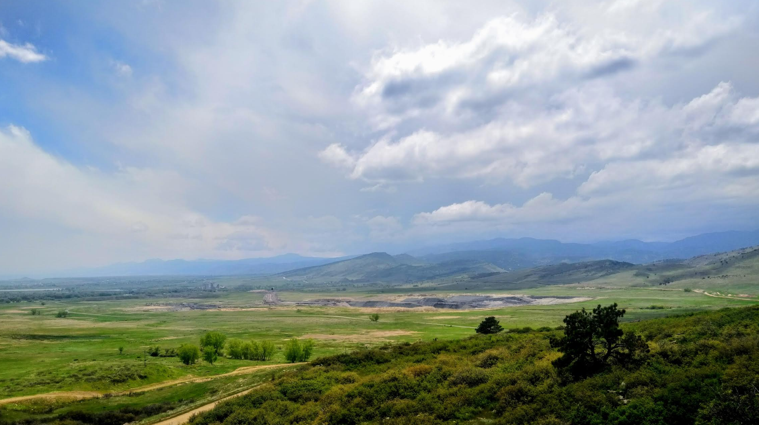
We conclude with a telling photo taken Memorial Day afternoon near Lyons. The hillsides are such a vibrant shade of green, one could mistake the Front Range for Hawaii right now (sans the ocean)!
Forecast Specifics:
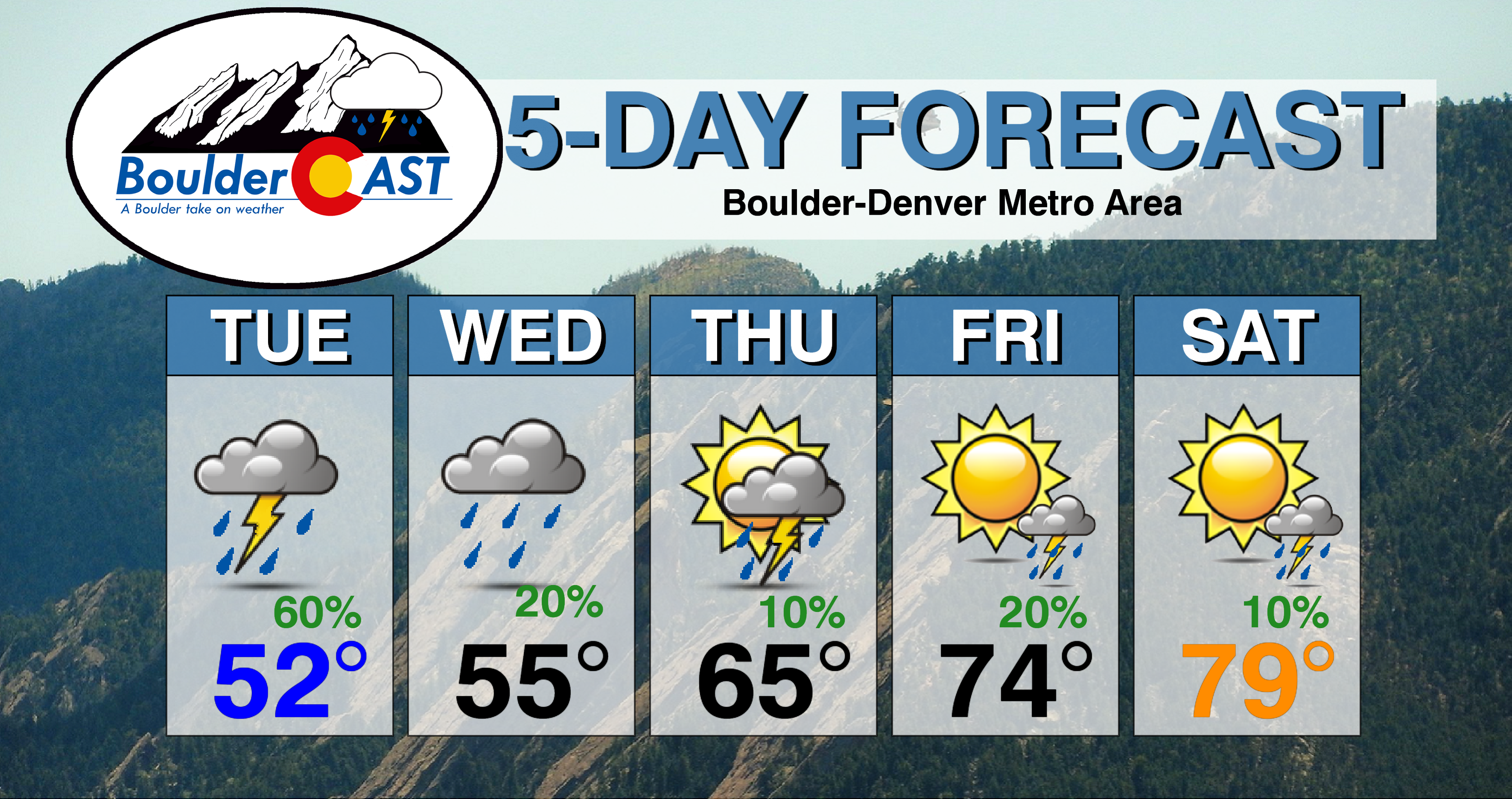
Tuesday: Mostly cloudy with intermittent rain showers through the day, persisting into the night-time. Some thunderstorms are also possible which may contain small hail. Highs in the lower to middle 50’s on the Plains and low 40’s in the Foothills.
Wednesday: Mostly cloudy and continued cool with spotty showers throughout the day. Highs in the middle to upper 50’s on the Plains and middle 40’s in the Foothills.
Thursday: Partly to mostly sunny with isolated afternoon and evening storms, mainly across the higher elevations Highs in the upper 60’s to lower 70’s for the Plains, with upper 50’s in the Foothills.
Friday: Mostly sunny with isolated afternoon and evening thunderstorms. High temperatures in the middle 70’s to near 80 across the Plains, and middle 60’s in the Foothills.
Saturday: Partly sunny with isolated late day showers and storms, mainly south of Denver. Highs in the upper 70’s for the Plains and middle 60’s in the Foothills.
High Country: Widespread snow showers are expected as the main low pressure moves across Colorado Tuesday into Tuesday night with 5-12″ expected in the Mountains north of Interstate 70 (highest amounts in Larimer County). Spotty late-day rain and snow showers are likely Wednesday through Saturday across the Mountains, with minor and patchy accumulation possible. Check PowderCAST for updated forecasts for all the Colorado ski resorts.
DISCLAIMER: This weekly outlook forecast was created Monday morning and covers the entire upcoming week. Accuracy will decrease as the week progresses as this post is NOT updated. To receive daily updated forecasts from our team, subscribe to BoulderCAST Premium.

.
Spread the word, share our forecast!


You must be logged in to post a comment.