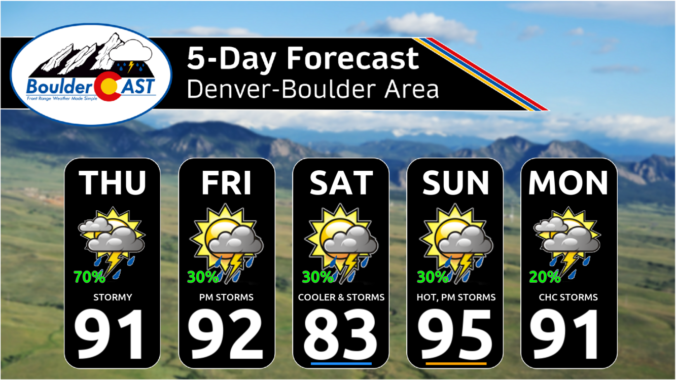
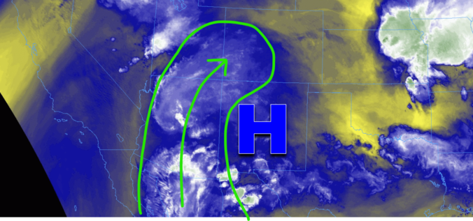
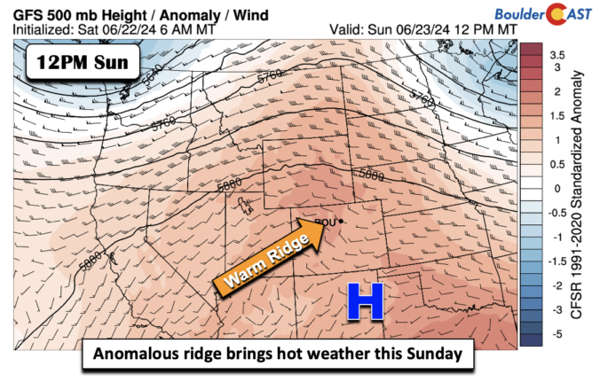
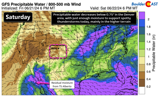
It will be another hot one today with lower 90s for highs. Clouds will be in the increase for the afternoon and evening as isolated to scattered showers and storms develop once again. A trough to our northwest will track east-southeast into the upper Mississippi Valley. As that trough moves, it will continue to advect into the state deep and …
Yesterday's storm clouds produced some of the most widespread and intense rainfall our area has seen in months, but sadly most locations received less than 0.1" of rain. However, up to 0.5" or so was reported in parts of Boulder. The chance of rain will stay in the forecast today as high pressure remains centered to our south, albeit slightly …
Tuesday was the hottest day yet in 2024 for many cities, with Denver officially reaching 100°F (briefly at DIA) for the first time since August of 2022. Boulder was just a tad cooler at 98°F, our second hottest day this summer. Many areas across eastern Colorado were able to reach the triple digits on Tuesday, with generally upper 90s in …
It was a hot one yesterday with most of the Front Range in the mid to upper 90s. The analysis below blends a bunch of observations and thus some higher values may not be evident in the image. Nevertheless, it was hot! It will be another hot one today as the ridge shifts west toward the Four Corners and northern …
Ahot ridge will build west this afternoon and evening and largely park itself across the region through much of the coming week. That is going to spell out successive days of 90+ degrees and spots in Denver in the upper 90s. Rain chances look limited today and in the extended. The low-level airmass today will warm to between 16 and …
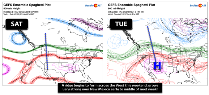
After a couple days of more pronounced late-day thunderstorm activity, today will begin our drying trend as high pressure in the southeast United States phases westward, setting up shop across New Mexico and Arizona this weekend and throughout much of next week. The 500mb height anomaly forecast animation below spans until Thursday when the ridge will be locked in to …
Most areas received much-needed rainfall on Thursday, but amounts were generally less than 0.25" for most. A few spots where stronger storms hit from Longmont to Greeley saw greater than 0.5" of rain. Today will be similar in many regards to Thursday, including: Rainfall chances (30-50%): A shortwave disturbance will pass across the area, well timed with the afternoon period. …
🌨️ Brief Mountain Snow – A fast-moving storm brings a quick burst of …
3-Day Forecast

Did You Know?
On the evening of June 4 2015, an EF3 tornado developed just north of Longmont. This is the only documented EF3 (or higher) strength tornado in Boulder County. Fortunately, it rolled through farmland and no one was injured. The same night, hail ranging in size from golf balls to tennis balls fell along a line stretching from Longmont to Lyons.