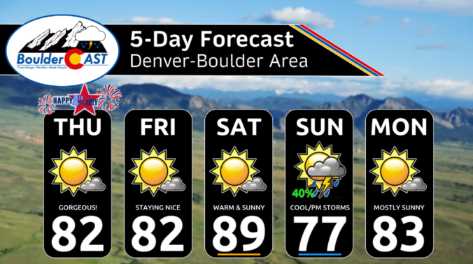
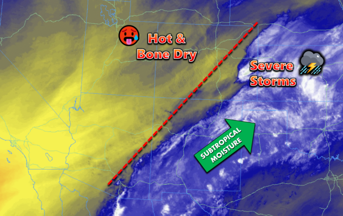
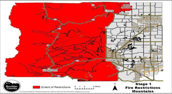
Today, there will be a few boundaries of note. The first is a weak surface trough or cool front tied to an area of low pressure over the eastern Dakotas. This boundary stretches into Nebraska and northeast sections of Colorado. While we will be warming up this afternoon as the airmass modifies, this boundary could result in some weak northeast …
Yesterday's cold front now lies to our south and east across New Mexico, Texas, and Oklahoma. Even though it is well to our south, the cooler airmass remains for our Friday. Highs will be in the low 80s with lots of sunshine and no chance of rain. However, the chance of rain will return on Sunday. A cold front will …
Last night's cold front raced through around 10:30 PM local time packed with abnormally strong winds for July standards. Wind gusts up to 51 MPH accompanied the front, though gusts in Boulder were closer to 35 MPH. Despite the formidability of the front, this was a mostly dry passage with just a few weak showers spawning along it east of …
Today begins a more substantial trend towards bone-dry conditions across the Front Range area --- something we bluntly detailed in our weekly outlook on Monday. This morning's GOES-East water vapor animation below shows bountiful dry air across central and western Colorado, as well as everywhere upstream from us to the west and southwest. This dry air will make forming any …
Acold front has moved through overnight and today will be a few degrees cooler as a result. The parent storm system of the front is trekking through today, seen as the shortwave energy clipping across northern Colorado and Wyoming in the 500mb vorticity forecast animation below. Some showers may land across parts of the Front Range this morning, mainly north …
Atrough axis will exist along the west coast and will move inland later tonight. To our southeast is also a ridge of high pressure. In between these two pressure centers is Colorado, which will influence west to southwesterly moist flow. Temperatures will rise today with highs back to the low 90s as return southerly flow takes over. With the trough …
Check out this gorgeous sunset image from last night. After the convection waned, leftover cirrus and wave clouds led to a spectacular site to see! We may see something similar again tonight as storms are again in the forecast. It will be a much cooler day today as a strong cold front has pushed through the region. High pressure is …
🌨️ Brief Mountain Snow – A fast-moving storm brings a quick burst of …
3-Day Forecast

Did You Know?
Daytime heating must provide the energy to kick off monsoon thunderstorms. As such, monsoon storms usually can only form in the afternoon and evening hours, and die out after sunset.