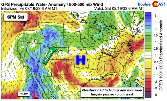
The anomalous ridge largely remains in place across the central CONUS. Drier air and subsidence is found in the center of the ridge and to its east, while moister air is present to the west tied to the monsoon and both an offshore trough and Hilary near southern Baja. The anomalous moisture today/tonight will for the most part remained pinned …
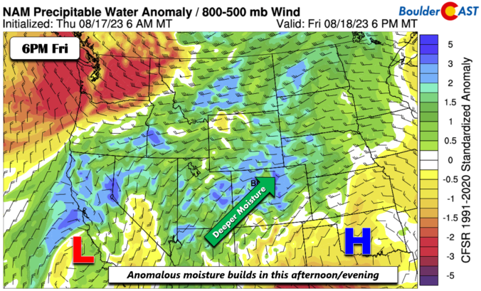
The flow turns more favorable for showers and storms this afternoon and evening, especially along/east of the Front Range. At mid-levels, our high pressure ridge will slide east over western Oklahoma. At the same time, an area of low pressure will be off the coast of California. These two systems will aid in a favorable southwest flow into Colorado, bringing …
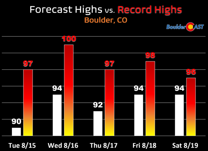
Temperatures returned to the 90s across the Front Range yesterday for just the third time in the month of August with an official high of 91°F being recorded in Boulder. Just about every city in the Front Range squeaked into the lower 90s. Tuesday was Boulder's 19th 90-degree day of the summer thus far, well below the normal count of …
Hot and dry conditions will take over today and continue the rest of the week as a mid-level ridge develops over the central Rockies forming a long ridge axis from Texas, through Colorado and across the Pacific Northwest --- as shown below. This setup is bringing a resoundingly dry northwest flow to eastern Colorado as you can see in the …
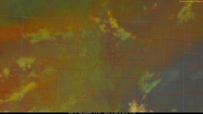
The anticipated cold front quickly blew in this morning around 5:30AM bringing gusty north winds and a more moisture-rich airmass to the Front Range. The frontal passage can be seen on GOES-East's derived airmass animation: As of 6AM, the front was located just south of I-70, with wind gusts up to 40 MPH reported as the front passed through Fort …
Quite a bit of monsoon moisture is situated over the state this morning as the large-scale setup remains mostly unchanged from yesterday with complimentary pressure systems working together to pull moisture northward into the Four Corners region. GOES-East imagery shows the faucet of moisture aimed at Colorado right now, including some early morning thunderstorms popping across southeast Colorado. Things across …
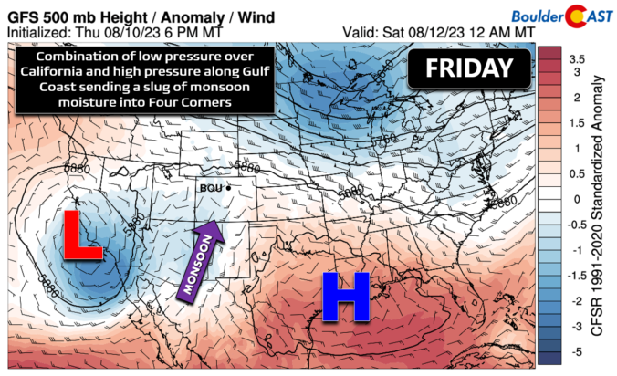
A classic summertime setup is underway across the Four Corners region right now as two broad pressure systems team up to funnel monsoonal moisture northward into the Southwest. Counter-clockwise flow around a low pressure near California is working in tandem with the clockwise flow around high pressure along the Gulf Coast. The result has brought a swift resurgence of monsoon moisture …
🌨️ Light Mountain Snow – Some light mountain snow showers possible today – …
3-Day Forecast

Did You Know?
Three or four days out, if the models are indicating good snow in the area north of Denver, say for Cheyenne, there are still decent odds it will end up tracking over our region. However, if the models paint heavy snow over southern Colorado or northern New Mexico, our chances for decent snow are slim to none. We always need to be cautious of this southward shift.