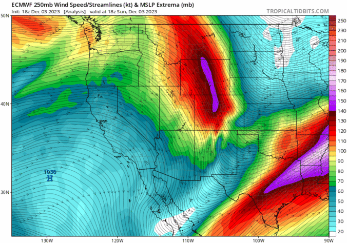
Astrong upper-level jet streak will be overhead today, stretching from Idaho into Kansas. The flow at upper-levels will reach speeds of about 130 mph from the northwest. This strong flow will be moving across northern Colorado this morning and afternoon, spelling out gusty winds for the Plains and Foothills today. The strong cross-barrier flow will bring strong downslope warming and …
The shortwave trough which brought a quick hit of accumulating snow last night will be moving off to the east into the Midwest and Great Lakes. In its wake, high pressure ridging will start to build east from the west coast. The ridge will not fully encroach us but it will allow for sunshine to break out. After some light …
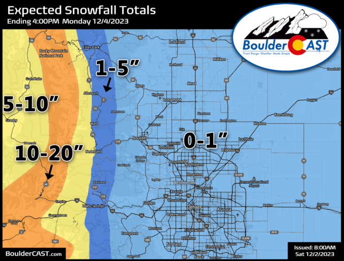
Two shortwaves will move through and impact Colorado today and tonight. The first one comes through this morning to early afternoon and a second moves through this evening and overnight into early Saturday. Both of these shortwaves appear weaker than originally anticipated. As a result, some models have come in weaker with snow amounts for the system, which we will …
Yesterday's high temperatures soared several degrees above model guidance across the Front Range with mid to upper 60s observed in southern Denver, but 50s further north from Longmont to Fort Collins. Temperatures are expected to be even warmer out there today as the airmass bakes a few more degrees as the strong ridge of high pressure lingers directly over Colorado …
The pesky jet stream which has been lingering over Colorado the last several days has finally migrated eastward and away from our area. The jet stream-level wind forecast animation below shows us the big ridge of high pressure entering the region from the west in the wake of the jet. This ridge will lead to veritably pleasant conditions across the …
Overnight downslope wind gusts topped 70 MPH in the Foothills and within the city of Boulder, with greater than 35 MPH gusts reported elsewhere across most of the FrontRange. The strongest gusts, approaching hurricane force, only lasted for about two hours from 9PM to 11PM on Saturday. It was blustery the rest of the day, though. Winds will be a …
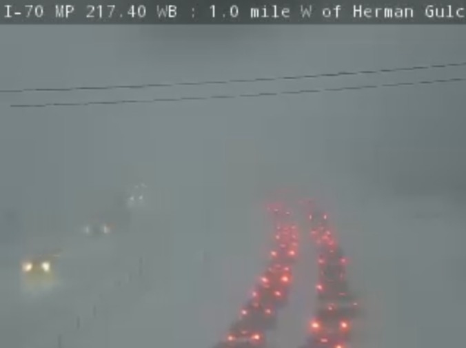
Weather concerns across our region remain two-fold today --- coming in the form of heavy Mountain snow along/west of the Divide as well as gusty downslope winds to the east in the Foothills and Denver Metro area. A broad trough of low pressure sits over the Rockies right now with light to moderate snow already falling in the Mountains. As …