Category: Premium Content (Page 104 of 451)

This content is for Premium Members only.
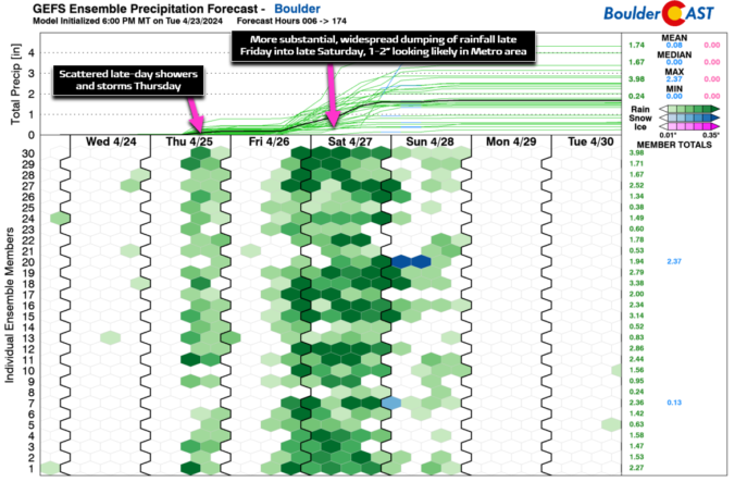
Premium BoulderCAST Daily – Wed 04/24/24 | Nice today, but multiple systems are eyeing Colorado and 1-2″ of rain possible

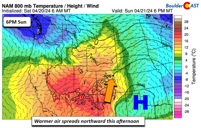
As promised, a shortwave ridge will gain control of the area today pushing a warmer and drier airmass into eastern Colorado --- wave goodbye to the "chilly" 60s! This will translate into a warmer and drier day today for the entire Front Range. Look for highs to push into the low to middle 70s. A stormy pattern takes over tomorrow …

Premium BoulderCAST Daily – Tue 04/23/24 | Highs only near 60 degrees with a chance of rain later

After highs well into the 70s on Monday, our Tuesday will be cooler following the passage of a dry cold front that passed during the wee morning hours. However, an uptick in moisture and post-frontal upslope will aid in the development of spotty late-day showers and a few thunderstorms across the entire area. Showers and storms will be weak overall, …

Premium BoulderCAST Daily – Sun 04/21/24 | Morning fog/clouds transition to afternoon sunshine and warmer temperatures

An area of low clouds and fog have blanketed the Front Range as a result of the saturation at low-levels from the fresh snow the past 24 hours. These low clouds and fog will slowly lift and exit around midday, leaving behind a fair bit of afternoon sunshine working in this afternoon. But the morning clouds/fog will make for a …

Premium BoulderCAST Daily – Sat 04/20/24 | Snow tapers off around miday

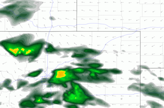
Banded snow this morning will gradually taper off by midday today as the jet energy weakens later this morning and especially this afternoon. The HRRR model (below) shows the continued threat of banded snow in the morning. We could see a few additional inches before snow tapers off by midday. Temperatures, however, will remain on the cold side with highs …

Premium BoulderCAST Daily – Fri 04/19/24 | Rain changing to snow later today and tonight with several slushy inches possible

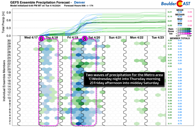
Aweak but two-tiered troughs will indirectly impact the state this afternoon into midday Saturday. A trough will be present across the upper Mississippi Valley, while a secondary trough will be over southern Arizona and Mexico. These two waves of energy will aid strong vertical motion over the Front Range and Foothills, mainly in the form of upper divergence from a …

Premium This Weekend in Colorado Weather: A few days of winter weather ahead, but we’ll be back into the 70s by Sunday!

Alight smattering of rain, drizzle, snow and freezing drizzle fell across the Front Range overnight. There is still some areas of drizzle falling in and near the lower Foothills, including from Boulder, to Golden and Roxborough. Temperatures in these areas range from 29 to 32°F so this is indeed freezing drizzle. Use caution if traveling this morning out there. Wet …

Premium BoulderCAST Daily – Wed 04/17/24 | A breezy & mild Wednesday, but change commences this evening with the arrival of the first cold front

Today will offer one last decent spring day before we transition towards much cooler and slightly unsettled weather for the rest of the week. GOES-East water vapor imagery this morning shows an extensive wave cloud present over the Front Range in response to Pacific moisture streaming in ahead of the next system. This will be thickest in the morning but …

« Older posts Newer posts »